Madison Township, Jefferson County, Indiana

Last updated
Madison Township
Township
Map highlighting Madison Township, Jefferson County, Indiana.svg
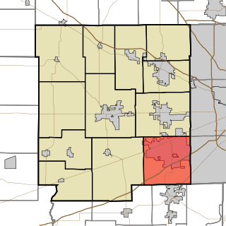
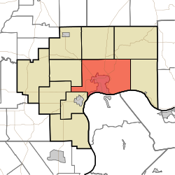
Location in Jefferson County
Coordinates: 38°46′45″N85°23′06″W / 38.77917°N 85.38500°W / 38.77917; -85.38500 Coordinates: 38°46′45″N85°23′06″W / 38.77917°N 85.38500°W / 38.77917; -85.38500
Country United States
State Indiana
County Jefferson
Government
  Type Indiana township
Area
  Total 58 sq mi (150 km2)
  Land 57.41 sq mi (148.7 km2)
  Water 0.59 sq mi (1.5 km2)  1.02%
Elevation 915 ft (279 m)
Population (2010)
  Total 17,415
  Density 303.4/sq mi (117.1/km2)
GNIS feature ID 0453593

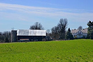
Madison Township is one of ten townships in Jefferson County, Indiana, United States. As of the 2010 census, its population was 17,415 and it contained 8,087 housing units. [1]

A civil township is a widely used unit of local government in the United States that is subordinate to a county. The term town is used in New England, New York, and Wisconsin to refer to the equivalent of the civil township in these states. Specific responsibilities and the degree of autonomy vary based on each state. Civil townships are distinct from survey townships, but in states that have both, the boundaries often coincide and may completely geographically subdivide a county. The U.S. Census Bureau classifies civil townships as minor civil divisions. Currently, there are 20 states with civil townships.

Jefferson County, Indiana County in the United States

Jefferson County is a county located in the U.S. state of Indiana. As of 2017, the population was 32,565. The county seat is Madison.

Indiana State of the United States of America

Indiana is a U.S. state located in the Midwestern and Great Lakes regions of North America. Indiana is the 38th largest by area and the 17th most populous of the 50 United States. Its capital and largest city is Indianapolis. Indiana was admitted to the United States as the 19th U.S. state on December 11, 1816. Indiana borders Lake Michigan to the northwest, Michigan to the north, Ohio to the east, Kentucky to the south and southeast, and Illinois to the west.

Contents

History

It was one of three townships created when Jefferson County began operation on Feb. 11, 1811. Prior to that, the area was part of Madison Township Clark County. It has the largest population of any of Jefferson County's 10 townships as it includes the city of Madison.

Outside of the City of Madison, the township has the following active churches: Ryker's Ridge Baptist Church, which was founded in 1840, and Wirt Baptist Church, founded in 1818 as Harbert's Creek Baptist Church. Extinct churches in the country include Bee Camp Baptist (1872-ca.1879), Center Presbyterian (1831-ca. 1850), Graysville Methodist (ca. 1837-ca. 1870?), Mt. Zion Methodist (1868–1972), Olive Branch Methodist (1835–1938), Otterbein Chapel United Brethren (1867-after 1916), Ryker's Ridge Presbyterian (1831-ca. 1837)

There is one public school outside of the city, Ryker's Ridge Elementary School. It was originally the Central School, a 1-12 school, which had its first high school graduation in 1878 and last in 1961, when it was consolidated with the Madison system.

The township has two active post offices, Madison and North Madison. Madison was established in 1812 and North Madison on Jan. 13,1848.

Madison has also had the following post offices: Bee Camp, (Feb. 18, 1880-Feb. 15, 1905) China: Madison/Shelby Twp. Jan. 30, 1833-Nov. 29, 1838. Moses H. Wilder; Feb., 3, 1879-May 2, 1881, Feb. 23, 1882-Feb. 28, 1902 (to Madison) postmaster, Jacob Thiennes. The first post office was likely in Madison Twp. The next two renditions were in Shelby Twp. Eagle Springs (Oct. 19, 1868-Dec. 5, 1870); Stoney Point (July 26, 1853 – May 31, 1906); Waldinger (Dec. 30, 1897-Apr. 15, 1902); Wirt (Dec. 22, 1834-June 19, 1839) and (June 24, 1856 – June 30, 1950; Zion (Sept. 13, 1895–July 15, 1899).

Lemuel Allen Farm and Mathias Wolf Farm were listed on the National Register of Historic Places in 2016. [2]

Lemuel Allen Farm building in Indiana, United States

Lemuel Allen Farm is a historic home and farm located in Madison Township, Jefferson County, Indiana. The farmhouse was built in 1877, and is a 1 1/2-story, central passage plan, vernacular Italianate style brick dwelling. It features a side-gabled roof sheathed in slate shingles with triple-embedded and diamond patterns in red on either side of the front-gable on the façade. Also on the property are the contributing privy and large, transverse-frame basement barn, built around 1877, and a silo, the workshop, the granary, the garage, the feed shed, and a tool shed, all dated to the 1920s.

Mathias Wolf Farm building in Indiana, United States

Mathias Wolf Farm is a historic home and farm located in Madison Township, Jefferson County, Indiana. The farmhouse was built about 1854, and is a 1 1/2-story, central passage plan, vernacular Gothic Revival style limestone dwelling. Also on the property are the contributing smokehouse, outhouse, transverse-frame barn, and shed.

National Register of Historic Places federal list of historic sites in the United States

The National Register of Historic Places (NRHP) is the United States federal government's official list of districts, sites, buildings, structures, and objects deemed worthy of preservation for their historical significance. A property listed in the National Register, or located within a National Register Historic District, may qualify for tax incentives derived from the total value of expenses incurred preserving the property.

Geography

According to the 2010 census, the township has a total area of 58 square miles (150 km2), of which 57.41 square miles (148.7 km2) (or 98.98%) is land and 0.59 square miles (1.5 km2) (or 1.02%) is water. [1] The streams of Bee Camp Creek, Big Clifty Creek, Crooked Creek, Deans Branch, Dry Fork, Eagle Hollow Creek, Little Clifty Creek, Little Crooked Creek, Razor's Fork, Schnapps Creek, Turkey Run (usually called Turkey Branch locally), West Fork of the Indian-Kentuck Creek and Wolf Run run through this township.

Cities and towns

Extinct towns

Adjacent townships

Monroe Township, Jefferson County, Indiana Township in Indiana, United States

Monroe Township is one of ten townships in Jefferson County, Indiana, United States. As of the 2010 census, its population was 374 and it contained 176 housing units.

Shelby Township, Jefferson County, Indiana Township in Indiana, United States

Shelby Township is one of ten townships in Jefferson County, Indiana, United States. As of the 2010 census, its population was 1,133 and it contained 453 housing units.

Milton Township, Jefferson County, Indiana Township in Indiana, United States

Milton Township is one of ten townships in Jefferson County, Indiana, United States. As of the 2010 census, its population was 896 and it contained 470 housing units.

Cemeteries

The township contains these cemeteries: Booth, Craig, Bramwell, Brisbane, Brown-Bacon, Bryner, Fairmount, Graysville (Miller), Higbie, Indiana Veterans Memorial Cemetery, Jewish, Lund, Minor, Monroe, Olive Branch, Olive Branch, Paul, Pleasant Ridge (Reul), Rykers Ridge Baptist (Old and New), Saint Anthony Roman Catholic, Saint Josephs Roman Catholic, Saint Patricks Roman Catholic, Springdale, Thomas, Underwood, Wirt Baptist and Woodfill.

The Baxter, Bayless, Big Creek, Craig (another Craig Cemetery), Marble Corner, Marble Valley, Monroe and Mt. Monroe cemeteries were relocated to an area just south of Fairmount Cemetery in 1941 when the former Jefferson Proving Ground was created. Bayless was originally in the northern part of the township. The Baxter, Big Creek, Marble Valley, Monroe and Mt. Monroe cemeteries had been in Monroe Township. Marble Corner was relocated from Shelby Township, Ripley County. Some graves from St. Magdalene cemetery were moved from the original site in the same township to St. Patrick's cemetery. The Lund family cemetery, originally located near the Ohio River was moved to the Bayless Cemetery about 1951 during the construction of the Indiana-Kentucky Electric Corp. power plant. Many of the graves in the Old Third Street Cemetery in downtown Madison relocated to Fairmount Cemetery on the Madison hilltop in the 1800s.

Major highways

U.S. Route 421 highway in the United States

U.S. Route 421 (US 421) is a spur route of U.S. 21. It runs for 941 miles (1,514 km) from Fort Fisher, North Carolina south of Wilmington to Michigan City, Indiana at U.S. 20.

Indiana State Road 7 highway in Indiana

State Road 7 in the U.S. State of Indiana is located in southeast Indiana. It runs from northwest-to-southeast connecting the cities of Columbus and Madison.

State Road 56 in the U.S. state of Indiana is a route that travels the south central part of the state from west to east.

Airports and landing strips

Related Research Articles

Canaan, Indiana Census-designated place in Indiana, United States

Canaan is an unincorporated community and census-designated place (CDP) in Shelby Township, Jefferson County, Indiana, United States. As of the 2010 census it had a population of 90.

Guilford Township, Hendricks County, Indiana Township in Indiana, United States

Guilford Township is one of twelve townships in Hendricks County, Indiana, United States. As of the 2010 census, its population was 27,844.

Center Township, Greene County, Indiana Township in Indiana, United States

Center Township is one of fifteen townships in Greene County, Indiana, USA. As of the 2010 census, its population was 3,535.

Taylor Township, Greene County, Indiana Township in Indiana, United States

Taylor Township is one of fifteen townships in Greene County, Indiana, USA. At the 2010 census, its population was 1,200.

Clear Creek Township, Monroe County, Indiana Township in Indiana, United States

Clear Creek Township is one of eleven townships in Monroe County, Indiana, United States. As of the 2010 census, its population was 5,000 and it contained 2,674 housing units.

Charlestown Township, Clark County, Indiana Township in Indiana, United States

Charlestown Township is one of twelve townships in Clark County, Indiana. As of the 2010 census, its population was 13,450 and it contained 5,382 housing units.

Washington Township, Delaware County, Indiana Township in Indiana, United States

Washington Township is one of twelve townships in Delaware County, Indiana. According to the 2010 census, its population was 2,027 and it contained 921 housing units.

Fairmount Township, Grant County, Indiana Township in Indiana, United States

Fairmount Township is one of thirteen townships in Grant County, Indiana, United States. As of the 2010 census, its population was 4,239 and it contained 1,909 housing units.

Jefferson Township, Grant County, Indiana Township in Indiana, United States

Jefferson Township is one of thirteen townships in Grant County, Indiana, United States. As of the 2010 census, its population was 5,839 and it contained 1,758 housing units.

Mill Township, Grant County, Indiana Township in Indiana, United States

Mill Township is one of thirteen townships in Grant County, Indiana, United States. As of the 2010 census, its population was 10,882 and it contained 4,809 housing units.

Brown Township, Hancock County, Indiana Township in Indiana, United States

Brown Township is one of nine townships in Hancock County, Indiana, United States. As of the 2010 census, its population was 2,571 and it contained 1,067 housing units.

Lancaster Township, Jefferson County, Indiana Township in Indiana, United States

Lancaster Township is one of ten townships in Jefferson County, Indiana, United States. As of the 2010 census, its population was 1,511 and it contained 635 housing units.

Republican Township, Jefferson County, Indiana Township in Indiana, United States

Republican Township is one of ten townships in Jefferson County, Indiana, United States. As of the 2010 census, its population was 1,599 and it contained 639 housing units.

Saluda Township, Jefferson County, Indiana Township in Indiana, United States

Saluda Township is one of ten townships in Jefferson County, Indiana, United States. As of the 2010 census, its population was 1,370 and it contained 619 housing units. It was created by the Jefferson County Court of Common Pleas on Feb. 13, 1817. Saluda is derived from a Native American name meaning "river of corn".

Smyrna Township, Jefferson County, Indiana Township in Indiana, United States

Smyrna Township is one of ten townships in Jefferson County, Indiana, United States. As of the 2010 census, its population was 1,096 and it contained 466 housing units.

China, Indiana Unincorporated community in Indiana, United States

China is an unincorporated community in Shelby Township, Jefferson County, Indiana. It spans Shelby and Madison Townships and was for years largely defined by the existence of a general store in Madison Township and the former St. Anthony's Catholic Church in Shelby township. Razor's Fork runs between the two sections. Indiana State Road 62 runs parallel to Razor's Fork in Madison Township, and then crosses the stream and heads north to Canaan.

Lancaster, Jefferson County, Indiana Unincorporated community in Indiana, United States

Lancaster is an unincorporated community in Lancaster Township, Jefferson County, Indiana.

References

  1. 1 2 "Population, Housing Units, Area, and Density: 2010 - County -- County Subdivision and Place -- 2010 Census Summary File 1". United States Census. Retrieved 2013-05-10.
  2. "National Register of Historic Places Listings". Weekly List of Actions Taken on Properties: 6/06/16 through 6/10/16. National Park Service. 2016-06-17.

Baker, J. David, The Postal History of Indiana, 1976, Philatelic Bibliophile, P.O. Box 213971, Louisville, Ky. 1976. Gresham, John M. & Co., 1889. Biographical & Historical Souvenir for the Counties of Clark, Crawford, Harrison, Floyd, Jefferson, Jennings, Scott and Washington.