Malad City, Idaho

Last updated

Malad City, Idaho
Malad Idaho City Hall.jpeg
City Hall in March 2010
Motto: 
Where Idaho Begins
Oneida County Idaho Incorporated and Unincorporated areas Malad City Highlighted 1650140.svg
Location of Malad City in Oneida County, Idaho.
Usa edcp location map.svg
Red pog.svg
Malad City, Idaho
Location in the United States
Coordinates: 42°11′27″N112°14′57″W / 42.19083°N 112.24917°W / 42.19083; -112.24917
CountryUnited States
State Idaho
County Oneida
Government
  MayorJoan Hawkins
Area
[1]
  Total1.64 sq mi (4.25 km2)
  Land1.64 sq mi (4.25 km2)
  Water0.00 sq mi (0.00 km2)
Elevation
4,551 ft (1,387 m)
Population
 (2010) [2]
  Total2,095
  Estimate 
(2019) [3]
2,137
  Density1,302.25/sq mi (502.67/km2)
Time zone UTC−7 (Mountain (MST))
  Summer (DST) UTC−6 (MDT)
ZIP code
83252
Area code(s) 208, 986
FIPS code 16-50140
GNIS feature ID0396844
Website www.maladidaho.org

Malad City (also commonly known as Malad) is the only city in Oneida County, Idaho, United States. [4] [5] In 2024 the population was around 2,239 people., up from 2,158 in 2000. [6]

Contents

The city is named after the nearby Malad River, the name being French for "sickly". [7] Malad City is located along Interstate 15 on the east side of the Malad Valley 13 miles (21 km) from the Utah/Idaho border.

History

Malad, 1872. Photo by William Henry Jackson. Malad, Oneida County, Idaho - NARA - 516760.jpg
Malad, 1872. Photo by William Henry Jackson.

Established in 1864, Malad is one of the oldest communities in the state of Idaho. The community received its name from Donald Mackenzie, a Scottish-Canadian trapper, who passed through the valley between 1818 and 1821 with a party of trappers. Some of his men became sick while camped here and, believing that the illness was caused by drinking water from the valley's principal stream, he named it "Malade" meaning sick or bad in the French language. Actually, the water had nothing to do with the men's illness, as it was later learned by the second party led by Jim Bridger between 1832 and 1835. The men had most likely eaten some beaver that fed on the poisonous roots of water hemlock trees that put a naturally occurring cicutoxin into the animals' flesh. The beaver would have likely been immune to the poison because of long-term adaptation, but the trappers suffered from their feast. Native tribes avoided this outcome by altering food preparation methods to include boiling, which apparently deactivated the poison. [7] [8]

Malad began largely as a Welsh LDS settlement, whose settlers brought their Welsh traditions with them. In addition to the LDS majority, some of the leading families in the community belonged to the Reorganized Church of Jesus Christ of Latter Day Saints. These two denominations each built a place of worship in the town. Some of the minutes from early town meetings were taken down in both English and Welsh. The city is very proud of its Welsh heritage. Malad lays claim to having more people of Welsh descent per capita than anywhere outside Wales. [9] Malad celebrated its Welsh heritage by holding an annual “eisteddfod”, patterned after the music and poetry contests held in Wales for over 900 years. The eisteddfod was an all-day event with people coming from all over southeastern Idaho. The event featured music, songs and storytelling of Wales. The custom continued until 1916 and the American entry into World War I. With the goal of renewing the old eisteddfod tradition in Malad, in 2004, the annual Malad Valley Welsh Festival was established. [10]

In the summer of 1843 John C. Fremont and his party of 39 men passed the spot where Malad City now stands.

LDS prophet Brigham Young came through the Malad Valley in 1855. In 1856, at his request, Utahn members of the Church of Jesus Christ of Latter-day Saints migrated to the region. This party of 15 families led by Ezra Barnard traveled to the Malad Valley and established a community by the name of Fort Stuart. The following year in 1857, Fort Stuart was renamed Malad City. A U.S. post office was established in 1865.

By 1886 Malad City was the fastest growing village in eastern Idaho. The city was an important commercial center between Salt Lake and Butte, Montana. In 1906, the railroad reached Malad City, allowing travel to Salt Lake City in only a four-hour ride by rail. The population of the city would double over the next 15 years as a result.

On June 19, 1910, Malad experienced a flood when the earthen Deep Creek Dam, northeast of the city, broke.

On March 27, 1975, a magnitude 6.1 earthquake shook the Pocatello Valley near the Idaho-Utah border. The epicenter was only 15 miles (24 km) southwest of Malad City which was hit hardest by the quake. Nearly two-thirds of its homes and businesses had some sort of damage.

Malad City received national news coverage when a corporate jet carrying eight people including four Coca-Cola executives crashed January 15, 1996 killing all on board. [11] The large twin-engine turbo-prop was flying from Salt Lake City, Utah to Pocatello, Idaho for a Coca-Cola sales meeting. The Mitsubishi MU-2 aircraft crashed and burned at the base of a canyon 8 miles (13 km) northwest of Malad. According to the National Transportation Safety Board in its published SEA96MA043 Accident Report, the cause of the accident was listed as ice on the wings.

Towards the end of 2003, a nationwide influenza outbreak occurred. Malad was, appropriately, likely the hardest hit community in the nation. So many people became ill during the first part of December, 2003 that the city was virtually shut down. The entire school district in Malad was closed for three days in an effort to keep students from spreading the ailment. Roughly a third of the students became ill. Church services and Christmas festivities were also cancelled.[ citation needed ]

Malad City once had the oldest department store in the state of Idaho. Evans Co-op opened in 1865 as part of a Latter-day Saint movement in which local production and purchasing was encouraged through cooperatives. Though Evans is no more, the historic building remains and is now home to a True Value Hardware. Malad City also has the longest running weekly newspaper in Idaho, called "The Idaho Enterprise" which published its first issue on June 6, 1879. [12]

Because of its proximity to Utah, which has no state lottery, Malad has become a major retail site for the Idaho Lottery. The Top Stop Gasoline and Convenience store in Malad is responsible for 3 percent of Idaho's lottery sales, and the town as a whole accounts for over 19 percent of state sales. Only Boise, the state's largest city, has higher lotto sales. Over the 22-year history of the Idaho Lottery, it is estimated that Utahns have provided $54.1 million in lottery profits, which Idaho then uses for its own capital works and school funding. [13]

Geography and climate

According to the United States Census Bureau, the city has a total area of 1.66 square miles (4.30 km2), all of it land. [14] It lies on the eastern edge of Malad Valley at 4,540 feet (1,380 m) in elevation.

The Wasatch fault runs along the east side of Malad Valley, and there are several active faults in the area to the south and west.

Climate

Malad City has a humid continental climate with warm summers (Köppen Dfb).

Climate data for Malad City, Idaho, 1991–2020 normals, extremes 1973–present
MonthJanFebMarAprMayJunJulAugSepOctNovDecYear
Record high °F (°C)59
(15)
64
(18)
78
(26)
85
(29)
96
(36)
102
(39)
105
(41)
104
(40)
100
(38)
90
(32)
73
(23)
63
(17)
105
(41)
Mean maximum °F (°C)44.7
(7.1)
50.8
(10.4)
66.5
(19.2)
77.1
(25.1)
85.0
(29.4)
93.1
(33.9)
99.3
(37.4)
97.1
(36.2)
91.5
(33.1)
79.9
(26.6)
61.4
(16.3)
48.6
(9.2)
99.6
(37.6)
Mean daily maximum °F (°C)32.7
(0.4)
38.4
(3.6)
50.5
(10.3)
59.5
(15.3)
69.8
(21.0)
79.7
(26.5)
90.6
(32.6)
88.4
(31.3)
78.4
(25.8)
62.7
(17.1)
46.9
(8.3)
33.9
(1.1)
61.0
(16.1)
Daily mean °F (°C)23.6
(−4.7)
28.4
(−2.0)
38.5
(3.6)
46.0
(7.8)
54.6
(12.6)
62.6
(17.0)
71.0
(21.7)
69.4
(20.8)
59.9
(15.5)
47.5
(8.6)
35.1
(1.7)
24.8
(−4.0)
46.8
(8.2)
Mean daily minimum °F (°C)14.6
(−9.7)
18.4
(−7.6)
26.5
(−3.1)
32.4
(0.2)
39.4
(4.1)
45.5
(7.5)
51.3
(10.7)
50.4
(10.2)
41.4
(5.2)
32.3
(0.2)
23.4
(−4.8)
15.7
(−9.1)
32.6
(0.3)
Mean minimum °F (°C)−4.5
(−20.3)
0.4
(−17.6)
11.0
(−11.7)
18.9
(−7.3)
25.7
(−3.5)
32.9
(0.5)
40.9
(4.9)
39.9
(4.4)
28.5
(−1.9)
18.9
(−7.3)
7.5
(−13.6)
−2.7
(−19.3)
−8.6
(−22.6)
Record low °F (°C)−33
(−36)
−35
(−37)
−10
(−23)
7
(−14)
17
(−8)
27
(−3)
32
(0)
26
(−3)
18
(−8)
3
(−16)
−18
(−28)
−32
(−36)
−35
(−37)
Average precipitation inches (mm)1.53
(39)
1.25
(32)
0.99
(25)
1.24
(31)
1.84
(47)
0.73
(19)
0.60
(15)
0.70
(18)
1.23
(31)
1.15
(29)
0.73
(19)
1.11
(28)
13.10
(333)
Average snowfall inches (cm)10.8
(27)
5.7
(14)
3.4
(8.6)
0.9
(2.3)
0.1
(0.25)
0.0
(0.0)
0.0
(0.0)
0.0
(0.0)
0.0
(0.0)
0.3
(0.76)
4.1
(10)
8.7
(22)
34.0
(86)
Average precipitation days (≥ 0.01 in)7.77.05.66.57.64.62.93.44.34.44.76.565.2
Average snowy days (≥ 0.1 in)6.44.02.00.60.10.00.00.00.00.32.75.121.2
Source 1: NOAA (snow/snow days 19812010) [15] [16]
Source 2: National Weather Service [17]

Demographics

Historical population
CensusPop.Note
1880 759
1900 1,050
1910 1,30324.1%
1920 2,59899.4%
1930 2,535−2.4%
1940 2,7317.7%
1950 2,715−0.6%
1960 2,274−16.2%
1970 1,848−18.7%
1980 1,9153.6%
1990 1,9461.6%
2000 2,15810.9%
2010 2,095−2.9%
2019 (est.)2,137 [3] 2.0%
U.S. Decennial Census [18]

2024 census

The most recent evaluation of the racial makeup of the city was 98.11% White, 0.86% Native American, 0.77% any other race, and a mix of two or more 0.27%. Approximately 2,239 people were living in Oneida County. There are 2,239 people, 868 households, with 556 families living in the county.

2010 census

As of the census [2] of 2010, there were 2,095 people, 786 households, and 552 families residing in the city. The population density was 1,262.0 inhabitants per square mile (487.3/km2). There were 893 housing units at an average density of 538.0 units per square mile (207.7 units/km2). The racial makeup of the city was 96.5% White, 0.5% Native American, 0.8% Asian, 0.9% from other races, and 1.3% from two or more races. Hispanic or Latino of any race were 2.9% of the population.

There were 786 households, of which 34.7% had children under the age of 18 living with them, 58.7% were married couples living together, 8.0% had a female householder with no husband present, 3.6% had a male householder with no wife present, and 29.8% were non-families. 27.4% of all households were made up of individuals, and 14.1% had someone living alone who was 65 years of age or older. The average household size was 2.60 and the average family size was 3.21.

The median age in the city was 38.2 years. 29.1% of residents were under the age of 18; 6% were between the ages of 18 and 24; 21.4% were from 25 to 44; 25.6% were from 45 to 64; and 17.9% were 65 years of age or older. The gender makeup of the city was 49.4% male and 50.6% female.

2000 census

As of the census [19] of 2000, there were 2,158 people, 797 households, and 561 families residing in the city. The population density was 1,294.6 inhabitants per square mile (499.8/km2). There were 908 housing units at an average density of 544.7 units per square mile (210.3 units/km2). The racial makeup of the city was 98.01% White, 0.14% African American, 0.37% Native American, 0.23% Asian, 0.09% Pacific Islander, 0.56% from other races, and 0.60% from two or more races. Hispanic or Latino of any race were 1.85% of the population.

There were 797 households, out of which 34.3% had children under the age of 18 living with them, 61.5% were married couples living together, 6.3% had a female householder with no husband present, and 29.5% were non-families. 27.9% of all households were made up of individuals, and 16.8% had someone living alone who was 65 years of age or older. The average household size was 2.65 and the average family size was 3.24.

In the city, the population was spread out, with 29.9% under the age of 18, 7.1% from 18 to 24, 22.6% from 25 to 44, 20.0% from 45 to 64, and 20.4% who were 65 years of age or older. The median age was 38 years. For every 100 females, there were 92.7 males. For every 100 females age 18 and over, there were 92.2 males.

The median income for a household in the city was $32,235, and the median income for a family was $38,068. Males had a median income of $29,125 versus $19,338 for females. The per capita income for the city was $13,926. About 6.2% of families and 10.0% of the population were below the poverty line, including 9.7% of those under age 18 and 13.8% of those age 65 or over.

Arts and culture

Annual cultural events

Malad Welsh Festival — See second paragraph in this article under "History". [10]

Museums and other points of interest

Oneida County Pioneer Museum – The building was constructed in 1914 by R.B. Davis and used as a drug store and for other business purposes until becoming home to the museum in 1992. The original safe and the original pressed-tin ceiling are still in good condition and are notable features of the museum.

Parks and recreation

Education

Malad is served by the PK-12 Oneida County School District. Malad's public schools include:

Notable people

The short film Peluca , the work of Jared Hess and the precursor film to the hit Napoleon Dynamite, mentions Malad. The antagonist, Seth, is played by Jon Heder and tells his friends that he has an FFA competition in "Ma-lawd" the following morning. Peluca and Napoleon Dynamite were both filmed in neighboring Franklin County, Idaho and reference much of the surrounding area in their film.

Related Research Articles

<span class="mw-page-title-main">Cache County, Utah</span> County in Utah, United States

Cache County is a county located in the Wasatch Front region of Utah. As of the 2020 United States Census, the population was 133,154, with an estimated 140,173 in 2022. Its county seat and largest city is Logan. Cache County is one of two counties included in the Logan metropolitan area, alongside Franklin County, Idaho.

<span class="mw-page-title-main">Box Elder County, Utah</span> County in Utah, United States

Box Elder County is a county at the northwestern corner of Utah, United States. At the 2020 census, the population was 57,666, up from the 2010 figure of 49,975. Its county seat and largest city is Brigham City. The county was named for the box elder trees that abound in the county.

<span class="mw-page-title-main">Power County, Idaho</span> County in Idaho, United States

Power County is a county located in the U.S. state of Idaho. As of the 2020 Census, the county had a population of 7,878. The county seat and largest city is American Falls. The county was created by the Idaho Legislature on January 30, 1913, by a partition of Cassia County. It is named for an early hydroelectric power plant (1902) at the American Falls.

<span class="mw-page-title-main">Oneida County, Idaho</span> County in Idaho, United States

Oneida County is a county located in the U.S. state of Idaho. As of the 2020 Census the county had a population of 4,564. The county seat and largest city is Malad City. Most of the county's population lives in Malad City and the surrounding Malad Valley.

<span class="mw-page-title-main">Jefferson County, Idaho</span> County in Idaho, United States

Jefferson County is a county located in the U.S. state of Idaho. As of the 2020 Census, the county's population was 30,891. The county seat and largest city is Rigby. The county was established in 1913 and named after Thomas Jefferson, the third U.S. President. Jefferson County is part of the Idaho Falls, ID Metropolitan Statistical Area.

<span class="mw-page-title-main">Franklin County, Idaho</span> County in Idaho, United States

Franklin County is a county located in the U.S. state of Idaho. As of the 2020 Census the county had a population of 14,194. The county seat and largest city is Preston. The county was established in 1913 and named after Franklin D. Richards, an Apostle of the Church of Jesus Christ of Latter-day Saints. It is the only Franklin County in the United States that is not named after Benjamin Franklin. Franklin County is part of the Logan, UT-ID Metropolitan Statistical Area.

<span class="mw-page-title-main">Cassia County, Idaho</span> County in Idaho, United States

Cassia County is a county in the U.S. state of Idaho. As of the 2020 Census the county had a population of 24,655. The county seat and largest city is Burley. Cassia County is included in the Burley, ID Micropolitan Statistical Area.

<span class="mw-page-title-main">Caribou County, Idaho</span> County in Idaho, United States

Caribou County is a county located in the U.S. state of Idaho. As of the 2020 Census the county had a population of 7,027. The county seat and largest city is Soda Springs.

<span class="mw-page-title-main">Bonneville County, Idaho</span> County in Idaho, United States

Bonneville County is a county located in the U.S. state of Idaho. As of the 2020 census, the population was 123,964, making it the fourth-most populous county in Idaho and the most populous in eastern Idaho. Its county seat and largest city is Idaho Falls. Bonneville County was established in 1911 and named after Benjamin Bonneville (1796–1878), a French-born officer in the U.S. Army, fur trapper, and explorer in the American West. Benjamin was the son of Nicholas Bonneville of France, an Illuminati member who had written the "Illuminati Manifesto for World Revolution" in 1792, which played a significant role in the French revolution. Bonneville County is part of the Idaho Falls Metropolitan Statistical Area.

<span class="mw-page-title-main">McCammon, Idaho</span> City in Idaho, United States

McCammon is a city in Bannock County, Idaho, United States. It is part of the Pocatello, Idaho Metropolitan Statistical Area'. The population was 809 at the 2010 census. In 1892, McCammon became the junction point between the Oregon Short Line Railroad and Utah and Northern Railway, and city gained the nickname Junction City.

<span class="mw-page-title-main">Montpelier, Idaho</span> City in Idaho, United States

Montpelier is a city in Bear Lake County, Idaho, United States. The population was 2,538 at the 2019 estimation, down from 2,597 in 2010 census. The city is the largest community in the Bear Lake Valley, a farming region north of Bear Lake in southeastern Idaho along the Utah border. It was settled in 1863 by Mormon pioneers on the route of the Oregon Trail. Nearby to the east is the border with Wyoming.

<span class="mw-page-title-main">St. Charles, Idaho</span> City in Idaho, United States

St. Charles is a city in southern Bear Lake County, Idaho, United States, that is located near the northwestern shore of Bear Lake. Its population was 131 at the 2010 census, down from 156 in 2000.

<span class="mw-page-title-main">Aberdeen, Idaho</span> City in Bingham County, Idaho, United States

Aberdeen is a city in Bingham County, Idaho, United States. The community was named after Aberdeen, in Scotland. The population was 1,756 at the 2020 census.

<span class="mw-page-title-main">Swan Valley, Idaho</span> City in Idaho, United States

Swan Valley is a city in Bonneville County, Idaho, United States. It is part of the Idaho Falls, Idaho Metropolitan Statistical Area. The population was 204 at the 2010 census.

<span class="mw-page-title-main">Albion, Idaho</span> City in Idaho, United States

Albion is a city in Cassia County, Idaho, United States. It is part of the Burley, Idaho Micropolitan Statistical Area. The population was 234 at the 2020 census. Albion was the county seat of Cassia County from 1879 to 1918.

<span class="mw-page-title-main">Preston, Idaho</span> City in Idaho, United States

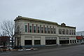
Preston is a city in Franklin County, Idaho, United States. The population was 5,591 at the 2020 census, up from 5,204 at the 2010 census. The city is the county seat of Franklin County. It is part of the Logan, Utah-Idaho Metropolitan Statistical Area.

<span class="mw-page-title-main">Perry, Utah</span> City in Utah, United States

Perry is a city in Box Elder County, Utah, United States. The population was 4,512 at the 2010 census.

<span class="mw-page-title-main">Portage, Utah</span> Town in Utah, United States

Portage is a town in Box Elder County, Utah, United States. The population was 245 at the 2010 census. The town received its name from Lorenzo Snow, an apostle of the Church of Jesus Christ of Latter-day Saints. He named it Portage after his birthplace of Portage County, Ohio.

<span class="mw-page-title-main">Tremonton, Utah</span> City in Utah, United States

Tremonton is a city in Box Elder County, Utah. The population was 7,647 at the time of the 2010 census.. As of 2024, Tremonton has an estimated population of 13,713 and is one of the fastest growing municipalites in the state of Utah.

<span class="mw-page-title-main">Amalga, Utah</span> Town in the state of Utah, United States

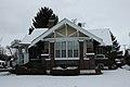
Amalga is a town in Cache County, Utah, United States. The population was 488 at the 2010 census. It is included in the Logan, Utah-Idaho (partial) Metropolitan Statistical Area.

References

  1. "2019 U.S. Gazetteer Files". United States Census Bureau. Retrieved July 9, 2020.
  2. 1 2 "U.S. Census website". United States Census Bureau . Retrieved December 18, 2012.
  3. 1 2 "Population and Housing Unit Estimates". United States Census Bureau. May 24, 2020. Retrieved May 27, 2020.
  4. "Find a County". National Association of Counties. Retrieved June 7, 2011.
  5. "Subcounty population estimates: Idaho 2000–2007". United States Census Bureau, Population Division. March 18, 2009. Archived from the original (CSV) on March 31, 2009. Retrieved April 4, 2009.
  6. Spokesman-Review Archived 2016-08-05 at the Wayback Machine – 2010 census – Malad City, Idaho – accessed 2011-12-27
  7. 1 2 "Profile for Malad City, Idaho, ID". ePodunk. Retrieved September 25, 2012.
  8. McDevitt, T. (2001). Idaho's Malad Valley: A History. Little Red Hen, Inc. ISBN   093304609X)
  9. "BBC NEWS – UK – Wales – South West Wales – Tiny US town's big Welsh heritage". BBC News .
  10. 1 2 "Malad Valley Welsh Festival".
  11. "CNN – News Briefs – Jan. 15, 1996". CNN .
  12. Idaho Enterprise front page banner
  13. Davidson, Lee (April 6, 2012). "Utahns Buy 19% of Idaho's Lottery Tickets". Salt Lake Tribune.
  14. "US Gazetteer files 2010". United States Census Bureau. Archived from the original on July 2, 2012. Retrieved December 18, 2012.
  15. "U.S. Climate Normals Quick Access – Station: Malad City, ID (19912020)". National Oceanic and Atmospheric Administration. Retrieved July 6, 2023.
  16. "U.S. Climate Normals Quick Access – Station: Malad City, ID (19812010)". National Oceanic and Atmospheric Administration. Retrieved July 6, 2023.
  17. "NOAA Online Weather Data – NWS Pocatello". National Weather Service. Retrieved July 6, 2023.
  18. "Census of Population and Housing". Census.gov. Retrieved June 4, 2015.
  19. "U.S. Census website". United States Census Bureau . Retrieved January 31, 2008.
  20. "Idaho Governor John Victor Evans". National Governors Association. Retrieved September 25, 2012.
  21. "Mabel Jones Gabbott". eprimary. Retrieved September 25, 2012.
  22. "HARDING, Ralph R., (1929–2006)". Biographical Directory of the United States Congress. Retrieved September 25, 2012.