
Hunter's Creek is a master planned, unincorporated community and census-designated place in Orange County, Florida, United States. It is part of the Orlando–Kissimmee–Sanford, Florida Metropolitan Statistical Area. The population was 14,321 at the 2010 census. It has grown up around a large planned community named Hunter's Creek, though the CDP name given by the United States Census Bureau lacks the apostrophe.
Clear Lake is a populated place located in Collin County, Texas, United States, on the south end of the Lavon Lake Peninsula. By land, it is south of Princeton and over water, northwest of Lavon, southwest of Copeville, and north of Wylie.

The Cullasaja River is a short river located entirely in Macon County, North Carolina. It is a tributary of the Little Tennessee River into which it flows near the county seat of Franklin.

Doubtful Sound / Patea is a fiord in Fiordland, in the far south west of New Zealand. It is located in the same region as the smaller but more famous and accessible Milford Sound / Piopiotahi. It took second place after Milford Sound as New Zealand's most famous tourism destination.

The Lane Cove River, a northern tributary of the Parramatta River, is a tide-dominated, drowned valley estuary west of Sydney Harbour, located in Sydney, New South Wales, Australia. The river is a tributary of the Parramatta River, winding through a bushland valley. It joins Parramatta River at Greenwich and Woolwich, where together they form an arm of Sydney Harbour, and serves as a border along with Middle Harbour separating Sydney's North Shore.

Raven Rock State Park is a North Carolina state park in Harnett County, North Carolina in the United States. Located near Lillington, North Carolina, it covers 4,810 acres (19.5 km2) along the banks of the Cape Fear River. Raven Rock State Park is located on the eastern edge of the Piedmont.

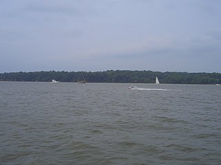
The Severn River is a tidal estuary 14 miles (23 km) long, located in Anne Arundel County in the U.S. state of Maryland, south of the Magothy River and north of the South River.
Hampton Cove is a master-planned housing subdivision located in Big Cove area of Huntsville, Alabama. Situated in the foothills and valleys of North Alabama's Cumberland Plateau, the 2,800-acre (11 km2) Housing lies in the coves between Monte Sano Mountain and Green Mountain to the west, and Keel Mountain to the east.

Whiteshell Provincial Park is a provincial park in southeast Manitoba, approximately 120 kilometres (75 mi) east of the city of Winnipeg. The park is considered to be a Class II protected area under the IUCN protected area management categories. It is 275,210 hectares in size.
The Sassafras River is a tributary of the Chesapeake Bay on the Delmarva Peninsula in the United States. It is approximately 22 miles (35 km) long and starts in western New Castle County, Delaware, and along the boundary between Cecil County, Maryland on the north and Kent County, Maryland on the south. It rises southwest of Middletown, Delaware and ends at the Chesapeake Bay in a wide mouth between Howell Point near Betterton, Maryland and Grove Point on Grove Neck.
Lake Bonavista is a neighbourhood in Southeast Calgary, Alberta, Canada. It is bounded by Anderson Road to the north, Macleod Trail to the west, Canyon Meadows Drive to the south, and Bow Bottom Trail to the east. The small community of Bonavista Downs resides in the northeast corner of the neighbourhood.
The Magothy River runs 12.1 miles (19.5 km) through Anne Arundel County in the U.S. state of Maryland. It is located south of the Patapsco River and north of the Severn River. There are two public park paddling access points, Beachwood Park on the north shore a half mile east of the Magothy Bridge Road bridge, and Spriggs Farm Park off Bayberry Drive, on the south shore two miles west of the Magothy's mouth. Both are Anne Arundel County parks.
Bridgeland Community is an 11,401-acre (46.14 km2) master-planned community under construction in unincorporated Harris County, Texas to the northwest of Houston between U.S. Highway 290 and Interstate 10. Bisecting Bridgeland is Segment E of the Grand Parkway, a 15.2-mile thoroughfare that broke ground in 2011 and opened in December 2013.

Cowans Gap State Park is a 1,085-acre (439 ha) Pennsylvania state park in Todd Township, Fulton County and Metal Township, Franklin County, Pennsylvania in the United States. The park is largely surrounded by Buchanan State Forest in Allens Valley just off Pennsylvania Route 75 near Fort Loudon.

Abbotts Creek starts in Kernersville, NC in Forsyth County and flows into High Rock Lake near Lexington, NC in Davidson County just north of Hwy 47. The section of High Rock Lake that is officially Abbotts Creeks ends near the Hwy 8 causeway, in Southmont, NC.
Rainbow Lake is a 116-acre manmade lake near the town of Pinetop-Lakeside and the community of Lake of the Woods in southern Navajo County, Arizona, United States. The lake was created in 1903 when Mormon settlers dammed Walnut Creek, a tributary of the Little Colorado River, to impound water for irrigation.
Tuckasegee, named after the historic Cherokee town of that name located near here, is an unincorporated community in Jackson County, North Carolina, United States. It followed the earlier Cherokee town as developing on the upper Tuckaseegee River, at the confluence of its East and West forks.

Cherry Hill is a census-designated place (CDP) in Prince William County, Virginia, United States. The population was 16,000 according to the 2010 Census. As of the 2020 census, it was estimated to be 23,683. The CDP is made up of the Cherry Hill peninsula, to the northeast of the town of Dumfries.
Lake Calabay is a manmade dredged freshwater lake in the residential community of Hunter's Creek, Florida, just inside the south border of Orange County, Florida. This lake was a somewhat swampy area prior to its construction about 1993. It was built as a feature for the Hunter's Creek development. Three different gated neighborhoods were built around Lake Calabay. To the east and north is Calabay Cove, with 104 homes constructed from 1993 to 1998. On the west is Montara, with twenty-four homes built between 1994 and 1996. On the south is Ashton, with thirty-four homes built between 1996 and 1997.
Attakapas Wildlife Management Area, also known as Attakapas Island Wildlife Management Area, is a 27,962-acre tract of protected area located in St. Mary, St. Martin, and Iberia Parishes, Louisiana. The property was acquired in 1976 and is under the authority of the Louisiana Department of Wildlife and Fisheries (LDWF). The LDWF has 25,730 acres and the USACOE has 2,200 acres.

