
North Heights is a neighborhood in Youngstown, Ohio, located on the city's upper North Side. The neighborhood's name derives from the fact that it sits at a higher elevation than the Wick Park District, Youngstown State University, and Downtown Youngstown. The neighborhood is bordered on the north by Liberty Township, with Gypsy Lane marking the city limit ; Belmont Avenue to the west; Redondo Road and Crandall Park to the south; and Fifth Avenue to the east.
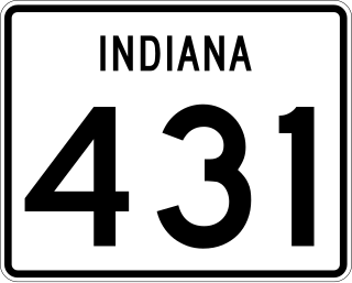
State Road 431 was a state road connecting U.S. Route 31 with Interstate 465 at Exit 33. It passed through the Indianapolis suburb of Carmel, allowing traffic on U.S. 31 north of Carmel a shorter route to I-465 and the east side of Indianapolis. Until the 1990s, the SR 431 designation extended south of I-465 to 86th Street. Prior to that, it also continued south along N. Keystone Avenue to State Road 37 at Fall Creek Parkway, North Drive in Indianapolis. A second section of SR 431 followed the old route of U.S. 31 between Greenwood and the south side of Indianapolis.
The Riverside neighborhood is a historic neighborhood on the near west side of Indianapolis, Indiana, United States. The housing consists mainly of American foursquare-type homes and bungalows built in the 1910s to 1920s. Seventy-five percent of the homes in the area were built before 1939. Riverside is named for its location beside the White River.
Bridgeland Community is an 11,401-acre (46.14 km2) master-planned community under construction in unincorporated Harris County, Texas to the northwest of Houston between U.S. Highway 290 and Interstate 10. Bisecting Bridgeland is Segment E of the Grand Parkway, a 15.2-mile thoroughfare that broke ground in 2011 and opened in December 2013.
The City of Oklahoma City uses Special Zoning Districts as a tool to maintain the character of many neighborhood communities.
Fall Creek Place is one of many revitalized neighborhoods in inner Indianapolis, Indiana, United States. The neighborhood is bounded by Meridian Street on the west, Fall Creek Parkway on the north, just east of College Avenue on the east, and 22nd Street on the south. Before the project's Phase IV began in 2006, its eastern boundary was Park Avenue.
Carole Highlands is an unincorporated community located in Prince George's County, Maryland, United States. Carole Highlands is contained between East West Highway to the south, University Boulevard to the north, Larch Avenue, Hopewell Avenue, and 15th Avenue to the west, and Riggs Road to the east. Carole Highlands borders the adjacent neighborhoods of Chillum, Green Meadows, Lewisdale, and Langley Park in Prince George's County, while bordering the city of Takoma Park in Montgomery County, MD. For statistical purposes, it is part of the Chillum census-designated place (CDP).
Butler–Tarkington is a neighborhood on the north side of Indianapolis with the following borders: 38th Street and Crown Hill Cemetery to the south, the Central Canal and Westfield Boulevard to the north, Michigan Road to the west, and Meridian Street to the east.
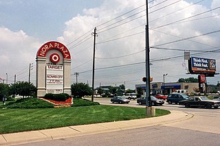
Nora is a community on the far north side of Indianapolis, Indiana. It is home to North Central High School and the founding section of the Monon Trail. Nora's neighborhoods typically feature diverse housing stock, large lots and mature trees. The Nora community contains six distinct business/commercial districts, including Nora Plaza, Greenbriar Plaza, and The Fashion Mall at Keystone.

Westport is a neighborhood in south Baltimore, Maryland. Westport is a majority African-American neighborhood that has struggled with crime, housing abandonment, and unemployment in the past decade. The neighborhood is bordered by the Middle Branch of the Patapsco River on the east, the city neighborhoods of Cherry Hill, Brooklyn and the southwestern Baltimore County community of Lansdowne to the southwest, Hollins Ferry Road and the Mount Winans and Lakeland neighborhoods to the west, and Interstate 95 to the north, along with the South Baltimore communities of Federal Hill and Otterbein. The Baltimore–Washington Parkway runs through the middle of Westport and intersects with Interstate 95, the main East Coast super-highway, north to south, Maine to Florida.
Meridian-Kessler is a residential neighborhood located about 4 miles (6.4 km) north of downtown Indianapolis. It is bounded on the north by Kessler Boulevard, on the east by the Monon Trail greenway corridor, on the south by 38th Street, and to the west by Meridian Street. Meridian Street forms a shared boundary with the adjacent Butler-Tarkington neighborhood.
The Bates–Hendricks neighborhood is situated just south and east of the downtown commercial district of Indianapolis, Indiana. The Fountain Square business district is just to the east.

Capitol View is a historic in-town southwest Atlanta neighborhood 2.5 miles from downtown Atlanta, Georgia that was named for its view of the Georgia State Capitol building. Its boundaries include Metropolitan Parkway to the east, Lee Street to the west, and the Beltline to the north. On the south, the border follows Arden Street, Deckner Avenue, and Perkerson Park.

Adair Park is a residential neighborhood located southwest of downtown Atlanta. It has the form of a left curly bracket, bordered by the MARTA north–south rail line on the northwest, the BeltLine trail on the southwest and Metropolitan Parkway on the east. Historically Adair Park also included the area from Metropolitan Parkway to McDaniel Street on the east, but the city now considers that area part of the Pittsburgh neighborhood.
Fall Creek is a navigable in law waterway in the U.S. state of Indiana, and a tributary of the White River. It is 57.5 miles (92.5 km) long and has a watershed drainage area of 318 square miles (820 km2) in central Indiana before flowing into the White River in Indianapolis. As it flows southwest, Fall Creek is the namesake of three townships in Indiana, in Henry County, Madison County, and then Hamilton County.

Mapleton is a neighborhood in southern Brooklyn, New York City, bounded by 16th Avenue on the west, Dahill Road on the east, 57th Street on the north, and 65th Street on the south. It borders Bensonhurst and Borough Park to the west, and Midwood to the east.

The Central Court Historic District is a historic district and neighborhood of the city of Indianapolis in northern Center Township, Marion County, Indiana, United States. Built around Central Court near the intersection of 36th Street and Central Avenue, the neighborhood consists of seventy-five buildings over an area of 7.6 acres (3.1 ha).

The Indianapolis Park and Boulevard System is a group of parks, parkways, and boulevards in Indianapolis, Indiana, that was designed by landscape architect George Edward Kessler in the early part of the twentieth century. Also known as the Kessler System, the district includes 3,474 acres (1,406 ha) and has shaped the city through the present day. This historic district was added to the National Register of Historic Places in 2003.

Newport Village Historic District is a neighborhood in Boardman, Ohio. The neighborhood is bordered by the City of Youngstown, Ohio to the north and east, Glenwood Avenue to the west, and Forest Glen Estates Historic District to the south. Newport Village is known for its quaint tree-lined residential streets and early twentieth century Tudor revival and colonial revival architecture.
Fall Creek Greenway, often referred to as Fall Creek Trail, is a shared-use path in Indianapolis, Indiana, United States. The greenway begins at the border of Fort Harrison State Park on Boy Scout Road in the northeast corner of the city, meandering southwest along Fall Creek. The greenway terminates at Burdsal Parkway and the Indiana Central Canal in Indianapolis's Riverside neighborhood. It is nearly 7 miles (11 km) long and connects with the Monon Trail just south of Fall Creek Parkway near the Mapleton-Fall Creek neighborhood. A second and final phase will complete a gap in the greenway between its current terminus to the intersection of Indiana Avenue and 10th Street.