City-designated
"neighborhood areas" | Subdivisions and districts covered | Population (2020) [lower-alpha 2] | Population rank [lower-alpha 2] | Locator map |
|---|
| Acton | Harmony | 3,714 | 78th |  |
| Airport | | 123 | 98th |  |
| Allisonville | Arrowhead Estates · Beaumont on the Green · Eastwood · High Gate · Ivy Hills · Roland Park · Steinmeier Estates · Steinmeier Village · Sycamore Springs · Tanglewood | 10,207 | 38th |  |
| Ameriplex | Stone Ridge · Valley Brook | 4,037 | 75th |  |
| Arlington Woods | | 8,291 | 45th |  |
| Augusta / New Augusta | Augusta Green · Branch Creek at Pike · Brentwood Springs · Bretton Wood · Cooper Pointe · Crooked Creek Villages · Faith Knoll · Lloyd Meadows · New Augusta Woods · Northpointe Village | 18,813 | 14th |  |
| Beech Grove [lower-alpha 3] | Carrington · Carrington Woods · Park Meadow · South Grove Woods | 14,646 | 23rd |  |
| Brendonwood | Brendon Park · Brendonridge · Brendonshire · Windridge | 3,264 | 83rd |  |
| Broad Ripple [lower-alpha 4] | Dawnbury–Keystone [28] [lower-alpha 5] · Warfleigh | 7,461 | 50th |  |
| Butler–Tarkington / Rocky Ripple [lower-alpha 1] | | 10,899 | 35th |  |
| Camby | Groves at Camby Village · Harvard Green at Camby Village · Heartland Crossing | 7,308 | 51st |  |
| Canterbury–Chatard | | 4,145 | 74th | 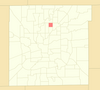 |
| Castleton | Autumn Woods · Avery Pointe · Bayside Woods · Berkley Place · Castlebridge · Castle Creek · Castle Knoll Farms · Castlewood Estates · Charter Pointe · Hearth Stone · Lakeshore · The Masters · The Preserve on Allisonville · Riverbend · Scandia · Spinnaker Cove · Steeplechase · Woodbridge of Castleton · Woodbrook · Woods Edge | 11,198 | 33rd | 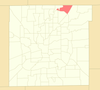 |
| Chapel Hill–Ben Davis | Arbor Woods · Avon Creek Estates · Berkshire Lakes · Berkshire Woods · Bridgeport · Bridgeport Commons · Cameron Meadows · Chapel Bend · Chapel Glen · Country Meadows · Countryside · Farley · Heatherwood Estates · Lake of the Pines · Mariwood · New Heritage · Parc Estates · Parc Estates North · Salem Creek Meadows · Sungate · Sunset Lake · West Glen Village · West Wayne Woods · Westwood | 34,670 | 2nd | 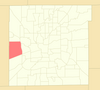 |
| Christian Park | Twin Aire | 9,179 | 42nd |  |
| Clearwater | Harbour Club · Somerset Bay · Sylvan Ridge · Sylvan Ridge Lakes | 3,413 | 81st |  |
| Clermont [lower-alpha 1] | | 2,330 | 87th | 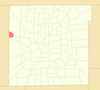 |
| College Park | College Park Estates · Waterbury | 3,559 | 79th |  |
| Crooked Creek [29] | Harcourt Springs | 13,226 | 25th |  |
| Crown Hill [30] | Highland Vicinity | 4,506 | 72nd |  |
| Crows Nest [lower-alpha 1] | North Crows Nest [lower-alpha 1] | 339 | 97th |  |
| Cumberland [lower-alpha 1] | | 2,453 | 86th |  |
| Delaware Trails | Brackenwood · Countrybrook North · Foxhill Acres Estates · Fox Hill Estates · Lions Head | 7,514 | 49th | 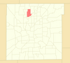 |
| Devington | Devon Hills | 11,925 | 30th | 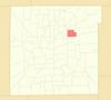 |
| Devon | Devon Hills · Devon Ridge · Devon Woods [lower-alpha 6] · Ladywood Estates | 1,951 | 91st | 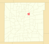 |
| Devonshire | Avalon Estates · Avalon Hills · Kessler Commons · Lake Kesslerwood · Spruce Knoll · Wynterway Estates | 6,256 | 60th | 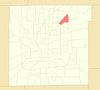 |
| Downtown | 16 Tech Innovation District · Babe Denny · Canal and White River State Park [lower-alpha 4] · Chatham–Arch · Cole–Noble · Flanner House Homes · Fletcher Place · Indiana Avenue [lower-alpha 4] · Lockefield Gardens · Lockerbie Square · Market East [lower-alpha 4] · Mass Ave [lower-alpha 4] · Ransom Place · Renaissance Place · St. Joseph · Wholesale District [lower-alpha 4] | 22,412 | 10th | 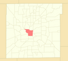 |
| Eagle Creek | Aspen Ridge · Bayhead Village · Bay Landing · Bay Point · Center Point · Chesapeake Landing · Cobble Stone · Coppermill at the Park · Deer Cross · Eagle Bay · Eagle Chase · Eagle Creek Woods · Eagle Pointe · Eagles Crossing · Eagles Landing · Eagles Watch · Eagles Way · Fox Orchard · Heather Ridge · Hickory Square · Idlewood · Malibu Mills · Oaks of Eagle Creek · The Park at Eagle Creek · The Preserve at Eagle Creek · Reflections · Spinnaker · Summerfield · Timberview at Eagle Creek · The Trees · Trophy Club · Twin Oaks · Waterwood at Eagle Creek · Westbay · Wind Drift | 17,355 | 16th |  |
| Eagledale | Highwoods · Rolling Meadows · Venerable Flackville [31] · Westview [32] | 23,365 | 8th | 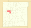 |
| Eastgate | English Crossing · Shiloh Estates · Sycamore Heights · Warren Park [lower-alpha 1] [lower-alpha 7] | 6,235 | 61st |  |
| East Warren | Autumn Glen · Bradford Trace · Braeburn Village · BrookWood · Hartman Village · Heather Hills · Maple Creek · Park Valley Estates · RossWood · Tealpoint · Valley Creek · Warren Lakes · Washington Place · Wellington Park | 23,854 | 7th | 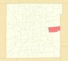 |
| Eastside | Community Heights · Warren Park [lower-alpha 1] [lower-alpha 7] · Windsor Village | 11,496 | 32nd | 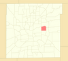 |
| Edgewood | Drakeshire · Longacre · Mary Knoll | 9,553 | 39th |  |
| Faigrounds | Keystone–Monon | 4,615 | 71st |  |
| Far Eastside | Briarbrook Village · Franklin Heights · Homewood Park · Northeastwood · Pine Crest · West Eastwood [33] | 40,647 | 1st |  |
| Five Points | Adler Grove · Hanover · Wildwood Farms at Becker Estates · Wildwood Farms at Moeller Estates | 6,610 | 57th |  |
| Forest Manor | | 3,497 | 80th |  |
| Fountain Square [lower-alpha 4] | Irish Hill · Laurel and Prospect District · North Square · Prospect Falls · State and Prospect District · Virginia Avenue District | 5,989 | 63rd |  |
| Gallaudet | Amber Ridge · Ashland Pointe · Buck Creek Woods · Burton Crossing · Carriage Courts · Edgewood Trace · Glen Ridge · The Pointe Dimond Ridge · The Point Emerald Ridge · Southport Green · Spring Oaks · Stone Pointe · Thompson Park · Village of New Bethel · Waters Edge · Wildcat Park · Wildcat Run · Woodland Trace | 13,031 | 26th |  |
| Garden City | Lynhurst Gardens · Mickleyville · Speedway Woods | 16,595 | 17th |  |
| Garfield Park | Germania Creek · South Village | 5,213 | 69th |  |
| Geist | Admirals Bay · Admirals Pointe · Admirals Sound · Beam Reach · Feather Bay · Feather Cove I, II, III · The Hamptons at Geist · Harbour Pines · Harbour Pines North · Lighthouse Cove · Masthead of Geist Harbours · The Moorings · The Preserve at Fall Creek · ShoreWalk · Vineyards of Fall Creek · Windsong | 9,083 | 43rd |  |
| Glendale | Chatham Pointe · Terra Vista · Westmore Heights [34] | 3,979 | 76th |  |
| Glenns Valley | Arbors on Bluff · Aspen Lakes · Dakota Ridge · Emerald Highlands at Killarney Hill · Hunter's Run · Killarney Hill at Murphy's Landing · Maple Grove · Monteo Village · Murphy's Landing · Perry Commons · Ridge Hills Trails · Shannon Lakes at Murphy's Landing · Sonesta · Southwinds at Murphy's Landing · Southwinds Circle · Southwinds Villas · Valley Ridge Farms · Valley View Farms | 9,540 | 40th |  |
| Hill Valley | Buffalo Creek · Classic View · Hill Valley Estates · The Magnolia | 7,205 | 52nd |  |
| Homecroft [lower-alpha 1] | Perry Manor · Perry Woods Estates | 5,555 | 67th |  |
| I-65 / South Emerson | Arlington Meadows · Bradford Place · Buck Creek Meadows · Coventry Park · Epler Trace · Farhill Downs · Farhill Woods · Franklin Lake in the Woods · Garden Park South · Gray Arbor · Gray Fox Commons · Greystone · Highgate Estates · Maple Glen · Moss Creek · Perry Pines · Quail Creek · Southport Trace · Stone Mill · White Oak Farms · White Oak Woods · Woodlands & Meadows | 14,692 | 21st |  |
| I-69 / Fall Creek | Avalon Hill East · Beechler Estates · Bolander Woods · Cardinal Cove · Castillia · Castlebrook · Castle Cove · Castle Ridge · Castleton Estates ·Castleton Farms · Copperfield · Creek Ridge · De Ville Place · Eagle Nest · Front Gate · Geist Landing · Glastonbury Court · Harbour Pines · Harrison Run · Heritage Park · Hunters Ridge · Knollwood · Knollwood Creek · Lake Castleton · Lantern Hills · Pinegrove · Pine Ridge Estates · Pinesprings · The Pines of Fall Creek · The Preserve at Fall Creek · The Sanctuary · Sargent Creek · Sargent Manor · Sargent Woods · Scarborough Village · Shadeland Station · Shadow Ridge · Summerwood · Village Manor · The Villages (Cape Cod Village · Champions Village · Fountain Village · Village Gate · Village Woods) · Yorkshire | 18,233 | 15th |  |
| International Marketplace | Moller Village | 720 | 95th |  |
| Irvington | Emerson Avenue Addition · Irvington Terrace · Pleasanton in Irvington · Warren Park [lower-alpha 1] [lower-alpha 7] | 11,038 | 34th | 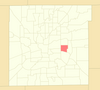 |
| Key Meadows | Country Club Pines · Country Club Place · Country Village · Eagle Valley · The Islands · Liberty Oak · Mallard Green · Parc Estates North · Robey · Robey Glen · Sunningdale Commons · Tansel Creek · Tansel Crossing · Tansel Grove · Tansel Park · The Villages at Drake Landing · The Waterfront · Windham Lake | 10,276 | 37th | 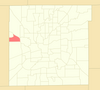 |
| Keystone at the Crossing | Crystal Lake · Lakes at the Crossing · River Crossing · River Ridge | 2,661 | 85th |  |
| Lawrence [lower-alpha 3] | Benjamin Square · Briar Creek · Briar Run · Eagles at Winding Ridge · Greenbriar (mobile home community) · Harrison Park · North Lawrence Park · Northstone at Winding Ridge · Parkwood · Quail Creek · Spring Run at Winding Ridge · Spring Valley · Traditions · Winding Ridge · Wynfield | 26,478 | 6th | 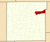 |
| Lawrence [lower-alpha 3] –Fort Ben–Oaklandon | Admirals Cove · Admirals Landing · Bay Ridge · Bradford Creek · Bradford Pointe · Carroll Crossing · Chesapeake · Cobblestone · Crossing South of Geist Harbours · Crystal Pointe · Eagle Pines · Echo Pointe · Fort Benjamin Harrison · Fountain Springs · Foxpointe · Geist Valley Estates · Glen Cove · Harrison Ridge · Hidden Oak · The Highlands at Geist · Indian Lake · Indian Pointe · Kensington Commons · Kensington Farms · Laurel Oaks · Lawrence Woods · Maple Bluffs · Maplewood · The North Woods at Geist · Oakland Hills · Oakland Woods · Oaklandon Meadows · Parkside Crossing · Pebblebrooke at Geist · Persimmon Creek · Persimmon Ridge · Ridge Creek Pines · River Oaks · Rosehaven · Seven Oaks · Sparrowood · Standish Estates at Fort Harrison · Sunnybrooke · Sunset Cove · Timber Ridge · Trilobi Hills · Watson Farms · Winona Place · Woods at Indian Lake | 23,068 | 9th |  |
| Linden Wood | Carriage Estates · Cheyne Walk · Creekbend · Deerfield Village · Foothill Farms · Forrest Commons · Fox Ridge · Huddleston Estates · Meridian Woods Manor · Meridian Woods Park · Orchard Village · Parke Place · Southern Oaks · The Villages of Cobblestone (Berkley · Cambridge · Dartmouth · Oxford · Stanford) | 11,786 | 31st | 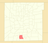 |
| Mapleton–Fall Creek | Central Court · Historic Meridian Park · Watson Park | 6,829 | 54th | 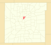 |
| Marian–Cold Springs | Cold Spring Estates · Kessler Wides at 30th Street | 3,242 | 84th |  |
| Mars Hill | High Manor · Mann Village · Maywood Manor · Seerley Creek | 15,364 | 19th | 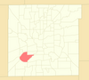 |
| Martindale–Brightwood | | 12,578 | 27th | 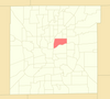 |
| Maywood | | 392 | 96th |  |
| Meadows | Devon Woods [lower-alpha 6] | 6,561 | 58th |  |
| Meridian Hills [lower-alpha 1] / Williams Creek [lower-alpha 1] | Arden · Beechwood Farm · Windcombe [35] | 5,007 | 70th |  |
| Meridian–Kessler | Forest Hills · Oliver Johnson's Woods · Washington Park | 13,386 | 24th |  |
| Millersville | Allison Commons · Brockton · Creekview Estates · Fall Creek Manor · Lake Maxinhall Estates · North Kessler Manor · Rolling Ridge · Wides Addition | 7,604 | 48th | 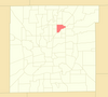 |
| Near Eastside | Bosart Brown · Brookside [36] · Cottage Home · Emerson Heights · Englewood · Fletcher–Lippencott · Forest Manor Park [37] · Grace Tuxedo Park · Holy Cross · Hollywood Place · Little Flower · Otterbein · Rivoli Park · Robson–Voorhees · Rural–Sherman · St. Clair Place · Spades Park · Springdale · Westminster/St. Philip Neri [38] · Willard Park [39] · Woodruff Place | 30,356 | 3rd |  |
| Near Northwest – Riverside | Golden Hill | 7,856 | 47th | 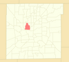 |
| Near Northside | Fall Creek Place · Herron–Morton Place · Kennedy–King · Meridian Highland · Monon Yard · Old Northside · Reagan Park | 10,779 | 36th | 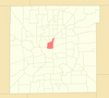 |
| Near Southeast | Barrington · Bean Creek · Beech Crest [40] · Norwood · Red Maple Grove | 15,871 | 18th | 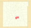 |
| Near Southside | Bates–Hendricks · Old Southside | 6,102 | 62nd |  |
| Near Westside | 58/Bahr at Central State · Bolton Square at Central State · Fairfax · Haughville · Hawthorne · Stringtown · Westside [41] | 19,054 | 11th |  |
| New Bethel | Fox Hollow · Hunters Crossing · Indigo Run · Sagebrook · Wolf Run | 3,948 | 77th | 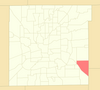 |
| Nora / Far Northside | Belle Meade · Cedar Knolls · College Commons · Driftwood Hills · Sherwood Forest · Willowood | 8,314 | 44th |  |
| North Central | Muir Woods · Mystic Bay · Oxbow · Shore Acres · Solana at the Crossing | 3,311 | 82nd |  |
| North Perry | Frog Holler · Marquis Manor · Meridian Gardens | 6,809 | 55th |  |
| Northwest High School | Eagles Knoll · Falcons Nest · Gateway West · Hidden Bay · Lakeside Manor · The Willows · Woodland Place | 18,915 | 12th | 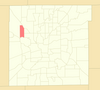 |
| Park 100 | | 94 | 99th | 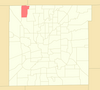 |
| Park Fletcher | | 788 | 94th | 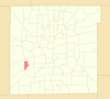 |
| Poplar Grove | Arlington Commons · Ashland · Big Run · Chessington Grove · Churchman Estates · Churchman Manor · Copper Grove · Crystal Lake · Franklin Crossing · Hickory Knoll · Newberry Glen · Spring Lake | 5,898 | 65th |  |
| Ravenswood | Dawnbury–Keystone [lower-alpha 5] | 1,799 | 92nd | 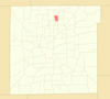 |
| Raymond Park | Brookfield Place · Greythorne · Mayfair at Raymond Park · Raymond Park Village · Willow Lakes · The Woods at Liberty Park | 5,268 | 68th |  |
| Snacks / Guion Creek | Augusta Meadows · Bradford Meadows · Brookstone · Cheswick Place · Countrybrook · Country Farms · Deer Creek Estates · Eagle Creek North · Eagle Trace Village · Falcon Lakes · Fieldstone · Georgetown Crossing · Guion Lakes · Guion Pointe Kessler Greene · Liberty Creek North and South · Morningside · Northern Estates · Oakforge · The Pines · Robertson Village · Saddlebrook · Shadow Pointe · Spring Creek · Stratford Glen · Twin Creek · Wood Creek | 29,592 | 4th |  |
| South Franklin | Abbey Road · Abbington · Bel Moore · Bentley Commons · Bentley Estates · Bentley Farms · Birchwood Park · Brookston · Crossroads at Southport · Edenwilde · Feather Run · Feather Trace · Flat Branch Estates · Franklin Meadows · Franklin Parke Estates · Ironstone · Keeneland Crest · Lakeland Trails · McGregor Highlands · Meadowbend · Misty Woods · Pine Lake · Princeton Lakes · Red Fox Woods · Smithfield · Southern Lakes · Southern Ridge · Southern Springs · Southern Trails · Stone Briar · Stone Bridge · Stone Creek · Sycamore Run · Timberfield · Timberlakes · Westbrooke | 18,915 | 12th | 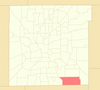 |
| South Perry | Averly Park · Grand View Acres and Southgate Farms [42] · Gray Farm Estates · Greenbrooke · Harvard Square · LaScala Villas · The Maples · McFarland Farms · Pleasant Lake Estates · Richmond Hill · Sherman Commons · Sherman Oaks · Southridge Square · Southwood · The Springs · Sterling Ridge · Summer Walk · Whitaker Valley · Whitaker Valley Estates · Winchester Village [43] | 26,675 | 5th |  |
| Southdale | Bluff Manor · Crosscreek · Meridian Place · Orchard Park · Orchard View Estates · Rosebrock Estates | 5,570 | 66th | 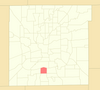 |
| Southeast | Addison Meadows · Foxfire · Franklin Gardens · Wallace Crossing · Woodland Trails | 6,540 | 59th |  |
| Southeast Warren | Bade Woods · Cedar Springs · Creekside Meadows · Creekside Woods · Creekwood Hills · Forest Creek · Grassy Creek · Grassy Village · Hamptons · Hidden Lake Estates · Irongate · Lakes at Grassy Creek · Muesing Farms · Paddock · Stable Chase · Treyburn Green · Washington Trail · Whispering Pines · The Woods at Grassy Creek · Woodsong | 9,206 | 41st | 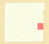 |
| Southern Dunes | Arrowhead at Southern Dunes · Bayberry Village · Buck Creek Village · Cedar Park · Cheyenne Lakes at Southern Dunes · Chippewa Lakes at Southern Dunes · Governors Pointe · Hudson Bay at Southern Dunes · Huron Lakes at Southern Dunes · Pawnee Ridge at Southern Dunes · The Villas at Lake Lakota · Whispering Falls · Wichita Falls at Southern Dunes | 7,974 | 46th | 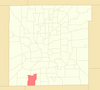 |
| Southport [lower-alpha 3] | Justus Southern Manor Estates | 2,123 | 89th |  |
| Speedway [lower-alpha 3] | | 15,136 | 20th |  |
| St. Vincent / Greenbriar | Alverna · Bridgefield · Eden Woods · Golden Oaks · Homestead Lakes · Mayfield · Northbrook · North Willow Farms · Pickwick Commons · Pickwick Drive · Pickwick Farms · Somerset Hills · Tamarack · Williamshire · Williston Green | 14,674 | 22nd |  |
| Stout Field | Drexel Gardens | 5,930 | 64th |  |
| Sunshine Gardens | Bluff View Meadow | 1,393 | 93rd |  |
| Traders Point | Chestnut Hills · Eagle Creek Manor · Hunters Green · Huntington · Normandy Farms · Pike Wood · Woods at Traders Point | 6,661 | 56th |  |
| University Heights | Carson Heights · Rosedale Hills | 12,452 | 29th |  |
| Valley Mills | Cardinal Village · Copeland Mills Estates · Decatur Commons · Decatur Ridge · Emerald Village · River Run · Timberleaf · Wedgewood | 12,460 | 28th |  |
| Wanamaker | Marlin Meadows | 2,210 | 88th |  |
| West Indianapolis | The Valley | 7,056 | 53rd |  |
| West Newton | Crossfield · Oak Trace | 2,030 | 90th |  |
| Wynnedale [lower-alpha 1] / Spring Hill [lower-alpha 1] | | 4,273 | 73rd |  |
|
| Marion County | — | 977,203 [44] | Total | |
|