Indianapolis, colloquially known as Indy, is the capital and most populous city of the U.S. state of Indiana and the seat of Marion County. According to the U.S. Census Bureau, the consolidated population of Indianapolis and Marion County was 977,203 in 2020. The "balance" population, which excludes semi-autonomous municipalities in Marion County, was 887,642. It is the 16th-most populous city in the U.S., the third-most populous city in the Midwest after Chicago and Columbus, Ohio, and the fourth-most populous state capital after Phoenix, Arizona, Austin, Texas, and Columbus. The Indianapolis metropolitan area is the 33rd-most populous metropolitan statistical area in the U.S., with 2,111,040 residents. Its combined statistical area ranks 28th, with a population of 2,431,361. Indianapolis covers 368 square miles (950 km2), making it the 18th largest city by land area in the U.S.

Marion County is located in the U.S. state of Indiana. The 2020 United States census reported a population of 977,203, making it the largest county in the state and 51st most populated county in the country. Indianapolis is the county seat, the state capital, and largest city. Marion County is consolidated with Indianapolis through an arrangement known as Unigov.

Zionsville is a suburban town located in the extreme southeast area of Boone County, Indiana, United States, northwest of Indianapolis. The population was 14,160 at the 2010 census, 30,693 at the 2020 census.

Westfield is a city in Hamilton County, Indiana, United States. As of the 2010 census the population was 30,068, and in 2020 the population was 46,410. Westfield is in the Indianapolis metropolitan area.
Avon is a town in Washington Township, Hendricks County, Indiana, United States. The population was 21,474 at the 2020 census. It is part of the Indianapolis metropolitan area.

Plainfield is a town in Guilford, Liberty, and Washington townships, Hendricks County, Indiana, United States. The population was 27,631 at the 2010 census, and in 2022 the estimated population was 36,074.
Lawrence is a city in Marion County, Indiana, United States. It is one of four "excluded cities" in Marion County. The city is home to Fort Benjamin Harrison within Fort Harrison State Park. The population was 49,370 at the 2020 census. The city is on the northeast side of Indianapolis.

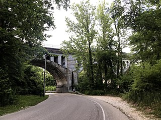
The Monon Trail is a rail trail located entirely within the state of Indiana. The Monon Railroad was a popular railroad line connecting the cities of Chicago and Indianapolis, with stops at major settlements along its route. After the decline of railroad travel and the sale of the company in 1987, the portion of the line between Indianapolis and Delphi, Indiana, was abandoned.
The Metropolitan School District of Lawrence Township is a school district in Lawrence Township in northeast Marion County, Indianapolis, Indiana. It covers an area of 48 square miles (120 km2) and in 2010 had a student enrollment just under 16,000.

The Metropolitan School District of Washington Township (MSDWT) is a public school district located in the northern section of Indianapolis, Indiana and Marion County. The district was established in 1955 and serves the area of Washington Township that was outside the city limits before the city and county were merged in 1970. As of 2016–17, MSDWT had approximately 11,482 students in grades K–12. The district has been an educational leader in Indiana for the last 60 years and offers a comprehensive educational curriculum with special activities and programs geared to provide enrichment, exploration, and instructional support for students. It also provides excellent opportunities for students to participate in outstanding performing arts, fine arts, academic teams, publications, athletics, and other student activities.

Indianapolis Public Schools (IPS) is the largest school district in Indianapolis, and the second largest school district in the state of Indiana as of 2021, behind Fort Wayne Community Schools. The district's headquarters are in the John Morton-Finney Center for Educational Services.

Decatur Township is one of the nine townships in Marion County, Indiana, United States, and part of the consolidated city of Indianapolis. As of the 2010 census, it had a population of 32,388. Located in the southwest corner of the county, the township is home to the Indianapolis International Airport main terminal. It is one of the most rural sections of the county, but has seen many new residential and commercial developments. AmeriPlex, one of the largest industrial parks in Indiana, is in Decatur Township. Through the White River, Decatur and Perry townships share the only water boundary among Marion County's townships.
The neighborhood of Irvington, named after Washington Irving, includes Irvington Historic District, a historic district in Indianapolis, Indiana. The historic district is a 545-acre (221 ha) area that was listed on the National Register of Historic Places in 1987. That year, the district included 2,373 contributing buildings, 5 other contributing structures, and 2 contributing sites.
Near Northside is a historic neighborhood located in Northside, Houston, Texas. Near Northside is primarily occupied by people of Hispanic descent.

Indiana's 7th congressional district is a congressional district in the U.S. state of Indiana. It is entirely located within Marion County and includes most of Indianapolis, except for the southern side, which is located within the 6th district.

Washington Township is one of the nine townships of Marion County, Indiana, located in the northern part of the county. The township is entirely within the city of Indianapolis. The population as of the 2010 census was 132,049. The first settlement at Washington Township was made in 1819.

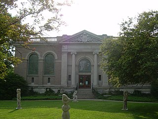
The Indianapolis Public Library (IndyPL), formerly known as the Indianapolis–Marion County Public Library, is the public library system serving the citizens of Marion County, Indiana, United States and its largest city, Indianapolis. The library was founded in 1873 and has grown to include a Central Library building, located adjacent to the Indiana World War Memorial Plaza, and 24 branch libraries spread throughout the county.
The Bates–Hendricks neighborhood is situated just south and east of the downtown commercial district of Indianapolis, Indiana. The Fountain Square business district is just to the east.

Broad Ripple Village is one of seven areas designated as cultural districts in Indianapolis, Indiana. Located in Washington Township, Marion County, Indiana, about six miles north of downtown Indianapolis, Broad Ripple was first platted in 1837, became incorporated as the Town of Broad Ripple in 1894, and was annexed to the City of Indianapolis in 1922.