Mapun

Last updated
Mapun
مڤون
Cagayan de Sulu
Municipality of Mapun
Mapun Municipal Hall.jpg
Municipal Hall
Flag of Mapun, Tawi-Tawi.png
Ph locator tawi-tawi mapun.png
Map of Tawi-Tawi with Mapun highlighted
OpenStreetMap
Mapun
Philippines location map (square).svg
Red pog.svg
Mapun
Location within the Philippines
Coordinates: 6°58′41″N118°30′47″E / 6.978°N 118.513°E / 6.978; 118.513
CountryPhilippines
Region Bangsamoro Autonomous Region in Muslim Mindanao
Province Tawi-Tawi
District Lone district
Barangays 15 (see Barangays)
Government
[1]
  Type Sangguniang Bayan
   Mayor Vacant
   Vice Mayor Vacant
   Representative Dimszar M. Sali
   Municipal Council
Members
   Electorate 17,614 voters (2022)
Area
[2]
  Total181.29 km2 (70.00 sq mi)
Elevation
6.7 m (22.0 ft)
Highest elevation
241 m (791 ft)
Lowest elevation
0 m (0 ft)
Population
 (2020 census) [3]
  Total30,038
  Density170/km2 (430/sq mi)
   Households
4,928
Demonym Jama Mapun
Economy
   Income class 4th municipal income class
   Poverty incidence
38.18
% (2021) [4]
   Revenue 120.2 million (2020)
   Assets 38.04 million (2020)
   Expenditure 125.7 million (2020)
Service provider
  ElectricityCagayan de Sulu Electric Cooperative (CASELCO)
Time zone UTC+8 (PST)
ZIP code
7508
PSGC
IDD : area code +63(0)68
Native languages Sama
Tagalog
Sabah Malay

Mapun, officially the Municipality of Mapun (Tagalog : Bayan ng Mapun), is a 4th class municipality in the province of Tawi-Tawi, Philippines. According to the 2020 census, it has a population of 30,038 people. [3]

Contents

It is formerly known as Cagayan de Sulu until 1984, then as Cagayan de Tawi-Tawi until 1988. [5]

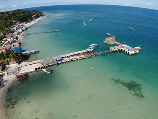
Mapun is an island municipality in the Sulu Sea [6] on the south-western extreme of the Philippines, located very close to Sabah, Malaysia as well as to Palawan. The people inhabiting the island are known as Jama Mapun or "people of Mapun". Their local language is Pullun Mapun, which means "Mapun language".

Due to an administrative error in the Treaty of Paris, while the remainder of the Philippines was ceded to the United States, Sibutu and Cagayan de Sulu were retained under Spanish Sovereignty until they were formally ceded to the United States upon the ratification of the Treaty of Washington on March 23, 1901.

Geography

Mapun Tawi-Tawi is surrounded by several islets such as:

Most of these are located at Barangay Umus Mataha.

Barangays

Mapun is politically subdivided into 15 barangays. Each barangay consists of puroks while some have sitios.

Climate

Climate data for Mapun, Tawi-Tawi
MonthJanFebMarAprMayJunJulAugSepOctNovDecYear
Mean daily maximum °C (°F)28
(82)
28
(82)
29
(84)
31
(88)
31
(88)
31
(88)
30
(86)
31
(88)
30
(86)
30
(86)
29
(84)
28
(82)
30
(85)
Mean daily minimum °C (°F)24
(75)
23
(73)
23
(73)
24
(75)
24
(75)
25
(77)
24
(75)
25
(77)
24
(75)
24
(75)
24
(75)
24
(75)
24
(75)
Average precipitation mm (inches)123
(4.8)
81
(3.2)
79
(3.1)
48
(1.9)
65
(2.6)
65
(2.6)
68
(2.7)
64
(2.5)
66
(2.6)
100
(3.9)
101
(4.0)
134
(5.3)
994
(39.2)
Average rainy days17.714.516.114.922.724.325.725.423.825.722.920.8254.5
Source: Meteoblue [7]

Demographics

Population census of Mapun
YearPop.±% p.a.
1903 2,000    
1918 6,090+7.71%
1939 6,851+0.56%
1948 8,824+2.85%
1960 10,789+1.69%
1970 12,577+1.54%
1975 15,892+4.80%
1980 19,607+4.29%
1990 19,372−0.12%
1995 20,716+1.26%
2000 22,011+1.31%
2007 29,801+4.27%
2010 24,168−7.34%
2015 26,597+1.84%
2020 30,038+2.42%
Source: Philippine Statistics Authority [8] [9] [10] [11]

Education

The Jama Mapun people's indigenous cosmology is extremely vast. Examples of figures in their cosmology are Niyu-niyu (coconut palm), Lumba-lumba (dolphin), and Anak Datu (two sons of a datu spearing another figure, Bunta - a blowfish). BigdipISS.jpg
The Jama Mapun people's indigenous cosmology is extremely vast. Examples of figures in their cosmology are Niyu-niyu (coconut palm), Lumba-lumba (dolphin), and Anak Datu (two sons of a datu spearing another figure, Bunta - a blowfish).
Elementary
Secondary
Tertiary

Mindanao State University Extension - a public school and the only college institution in Mapun. MSU-Extension offers two-year courses.

Majority of those who graduate from high school pursue their studies in other places, most notably Zamboanga City, Palawan, and Bongao. On the other hand, most of the graduates from elementary and high school are forced to stop their studies due to poverty lack of scholarships from the government. Most of them have found a job in neighboring country like Malaysia. Tend to work as a construction workers and fisherman.

Culture

Mapun Day

Mapun Foundation Day is celebrated by the Jama Mapun every September 5. This week-long celebration starts on September 1, with a parade and then a short program held in Lupa Pula Central School.

Various competitions are held during Mapun Day, which includes singing competitions (in English, Tausug, and Pullun Mapun), dance showdowns (modern dance, folk dance, pangalay, which is a native dance, and lunsay, which is a dance performed during weddings), Azaan competition, Tarasul iban Daman (Mapun's version of declamation and oration), and Leleng, to name a few.

Each Barangay has their own representatives in the various events. However, the most popular is the "Budjang Mapun", which is a beauty contest. Each barangay has its own contestant in this event. The winner of the search for "Budjang Mapun" is usually sent to Bongao as Mapun's representative in Budjang Tawi-Tawi, a similar beauty search held in Bongao every Province Day. Every municipality in Tawi-Tawi has its own contestant.

Economy

Poverty Incidence of Mapun

10
20
30
40
50
60
70
2000
61.00
2003
48.92
2006
46.20
2009
35.19
2012
30.57
2015
27.63
2018
18.81
2021
38.18

Source: Philippine Statistics Authority [13] [14] [15] [16] [17] [18] [19] [20]


Main source of income from this province are farming and fishing. In a bid to advance competitiveness of Tawi-Tawi in farming industry, this province supplies large companies when it comes on coconut plantation mainly "COPRA". 80% of the land consist of coconut trees, quarterly harvested and to be traded and refined in other places, like Palawan and Zamboanga City.

Rice fields are not known in this area due to lack of water irrigation projects, rice is imported locally from Palawan and Zamboanga City and mostly from Malaysia. Most of the locals use cassava as base on their daily meal.

See also

Related Research Articles

<span class="mw-page-title-main">Sulu</span> Province in Bangsamoro, Philippines

Sulu, officially the Province of Sulu, is a province of the Philippines in the Sulu Archipelago and part of the Bangsamoro Autonomous Region in Muslim Mindanao (BARMM).

<span class="mw-page-title-main">Tawi-Tawi</span> Province in Bangsamoro, Philippines

Tawi-Tawi, officially the Province of Tawi-Tawi, is an island province in the Philippines located in the Bangsamoro Autonomous Region in Muslim Mindanao (BARMM). The capital of Tawi-Tawi is Bongao.

<span class="mw-page-title-main">Lugus, Sulu</span> Municipality in Sulu, Philippines

Lugus, officially the Municipality of Lugus, is a 5th class municipality in the province of Sulu, Philippines. According to the 2020 census, it has a population of 29,043 people.

<span class="mw-page-title-main">Parang, Sulu</span> Municipality in Sulu, Philippines

Parang, officially the Municipality of Parang, is a 2nd class municipality in the province of Sulu, Philippines. According to the 2020 census, it has a population of 71,495 people.

<span class="mw-page-title-main">Banguingui, Sulu</span> Municipality in Sulu, Philippines

Banguingui, officially the Municipality of Banguingui, is a 4th class municipality in the province of Sulu, Philippines. According to the 2020 census, it has a population of 35,616 people.

<span class="mw-page-title-main">Bongao</span> Capital of Tawi-Tawi, Philippines

Bongao, officially the Municipality of Bongao, is a 2nd class municipality and capital of the province of Tawi-Tawi, Philippines. According to the 2020 census, it has a population of 116,118 people.

<span class="mw-page-title-main">Languyan</span> Municipality in Tawi-Tawi, Philippines

Languyan, officially the Municipality of Languyan, is a 1st class municipality in the province of Tawi-Tawi, Philippines. According to the 2020 census, it has a population of 37,096 people.

<span class="mw-page-title-main">Panglima Sugala</span> Municipality in Tawi-Tawi, Philippines

Panglima Sugala, officially the Municipality of Panglima Sugala, is a 3rd class municipality in the province of Tawi-Tawi, Philippines. According to the 2020 census, it has a population of 48,055 people. It was formerly known as Balimbing.

<span class="mw-page-title-main">Sitangkai</span> Municipality in Tawi-Tawi, Philippines

Sitangkai, officially the Municipality of Sitangkai, is a 1st class municipality in the province of Tawi-Tawi, Philippines. According to the 2020 census, it has a population of 37,319 people.

<span class="mw-page-title-main">Tandubas</span> Municipality in Tawi-Tawi, Philippines

Tandubas, officially the Municipality of Tandubas, is a 2nd class municipality in the province of Tawi-Tawi, Philippines. According to the 2020 census, it has a population of 34,316 people.

<span class="mw-page-title-main">Turtle Islands, Tawi-Tawi</span> Municipality in Tawi-Tawi, Philippines

Turtle Islands, officially the Municipality of Turtle Islands, is a 5th class municipality in the province of Tawi-Tawi, Philippines. According to the 2020 census, it has a population of 5,683 people, making it the least populated town in the province.

<span class="mw-page-title-main">Pualas</span> Municipality in Lanao del Sur, Philippines

Pualas, officially the Municipality of Pualas, is a 5th class municipality in the province of Lanao del Sur, Philippines. According to the 2020 census, it has a population of 14,526 people.

<span class="mw-page-title-main">Sultan Dumalondong</span> Municipality in Lanao del Sur, Philippines

Sultan Dumalondong, officially the Municipality of Sultan Dumalondong, is a 6th class municipality in the province of Lanao del Sur, Philippines. According to the 2020 census, it has a population of 12,500 people.

<span class="mw-page-title-main">Tamparan</span> Municipality in Lanao del Sur, Philippines

Tamparan, officially the Municipality of Tamparan, is a 5th class municipality in the province of Lanao del Sur, Philippines. According to the 2020 census, it has a population of 32,074 people.

<span class="mw-page-title-main">Libona</span> Municipality in Bukidnon, Philippines

Libona, officially the Municipality of Libona, is a 1st class municipality in the province of Bukidnon, Philippines. According to the 2020 census, it has a population of 48,965 people.

<span class="mw-page-title-main">Aloran</span> Municipality in Misamis Occidental, Philippines

Aloran, officially the Municipality of Aloran, is a 4th class municipality in the province of Misamis Occidental, Philippines. According to the 2020 census, it has a population of 27,934 people.

<span class="mw-page-title-main">Alubijid</span> Municipality in Misamis Oriental, Philippines

Alubijid, officially the Municipality of Alubijid, is a 4th class municipality in the province of Misamis Oriental, Philippines. According to the 2020 census, it has a population of 32,163 people.

<span class="mw-page-title-main">Al-Barka</span> Municipality in Basilan, Philippines

Al-Barka, officially the Municipality of Al-Barka, is a municipality in the province of Basilan, Philippines. According to the 2020 census, it has a population of 23,736 people.

<span class="mw-page-title-main">Sibutu</span> Municipality in Tawi-Tawi, Philippines

Sibutu, officially the Municipality of Sibutu, is a municipality in the province of Tawi-Tawi, Philippines. According to the 2020 census, it has a population of 34,243 people.

<span class="mw-page-title-main">Omar, Sulu</span> Municipality in Sulu, Philippines

Omar, officially the Municipality of Omar, is a municipality in the province of Sulu, Philippines. According to the 2020 census, it has a population of 28,070 people.

References

  1. Municipality of Mapun | (DILG)
  2. "2015 Census of Population, Report No. 3 – Population, Land Area, and Population Density" (PDF). Philippine Statistics Authority. Quezon City, Philippines. August 2016. ISSN   0117-1453. Archived (PDF) from the original on May 25, 2021. Retrieved July 16, 2021.
  3. 1 2 Census of Population (2020). "Bangsamoro (BARMM)". Total Population by Province, City, Municipality and Barangay. Philippine Statistics Authority . Retrieved 8 July 2021.
  4. "PSA Releases the 2021 City and Municipal Level Poverty Estimates". Philippine Statistics Authority. 2 April 2024. Retrieved 28 April 2024.
  5. Republic Act No. 6672, Supreme Court E-library
  6. C.Michael Hogan. 2011. Sulu Sea. Encyclopedia of Earth. Eds. P.Saundry & C.J.Cleveland. Washington DC
  7. "Mapun, Tawi-Tawi : Average Temperatures and Rainfall". Meteoblue. Retrieved 30 January 2019.
  8. Census of Population (2015). "ARMM – Autonomous Region in Muslim Mindanao". Total Population by Province, City, Municipality and Barangay. Philippine Statistics Authority . Retrieved 20 June 2016.
  9. Census of Population and Housing (2010). "ARMM – Autonomous Region in Muslim Mindanao" (PDF). Total Population by Province, City, Municipality and Barangay. National Statistics Office . Retrieved 29 June 2016.
  10. Censuses of Population (1903–2007). "ARMM – Autonomous Region in Muslim Mindanao". Table 1. Population Enumerated in Various Censuses by Province/Highly Urbanized City: 1903 to 2007. National Statistics Office.{{cite encyclopedia}}: CS1 maint: numeric names: authors list (link)
  11. "Province of Tawitawi". Municipality Population Data. Local Water Utilities Administration Research Division. Retrieved 17 December 2016.
  12. https://www.ichcap.org/eng/ek/sub3/pdf_file/domain4/089_Constellations.pdf [ bare URL PDF ]
  13. "Poverty incidence (PI):". Philippine Statistics Authority. Retrieved December 28, 2020.
  14. "Estimation of Local Poverty in the Philippines" (PDF). Philippine Statistics Authority. 29 November 2005.
  15. "2003 City and Municipal Level Poverty Estimates" (PDF). Philippine Statistics Authority. 23 March 2009.
  16. "City and Municipal Level Poverty Estimates; 2006 and 2009" (PDF). Philippine Statistics Authority. 3 August 2012.
  17. "2012 Municipal and City Level Poverty Estimates" (PDF). Philippine Statistics Authority. 31 May 2016.
  18. "Municipal and City Level Small Area Poverty Estimates; 2009, 2012 and 2015". Philippine Statistics Authority. 10 July 2019.
  19. "PSA Releases the 2018 Municipal and City Level Poverty Estimates". Philippine Statistics Authority. 15 December 2021. Retrieved 22 January 2022.
  20. "PSA Releases the 2021 City and Municipal Level Poverty Estimates". Philippine Statistics Authority. 2 April 2024. Retrieved 28 April 2024.