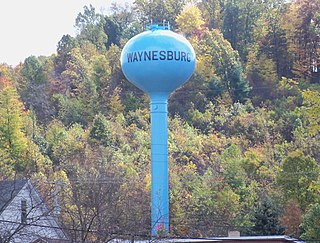
Waynesburg is a village in Stark County, Ohio, United States. The population was 923 at the 2010 census, a decrease from 1,003 in 2000. It is part of the Canton-Massillon, OH Metropolitan Statistical Area.

Orrville is a city in Wayne County, Ohio, United States. It is about 9 miles east of Wooster and 20 miles southwest of Akron. The population was 8,380 at the 2010 census.

Minerva is a village in Carroll, Columbiana, and Stark counties in the U.S. state of Ohio. The population was 3,720 at the 2010 census. In 2020, the United States Census Bureau estimated it to be 3,482.
Samuel Watts Davies was an American politician.

Piedmont is an unincorporated community in western Moorefield Township, Harrison County, Ohio, United States. It has a post office with the ZIP code 43983.

Lafferty is a census-designated place in northeastern Union Township, Belmont County, Ohio, United States, along Wheeling Creek. As of the 2010 census it had a population of 304. It has a post office with the ZIP code 43951.

Sandyville is an unincorporated community in northern Sandy Township, Tuscarawas County, Ohio, United States. It has a post office with the ZIP code 44671. It lies along State Route 800 between Canton and New Philadelphia.

Paris is an unincorporated community in northwestern Paris Township, Stark County, Ohio. It has a post office with the ZIP code 44669. It lies along State Route 172 between East Canton and Lisbon. The community is part of the Canton–Massillon Metropolitan Statistical Area.

Maximo is an unincorporated community in northwestern Washington Township, Stark County, Ohio, United States. It has a post office with the ZIP code 44650. The community is part of the Canton–Massillon Metropolitan Statistical Area.
Robertsville is an unincorporated community and census-designated place in western Paris Township, Stark County, Ohio, United States. It has a post office with the ZIP code 44670. It lies along U.S. Route 30 between East Canton and Minerva. The community is part of the Canton–Massillon Metropolitan Statistical Area.

Whipple is an unincorporated community in southern Salem Township, Washington County, Ohio, United States. Although it is unincorporated, it once had a post office, with the ZIP code 45788. It lies on State Route 821 south of the village of Lower Salem, at the junction of Whipple Run with Duck Creek. The community took its name from nearby Whipple Run.

Watertown is an unincorporated community in southwestern Watertown Township, Washington County, Ohio, United States. It has a post office with the ZIP code 45787. It lies near the intersection of State Routes 339 and 676 near Wolf Creek, which meets the Muskingum River at Waterford to the north.

Vincent is a census-designated place in southern Barlow Township, Washington County, Ohio, United States. It has a post office with the ZIP code 45784. It lies along State Route 339 near Tupper Creek, a subsidiary of the Little Hocking River, which in turn meets the Ohio River at Little Hocking to the south.

Cairo is an unincorporated community that lies upon the border of Lake Township and Plain Township within Stark County, Ohio, United States. Its altitude is 1,145 feet (349 m). The community is part of the Canton–Massillon Metropolitan Statistical Area.

New Franklin is an unincorporated community in northeastern Paris Township, Stark County, Ohio, United States, lying at the intersection of State Routes 172 and 183. The community is part of the Canton–Massillon Metropolitan Statistical Area.

North Industry is an unincorporated community in southern Canton Township, Stark County, Ohio, United States, along the Nimishillen Creek. Its altitude is 1,001 feet (305 m). The community is part of the Canton–Massillon Metropolitan Statistical Area. North Industry is often referred to as "Canton South" by the local residents. The mayor of Slabtown is local resident Jeremy Noll.

Richville is an unincorporated community and census-designated places in southern Perry Township, Stark County, Ohio, United States. State Route 627 passes through the community. The community is part of the Canton–Massillon Metropolitan Statistical Area.

Waco is an unincorporated community in central Canton Township, Stark County, Ohio, United States. It lies along State Route 43 just southeast of the Canton city line. Waco's altitude is 1,070 feet (326 m) The community is part of the Canton–Massillon Metropolitan Statistical Area.
Suver is an unincorporated community in Polk County, Oregon, United States. It is located about 10 miles north of Corvallis and about 8 miles south of Monmouth, 1 mile east of Oregon Route 99W.
Freeland is an unincorporated community in Muskingum County, in the U.S. state of Ohio.