Martins Ferry, Ohio

Last updated

Martins Ferry, Ohio
Fourth from Hanover, Martins Ferry.jpg
Fourth Street downtown
Nickname: 
Ohio's First Settlement
OHMap-doton-Martins Ferry.png
Location of Martins Ferry, Ohio
Map of Belmont County Ohio Highlighting Martins Ferry City.png
Location of Martins Ferry in Belmont County
Coordinates: 40°07′10″N80°43′05″W / 40.11944°N 80.71806°W / 40.11944; -80.71806
Country United States
State Ohio
County Belmont
Government
  Type Mayor-Council
  MayorJohn Davies [1]
  Council PresidentKristine Davis [1]
Area
[2]
  Total2.33 sq mi (6.04 km2)
  Land2.33 sq mi (6.03 km2)
  Water0.00 sq mi (0.00 km2)
Elevation
[3]
761 ft (232 m)
Population
 (2020)
  Total6,260
  Density2,689.00/sq mi (1,038.02/km2)
Time zone UTC-5 (Eastern (EST))
  Summer (DST) UTC-4 (EDT)
ZIP code
43935
Area code 740
FIPS code 39-48104 [4]
GNIS feature ID2395030 [3]
Website www.martinsferry.org

Martins Ferry is the most populous city in Belmont County, Ohio, United States. The population was 6,260 as of the 2020 census. Located along the Ohio River across from Wheeling, West Virginia, it is part of the Wheeling metropolitan area.

Contents

History

Aerial view of Martins Ferry in 1899 Martin's Ferry, Ohio 1899 LOC gm71005336.tif
Aerial view of Martins Ferry in 1899

Martins Ferry is the oldest European settlement in the state of Ohio, having been settled at least as early as 1779, almost a decade before Marietta. The settlement got its start as a consequence of a land grant to George Mercer of the Ohio Company in 1748 from the British Crown for 200,000 acres in the Ohio Country, a colloquial term for what is now much of Ohio, and western West Virginia and Pennsylvania. The grant called for among other things, establishment of a fort. The grant was for land south of the Ohio River in West Virginia (then Virginia). Settlement was hampered by the outbreak of the French and Indian War. The settlement was named Zanesburg (renamed Wheeling in 1795). The Ohio Company was dissolved in 1779, and claims issued by the Crown became moot after the Revolutionary War. The community across the river was a westward extension of Zanesburg, but at that time, settlement on the west bank of the Ohio River was prohibited by the Treaty of Fort Stanwix, 1768. Through the years, it has been known as Hoglinstown, Mercertown, Norristown (1785), Jefferson (1795), Martinsville (1835), and Martin's Ferry (1865).

Squatters from across the Ohio were the earliest settlers. The settlement formed in the shadow of Virginia's Fort Fincastle, later renamed Fort Henry on the Virginia side of the Ohio, built in 1774. The town was disbanded a couple of times before becoming established as Norristown in 1785.[ citation needed ] In 1795, the town of Jefferson was platted by Absalom Martin, one of the city's earliest settlers, who operated a ferry there. In 1801, he abandoned his plat when St. Clairsville was selected as the county seat of the newly organized county of Belmont, one of the founding territories of the Northwest Territory.

In 1835, Ebenezer Martin, the son of Absalom Martin, redesigned the town, which he called "Martinsville", with a grid system of streets, much of which survives to this day. Martinsville remained an unincorporated settlement for a relatively long time. It was eventually incorporated as a village in 1865 and renamed Martin's Ferry for Ebenezer's father's ferry. It was chartered as a city in 1885, and sometime later the apostrophe was dropped from the city's name.

The city developed as an important industrial center during the late 19th century and early 20th century. It became an important rail hub and river port. Over the past 50 years, the town's population has decreased significantly as industries have closed or moved elsewhere. Today, the city's population is less than half of what it once was. [5]

Geography

According to the United States Census Bureau, the city has a total area of 2.33 square miles (6.03 km2), all land. [6]

The town is built on two basic plateaus between a hill and the Ohio River. The lower plateau, along the river, is dominated by a large industrial park, the Martins Ferry Football Stadium, and Ohio State Route 7 (a four-lane traffic artery that runs from north to south across eastern Ohio). The higher plateau, which is the larger of the two, is predominantly residential and commercial, and is home to most of the city's residents. It gradually rises to a steep hillside in the west that forms a natural wall.

Directly across the river lies the city of Wheeling, West Virginia, and to the east is the Pennsylvania state line. The city of Columbus is 125 miles (201 km) to the west, and Pittsburgh is 59 miles (95 km) northeast of the city. On the southern end of town, Martins Ferry is directly connected to the village of Bridgeport.

Climate

The climate in this area is characterized by hot, humid summers and dry, cold winter temperatures. According to the Köppen Climate Classification system, Martins Ferry has a Humid continental climate. [7]

Climate data for Martins Ferry, Ohio
MonthJanFebMarAprMayJunJulAugSepOctNovDecYear
Mean daily maximum °C (°F)4
(40)
5
(41)
11
(51)
17
(63)
23
(74)
28
(82)
30
(86)
29
(85)
26
(79)
20
(68)
12
(53)
6
(42)
18
(64)
Mean daily minimum °C (°F)−6
(22)
−6
(22)
−2
(29)
3
(38)
9
(48)
14
(58)
17
(62)
16
(61)
12
(54)
6
(43)
1
(33)
−4
(25)
5
(41)
Average precipitation mm (inches)74
(2.9)
64
(2.5)
91
(3.6)
86
(3.4)
94
(3.7)
99
(3.9)
94
(3.7)
89
(3.5)
84
(3.3)
64
(2.5)
69
(2.7)
69
(2.7)
980
(38.4)
Source: Weatherbase [8]

Demographics

Historical population
CensusPop.Note
1860 1,220
1870 1,83550.4%
1880 3,819108.1%
1890 6,25063.7%
1900 7,76024.2%
1910 9,13317.7%
1920 11,63427.4%
1930 14,52424.8%
1940 14,7291.4%
1950 13,220−10.2%
1960 11,919−9.8%
1970 10,757−9.7%
1980 9,304−13.5%
1990 7,990−14.1%
2000 7,226−9.6%
2010 6,915−4.3%
2020 6,260−9.5%
2021 (est.)6,216 [9] −0.7%
U.S. Decennial Census [10] [11]

2010 census

As of the census [5] of 2010, there were 6,915 people, 3,022 households, and 1,787 families residing in the city. The population density was 2,967.8 inhabitants per square mile (1,145.9/km2). There were 3,431 housing units at an average density of 1,472.5 per square mile (568.5/km2). The racial makeup of the city was 91.6% White, 5.6% African American, 0.3% Native American, 0.1% Asian, 0.2% from other races, and 2.2% from two or more races. Hispanic or Latino of any race 0.7% of the population.

There were 3,022 households, of which 27.3% had children under the age of 18 living with them, 38.2% were married couples living together, 16.1% had a female householder with no husband present, 4.9% had a male householder with no wife present, and 40.9% were non-families. 35.3% of all households were made up of individuals, and 15% had someone living alone who was 65 years of age or older. The average household size was 2.26 and the average family size was 2.89.

The median age in the city was 42.1 years. 21.3% of residents were under the age of 18; 9.2% were between the ages of 18 and 24; 23.5% were from 25 to 44; 28.9% were from 45 to 64; and 17.2% were 65 years of age or older. The gender makeup of the city was 46.8% male and 53.2% female.

2000 census

During the census [4] of 2000, there were 7,226 people, 3,202 households, and 1,959 families residing in the city. The population density was 3,345.1 inhabitants per square mile (1,291.6/km2). There were 3,680 housing units at an average density of 1,703.6 per square mile (657.8/km2). The racial makeup of the city was 93.19% White, 5.11% African American, 0.30% Native American, 0.04% Asian, 0.03% Pacific Islander, 0.22% from other races, and 1.11% from two or more races. Hispanic or Latino of any race were 0.64% of the population.

There were 3,202 households, out of which 26.5% had children under the age of 18 living with them, 42.2% were married couples living together, 15.5% had a female householder with no husband present, and 38.8% were non-families. 35.2% of all households were made up of individuals, and 19.1% had someone living alone who was 65 years of age or older. The average household size was 2.24 and the average family size was 2.86.

In the city, the population was spread out, with 22.4% under the age of 18, 7.2% from 18 to 24, 25.9% from 25 to 44, 24.1% from 45 to 64, and 20.3% who were 65 years of age or older. The median age was 41 years. For every 100 females, there were 84.1 males. For every 100 females age 18 and over, there were 78.5 males.

The median income for a household in the city was $23,960, and the median income for a family was $32,365. Males had a median income of $30,486 versus $21,979 for females. The per capita income for the city was $16,672. About 16.1% of families and 18.3% of the population were below the poverty line, including 28.6% of those under age 18 and 9.9% of those age 65 or over.

Culture

There are 14 churches providing places of worship for Catholics, Baptists, Methodists, Nazarenes, Pentecostals, Presbyterians, Lutherans, Greek Orthodox Christians, Episcopalians and non-denominational Christians. There are also a number of clubs and organizations for veterans, ethnic groups and senior citizens.

The city has multiple cemeteries, including Riverview Cemetery, St. Mary's Catholic Cemetery and Walnut Grove Pioneer Cemetery. The latter is the burial place of local heroine, Betty Zane, who saved Fort Henry in Wheeling during one of the last battles of the American Revolutionary War by hiding gunpowder inside her dress. Her brother, Ebenezer Zane, who cut Zane's Trace from Wheeling to Maysville, Kentucky, opening the west for settlement, is also buried in Walnut Grove Pioneer Cemetery, along with Absalom and Ebenezer Martin and other important early settlers.

The volunteer fire department celebrates Betty Zane Frontier Days annually, in honor of American Revolutionary War participant Betty Zane.

In early spring, the city holds a Soap Box Derby.

Education

The children of Martins Ferry are educated by the Martins Ferry City School District. Martins Ferry High School is located in and serves the city. In addition to the public school system, Martins Ferry is also served by two religious schools: St Mary's Catholic School and the Martins Ferry Christian School.

Martins Ferry has a public library, a branch of the Belmont County District Library. [12]

Notable people

James Wright wrote Autumn Begins in Martins Ferry, Ohio. [13] The James Wright Poetry Festival was held in Martins Ferry from 1981 to 2007.

See also

Related Research Articles

<span class="mw-page-title-main">Lancaster, Ohio</span> City in Ohio, United States

Lancaster is a city in and the county seat of Fairfield County, Ohio, in the south-central part of the state. As of the 2020 census, the city population was 40,552. The city is near the Hocking River, about 33 miles (53 km) southeast of Columbus and 38 miles (61 km) southwest of Zanesville. It is part of the Columbus metropolitan area.

<span class="mw-page-title-main">Ohio County, West Virginia</span> County in West Virginia, United States

Ohio County is a county located in the Northern Panhandle of the U.S. state of West Virginia. As of the 2020 census, the population was 42,425. Its county seat is Wheeling. The county was formed in 1776 from the District of West Augusta, Virginia. It was named for the Ohio River, which forms its western boundary with the state of Ohio. West Liberty was designated as the county seat in 1777, serving to 1797.

<span class="mw-page-title-main">Marshall County, West Virginia</span> County in West Virginia, United States

Marshall County is a county in the U.S. state of West Virginia. At the 2020 census, the population was 30,591. Its county seat is Moundsville. With its southern border at what would be a continuation of the Mason-Dixon line to the Ohio River, it forms the base of the Northern Panhandle of West Virginia.

<span class="mw-page-title-main">Belmont County, Ohio</span> County in Ohio, United States

Belmont County is a county in the U.S. state of Ohio. As of the 2020 United States census, the population was 66,497. Its county seat is St. Clairsville, while its largest city is Martins Ferry. The county was created on September 7, 1801, and organized on November 7, 1801. It takes its name from the French for "beautiful mountain".

<span class="mw-page-title-main">Bridgeport, Ohio</span> Village in Ohio, United States

Bridgeport is a village in eastern Belmont County, Ohio, United States. It lies across the Ohio River from Wheeling, West Virginia, at the mouth of Wheeling Creek and is connected by two bridges to Wheeling Island. The population was 1,582 at the 2020 census. It is part of the Wheeling metropolitan area.

<span class="mw-page-title-main">Neffs, Ohio</span> Census-designated place in Ohio, United States

Neffs is an unincorporated community and census-designated place in northwestern Pultney Township, Belmont County, Ohio, United States. The population was 878 at the 2020 census. It is part of the Wheeling metropolitan area.

<span class="mw-page-title-main">Powhatan Point, Ohio</span> Village in Ohio, United States

Powhatan Point is a village in southeastern Belmont County, Ohio, United States, along the Ohio River. The population was 1,461 at the 2020 census. It is part of the Wheeling metropolitan area.

<span class="mw-page-title-main">Shadyside, Ohio</span> Village in Ohio, United States

Shadyside is a village in eastern Belmont County, Ohio, United States, along the Ohio River. The population was 3,454 at the 2020 census. It is part of the Wheeling metropolitan area.

<span class="mw-page-title-main">St. Clairsville, Ohio</span> City in Ohio, United States

St. Clairsville or Saint Clairsville is a city in and the county seat of Belmont County, Ohio, United States. The population was 5,096 at the 2020 census. It is part of the Wheeling metropolitan area.

<span class="mw-page-title-main">Cambridge, Ohio</span> City in Ohio, United States

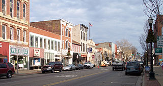
Cambridge (CAM-bridge) is a city in and the county seat of Guernsey County, Ohio, United States. It lies in southeastern Ohio, in the Appalachian Plateau of the Appalachian Mountains about 75 miles (121 km) east of Columbus and approximately 124 miles (200 km) south of Cleveland. The population was 10,089 at the 2020 census. It is the principal city of the Cambridge micropolitan area and is located adjacent to the intersection of Interstates 70 and 77.

<span class="mw-page-title-main">Zanesfield, Ohio</span> Village in Ohio, United States

Zanesfield is a village in Logan County, Ohio, United States of America. The population was 194 at the 2020 census. It is the smallest incorporated village in Logan County.

<span class="mw-page-title-main">Zanesville, Ohio</span> City in Ohio, United States

Zanesville is a city in and the county seat of Muskingum County, Ohio, United States. Located at the confluence of the Licking and Muskingum rivers, the city is approximately 52 miles (84 km) east of Columbus and had a population of 24,765 as of the 2020 census, down from 25,487 as of the 2010 census. Historically the state capital of Ohio from 1810 to 1812, Zanesville anchors the Zanesville micropolitan area and is part of the greater Columbus-Marion-Zanesville combined statistical area.

<span class="mw-page-title-main">Rose Hill, Lee County, Virginia</span> Census-designated place in Virginia, United States

Rose Hill is an unincorporated community and census-designated place (CDP) in Lee County, Virginia, United States. The population was 799 at the 2010 census, up from 714 at the 2000 census.

<span class="mw-page-title-main">Philippi, West Virginia</span> City in West Virginia

Philippi ('FILL-uh-pea') is a city in and the county seat of Barbour County, West Virginia, United States, along the Tygart Valley River. The population was 2,929 at the 2020 census. In 1861, the city was the site of the Battle of Philippi, known as the "Philippi Races". Although a minor skirmish, this is considered the earliest notable land action of the American Civil War. The city has a weekly newspaper, The Barbour Democrat.

<span class="mw-page-title-main">Belmont, West Virginia</span> Town in West Virginia, United States

Belmont is a town in Pleasants County, West Virginia, United States. It is part of the Parkersburg–Vienna metropolitan area. The population was 872 at the 2020 census. Belmont was incorporated on April 19, 1946 by the Circuit Court of Pleasants County. The city was named for the beautiful hills in the area.

<span class="mw-page-title-main">Friendly, West Virginia</span> Town in West Virginia, United States

Friendly is a town in Tyler County, West Virginia, United States. The population was 100 at the 2020 census.

<span class="mw-page-title-main">New Martinsville, West Virginia</span> City in West Virginia, United States

New Martinsville is a city in and the county seat of Wetzel County, West Virginia, United States, along the Ohio River. The population was 5,186 at the 2020 census.

<span class="mw-page-title-main">Wheeling, West Virginia</span> City in the United States

Wheeling is a city in the U.S. state of West Virginia. Located almost entirely in Ohio County, of which it is the county seat, it lies along the Ohio River in the foothills of the Appalachian Mountains and also contains a tiny portion extending into Marshall County. Wheeling is located about 60 miles (96 km) west of Pittsburgh and is the principal city of the Wheeling metropolitan area. As of the 2020 census, the city had a population of 27,062, and the metro area had a population of 139,513. It is the fifth most populous city in West Virginia, and the most populous in the state’s Northern Panhandle.

<span class="mw-page-title-main">Ebenezer Zane</span> American politician

Ebenezer Zane was an American pioneer, soldier, politician, road builder and land speculator. Born in the Colony of Virginia, Zane established a settlement near Fort Henry which became Wheeling, on the Ohio River. He also blazed an early road through the Ohio Country to Limestone known as Zane's Trace.

<span class="mw-page-title-main">Betty Zane</span>

Elizabeth Zane McLaughlin Clark was a heroine of the Revolutionary War on the American frontier. She was the daughter of William Andrew Zane and Nancy Ann Zane, and the sister of Ebenezer Zane, Silas Zane, Jonathan Zane, Isaac Zane and Andrew Zane.

References

  1. 1 2 "Government - City of Martins Ferry". City of Martins Ferry. Retrieved February 2, 2023.
  2. "ArcGIS REST Services Directory". United States Census Bureau. Retrieved September 20, 2022.
  3. 1 2 U.S. Geological Survey Geographic Names Information System: Martins Ferry, Ohio
  4. 1 2 "U.S. Census website". United States Census Bureau . Retrieved January 31, 2008.
  5. 1 2 "U.S. Census website". United States Census Bureau . Retrieved January 6, 2013.
  6. "US Gazetteer files 2010". United States Census Bureau. Archived from the original on January 12, 2012. Retrieved January 6, 2013.
  7. Climate Summary for Martins Ferry
  8. "Weatherbase.com". Weatherbase. 2013. Retrieved on September 14, 2013.
  9. "Population and Housing Unit Estimates" . Retrieved May 21, 2020.
  10. "Census of Population and Housing". Census.gov. Retrieved June 4, 2015.
  11. "Martins Ferry city, Ohio". census.gov. Retrieved July 1, 2022.
  12. "Locations & Hours". Belmont County District Library. Retrieved February 25, 2018.
  13. "Autumn Begins in Martins Ferry, Ohio". poets.org. Retrieved October 7, 2017.