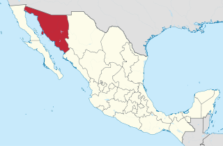
Sonora, officially Estado Libre y Soberano de Sonora, is one of the 31 states which, along with Mexico City, comprise the Federal Entities of Mexico. The state is divided into 72 municipalities; the capital city of which being Hermosillo, located in the center of the state. Other large cities include Ciudad Obregón, Nogales, San Luis Río Colorado, and Navojoa.
Huatabampo is a city in Huatabampo Municipality in the state of Sonora, in northwestern Mexico. It is situated on the Gulf of California, near the mouth of the Mayo River. It is located at latitude 26°49′N109°40′W. Huatabampo is 34 km (21 mi) southwest of Navojoa via Sonora State Highway 56 and Sonora State Highway 149. Mexican Federal Highway 15 can be accessed via Sonora State Highway 176. It is notable as the home of revolutionary general Álvaro Obregón, a successful chickpea farmer before the Mexican Revolution, and now his burial site.
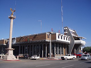
Navojoa is the fifth-largest city in the northern Mexican state of Sonora and is situated in the southern part of the state. The city is the administrative seat of Navojoa Municipality, located in the Mayo River Valley.

Ciudad Obregón is a city in southern Sonora. It is the state's second largest city after Hermosillo and serves as the municipal seat of Cajeme. As of 2020, the city has a population of 436,484. Ciudad Obregón is 530 km (330 mi) south of the state's northern border.
Mayo is an Uto-Aztecan language. It is spoken by about 40,000 people, the Mexican Mayo or Yoreme Indians, who live in the South of the Mexican state of Sonora and in the North of the neighboring state of Sinaloa. Under the General Law of Linguistic Rights of the Indigenous Peoples" Law of Linguistic Rights, it is recognized as a "national language" along with 62 other indigenous languages and Spanish which all have the same validity in Mexico. The language is considered 'critically endangered' by UNESCO.

The Mexican Pacific League, known as Liga ARCO Mexicana del Pacífico for sponsorship reasons or simply LMP for its acronym in Spanish, is a ten team professional baseball winter league based in Northwestern Mexico founded in 1945. The league's champion takes part in the Caribbean Series each year.

Federal Highway 15 is Mexico 15 International Highway or Mexico-Nogales Highway, is a primary north–south highway, and is a free part of the federal highways corridors of Mexico. The highway begins in the north at the Mexico–United States border at the Nogales Port of Entry in Nogales, Sonora, and terminates to the south in Mexico City.
Etchojoa is the seat of Etchojoa Municipality. Founded in 1613, Etchojoa is located in the southwest of the Mexican state of Sonora. It is situated at 26°52′N109°39′W. The total municipal area is 1,220.23 km².
The Autonomous University of Sinaloa is a public university with its central campus located in the state capital of Culiacán, Sinaloa and with campuses in multiple locations within the state. The university is renowned for having quality academic conduct and governing systems, and is ranked in the top 25 universities of Mexico.

Las Bocas is a small fishing village located in the south of the Mexican state of Sonora. It is part of the Huatabampo municipality. Despite being part of Huatabampo, most properties there are owned by families from Navojoa who have their second house next to the beach.
Navojoa Municipality is a municipality in the Mexican state of Sonora in north-western Mexico. As of 2015, the municipality had a total population of 163,650.
Vícam is a town in the Mexican state of Sonora located in the municipio of Guaymas. It is one of the main settlements of the Yaqui people. Historically the Yaqui also ranged through what is now the American Southwest, and there is a federally recognized tribe in the United States state of Arizona.
La Pintada is an archaeological site located some 60 kilometers south of the city of Hermosillo, Sonora, Mexico, within the "La Pintada" canyon, part of the "Sierra Libre", a small mountain massif of the coastal plains that extends throughout the Sonoran Desert.
This article details the history of Sonora. The Free and Sovereign State of Sonora is one of 31 states that, with the Federal District, comprise the 32 Federal Entities of Mexico. It is divided into 72 municipalities; the capital city is Hermosillo. Sonora is located in Northwest Mexico, bordered by the states of Chihuahua to the east, Baja California to the northwest and Sinaloa to the south. To the north, it shares the U.S.–Mexico border with the states of Arizona and New Mexico, and on the west has a significant share of the coastline of the Gulf of California.

The Yaqui Wars, were a series of armed conflicts between New Spain, and its successor state, the Mexican Republic, against the Yaqui Natives. The period began in 1533 and lasted until 1929. The Yaqui Wars, along with the Caste War against the Maya, were the last conflicts of the centuries long Mexican Indian Wars. Over the course of nearly 400 years, the Spanish and the Mexicans repeatedly launched military campaigns into Yaqui territory which resulted in several serious battles and massacres.
Juan José Ríos is an agricultural city located in Northern Sinaloa, Mexico. It is divided in two municipalities, where its major part is located in Guasave Municipality, and the rest is in Ahome Municipality. It had a population of 27,938 inhabitants, according to the 2010 census.
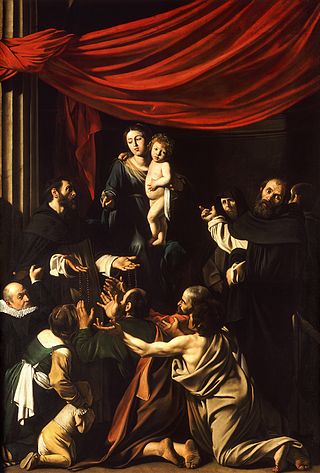
Sonora was a crucial region of the Mexican Revolution, with its main leaders called the Sonoran Dynasty or the Sonoran Triumvirate, that collectively ruled Mexico for fifteen years from 1920 to 1935. The northwestern state of Sonora was geographically and culturally distinct from other states of Mexico, including other parts of northern Mexico. Because of its geographical isolation from other parts of Mexico, its close ties with the United States, its large-scale export agriculture, its distinct indigenous populations, and its broad-based participation in the Revolution its leaders had a different worldview from central Mexico. Four Sonorans became Presidents of Mexico, Adolfo de la Huerta, Álvaro Obregón, Plutarco Elías Calles, and Abelardo L. Rodríguez. Seven other important figures of the revolution also come from Sonora or in nearby states, José María Maytorena and Benjamín G. Hill, both middle class; Manuel Diéguez, Salvador Alvarado, and Juan G. Cabral; and Francisco R. Serrano and Arnulfo R. Gómez. Although not formally a member of the Sonora Dynasty, Michoacan-born General Lázaro Cárdenas, later President of Mexico, was part of the revolutionary circle of Plutarco Elías Calles, right until the point that President Cárdenas forced former President Calles into exile in 1936. Only in recent years have historians begun focusing on the role of Sonora and the Sonoran Dynasty in Mexican Revolution, shifting from an emphasis on populist leaders like Francisco Villa of Chihuahua and Emiliano Zapata of Morelos. The Sonoran leaders sought greater material betterment for impoverished Mexicans, sought to centralize authority, and diminish the role of the Catholic Church. As with Díaz's Científicos, they believed in the importance of material progress, public education, and rationalism.
The Valle del Yaqui or Yaqui Valley is a highly productive agricultural area in Sonora. Durum wheat is a major crop. However, the crop is highly fertilized, and is a significant source of nitrous oxide, a powerful greenhouse gas.
The Revolución de los Ríos refers to an uprising lasting from 1867 to 1868 by the Mayo and the Yaqui people who lived along the Mayo and the Yaqui Rivers in Sonora, against the government of Mexico.
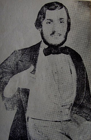
José María Tranquilino Almada y Quirós was an Imperial Mexican Colonel of the Second French intervention in Mexico. Popularly known as Chato Almada, he was one of the most prominent monarchist figures within the state of Sonora, known for his victory at the Battle of Álamos.


