
Bell is an incorporated city in Los Angeles County, California, near the center of the former San Antonio Township. Its population was 35,477 at the 2010 census, down from 36,664 in the 2000 census. Bell is located on the west bank of the Los Angeles River and is a suburb of the city of Los Angeles. At 2.5 square miles (6.5 km2), Bell is the thirteenth-smallest city in the United States with a population of at least 25,000.
Bell Gardens is a city in the U.S. state of California in the Los Angeles metropolitan area. Located in Los Angeles County, the city's population was 42,072 at the 2010 census, down from 44,054 at the 2000 census. Bell Gardens is part of the Gateway Cities Region, a largely urbanized region located in southeastern Los Angeles County.

Commerce is a city located in southeast Los Angeles County, California, United States. The population was 12,823 at the 2010 census, up from 12,568 at the 2000 census. It is usually referred to as the City of Commerce to distinguish it from the common noun. It is bordered by Vernon on the west, Los Angeles on the northwest, East Los Angeles on the north, Montebello on the east, Downey and Bell Gardens on the south, and Maywood on the southwest. The Los Angeles River forms part of its southwestern boundary, and the Rio Hondo separates it from Downey. Commerce is served by the Long Beach and Santa Ana freeways, as well as the Metrolink commuter rail service at the Commerce station.

Cudahy is a city located in southeastern Los Angeles County, California, United States. In area, Cudahy is the second smallest city in Los Angeles County after Hawaiian Gardens but with one of the highest population densities of any incorporated city in the United States. It is part of the Gateway Cities region and had a population of 23,805 as of the 2010 U.S. Census.
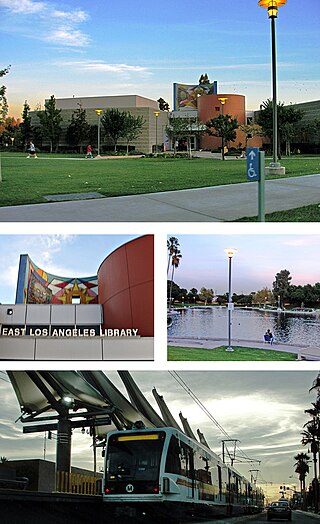
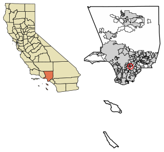
East Los Angeles, or East L.A., is an unincorporated area situated within Los Angeles County, California, United States. According to the United States Census Bureau, East Los Angeles is designated as a census-designated place (CDP) for statistical purposes. The most recent data from the 2020 census reports a population of 118,786, reflecting a 6.1% decrease compared to the 2010 population of 126,496.
Huntington Park is a city located in the South Central region of Los Angeles County, California, United States. The area includes separate communities of Florence, Firestone Park, Graham, and Walnut Park, California As of the 2020 census, the city had a total population of 54,883, of whom 97% are Hispanic/Latino and about half were born outside the U.S.

Maywood is a gateway city in Los Angeles County. At 1.18 square miles (3.1 km2), Maywood is the third-smallest incorporated city in Los Angeles County. It is bordered by the cities of Bell on the south, Vernon on the north and west, Huntington Park on the southwest, and Commerce on the east.

Walnut Park is a census-designated place (CDP) in Los Angeles County, California, United States, adjacent to Florence-Graham, Huntington Park and South Gate. The population was 15,966 at the 2010 census, down from 16,180 at the 2000 census.

San Pedro is a neighborhood located within the South Bay and Harbor region of the City of Los Angeles, California, United States. Formerly a separate city, it consolidated with Los Angeles in 1909. The Port of Los Angeles, a major international seaport, is partially located within San Pedro. The district has grown from being dominated by the fishing industry, to a working-class community within the city of Los Angeles, to an increasingly dense community.
Belmont Senior High School is a public high school located at 1575 West 2nd Street in the Westlake community of Los Angeles, California. The school, which serves grades 9 through 12, is part of the Los Angeles Unified School District.
Bell High School is a public high school in Bell, California, United States. The school, which serves grades 9 through 12, is a part of District 6 of the Los Angeles Unified School District. Bell High’s motto is "Honor lies in honest toil", its mascot is the eagle, and the school colors are purple and gold. They are rivals with the Huntington Park Spartans.

John C. Fremont High School is a Title 1 co-educational public high school located in South Los Angeles, California, United States.

California's 42nd congressional district is a U.S. congressional district in California. The district is currently represented by Democrat Robert Garcia.
Manual Arts High School is a secondary public school in Los Angeles, California, United States.
Huntington Park High School is a public high school in Huntington Park, California, part of the Los Angeles Unified School District.
James Monroe High School (JMHS), at 9229 Haskell Avenue in North Hills, California, is a public high school in the Los Angeles Unified School District. It is home to Small Learning Communities (SLCs) and two magnet schools. Its mascot is the Viking.

Los Angeles Unified School District (LAUSD) is a public school district in Los Angeles, California, United States. It is the largest public school system in California in terms of number of students and the 2nd largest public school district in the United States, with only the New York City Department of Education having a larger student population. During the 2022–2023 school year, LAUSD served 565,479 students, including 11,795 early childhood education students and 27,740 adult students. During the same school year, it had 24,769 teachers and 49,231 other employees. It is the second largest employer in Los Angeles County after the county government. The school district's budget for the 2021–2022 school year was $10.7 billion, increasing to $12.6 billion for the 2022–2023 school year.

The CIF Los Angeles City Section (CIF-LA) is the governing body of high school athletics for public schools in the city of Los Angeles and some surrounding communities. All of these schools were once associated with the Los Angeles Unified School District. It is one of ten sections that constitute the California Interscholastic Federation (CIF).

The 2019 Los Angeles special elections were held on March 5, 2019, and June 4, 2019. Voters elected candidates in a nonpartisan primary, with runoff elections scheduled for May 14, 2019 and August 13, 2019. One of the fifteen seats in the City Council were up for election while one of the seven seats in the Board of Education were up for election.


