Meridian Station, Mississippi

Last updated
Meridian Station, Mississippi
Lauderdale County Mississippi Incorporated and Unincorporated areas Meridian Station Highlighted.svg
Location of Meridian Station, Mississippi
Usa edcp location map.svg
Red pog.svg
Meridian Station, Mississippi
Location in the United States
Coordinates: 32°32′49″N88°37′19″W / 32.54694°N 88.62194°W / 32.54694; -88.62194 Coordinates: 32°32′49″N88°37′19″W / 32.54694°N 88.62194°W / 32.54694; -88.62194
Country United States
State Mississippi
County Lauderdale
Area
[1]
  Total1.70 sq mi (4.41 km2)
  Land1.66 sq mi (4.29 km2)
  Water0.05 sq mi (0.12 km2)
Elevation
250 ft (80 m)
Population
 (2020)
  Total581
  Density350.85/sq mi (135.43/km2)
Time zone UTC-6 (Central (CST))
  Summer (DST) UTC-5 (CDT)
ZIP Codes
39305, 39309
FIPS code 28-46680

Meridian Station is a census-designated place (CDP) in Lauderdale County, Mississippi, United States, corresponding to the residential portions of Naval Air Station Meridian. The population was 1,090 at the 2010 census. [2]

Contents

Geography

Meridian Station is located in northern Lauderdale County at 32°32′49″N88°37′19″W / 32.54694°N 88.62194°W / 32.54694; -88.62194 (32.547017, -88.621981). [3] It is 17 miles (27 km) north of Meridian, the county seat, via Mississippi Highway 39 and John C. Stennis Drive.

According to the United States Census Bureau, the CDP has a total area of 1.7 square miles (4.5 km2), of which 0.04 square miles (0.1 km2), or 2.69%, are water. [3]

Demographics

Historical population
CensusPop.Note
2020 581
U.S. Decennial Census [4]

As of the census [5] of 2000, there were 1,849 people, 354 households, and 344 families residing in the CDP. The population density was 656.5 inhabitants per square mile (253.5/km2). There were 526 housing units at an average density of 186.8 per square mile (72.1/km2). The racial makeup of the CDP was 62.57% White, 26.55% African American, 0.76% Native American, 2.65% Asian, 0.32% Pacific Islander, 3.79% from other races, and 3.35% from two or more races. Hispanic or Latino of any race were 8.06% of the population.

There were 354 households, out of which 75.4% had children under the age of 18 living with them, 88.1% were married couples living together, 6.5% had a female householder with no husband present, and 2.8% were non-families. 2.5% of all households were made up of individuals, and 0.3% had someone living alone who was 65 years of age or older. The average household size was 3.45 and the average family size was 3.49.

In the CDP, the population was spread out, with 29.1% under the age of 18, 30.4% from 18 to 24, 38.6% from 25 to 44, 1.7% from 45 to 64, and 0.2% who were 65 years of age or older. The median age was 22 years. For every 100 females, there were 137.1 males. For every 100 females age 18 and over, there were 145.0 males.

The median income for a household in the CDP was $42,024, and the median income for a family was $42,173. Males had a median income of $24,348 versus $17,284 for females. The per capita income for the CDP was $12,353. About 5.3% of families and 5.9% of the population were below the poverty line, including 6.0% of those under age 18 and none of those age 65 or over.

Related Research Articles

<span class="mw-page-title-main">Underwood-Petersville, Alabama</span> Census-designated place in Alabama, United States

Underwood-Petersville is a census-designated place (CDP) in Lauderdale County, Alabama United States. It is part of the Florence - Muscle Shoals Metropolitan Statistical Area known as "The Shoals". As of the 2010 census, the population of the CDP is 3,247.

<span class="mw-page-title-main">Granite Hills, California</span> Census-designated place in California, United States

Granite Hills is a census-designated place in San Diego County, California. The name is also applied to a neighborhood within the city limits of El Cajon in the eastern part of that city. The population of the CDP, which does not include the people living within the city of El Cajon, was 3,035 at the 2010 census, down from 3,246 at the 2000 census.

<span class="mw-page-title-main">Fort Benning South, Georgia</span> CDP in Georgia, United States

Fort Benning South is a former census-designated place (CDP) in Chattahoochee County, Georgia, United States. It is part of the Columbus, Georgia-Alabama Metropolitan Statistical Area. The population was 11,737 at the 2000 census. The area is now part of the consolidated city of Cusseta.

<span class="mw-page-title-main">Lakewood Shores, Illinois</span> Census-designated place in Illinois, United States

Lakewood Shores is a census-designated place (CDP) in Will County, Illinois, United States. The population was 665 at the 2020 census.

<span class="mw-page-title-main">Pachuta, Mississippi</span> Town in Mississippi, United States

Pachuta is a town in Clarke County, Mississippi, United States. The population was 261 at the 2010 census.

<span class="mw-page-title-main">Gulf Park Estates, Mississippi</span> Census-designated place in Mississippi, United States

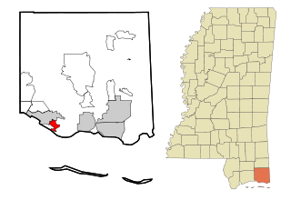
Gulf Park Estates is an unincorporated community and census-designated place (CDP) located south of Ocean Springs in Jackson County, Mississippi, United States. It is part of the Pascagoula Metropolitan Statistical Area. The population was 5,719 at the 2010 census, up from 4,272 at the 2000 census.

<span class="mw-page-title-main">Hurley, Mississippi</span> Census-designated place in Mississippi

Hurley is an unincorporated community and census-designated place (CDP) in Jackson County, Mississippi, United States. It is part of the Pascagoula Metropolitan Statistical Area. The population was 1,551 at the 2010 census, up from 985 at the 2000 census.

<span class="mw-page-title-main">St. Martin, Mississippi</span> Census-designated place in Mississippi

St. Martin is a census-designated place (CDP) in Jackson County, Mississippi, United States. It is part of the Pascagoula Metropolitan Statistical Area. The population was 7,730 at the 2010 census, up from 6,676 at the 2000 census.

<span class="mw-page-title-main">De Kalb, Mississippi</span> Town in Mississippi, United States

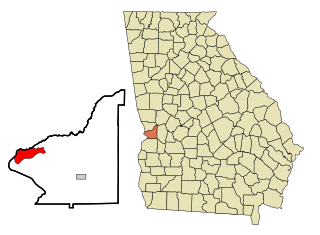
De Kalb is a town in and the county seat of Kemper County, Mississippi, United States. The population was 1,164 at the 2010 census. De Kalb is named after General Johann de Kalb, a Franconian-French military officer who served as a major general in the Continental Army during the American Revolutionary War.

<span class="mw-page-title-main">Marion, Mississippi</span> Town in Mississippi, United States

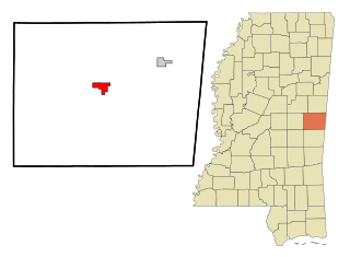
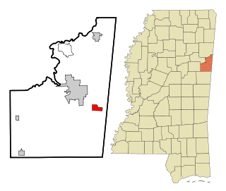
Marion is a town in Lauderdale County, Mississippi, United States. It is a northeastern suburb of Meridian, the county seat. The population of Marion was 1,479 at the 2010 census.

<span class="mw-page-title-main">Crawford, Mississippi</span> Town in Mississippi, United States

Crawford is a small town in Lowndes County, Mississippi, United States. The population was 641 at the 2010 census.

<span class="mw-page-title-main">New Hope, Mississippi</span> Census-designated place in Mississippi, United States

New Hope is a census-designated place (CDP) in Lowndes County, Mississippi, United States. As of the 2010 census, the CDP population was 3,193.

<span class="mw-page-title-main">Tucker, Mississippi</span> CDP in Mississippi, United States

Tucker is a census-designated place (CDP) in Neshoba County, Mississippi. It is one of the eight communities of the Mississippi Band of Choctaw Indians Reservation and the population is 93% Choctaw. The population was 642 at the 2020 census.

<span class="mw-page-title-main">Wade, Mississippi</span> Census-designated place in Mississippi, United States

Wade is an unincorporated community and census-designated place (CDP) in Jackson County, Mississippi, United States. It is part of the Pascagoula Metropolitan Statistical Area. The population was 1,074 at the 2010 census, up from 491 at the 2000 census.

<span class="mw-page-title-main">Collinsville, Mississippi</span> Census-designated place in Mississippi, United States

Collinsville is an unincorporated community and census-designated place (CDP) in Lauderdale County, Mississippi, United States. The population was 1,984 at the 2020 census.

<span class="mw-page-title-main">Nellieburg, Mississippi</span> Census-designated place in Mississippi, United States

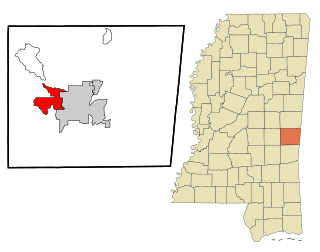
Nellieburg is an unincorporated community and census-designated place (CDP) in Lauderdale County, Mississippi, United States. The population was 1,316 at the 2020 census. It is a suburb of Meridian.

Meridian is a former census-designated place (CDP) in Stephens County, Oklahoma, United States. The population was 1,485 at the 2000 census. As of the 2020 census, the area, plus land to the north, was part of the Sunray CDP.

<span class="mw-page-title-main">Meridian, Pennsylvania</span> Census-designated place in Pennsylvania, United States

Meridian is a census-designated place (CDP) in Butler County, Pennsylvania, United States. The population was 3,881 at the 2010 census.

<span class="mw-page-title-main">East Hill-Meridian, Washington</span> Former CDP in Washington, United States

East Hill-Meridian is a former census-designated place (CDP) in King County, Washington. The population was 29,878 at the time of the 2010 census. The majority of the census area is now within the limits of Kent and Renton.

<span class="mw-page-title-main">Lake Ripley, Wisconsin</span> Census-designated place in Wisconsin, United States

Lake Ripley is a census-designated place (CDP), in the town of Oakland, Jefferson County, Wisconsin, United States. The population was 1,911 at the 2020 census.

References

  1. "2020 U.S. Gazetteer Files". United States Census Bureau. Retrieved July 24, 2022.
  2. "Total Population: 2010 Census DEC Summary File 1 (P1), Meridian Station CDP, Mississippi". data.census.gov. U.S. Census Bureau. Retrieved April 2, 2020.
  3. 1 2 "U.S. Gazetteer Files: 2019: Places: Mississippi". U.S. Census Bureau Geography Division. Retrieved April 2, 2020.
  4. "Census of Population and Housing". Census.gov. Retrieved June 4, 2016.
  5. "U.S. Census website". United States Census Bureau . Retrieved 2008-01-31.