Geography
Toomsuba is in eastern Lauderdale County, 13 miles (21 km) east of Meridian, the county seat. U.S. Routes 80 and 11 pass through the community as its main street. Interstate Highways 20 and 59 run along the southern edge of the community, with access from Exit 165 (Will Garrett Road). I-20 and I-59 lead west to Meridian and northeast 77 miles (124 km) to Tuscaloosa, Alabama, while U.S. Route 11 and 80 lead west to Meridian and east 9 miles (14 km) to their split near Cuba, Alabama.
According to the U.S. Census Bureau, the Toomsuba CDP has a total area of 5.0 square miles (13.0 km2), of which 4.7 square miles (12.1 km2) are land and 0.3 square miles (0.8 km2), or 6.27%, are land. [6] In addition to the Toomsuba town center at the crossroads of US 11/80 with Will Garrett Road and Lauderdale–Toomsuba Road, the CDP contains residential development around Bailey Lake, a reservoir just west of the town center.
Lauderdale County is a county located on the eastern border of the U.S. state of Mississippi. As of the 2020 census, the population was 72,984. The county seat is Meridian. The county is named for Colonel James Lauderdale, who was killed at the Battle of New Orleans in the War of 1812. Lauderdale County is included in the Meridian, MS Micropolitan Statistical Area.

Marion is a town in Lauderdale County, Mississippi, United States. It is a northeastern suburb of Meridian, the county seat. The population of Marion was 1,479 at the 2010 census.

Meridian Station is a census-designated place (CDP) in Lauderdale County, Mississippi, United States, corresponding to the residential portions of Naval Air Station Meridian. The population was 1,090 at the 2010 census.

Redwater is a census-designated place (CDP) in Leake County, Mississippi, United States. It is one of the eight communities of the Mississippi Band of Choctaw Indians Reservation, and the population is 61% Choctaw. The population was 633 at the 2010 census, up from 409 at the 2000 census.

Standing Pine is a census-designated place (CDP) in Leake County, Mississippi, United States. It is one of the eight communities of the Mississippi Band of Choctaw Indians Reservation, and the population is 94% Choctaw. The total population of the CDP was 517 at the 2020 census.

Collinsville is an unincorporated community and census-designated place (CDP) in Lauderdale County, Mississippi, United States. The population was 1,984 at the 2020 census.
Nellieburg is an unincorporated community and census-designated place (CDP) in Lauderdale County, Mississippi, United States. The population was 1,316 at the 2020 census. It is a suburb of Meridian.

Conehatta is a census-designated place (CDP) in Newton County, Mississippi. The population was 997 at the 2000 census. It is one of the eight communities included in the Mississippi Band of Choctaw Indians Reservation and the population is 76% Choctaw.

Bogue Chitto is a census-designated place (CDP) situated in Kemper and Neshoba counties, Mississippi. The population was 864 at the 2020 census. It is part of the Mississippi Band of Choctaw Indians Reservation and the population is 93% Choctaw.
Redwood is a census-designated place and unincorporated community located southeast of Twin Lake in Warren County, Mississippi, United States. The town is located near the junction of U.S. Route 61 and Mississippi Highway 3, approximately 10 miles north of Vicksburg. Its zip code is 39156.
Arkabutla is a census-designated place and unincorporated community in Tate County, Mississippi, United States. Arkabutla is located approximately 9 miles (14 km) west of Coldwater and approximately 9 miles (14 km) north of Strayhorn. It also lies approximately 4 miles (6.4 km) south of the dam at Arkabutla Lake. Although an unincorporated community, it has a post office and a zip code of 38602.
Lauderdale is an unincorporated community and census-designated place (CDP) in Lauderdale County, Mississippi, United States. It is situated along U.S. Highway 45, 16 miles (26 km) northeast of Meridian, the county seat. The population of Lauderdale was 395 at the 2020 census.
Delta City is a census-designated place and unincorporated community located on Mississippi Highway 434 in Sharkey County, Mississippi. Delta City is approximately 6 miles (9.7 km) east of Panther Burn and approximately 5 miles (8.0 km) north of Nitta Yuma. Although an unincorporated community, Delta City has a zip code of 39061.
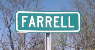
Farrell is an unincorporated community and census-designated place in Coahoma County, Mississippi, United States. Per the 2020 census, the population was 200. Farrell is located approximately 4 miles (6 km) south of Stovall and 4 miles (6 km) north of Sherard on Mississippi Highway 1. It is approximately 9 miles (14 km) northwest of Clarksdale, the county seat.

Dundee is a census-designated place and unincorporated community in Tunica County, Mississippi, United States. Dundee is 12 miles (19 km) south-southwest of Tunica. Dundee has a post office with ZIP code 38626.
Pheba is a census-designated place and unincorporated community located in Clay County, Mississippi, United States. Pheba is located at the intersection of Mississippi Highway 50 and Mississippi Highway 389 and is approximately 7 miles (11 km) west of Cedarbluff.
Nicholson is an unincorporated community and census-designated place (CDP) in Pearl River County, Mississippi, United States. As of the 2020 census, its population was 2,833. Its ZIP code is 39463.
Harperville is a census-designated place and unincorporated community in rural Scott County, Mississippi, United States. Harperville is located on Mississippi Highway 35, 9 miles (14 km) north of Forest. Harperville has a post office with ZIP code 39080.
Cleary is an unincorporated community and census-designated place in Rankin County, Mississippi, United States. Per the 2020 census, the population was 1,688.
Sharon is an unincorporated community and census-designated place (CDP) in Jones County, Mississippi, United States. The population was 1,344 at the 2020 census. It is part of the Laurel micropolitan statistical area.


