Vermilion Parish is a parish located in the U.S. state of Louisiana, created in 1844. The parish seat is Abbeville. Vermilion Parish is part of the Lafayette metropolitan statistical area, and located in southern Acadiana. At the 2010 U.S. census, the population was 57,999; the 2019 American Community Survey estimated its population was 59,865.

St. Martin Parish is a parish located in the U.S. state of Louisiana, founded in 1811. Its parish seat is St. Martinville, and the largest city is Breaux Bridge. At the 2010 U.S. census, the population was 52,160. At the 2020 census, 51,767 people lived in the parish. St. Martin Parish is part of the Lafayette metropolitan area in the region of Acadiana, along the Gulf Coast.

Cameron Parish is a parish in the southwest corner of the U.S. state of Louisiana. As of the 2020 census, the population was 5,617. The parish seat is Cameron. Although it is the largest parish by area in Louisiana, it has the second-smallest population in the state, ahead of only Tensas.

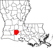
Acadia Parish is a parish located in the U.S. state of Louisiana. At the 2020 U.S. census, the population was 57,576. The parish seat is Crowley. The parish was founded from parts of St. Landry Parish in 1886, and later an election was held to determine the parish seat, ending when Crowley beat Rayne and Prairie Hayes. Acadia Parish is included in the Lafayette metropolitan statistical area.

Crowley is a city in, and the parish seat of, Acadia Parish in the U.S. state of Louisiana. At the 2020 United States census, Crowley had a population of 11,710. Crowley is the principal city of the Crowley micropolitan statistical area, which includes all of Acadia Parish. It is also part of the larger Lafayette–Acadiana combined statistical area.

Iota is a town in Acadia Parish, Louisiana. The population was 1,500 at the 2010 census.

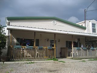
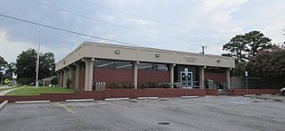
Morse is a village in Acadia Parish, Louisiana, United States. The population was 812 at the 2010 census. It is part of the Crowley Micropolitan Statistical Area.
Lafitte is an unincorporated community and census-designated place (CDP) in Jefferson Parish, Louisiana, United States. The population was 972 at the 2010 census, and 816 in 2019. In 2020, its population increased to 1,014 people. It is part of the New Orleans–Metairie–Kenner metropolitan statistical area. Lafitte is located at the southern end of Louisiana Highway 45 along Bayou Barataria, and fishing is a major part of the local economy and culture.
Terrytown is an unincorporated community and census-designated place (CDP) in Jefferson Parish, Louisiana, United States. It is on the "Westbank" of the Mississippi River. It is a suburb within the New Orleans–Metairie–Kenner metropolitan statistical area. The population was 23,319 at the 2010 census, and 25,278 in 2020.
Cut Off is a census-designated place (CDP) on the Bayou Lafourche in Lafourche Parish, Louisiana, United States. The population was 5,976 at the 2010 census. It is part of the Houma–Bayou Cane–Thibodaux Metropolitan Statistical Area. Cut Off's ZIP code is 70345, the area code is 985 and local telephone prefixes are 325, 632 and 693.

Raceland is an unincorporated community and census-designated place (CDP) on Bayou Lafourche in Lafourche Parish, Louisiana, United States. The population was 10,193 at the 2010 census. It is part of the Houma–Bayou Cane–Thibodaux Metropolitan Statistical Area.
Gueydan is a town in Vermilion Parish, Louisiana, United States. The population was 1,398 at the 2010 census, down from 1,598 in 2000. At the 2020 population estimates program, its population decreased to 1,328. It is part of the Abbeville micropolitan statistical area.

Eunice is a city in Acadia and St. Landry parishes in the U.S. state of Louisiana. The 2010 census placed the population at 10,398, a decrease of 1,101, or 9.5 percent, from the 2000 tabulation of 11,499.
Marthaville is an unincorporated community and census-designated place. It was first listed as a CDP in the 2020 census with a population of 90. It is part of the Natchitoches Micropolitan Statistical Area.

The Lafayette–Opelousas–Morgan City combined statistical area is made up of seven parishes in the Acadiana region of southern Louisiana. The statistical area consists of the Lafayette Metropolitan Statistical Area (MSA) and two micropolitical statistical areas (μSAs) – Opelousas, Louisiana Micropolitical Statistical Area and Morgan City, Louisiana Micropolitical Statistical Area. The region consists of seven parishes: Acadia, Iberia, Lafayette, St. Landry, St. Martin, St. Mary, and Vermilion Parishes. As of the 2010 census, the CSA had a population of 604,784.
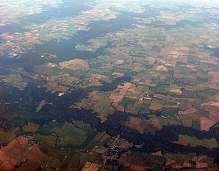
Egan is an unincorporated community and census-designated place in Acadia Parish, Louisiana, United States, located between Crowley and Jennings along Louisiana Highway 100, approximately two and one-half miles north of Midland near Bayou Jonas. The community is a part of the Crowley Micropolitan Statistical Area. As of the 2010 census, it had a population of 631.
Rio is an unincorporated community and census-designated place (CDP) in Washington Parish, Louisiana, United States.tates. It was first listed as a CDP in the 2020 census with a population of 137.
Lemannville is an unincorporated community and census-designated place in Ascension and St. James parishes, Louisiana, United States. Per the 2020 census, the population was 695.
Centerville is an unincorporated community and census-designated place located at the junction of Louisiana Highways 182 and 317 in St. Mary Parish, Louisiana, United States. The community, located on the Bayou Teche, is located 6 miles (9.7 km) southeast of Franklin.
Dorseyville is a census-designated place (CDP) in Iberville Parish, Louisiana, United States, corresponding to the unincorporated community of Dorcyville or Dorseyville. Dorseyville was first listed as a CDP prior to the 2020 census with a population of 159.