U.S. Route 90 in Louisiana

Last updated

US 90.svg

U.S. Highway 90

U.S. Route 90 in Louisiana
US 90 highlighted in red
Route information
Maintained by Louisiana DOTD
Length297.6 mi. [1]  (478.9 km)
Existed1926–present
Major junctions
West endI-10.svgUS 90.svg I-10  / US 90 at Texas state line east of Orange, TX
Major intersections
East endUS 90.svg US 90 at Mississippi state line west of Pearlington, MS
Location
Country United States
State Louisiana
Parishes Calcasieu, Jefferson Davis, Acadia, Lafayette, St. Martin, Iberia, St. Mary, Assumption, Terrebonne, Lafourche, St. Charles, Jefferson, Orleans, St. Tammany
Highway system
  • Louisiana State Highway System
Louisiana 89 (2008).svg LA 89 Louisiana 91 (2008).svg LA 91

U.S. Highway 90 (US 90), one of the major east–west U.S. Highways in the Southern United States, runs through southern Louisiana for 297.6 miles (478.9 km), serving Lake Charles, Lafayette, New Iberia, Morgan City, and New Orleans. Much of it west of Lafayette and east of New Orleans has been supplanted by Interstate 10 (I-10) for all but local traffic, but the section between Lafayette and New Orleans runs a good deal south of I-10.

Contents

The stretch between Lafayette and New Orleans is planned as a southern extension of I-49 and is signed as "future corridor I-49". This part of the highway is important to the offshore petroleum industry, as it connects the cities of Lafayette and New Orleans to the port cities along the coast. Most of US 90 from New Iberia to New Orleans that has not already been improved to Interstate grade, is mainly an expressway, excepting the towns traversed through, that can be easily upgraded to freeway standards. The freeway east of Morgan City, bypassing Houma to the north, was originally built as Louisiana Highway 3052 (LS 3052); US 90 was shifted to it from its former alignment (now LA 182) once it was completed.

US 90 replaced almost all of the Louisiana section of the San DiegoSt. Augustine running Old Spanish Trail. It was also designated Louisiana Highway 2 (LA 2) until the 1955 renumbering. A long section of the old road, from Lafayette to northeast of Raceland, is now LA 182.

Route description

State line to Lafayette

US 90 enters Louisiana at the Texas line over the Sabine River as part of I-10. Separating at exit 4 and running parallel on the north side of I-10 through Sulphur, before rejoining I-10 east of Westlake, crossing the Calcasieu River, and again splitting from I-10 at exit 31B (running on the south side of I-10) going through Lake Charles as Fruge, West 4th, then East 4th, before leaving town. In Iowa US 90 intersects with the southern terminus of US 165 continuing east through Lacassine, Welsh, Roanoke, Jennings, and Mermentau. East of Mermentau US 90 runs north of and parallel to a section of the Old Spanish Trail through Midland, Estherwood, and Crowley. In Crowley US 90 makes a north then east jog, bringing it close and parallel to I-10, passing through Rayne, Duson, Scott, and then into Lafayette.

Lafayette to Raceland

From Lafayette, US 90 traverses a south-southeast course to Patterson, where the highway takes a more easterly direction to New Orleans. The section east (south) of Broussard, beginning east of Captain Cade road [2] but west of LA 88, to just west of Patterson, has been improved to Interstate grade and completed in June 2011. These improvements include the completion of the overpasses at Coteau Road (LA 88), Jefferson Island Road (LA 675), Center street (LA 14), Avery Island road (LA 329), South Lewis Street (Parish Road 605), Weeks Island road (LA 83), Darnall Road (Parish Road 211), Patout Road (LA 85), and Canal Street (LA 668). This section ties into the already completed section that begins at LA 318 and terminates at East Main street (LA 182) just east of Calumet. West of Berwick US 90 is listed as Interstate grade with a 70-mile (110 km) per hour speed limit from (mile marker 174) to east of Raceland and an intersection with LA 1 (mile marker 215B), before reverting to a standard divided highway and continuing on a north/northeast direction to New Orleans.

New Orleans

US 90 enters Jefferson Parish, and after passing Avondale, heads north at an intersection with US 90 Business, called the Westbank Expressway, through Bridge City, and across the Mississippi River over the Huey P. Long Bridge. Crossing the river US 90, designated as S. Clearview Parkway, intersects with and runs east as the Jefferson Highway, [3] that was originally part of the "Interstate Trail" and the "Pine to Palm" highway, a 2,300-mile (3,700 km) north–south transcontinental U.S interstate highway running from New Orleans to Winnipeg, Manitoba, Canada [4] The highway terminus was at the corner of St. Charles Avenue and Common Street with a monument that was erected in 1916. The original highway was changed to follow US 90 and LA 48. After 1935 Jefferson became S. Claiborne Avenue at the Orleans Parish line and makes a sweeping south-to-north semicircle weaving through New Orleans. As the highway swings north it intersects and runs under an elevated I-10, where it turns northwest along Tulane Avenue. The highway soon turns northeast along South Broad Avenue—North Broad Avenue after the intersection with Canal Street—then runs into a pair of regular individual streets (i.e., not a street that has a median—or neutral ground in the vernacular of New Orleans—separating half of the lanes from the other half) that are from the old street grid and thus parallel at about 120 yards (110 m) from each other (named New Orleans Street & Allen Street) for about 14 mile (0.40 km), crossing I-610 in this tiny span, and finally turning right (east) onto Gentilly Boulevard (which has a median), which eventually becomes Chef Menteur Highway (a mainly straight highway that replaced what is now called Old Gentilly Road), then crossing I-510, and then a few miles later, loses the median and meanders (i.e., in a manner similar to the way that Old Gentily meanders) until first reaching the national southern terminus of U.S. 11, which leads to the Irish Bayou community, and then passing the Venetian Isles community (a subdivision in which homes have a canal in the backyard for easy access to the surrounding lakes), and finally becoming a two-lane highway at the bridge over the Chef Menteur Pass to go past the Lake Catherine community until reaching the bridge over the Rigolets, after which US 90 finally leaves the corporate limit of New Orleans, entering St. Tammany Parish. [5] The stretch in the Lake Catherine community is where Jayne Mansfield was killed in a car accident on her way to New Orleans from Mississippi.

In St. Tammany Parish, US 90 then enters Slidell. After exiting Slidell it heads east and crosses the Mississippi state line at a drawbridge at the Pearl River.

Interstates 49 and 910

The Business US 90 portion of the Pontchartrain Expressway is also designated as Interstate 910, [7] however it is not signed as such. This is a temporary designation that overlaps all freeway portions of Business US 90 (the Pontchartrain Expressway, Crescent City Connection, and Westbank Expressway). When Interstate 49 is completed from Lafayette to New Orleans, Business US 90/Interstate 910 will be resigned as Interstate 49.

History

The modern US 90 has its roots in an early 20th-century auto trail known as the Old Spanish Trail, which was designated as State Route 2 within Louisiana when the state first numbered its highway system in 1921. US 90 was applied to the route when the numbered U.S. Highway system was implemented in 1926. With minor exceptions, Route 2 generally remained co-signed with US 90 throughout the state until such overlapping between U.S. and state routes was eliminated in the 1955 Louisiana Highway renumbering. Prior to 1955, as US 90 was gradually relocated onto newer and improved alignments, Route 2 was often moved accordingly. Former alignments remaining in the state highway system were then designated as part of State Route 1092, with shorter pieces designated as Route 2-D, 2-E, and so on as needed.

Future

US 90 West and Future I-49 Corridor signs near Raceland in 2014. US90 West and Future I-49 Signs (41867248532).jpg
US 90 West and Future I-49 Corridor signs near Raceland in 2014.

In Louisiana, current plans call for parts of US 90 to be upgraded to Interstate Highway standards from Lafayette to just west of New Orleans and designated I-49. The stretch of US 90 to be upgraded to I-49 is listed under High Priority Corridor 37 and stretches from the West Bank Expressway (US 90 Business near Westwego) to just north of downtown Lafayette, where US 90 splits from US 167 (the two highways converge in downtown Lafayette). [9] The stretch of US 167 from US 90 to I-10 will also be upgraded and included as part of I-49. As of March 2008, due to a $1 billion surplus in the Louisiana state budget, the legislature approved a bill which proposed capacity improvements on US 90 in the Lafayette area. US 167/US 90 is currently six-lanes from I-10 in Lafayette to LA 182 and LA 96 in Broussard.[ citation needed ]

Major intersections

ParishLocationmi [1] [10] kmExitDestinationsNotes
Sabine River 0.000–
0.059
0.000–
0.095
West plate blue.svg
I-10.svg
West plate.svg
US 90.svg
I-10 west / US 90 west Beaumont
Continuation in Texas
Bridge over Sabine River
Calcasieu 0.1440.2321 Sabine River TurnaroundEastbound entrance and westbound exit
Toomey 3.448–
5.116
5.549–
8.233
4East plate blue.svg
I-10.svg
I-10 east Lake Charles
Eastern end of I-10 concurrency
5.2378.428North plate.svg
Louisiana 109 (2008).svg
LA 109 north Starks
West plate.svg
Louisiana 3112 (2008).svg
LA 3112 west
Southern terminus of LA 109; eastern terminus of LA 3112
Vinton 8.413.5Louisiana 3063 (2008).svgTo plate blue.svg
I-10.svg
LA 3063 (West Street) to I-10
Sulphur 22.836.7Louisiana 27 (2008).svg LA 27 (Beglis Parkway) DeQuincy, Cameron
24.940.1South plate.svg
Louisiana 108 (2008).svg
To plate blue.svg
I-10.svg
LA 108 south (North Cities Service Highway) to I-10
Northeastern terminus of LA 108
27.944.926West plate blue.svg
I-10.svg
I-10 west Beaumont
Western end of I-10 concurrency; eastbound entrance and westbound exit
Westlake 28.5–
28.9
45.9–
46.5
27Louisiana 378 (2008).svg LA 378 (Sampson Street) Westlake Southwestern terminus of LA 378
WestlakeLake Charles line28.9–
30.1
46.5–
48.4
Bridge over Calcasieu River
Lake Charles 30.448.929Louisiana 1262 (2008).svg LA 1262  Downtown Area Eastbound exit and westbound entrance
31.049.930ALouisiana 1262 (2008).svg LA 1262 (Lakeshore Drive)Northern terminus of LA 1262; eastbound entrance and westbound exit
31.3–
31.6
50.4–
50.9
30BRyan Street Downtown Area Eastbound entrance and westbound exit
31.9–
32.4
51.3–
52.1
31AEast plate.svg
Business plate.svg
US 90.svg
US 90 Bus. east (Enterprise Boulevard)
Western terminus of US 90 Bus.
32.6–
32.8
52.5–
52.8
31BEast plate blue.svg
I-10.svg
I-10 east Lafayette
Eastern end of I-10 concurrency
33.654.1North plate.svg
US 171.svg
South plate.svg
Louisiana 14 (2008).svg
US 171 north / LA 14 south (Martin Luther King Highway) Cameron, DeRidder
Southern terminus of US 171; western terminus of LA 14
34.455.4West plate.svg
Business plate.svg
US 90.svg
US 90 Bus. west (Pamco Road)
Eastern terminus of US 90 Bus.
34.555.5East plate blue.svg
I-210.svg
I-210 east Lafayette
Exit 11 on I-210; eastbound entrance and exit (westbound via US 90 Bus.)
36.759.1Louisiana 397 (2008).svgTo plate blue.svg
I-10.svg
LA 397 (East Ward Line Road) to I-10  Creole, Cameron
37.660.5Louisiana 3256 (2008).svg LA 3256 (Manchester Road) Chloe Western terminus of LA 3256
Iowa 43.570.0North plate.svg
Louisiana 383 (2008).svg
LA 383 north (South Thompson Avenue)
Southern terminus of LA 383
44.471.5North plate.svg
US 165.svg
To plate blue.svg
I-10.svg
US 165 north to I-10  Kinder, Alexandria
Southern terminus of US 165
Jefferson Davis Lacassine 48.678.2Louisiana 101 (2008).svg LA 101  Hayes
51.783.2Louisiana 1131 (2008).svg LA 1131 Northern terminus of LA 1131
Welsh 55.088.5North plate.svg
Louisiana 99 (2008).svg
LA 99 north (South Adams Street) Pine Island
Western end of LA 99 concurrency
55.389.0South plate.svg
Louisiana 99 (2008).svg
LA 99 south (South Simmons Street) Thornwell, Lake Arthur
Eastern end of LA 99 concurrency
57.893.0Louisiana 382 (2008).svg LA 382  Thornwell Northern terminus of LA 382
Roanoke 59.595.8North plate.svg
Louisiana 395 (2008).svg
LA 395 north Elton
Southern terminus of LA 395
Jennings 64.5103.8North plate.svg
Louisiana 26 (2008).svg
To plate blue.svg
I-10.svg
LA 26 north (Elton Road) to I-10  Elton
South plate.svg
Louisiana 26 (2008).svg
LA 26 south (North Lake Arthur Avenue) Lake Arthur
65.0104.6Louisiana 97 (2008).svgNorth plate.svg
Louisiana 102 (2008).svg
To plate blue.svg
I-10.svg
LA 97  / LA 102 north (North Cutting Avenue) to I-10  Evangeline, Lafayette
Western end of LA 102 concurrency; southern terminus of LA 97
65.9106.1South plate.svg
Louisiana 102 (2008).svg
LA 102 south (South Cutting Avenue)
West plate.svg
Louisiana 3055 (2008).svg
LA 3055 west (East Railroad Avenue) Lake Arthur
Eastern end of LA 102 concurrency; eastern terminus of LA 3055
68.6110.4Louisiana 1126 (2008).svg LA 1126 Eastern terminus of LA 1126
Jefferson DavisAcadia
parish line
Mermentau 70.4113.3Bridge over Mermentau River
Acadia 71.7115.4South plate.svg
Louisiana 92 (2008).svg
LA 92 south (Mermentau Cove Road)
Northwestern terminus of LA 92
Midland 75.8122.0South plate.svg
Louisiana 91 (2008).svg
LA 91 south (South Crocker Street) Morse, Gueydan
Western end of LA 91 concurrency
Estherwood 77.9125.4North plate.svg
Louisiana 91 (2008).svg
LA 91 north (North Canal Street) Iota
Eastern end of LA 91 concurrency
78.1125.7South plate.svg
Louisiana 1124 (2008).svg
LA 1124 south (South Leblanc Road) Morse, Kaplan
Crowley 84.1135.3North plate.svg
Louisiana 13 (2008).svg
LA 13 north (North Parkerson Avenue) Eunice
Western end of LA 13 concurrency
84.6136.2South plate.svg
Louisiana 13 (2008).svg
LA 13 south (North Eastern Avenue) Kaplan
Begin plate.svg
Truck plate.svg
Louisiana 13 (2008).svg
LA 13 Truck begins
Eastern end of LA 13 concurrency; western end of LA 13 Truck concurrency; southern terminus of LA 13 Truck
85.8138.1Truck plate.svg
Louisiana 13 (2008).svg
North plate.svg
Spur plate.svg
Louisiana 1111 (2008).svg
To plate blue.svg
I-10.svg
LA 13 Truck  / LA 1111 Spur north (Tower Road) to I-10  Eunice
Eastern end of LA 13 Truck concurrency; southwestern terminus of LA 1111 Spur
86.0138.4Spur plate.svg
Louisiana 1111 (2008).svg
To plate blue.svg
I-10.svg
LA 1111 Spur (Odd Fellows Road) to I-10  Eunice
Northeastern terminus of LA 1111 Spur
Rayne 91.4147.1South plate.svg
Louisiana 35 (2008).svg
LA 35 south (Abbeville Highway) Kaplan, Abbeville
Western end of LA 35 concurrency
92.0148.1North plate.svg
Louisiana 35 (2008).svg
To plate blue.svg
I-10.svg
LA 35 north (North Adams Avenue) to I-10  Opelousas
Eastern end of LA 35 concurrency
AcadiaLafayette
parish line
Duson 95.5153.7Louisiana 719 (2008).svg LA 719 (South Riceland Road)Northern terminus of LA 719
Lafayette 96.5155.3North plate.svg
Louisiana 95 (2008).svg
To plate blue.svg
I-10.svg
LA 95 north (Austria Road) to I-10  Church Point
Southern terminus of LA 95
97.5156.9Louisiana 343 (2008).svg LA 343 (South Richfield Road) Ridge, Maurice
Sadou 99.5160.1Louisiana 724 (2008).svg LA 724 (South Fieldspan Road) Judice
Scott 101.7163.7North plate.svg
Louisiana 93 (2008).svg
LA 93 north (Apollo Road) Cankton, Sunset
Southern terminus of LA 93
Lafayette 104.4168.0Louisiana 3184 (2008).svgTo plate blue.svg
I-10.svg
LA 3184 (Ambassador Caffery Parkway) to I-10
105.0169.0Louisiana 3025 (2008).svg LA 3025 (North Bertrand Drive)Northern terminus of LA 3025
106.2170.9East plate.svg
Business plate.svg
US 90.svg
Louisiana 182 (2008).svgTo plate blue.svg
I-10.svg
To plate blue.svg
I-49.svg
US 90 Bus. east / LA 182 (North University Avenue) to I-10  / I-49  Opelousas
Western terminus of US 90 Bus.
107.4172.8North plate.svg
US 167.svg
To plate blue.svg
I-10.svg
To plate blue.svg
I-49.svg
US 167 north (NW/NE Evangeline Thruway) to I-10  / I-49  Opelousas
Western end of US 167 concurrency; future western end of I-49 concurrency
107.7173.3North plate.svg
Louisiana 176 (2008).svg
LA 176 north (Jefferson Boulevard)
Southern terminus of LA 176
108.0173.8South plate.svg
US 167.svg
US 167 south (Johnston Street) Abbeville
East plate.svg
Louisiana 94 (2008).svg
LA 94 east (Louisiana Avenue) Breaux Bridge
Eastern end of US 167 concurrency; western terminus of LA 94
108.6174.8West plate.svg
Business plate.svg
US 90.svg
US 90 Bus. west (East Pinhook Road)
Eastern terminus of US 90 Bus.
109.4176.1Louisiana 729 (2008).svg LA 729 (General Mouton Avenue)Southeastern terminus of LA 729
110.1177.2Louisiana 728-2 (2008).svg LA 728-2 Southern terminus of LA 728-2
LafayetteBroussard line112.2180.6South plate.svg
Louisiana 89-1 (2008).svg
West plate.svg
Louisiana 182 (2008).svg
LA 89-1 south / LA 182 west (Southpark Road) Youngsville
Northern terminus of LA 89-1; western end of LA 182 concurrency
Broussard 113.1182.0Future Western end of freeway
Module:Jctint/USA warning: Unused argument(s): road, notes
115.621186.074115ASt. Nazaire Road / Albertson ParkwayEastbound exit, westbound entrance
115.951–
116.407
186.605–
187.339
115BEast plate.svg
Louisiana 182 (2008).svg
To plate.svg
Louisiana 96 (2008).svg
LA 182 east (East Main Street) to LA 96  Cade, St. Martinville
Eastern end of LA 182 concurrency; signed as Exit 115A westbound
116.9188.1117Louisiana 3073 (2008).svg LA 3073 (Ambassador Caffery Parkway, Corne Road)Signed eastbound; at-grade intersection; future interchange under construction and planned to be completed and opened in 2026
118.0189.9West plate.svg
Louisiana 92-1 (2008).svg
LA 92-1 west (Young Street) Youngsville
Western end of LA 92-1 concurrency
St. Martin 118.5190.7East plate.svg
Louisiana 92-1 (2008).svg
LA 92-1 east (Smede Highway) Cade, St. Martinville
Eastern end of LA 92-1 concurrency
Iberia 120.6194.1Current Western end of freeway
121.4–
121.9
195.4–
196.2
122Louisiana 88 (2008).svg LA 88 To Acadiana Regional Airport
125.9–
126.4
202.6–
203.4
126Louisiana 675 (2008).svg LA 675 (Jefferson Island Road)Western terminus of LA 675
New Iberia 127.8–
128.3
205.7–
206.5
128ALouisiana 14 (2008).svg LA 14 (Center Street) Avery Island, Abbeville To Palmetto Island State Park and Lake Fausse Pointe State Park
129.0207.6128BLouisiana 329 (2008).svg LA 329 (Avery Island Road) New Iberia, Avery Island Eastbound entrance and westbound exit
129.6–
130.2
208.6–
209.5
129CR 605 jct.svg PR 605 (South Lewis Street) Port of Iberia
130.6–
131.2
210.2–
211.1
130Louisiana 83 (2008).svg LA 83 (Weeks Island Road)
133.9–
134.4
215.5–
216.3
134CR 211 jct.svg PR 211 (Darnall Road)To Cypremort Point State Park and Lake Fausse Pointe State Park
136.9–
137.5
220.3–
221.3
137Louisiana 85 (2008).svg LA 85  Jeanerette, Patoutville
140.3–
140.8
225.8–
226.6
141Louisiana 668 (2008).svg LA 668 (Canal Street) Jeanerette
St. Mary 144.0231.7144Louisiana 318 (2008).svg LA 318  Sorrel, Weeks Island
Baldwin 148.2–
148.5
238.5–
239.0
148Louisiana 83 (2008).svg LA 83  Baldwin, Louisa
Franklin 151.7–
152.3
244.1–
245.1
152North plate.svg
Louisiana 3211 (2008).svg
LA 3211 north Franklin
Southern terminus of LA 3211
157.5–
157.8
253.5–
254.0
158North plate.svg
Louisiana 3215 (2008).svg
LA 3215 north Garden City, Franklin
Southern terminus of LA 3215
Bayou Sale 159.0–
159.6
255.9–
256.9
159Louisiana 317 (2008).svg LA 317  Centerville, Burns Point
Ricohoc 163.4263.0Eastern end of freeway
West plate.svg
Louisiana 182 (2008).svg
LA 182 west (East Main Street)
Western end of LA 182 concurrency; future interchange
164.1–
164.3
264.1–
264.4
Bridge over Wax Lake Outlet
Calumet 164.8265.2East plate.svg
Louisiana 182 (2008).svg
LA 182 east
Eastern end of LA 182 concurrency
Berwick 173.676279.504Western end of freeway
173.756–
174.433
279.633–
280.723
173Louisiana 182 (2008).svg LA 182  Berwick Signed as exit 174 westbound
BerwickMorgan City line174.609–
174.957
281.006–
281.566
Bridge over Lower Atchafalaya River  / Berwick Bay
Morgan City 175.136281.854175AFederal AvenueEastbound exit and westbound entrance
175.446–
176.028
282.353–
283.290
175BBusiness plate.svg
US 90.svg
East plate.svg
Louisiana 182 (2008).svg
US 90 Bus.  / LA 182 east
Louisiana 70 (2008).svg LA 70 (9th Street)
West plate.svg
Louisiana 182 (2008).svg
LA 182 west (Brashear Avenue) Morgan City
Western terminus of US 90 Bus. and LA 70; signed as exit 175 westbound
176.1–
176.6
283.4–
284.2
176Dr. Martin Luther King, Jr. Boulevard
Amelia 181.1–
181.7
291.5–
292.4
181CR 4 jct.svg PR 4 (Lake Palourde Bypass Road) Amelia
St. MaryAssumption
parish line
181.4–
182.7
291.9–
294.0
Bridge over Bayou Boeuf
Assumption 182.4–
182.9
293.5–
294.3
182Louisiana 662 (2008).svg LA 662  Boeuf
West plate.svg
Business plate.svg
US 90.svg
US 90 Bus. west
Eastern terminus of US 90 Bus.
Terrebonne 185.1–
185.8
297.9–
299.0
185Louisiana 662 (2008).svgTo plate.svg
Louisiana 182 (2008).svg
LA 662 to LA 182
Gibson 189.4–
190.4
304.8–
306.4
189Louisiana 20 (2008).svg LA 20  Gibson
Chacahoula 194.6–
195.0
313.2–
313.8
194Louisiana 20 (2008).svg LA 20  Chacahoula, Thibodaux
200.2–
200.4
322.2–
322.5
200Louisiana 311 (2008).svg LA 311
201.8–
202.5
324.8–
325.9
202Louisiana 24 (2008).svg LA 24  Thibodaux, Houma
TerrebonneLafourche
parish line
203.8–
204.6
328.0–
329.3
204Louisiana 316 (2008).svg LA 316 (Bayou Blue Road) Gray, Bayou Blue
Lafourche 210.9–
211.2
339.4–
339.9
210Louisiana 182 (2008).svg LA 182  Raceland, Houma
Raceland 215.509–
215.865
346.828–
347.401
215ALouisiana 1 (2008).svg LA 1  Raceland, Lockport Signed as exit 215 eastbound
216.285348.077215BLouisiana 308 (2008).svg LA 308  Raceland Eastbound entrance and westbound exit
218.373351.437Eastern end of freeway
219.2–
219.4
352.8–
353.1
Louisiana 182 (2008).svg LA 182  Raceland Southeastern terminus of LA 182
225.3362.6Louisiana 631 (2008).svg LA 631 Western terminus of LA 631
LafourcheSt. Charles
parish line
Des Allemands 225.4–
225.9
362.7–
363.6
Bridge over Bayou Des Allemands
St. Charles 226.4364.4Louisiana 632 (2008).svg LA 632 (Levee Road, WPA Road)
226.5–
226.7
364.5–
364.8
Spur plate.svg
Louisiana 631 (2008).svg
LA 631 Spur (Old US 90) Des Allemands Business District
Eastern terminus of LA 631 Spur (signed as LA 631)
228.8368.2Louisiana 635 (2008).svg LA 635 Eastern terminus of LA 635
Paradis 230.3370.6Louisiana 306 (2008).svg LA 306  Bayou Gauche
Boutte 232.8–
233.7
374.7–
376.1
North plate blue.svg
I-310.svg
Louisiana 3127 (2008).svg I-310 north / LA 3127  Donaldsonville, New Orleans
Southern terminus of I-310 and LA 3127
234.0376.6Louisiana 52 (2008).svg LA 52 (Paul Maillard Road) Luling
Louisiana 633 (2008).svg LA 633 (Magnolia Ridge Road)
Southern terminus of LA 52; northern terminus of LA 633
Luling 236.7380.9Louisiana 3060 (2008).svg LA 3060 (Barton Avenue)Southern terminus of LA 3060
Jefferson 246.6–
246.9
396.9–
397.3
East plate.svg
Business plate.svg
US 90.svg
US 90 Bus. east (West Bank Expressway) Gretna
Interchange; western terminus of US 90 Bus.; future eastern end of I-49 concurrency
247.5398.3West plate.svg
Louisiana 18 (2008).svg
LA 18 west (River Road) Avondale
Western end of LA 18 concurrency
Bridge City 248.3399.6East plate.svg
Louisiana 18 (2008).svg
LA 18 east (Seven Oaks Boulevard) Bridge City, Westwego
Interchange; eastern end of LA 18 concurrency
248.4–
250.3
399.8–
402.8
Huey P. Long Bridge over Mississippi River
Elmwood 250.3402.8West plate.svg
Louisiana 48 (2008).svg
LA 48 west (Jefferson Highway)
North plate.svg
Louisiana 3152 (2008).svg
LA 3152 north (South Clearview Parkway)
Interchange; eastern terminus of LA 48; southern terminus of LA 3152
Jefferson 251.6404.9Louisiana 611-3 (2008).svg LA 611-3 (Shrewsbury Road)Northern terminus of LA 611-3
251.9405.4North plate.svg
Louisiana 3046 (2008).svg
LA 3046 north (Causeway Boulevard)
Partial interchange; southern terminus of LA 3046
252.4406.2To plate.svg
South plate.svg
Louisiana 3139 (2008).svg
To LA 3139 south (Earhart Expressway) via Deckbar Avenue
Orleans New Orleans 257.2–
257.9
413.9–
415.0
I-10.svg I-10  Slidell, Baton Rouge Exit 234A,C on I-10; indirect access from westbound I-10 to eastbound US 90
West plate.svg
Business plate.svg
US 90.svg
US 90 Bus. west Mississippi River Bridge
Exit 13A–B on US 90 Bus.; indirect access from eastbound US 90
Poydras Street  Superdome Eastbound exit and westbound entrance
258.8416.5North plate.svg
US 61.svg
US 61 north (Tulane Avenue)
Southern terminus of US 61
261.3420.5East plate blue.svg
I-610.svg
I-610 east Slidell
Exit 2B on I-610; eastbound entrance and westbound exit
262.0421.6South plate.svg
Louisiana 3021 (2008).svg
LA 3021 south (Elysian Fields Avenue)
Northern terminus of LA 3021
263.7–
264.1
424.4–
425.0
France RoadInterchange
263.8–
264.5
424.5–
425.7
Danziger Bridge over Industrial Canal
264.5425.7To plate blue.svg
West plate blue.svg
I-10.svg
To I-10 west Baton Rouge via Downman Road
Eastbound exit and westbound entrance
264.9–
265.1
426.3–
426.6
I-10.svg I-10  Baton Rouge, Slidell Exit 240B on I-10
269.3–
269.8
433.4–
434.2
I-510.svgLouisiana 47 (2008).svg I-510  / LA 47 (Paris Road) Slidell, Chalmette Exit 2 on I-510
275.5443.4North plate.svg
US 11.svg
To plate blue.svg
I-10.svg
US 11 north to I-10  Irish Bayou
Southern terminus of US 11
279.2–
279.5
449.3–
449.8
Bridge over Chef Menteur Pass
OrleansSt. Tammany
parish line
288.0–
289.0
463.5–
465.1
Bridge over the Rigolets
St. Tammany 289.3465.6North plate.svg
Louisiana 433 (2008).svg
To plate blue.svg
I-10.svg
LA 433 north (Old Spanish Trail) to I-10
Southern terminus of LA 433
293.7472.7West plate.svg
US 190.svg
To plate blue.svg
I-10.svg
US 190 west to I-10  Slidell
Eastern terminus of US 190
Pearl River 294.2–
297.6
473.5–
478.9
Five bridges over Pearl River system
East plate.svg
US 90.svg
US 90 east Bay St. Louis
Continuation into Mississippi
1.000 mi = 1.609 km; 1.000 km = 0.621 mi

Related Research Articles

The Jefferson Highway was an automobile highway stretching through the central United States from New Orleans, Louisiana, to Winnipeg, Manitoba in Canada. The Jefferson Highway was replaced with the new numbered US Highway system in the late 1920s. Portions of the highway are still named Jefferson Highway, for example: the portions that run through Jefferson Parish, Louisiana; East Baton Rouge Parish, Louisiana; Lee's Summit, Missouri; Osseo, Minnesota; and Wadena, Minnesota.

<span class="mw-page-title-main">U.S. Route 90</span> Highway in the United States

U.S. Route 90 or U.S. Highway 90 (US 90) is an east–west major United States highway in the Southern United States. Despite the "0" in its route number, US 90 never was a full coast-to-coast route. It generally travels near Interstate 10 (I-10) and passes through the southern states of Texas, Louisiana, Mississippi, Alabama, and Florida. US 90 also includes part of the DeSoto Trail between Tallahassee and Lake City, Florida.

<span class="mw-page-title-main">Interstate 610 (Louisiana)</span> Highway in Louisiana

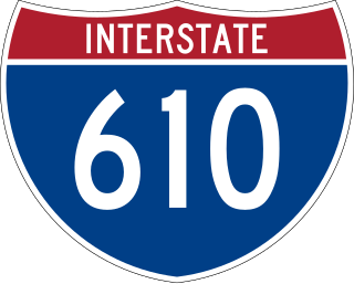
Interstate 610 (I-610) is a 4.52-mile-long (7.27 km) auxiliary route of I-10 that lies almost entirely within the city limits of New Orleans, Louisiana, bypassing its Central Business District.

<span class="mw-page-title-main">Chef Menteur Pass</span>

The Chef Menteur Pass is a narrow natural waterway which, along with the Rigolets, connects Lake Pontchartrain and Lake Borgne in New Orleans, Louisiana. It begins at 30°5′45″N89°48′52″W and follows a generally southeastward course. In the days of sailing ships, much commerce from the Gulf of Mexico sailed through the pass and the Rigolets into Lake Pontchartrain to New Orleans and surrounding communities. The Lake Catherine neighborhood of New Orleans is to the east side of the pass. The Venetian Isles neighborhood of New Orleans is to the west of the pass.

<span class="mw-page-title-main">Gentilly, New Orleans</span> New Orleans neighborhood in Louisiana, United States

Gentilly is a broad, predominantly middle-class and racially diverse section of New Orleans, Louisiana. The Gentilly neighborhood is bounded by Lake Pontchartrain to the north, France Road to the east, Bayou St. John to the west, and CSX Transportation railroad tracks to the south.

<span class="mw-page-title-main">New Orleans East</span> Eastern section of New Orleans

New Orleans East is the eastern section of New Orleans, Louisiana, the newest section of the city. This collection neighborhood sub divisions represents 65% of the city's total land area, but it is geographically isolated from the rest of the city by the Inner Harbor Navigational Canal. It is surrounded by water on all sides, bounded by the Industrial Canal, Gulf Intracoastal Waterway, Lake Pontchartrain, Lake Borgne, and the Rigolets, a long deep-water strait connecting the two lakes. Interstate 10 (I-10) splits the area nearly in half, and Chef Menteur Hwy, Downman Rd, Crowder Blvd, Dwyer Rd, Lake Forest Blvd, Read Blvd, Bullard Ave, Michoud Blvd, Hayne Blvd, Morrison Rd, Bundy Rd, and Almonaster Ave serve as major streets and corridors.

<span class="mw-page-title-main">Elysian Fields Avenue</span> Highway in Louisiana

Elysian Fields Avenue is a broad, straight avenue in New Orleans named after the Avenue des Champs-Élysées in Paris. It courses south to north from the Lower Mississippi River to Lake Pontchartrain, a distance of approximately 5 miles (8.0 km). The avenue intersects with Interstate 610, Interstate 10, and U.S. Highway 90, Gentilly Boulevard passing by Brother Martin High School. The part between North Claiborne Avenue and Gentilly Boulevard is Louisiana Highway 3021 ; the piece from N. Claiborne Avenue south to St. Claude Avenue carries Louisiana Highway 46.

<span class="mw-page-title-main">U.S. Route 90 Business (New Orleans, Louisiana)</span> Highway in New Orleans, Louisiana

U.S. Highway 90 Business is a business route of U.S. Highway 90 located in and near New Orleans, Louisiana. It runs 14.25 miles (22.93 km) in a general east–west direction from US 90 in Avondale to a junction with Interstate 10 (I-10) and US 90 in the New Orleans Central Business District.

<span class="mw-page-title-main">Airline Highway</span>

Airline Highway is a divided highway in the U.S. state of Louisiana, built in stages between 1925 and 1953 to bypass the older Jefferson Highway. It runs 115.6 miles (186.0 km), carrying U.S. Highway 61 from New Orleans northwest to Baton Rouge and U.S. Highway 190 from Baton Rouge west over the Mississippi River on the Huey P. Long Bridge. US 190 continues west towards Opelousas on an extension built at roughly the same time.

<span class="mw-page-title-main">Louisiana Highway 1</span> Highway in Louisiana

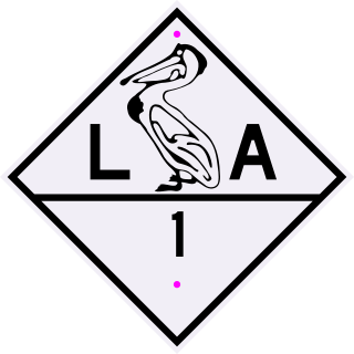
Louisiana Highway 1 (LA 1) is a state highway in Louisiana. At 431.88 miles (695.04 km), it is the longest numbered highway of any class in Louisiana. It runs diagonally across the state, connecting the oil and gas fields near the island of Grand Isle with the northwest corner of the state, north of Shreveport.

<span class="mw-page-title-main">Louisiana Highway 23</span> State highway in Louisiana, United States

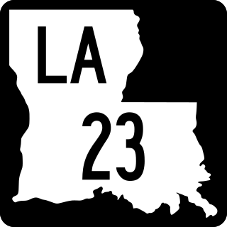
Louisiana Highway 23 is a north–south state highway in Louisiana that serves Plaquemines and Jefferson Parishes. It spans 74.0 miles (119.1 km) in roughly a southeast to northwest direction. It is known locally as Belle Chasse Highway, Lafayette Street, the West Bank Expressway, and Franklin Avenue.

<span class="mw-page-title-main">Old Spanish Trail (auto trail)</span> Auto trail across the United States

The Old Spanish Trail was an auto trail that once spanned the United States with almost 2,750 miles (4,430 km) of roadway from ocean to ocean. It crossed eight states and 67 counties along the southern border of the United States. Work on the auto highway began in 1915 at a meeting held at the Battle House Hotel in Mobile, Alabama; and, by the 1920s, the trail linked St. Augustine, Florida, to San Diego, California, with its center and headquarters in San Antonio, Texas. The work at San Antonio, and indeed nationally, was overseen by an executive committee consisting of prominent San Antonio businessmen which met at the Gunter Hotel weekly.

<span class="mw-page-title-main">Louisiana Highway 47</span> Highway in Louisiana

Louisiana Highway 47 (LA 47) is a state highway located in southeastern Louisiana. It runs 15.91 miles (25.60 km) in a general southeast to northwest direction from the Mississippi River levee in Chalmette to the intersection of Hayne Boulevard and Downman Road in New Orleans.

<span class="mw-page-title-main">Almonaster Avenue Bridge</span> New Orleans road/rail bridge

The Almonaster Avenue Bridge is a bascule bridge in New Orleans, Louisiana. The bridge has two vehicular lanes of Almonaster Avenue and two railroad tracks over the Industrial Canal.

<span class="mw-page-title-main">U.S. Route 11 in Louisiana</span> Segment of American highway

U.S. Highway 11 (US 11) is a part of the United States Numbered Highway System that spans 1,645 miles (2,647 km) from New Orleans, Louisiana, to Rouses Point, New York. Within the state of Louisiana, the highway travels 31 miles (50 km) from the national southern terminus at US 90 in New Orleans to the Mississippi state line south of Picayune.

<span class="mw-page-title-main">U.S. Route 51 in Louisiana</span> Section of U.S. Highway in Louisiana, United States

U.S. Highway 51 (US 51) is a part of the United States Numbered Highway System that spans 1,277 miles (2,055 km) from LaPlace, Louisiana to a point north of Hurley, Wisconsin. Within the state of Louisiana, the highway travels 69.12 miles (111.24 km) from the national southern terminus at US 61 in LaPlace to the Mississippi state line north of Kentwood.

<span class="mw-page-title-main">Louisiana State Route 1</span>

Louisiana State Route 1 was one of the 98 original state highways that were established in 1924. It was signed for the Jefferson Highway, an auto trail that ran from New Orleans to Winnipeg. LA 1 curved through the entire state, spanning from Shreveport through Alexandria and Baton Rouge to New Orleans, ending south of Pointe a la Hache. It was renumbered for the most part as US 71 and US 171.

<span class="mw-page-title-main">Louisiana Highway 3082</span> State highway in Louisiana, United States

Louisiana Highway 3082 was a state highway in Louisiana that served Orleans and St. Bernard Parishes. It spanned 6.2 miles (10.0 km) in a west–east direction along the present route of LA 39 between New Orleans and Chalmette. It was essentially a temporary designation for the relocation of LA 39 north (west) of LA 47.

<span class="mw-page-title-main">Louisiana Highway 613</span> State highway in Louisiana, United States

Louisiana Highway 613 was a collection of four state-maintained streets in Metairie and New Orleans established with the 1955 Louisiana Highway renumbering. All four routes have since been deleted from the state highway system.

References

  1. 1 2 Google (April 29, 2013). "Overview Map of US 90 in Louisiana" (Map). Google Maps . Google. Retrieved April 29, 2013.
  2. AOL (July 8, 2011). "U.S. Route 90 in Louisiana" (Map). Mapquest . AOL. Retrieved July 8, 2011.[ dead link ]
  3. Henry, Lyell (Summer 2008). "Following in Lincoln's Wake: The Jefferson Highway" (PDF). The Lincoln Highway Forum. Archived from the original (PDF) on October 3, 2011.
  4. Buehner, Kristin (October 22, 1995). "Jefferson Highway" (PDF). The Globe Gazette . Mason City, IA. Retrieved July 9, 2011.
  5. AOL. "New Orleans" (Map). Mapquest. AOL.[ dead link ]
  6. Jeff Hwy (n.d.). "History of the Jefferson Highway (Pine to Palm Highway)". Jefferson Highway: North America's First Transcontinental International Highway. Archived from the original on July 6, 2011. Retrieved July 8, 2011.[ self-published source ]
  7. Kurumi (n.d.). "I-910 (not signed as interstate) Louisiana". Kurumi.com.[ self-published source ]
  8. Jackson, Ron (2005). "Historic US 90: Abandoned Road to East Orange, Louisiana". TexasFreeway.com. Retrieved January 10, 2010.[ self-published source ]
  9. "Statutory Listing of Corridor Descriptions - High Priority Corridors - National Highway System - Planning - FHWA". www.fhwa.dot.gov. Retrieved January 4, 2022.
  10. Louisiana Department of Transportation and Development (2021). LADOTD Bing Maps Tool (Map). Retrieved July 13, 2022.
Template:Attached KML/U.S. Route 90 in Louisiana
KML is from Wikidata
US 90.svg U.S. Route 90
Previous state:
Texas
Louisiana Next state:
Mississippi