Sadou, Louisiana

Last updated

Sadou is an unincorporated community in Lafayette Parish, Louisiana, United States.

Unincorporated area Region of land not governed by own local government

In law, an unincorporated area is a region of land that is not governed by a local municipal corporation; similarly an unincorporated community is a settlement that is not governed by its own local municipal corporation, but rather is administered as part of larger administrative divisions, such as a township, parish, borough, county, city, canton, state, province or country. Occasionally, municipalities dissolve or disincorporate, which may happen if they become fiscally insolvent, and services become the responsibility of a higher administration. Widespread unincorporated communities and areas are a distinguishing feature of the United States and Canada. In most other countries of the world, there are either no unincorporated areas at all, or these are very rare; typically remote, outlying, sparsely populated or uninhabited areas.
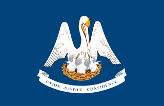
Louisiana State of the United States of America

Louisiana is a state in the Deep South region of the South Central United States. It is the 31st most extensive and the 25th most populous of the 50 United States. Louisiana is bordered by the state of Texas to the west, Arkansas to the north, Mississippi to the east, and the Gulf of Mexico to the south. A large part of its eastern boundary is demarcated by the Mississippi River. Louisiana is the only U.S. state with political subdivisions termed parishes, which are equivalent to counties. The state's capital is Baton Rouge, and its largest city is New Orleans.

The community is located near the intersection of US Hwy 90 US 90.svg and LA Hwy 724.

U.S. Route 90 in Louisiana highway in Louisiana

U.S. Highway 90 in Louisiana , one of the major east–west U.S. Highways in the Southern United States, runs through southern Louisiana for 297.6 miles (478.9 km), serving Lake Charles, Lafayette, New Iberia, Morgan City, and New Orleans. Much of it west of Lafayette and east of New Orleans has been supplanted by Interstate 10 (I-10) for all but local traffic, but the section between Lafayette and New Orleans runs a good deal south of I-10.

Related Research Articles

The Mid-America Center is an arena and convention center located in Council Bluffs, Iowa, just five minutes from downtown Omaha, Nebraska. The arena's maximum capacity is about 9,000 for concerts and 6,700 for ice hockey and arena football. The arena continues to provide free parking. Caesars Entertainment began managing the Center in 2012, taking over from SMG.

Lebanon, Georgia is a Cherokee County community that is now absorbed into Holly Springs. While the community is locally known and still referred to as Toonigh, the community has a post office located in a small strip mall just south of the Georgia Northeastern Railroad that was posted as Lebanon, Georgia. Lebanon's ZIP code is 30146.

Rumsey, California Unincorporated community in California, United States

Rumsey is an unincorporated community in Yolo County, California. It is located 18 miles (29 km) northwest of Esparto, in the Capay Valley, in the northwestern part of the county. Rumsey's ZIP Code is 95679 and its area code 530. It lies at an elevation of 420 feet.

Ossun is a Census-designated place in Lafayette Parish, Louisiana, United States.

Mouton is an unincorporated community in Lafayette Parish, Louisiana, United States.

Walroy is an unincorporated community in Lafayette Parish, Louisiana, United States.

Capitan is an unincorporated community in Lafayette Parish, Louisiana, United States.

Pilette is an unincorporated community in Lafayette Parish, Louisiana, United States.

Newtown is an unincorporated community in Greene County, Virginia, United States.

Chisford is an unincorporated community in Westmoreland County, in the U. S. state of Virginia.

Linwood is an unincorporated community in Carroll County, Maryland, United States. The community is home to the Linwood Historic District, added to the National Register of Historic Places in 1980.

Midway is an unincorporated community in Greene County, Virginia. It lies at an elevation of 659 feet.

Bellis, Alberta

Bellis is a hamlet in central Alberta, Canada within Smoky Lake County. Previously an incorporated municipality, Bellis dissolved from village status on January 1, 1946 to become part of the Municipal District of Vilna No. 575.

Etta is an unincorporated community in Caroline County, in the U.S. state of Virginia.

Moose Mountain No. 63 is a rural municipality in south-eastern Saskatchewan, Canada encompassing 740.91 square kilometers in area. The rural municipality maintains its office in Carlyle, Saskatchewan. The rural municipality in conjunction with the provincial government is in charge of maintenance of highways in its area. As well, the municipality provides policing, fire protection and municipal governance for the rural district, with a reeve as its administrator. Cannington Manor Provincial Park is located within the rural municipality.

Campbell Corner, Indiana Unincorporated community in Indiana, United States

Campbell Corner is an unincorporated community in Hamilton Township, Sullivan County, in the U.S. state of Indiana.

Brokenhead is a rural municipality in the province of Manitoba in Western Canada. The separately administered town of Beausejour lies within the borders of the municipality, south of its centre.

Sand Run is an unincorporated community in Ward Township, Hocking County, Ohio, United States.

Antioch, Greene County, Indiana Unincorporated community in Indiana, United States

Antioch is an unincorporated community in the southwestern part of Wright Township, Greene County, Indiana, United States. It lies near the intersection of County Road 575 North and County Road 500 North, which is a community nearly twenty miles west of the city of Bloomfield, the county seat of Greene County. Its elevation is 531 feet, and it is located at 39°05′55″N87°14′15″W.

Bard is an extinct town in Clark County, in the U.S. state of Nevada. The GNIS classifies it as a populated place.

References

    Coordinates: 30°14′15″N92°08′34″W / 30.23750°N 92.14278°W / 30.23750; -92.14278

    Geographic coordinate system Coordinate system

    A geographic coordinate system is a coordinate system that enables every location on Earth to be specified by a set of numbers, letters or symbols. The coordinates are often chosen such that one of the numbers represents a vertical position and two or three of the numbers represent a horizontal position; alternatively, a geographic position may be expressed in a combined three-dimensional Cartesian vector. A common choice of coordinates is latitude, longitude and elevation. To specify a location on a plane requires a map projection.