Amelia, Louisiana

Last updated

Amelia, Louisiana
USA Louisiana location map.svg
Red pog.svg
Amelia, Louisiana
Location of Amelia in Louisiana
Coordinates: 29°40′24″N91°06′11″W / 29.67333°N 91.10306°W / 29.67333; -91.10306
CountryUnited States
StateLouisiana
Parish St. Mary
Area
[1]
  Total2.78 sq mi (7.20 km2)
  Land2.52 sq mi (6.53 km2)
  Water0.26 sq mi (0.67 km2)
Elevation
7 ft (2 m)
Population
 (2020)
  Total2,132
  Density845.70/sq mi (326.56/km2)
Time zone UTC-6 (CST)
  Summer (DST) UTC-5 (CDT)
Area code 985
FIPS code 22-01815

Amelia is a census-designated place (CDP) in St. Mary Parish, Louisiana, United States. The population was 2,459 at the 2010 census. [2] It is part of the Morgan City Micropolitan Statistical Area.

Contents

History

The first postmaster named the town after Amelia Dupuis, his fiancée, who died shortly before their wedding day. [3]

Geography

Amelia is located at 29°40′24″N91°6′11″W / 29.67333°N 91.10306°W / 29.67333; -91.10306 (29.673361, -91.103181). [4]

On the eastern side of Amelia over Bayou Boeuf is the Assumption Parish line and the unincorporated community of Boeuf, Louisiana. Morgan City is located 8 miles (13 km) to the west.

According to the United States Census Bureau, the CDP has a total area of 2.8 square miles (7.3 km2), of which 2.6 square miles (6.7 km2) is land and 0.27 square miles (0.7 km2), or 9.12%, is water. [2]

Demographics

Historical population
CensusPop.Note
2000 2,423
2010 2,4591.5%
2020 2,132−13.3%
U.S. Decennial Census [5]

2020 census

Amelia racial composition [6]
RaceNumberPercentage
White (non-Hispanic)58327.35%
Black or African American (non-Hispanic)1728.07%
Native American 160.75%
Asian 25311.87%
Other/Mixed 602.81%
Hispanic or Latino 1,04849.16%

As of the 2020 United States census, there were 2,132 people, 904 households, and 522 families residing in the CDP.

2000 census

As of the census [7] of 2000, there were 2,423 people, 766 households, and 549 families residing in the CDP. The population density was 922.3 inhabitants per square mile (356.1/km2). There were 942 housing units at an average density of 358.6 per square mile (138.5/km2). The racial makeup of the CDP was 58.69% White, 12.38% African American, 0.66% Native American, 22.70% Asian, 4.25% from other races, and 1.32% from two or more races. Hispanic or Latino of any race were 8.17% of the population.

There were 766 households, out of which 38.5% had children under the age of 18 living with them, 55.0% were married couples living together, 9.9% had a female householder with no husband present, and 28.3% were non-families. 20.5% of all households were made up of individuals, and 5.6% had someone living alone who was 65 years of age or older. The average household size was 3.07 and the average family size was 3.60.

In the CDP, the population was spread out, with 31.6% under the age of 18, 10.1% from 18 to 24, 30.7% from 25 to 44, 20.6% from 45 to 64, and 6.9% who were 65 years of age or older. The median age was 31 years. For every 100 females, there were 123.3 males. For every 100 females age 18 and over, there were 129.5 males.

The median income for a household in the CDP was $26,953, and the median income for a family was $29,063. Males had a median income of $30,313 versus $16,917 for females. The per capita income for the CDP was $9,483. About 29.6% of families and 32.5% of the population were below the poverty line, including 38.9% of those under age 18 and 39.9% of those age 65 or over.

Related Research Articles

<span class="mw-page-title-main">Stevens Village, Alaska</span> CDP in Alaska, United States

Stevens Village is a census-designated place (CDP) in Yukon-Koyukuk Census Area, Alaska, United States. The population was 78 at the 2010 census, down from 87 in 2000.

<span class="mw-page-title-main">North Crossett, Arkansas</span> CDP in Arkansas, United States

North Crossett is a census-designated place (CDP) in Ashley County, Arkansas, United States. Per the 2020 census, the population was 2,756.

<span class="mw-page-title-main">Inverness Highlands North, Florida</span> Census-designated place in Florida, US

Inverness Highlands North is an unincorporated area and census-designated place (CDP) in Citrus County, Florida, United States. The population was 2,401 at the 2010 census, up from 1,470 in 2000.

Paincourtville is a census-designated place (CDP) in Assumption Parish, Louisiana, United States. The population was 911 at the 2010 census.

Moss Bluff is a census-designated place (CDP) in Calcasieu Parish, Louisiana, United States. The population was 12,522 at the 2020 census. Located just north of the city of Lake Charles, it is considered a suburb of that city. Moss Bluff is a burgeoning community, and is one of the communities in Calcasieu Parish besides Lake Charles and Sulphur experiencing growth. Several efforts have been made to incorporate Moss Bluff, but at the present time the community is unincorporated.

West Ferriday is an Unincorporated Community and former census-designated place (CDP) in Concordia Parish, Louisiana, United States. The population was 1,541 at the 2000 census. The area was not delineated as a CDP for the 2010 or the 2020 census.

<span class="mw-page-title-main">Gardere, Louisiana</span> Census-designated place in Louisiana, United States

Gardere is an unincorporated area and census-designated place (CDP) in East Baton Rouge Parish, Louisiana, United States. The area is also known as Riverland. The population was 10,580 at the 2010 census, up from 8,992 in 2000. It is part of the Baton Rouge Metropolitan Statistical Area.

<span class="mw-page-title-main">Merrydale, Louisiana</span> Census-designated place in Louisiana, United States

Merrydale is an unincorporated area and census-designated place (CDP) in East Baton Rouge Parish, Louisiana, United States. The population was 9,772 at the 2010 census, down from 10,427 in 2000. It is part of the Baton Rouge Metropolitan Statistical Area.

<span class="mw-page-title-main">Monticello, Louisiana</span> Census-designated place in Louisiana, United States

Monticello is a census-designated place (CDP) in East Baton Rouge Parish, Louisiana, United States. The population was 5,172 at the 2010 census, up from 4,763 in 2000. It is part of the Baton Rouge Metropolitan Statistical Area.

<span class="mw-page-title-main">Village St. George, Louisiana</span> Census-designated place in Louisiana, United States

Village St. George is a census-designated place (CDP) in East Baton Rouge Parish, Louisiana, United States. The population was 7,104 at the 2010 census. It is part of the Baton Rouge Metropolitan Statistical Area.

<span class="mw-page-title-main">Westminster, Louisiana</span> Census-designated place in Louisiana, United States

Westminster is a census-designated place (CDP) in East Baton Rouge Parish, Louisiana, United States. The population was 3,008 at the 2010 census, up from 2,515 in 2000. It is part of the Baton Rouge Metropolitan Statistical Area.

Lydia is an unincorporated community and census-designated place (CDP) in Iberia Parish, Louisiana, United States. The population was 952 at the 2010 census, down from 1,079 at the 2000 census. It is part of the New Iberia Micropolitan Statistical Area.

<span class="mw-page-title-main">Swartz, Louisiana</span> Census-designated place in Louisiana, United States

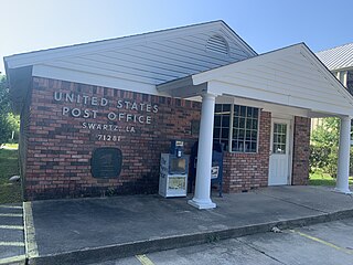
Swartz is a census-designated place (CDP) in Ouachita Parish in northeastern Louisiana, United States. The population was 4,536 in the 2010 census, an increase of 289 or 6.8 percent over the 2000 population. It is part of the Monroe Metropolitan Statistical Area.

<span class="mw-page-title-main">Baldwin, Louisiana</span> Town in Louisiana, United States

Baldwin is a town in St. Mary Parish, Louisiana, United States. The population was 2,436 at the 2010 census, down from 2,497 in 2000. It is part of the Morgan City Micropolitan Statistical Area.

Bayou Vista is a census-designated place (CDP) in St. Mary Parish, Louisiana, United States. The population was 4,652 at the 2010 census. It is part of the Morgan City Micropolitan Statistical Area.

<span class="mw-page-title-main">Dulac, Louisiana</span> CDP in Louisiana, United States

Dulac is a census-designated place (CDP) in Terrebonne Parish, Louisiana, United States. The population was 1,241 in 2020. It is part of the Houma–Bayou Cane–Thibodaux metropolitan statistical area.

<span class="mw-page-title-main">Cloverly, Maryland</span> Census-designated place in Maryland, United States

Cloverly is an unincorporated town and census-designated place in Montgomery County, Maryland, United States. Its population was 15,285 as of the 2020 census.

<span class="mw-page-title-main">North Boston, New York</span> Census-designated place in New York, United States

North Boston is a hamlet and census-designated place (CDP) in the town of Boston in Erie County, New York, United States. As of the 2010 census, the CDP population was 2,521. It is part of the Buffalo–Niagara Falls Metropolitan Statistical Area.

<span class="mw-page-title-main">Beechwood Trails, Ohio</span> Census-designated place in Ohio, United States

Beechwood Trails is a census-designated place (CDP) in Harrison Township, Licking County, Ohio, United States. The population was 3,276 at the 2020 census.

<span class="mw-page-title-main">Ranchos Penitas West, Texas</span> CDP in Texas, United States

Ranchos Penitas West is a census-designated place (CDP) in Webb County, Texas, United States. The population was 573 at the 2010 census.

References

  1. "2020 U.S. Gazetteer Files". United States Census Bureau. Retrieved March 20, 2022.
  2. 1 2 "Geographic Identifiers: 2010 Demographic Profile Data (G001): Amelia CDP, Louisiana". U.S. Census Bureau, American Factfinder. Retrieved March 29, 2013.
  3. Leeper, Clare D'Artois (October 19, 2012). Louisiana Place Names: Popular, Unusual, and Forgotten Stories of Towns, Cities, Plantations, Bayous, and Even Some Cemeteries. LSU Press. p. 16. ISBN   978-0-8071-4740-5.
  4. "US Gazetteer files: 2010, 2000, and 1990". United States Census Bureau. February 12, 2011. Retrieved April 23, 2011.
  5. "Census of Population and Housing". Census.gov. Retrieved June 4, 2016.
  6. "Explore Census Data". data.census.gov. Retrieved December 29, 2021.
  7. "U.S. Census website". United States Census Bureau . Retrieved January 31, 2008.