Millersburg, Oregon

Last updated

City Hall City Hall Reflection.jpg
City Hall
Millersburg, Oregon
Motto(s): 
A Community Linking Agriculture and Industry
Linn County Oregon Incorporated and Unincorporated areas Millersburg Highlighted.svg
Location in Oregon
Coordinates: 44°40′40″N123°04′09″W / 44.67778°N 123.06917°W / 44.67778; -123.06917
Country United States
State Oregon
County Linn
Incorporated 1974
Government
   Mayor Scott Cowen
Area
[1]
  Total4.68 sq mi (12.12 km2)
  Land4.46 sq mi (11.56 km2)
  Water0.22 sq mi (0.56 km2)
Elevation
[2]
220 ft (70 m)
Population
 (2020) [3]
  Total2,919
  Density654.04/sq mi (252.53/km2)
Time zone UTC-8 (Pacific)
  Summer (DST) UTC-7 (Pacific)
ZIP code
97321
Area code(s) 458 and 541
FIPS code 41-48300 [4]
GNIS feature ID2411111 [2]
Website cityofmillersburg.org

Millersburg is a city in Linn County, Oregon, United States. Millersburg originally was the name of a station on the Southern Pacific railroad line, which was named for a local farming family. The population was 1,329 at the 2010 census.

Contents

History

Millersburg came into being in 1974, to prevent the city of Albany from attempting to extend its city limits to include where Wah Chang Corporation operated a zirconium processing plant for the United States Bureau of Mines.

Although now owned by Allegheny Technologies and until recently known as ATI Wah Chang, this processing plant is the city's largest employer. [5]

Millersburg's infamous stench of past years, often attributed to the Wah Chang facility, is actually generated by the nearby Weyerhaeuser wood products processing mill. This has lent support to various attempts to close both plants. In August 2008, Weyerhauser sold the mill to International Paper. International Paper then closed the mill at the end of 2009, laying off 270 employees. [6] As of summer 2010, the mill sits idle.

On July 22, 2010, the demolition of the paper mill, now owned by International Paper, began with the implosion of the number 4 recovery boiler. [7] [8]

In 2008, Peak Sun Silicon built a 10,000-square-foot (930 m2) polysilicon production facility in Millersburg. They currently employ about 50 people with plans to expand up to 500 jobs by 2013. [9] However Peak Sun Silicon's land in Oregon was foreclosed on after they were unable to repay a loan from the Oregon Department of Energy. [10]

Geography

According to the United States Census Bureau, the city has a total area of 4.65 square miles (12.04 km2), of which 4.43 square miles (11.47 km2) is land and 0.22 square miles (0.57 km2) is water. [11]

Demographics

Historical population
CensusPop.Note
1980 562
1990 71527.2%
2000 651−9.0%
2010 1,329104.1%
2020 2,919119.6%
U.S. Decennial Census [12] [3]

2010 census

As of the census [13] of 2010, there were 1,329 people, 504 households, and 387 families living in the city. The population density was 300.0 inhabitants per square mile (115.8/km2). There were 538 housing units at an average density of 121.4 per square mile (46.9/km2). The racial makeup of the city was 91.9% White, 0.1% African American, 1.1% Native American, 1.4% Asian, 3.0% from other races, and 2.6% from two or more races. Hispanic or Latino of any race were 6.6% of the population.

There were 504 households, of which 34.1% had children under the age of 18 living with them, 65.3% were married couples living together, 7.5% had a female householder with no husband present, 4.0% had a male householder with no wife present, and 23.2% were non-families. 16.7% of all households were made up of individuals, and 6.4% had someone living alone who was 65 years of age or older. The average household size was 2.63 and the average family size was 2.92.

The median age in the city was 41.2 years. 23.6% of residents were under the age of 18; 5.2% were between the ages of 18 and 24; 27.2% were from 25 to 44; 30% were from 45 to 64; and 14.1% were 65 years of age or older. The gender makeup of the city was 50.6% male and 49.4% female.

2000 census

As of the census [4] of 2000, there were 651 people, 263 households, and 179 families living in the city. The population density was 145.9 inhabitants per square mile (56.3/km2). There were 288 housing units at an average density of 64.6 per square mile (24.9/km2). The racial makeup of the city was 96.47% White, 0.77% Native American, 0.92% Asian, 0.15% from other races, and 1.69% from two or more races. Hispanic or Latino of any race were 2.76% of the population.

There were 263 households, out of which 30.4% had children under the age of 18 living with them, 59.3% were married couples living together, 6.1% had a female householder with no husband present, and 31.6% were non-families. 25.1% of all households were made up of individuals, and 8.4% had someone living alone who was 65 years of age or older. The average household size was 2.48 and the average family size was 2.98.

In the city, the population was spread out, with 24.4% under the age of 18, 6.0% from 18 to 24, 29.3% from 25 to 44, 29.0% from 45 to 64, and 11.2% who were 65 years of age or older. The median age was 37 years. For every 100 females, there were 105.4 males. For every 100 females age 18 and over, there were 103.3 males.

The median income for a household in the city was $35,469, and the median income for a family was $48,393. Males had a median income of $35,909 versus $25,625 for females. The per capita income for the city was $16,964. About 7.1% of families and 8.7% of the population were below the poverty line, including 5.0% of those under age 18 and 12.9% of those age 65 or over.

Related Research Articles

<span class="mw-page-title-main">Linn County, Oregon</span> County in Oregon, United States

Linn County is one of the 36 counties in the U.S. state of Oregon. As of the 2020 census, the population was 128,610. The county seat is Albany. The county is named in the honor of Lewis F. Linn, a U.S. Senator from Missouri who advocated the American settlement of the Oregon Country. Linn County comprises the Albany, OR Metropolitan Statistical Area, which is included in the Portland-Vancouver-Salem, OR-WA Combined Statistical Area. It is located in the Willamette Valley. In 2010, the center of population of Oregon was located in Linn County, near the city of Lyons.

<span class="mw-page-title-main">Millersburg, Iowa</span> City in Iowa, United States

Millersburg is a city in Iowa County, Iowa, United States. The population was 135 at the time of the 2020 census.

Medusa is a hamlet in the Town of Rensselaerville, in Albany County, New York, United States. The population was 376 at the 2000 census, which listed the community as a census-designated place (CDP), but it was not included as a CDP in the 2010 census.

<span class="mw-page-title-main">Hines, Oregon</span> City in Oregon, United States

Hines is a city in Harney County, Oregon, United States. The population was 1,563 at the 2010 census.

<span class="mw-page-title-main">Eagle Point, Oregon</span> City in Oregon, United States

Eagle Point is a city in Jackson County, Oregon, United States. The population was 8,469 at the 2010 census, up from 4,798 at the 2000 census. As of 2018, the estimated population was 9,408.

<span class="mw-page-title-main">Gold Hill, Oregon</span> City in Jackson County, Oregon, United States

Gold Hill is a city in Jackson County, Oregon, in the United States. As of the 2010 census the population was 1,335. It is along a bend of the Rogue River.

<span class="mw-page-title-main">Brownsville, Oregon</span> City in Oregon, United States

Brownsville is a city in Linn County, Oregon, United States. As of the 2020 census the population was 1,694.

<span class="mw-page-title-main">Halsey, Oregon</span> City in Oregon, United States

Halsey is a city in Linn County, Oregon, United States. The population was 904 at the 2010 census.

<span class="mw-page-title-main">Scio, Oregon</span> City in Oregon, United States

Scio is a city in Linn County, Oregon, United States. The population was 838 at the 2010 census.

<span class="mw-page-title-main">Waterloo, Oregon</span> City in Oregon, United States

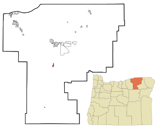
Waterloo is a city in Linn County, Oregon, United States. The population was 229 at the 2010 census.

<span class="mw-page-title-main">Aurora, Oregon</span> City in Oregon, United States

Aurora is a city in Marion County, Oregon, United States. Before being incorporated as a city, it was the location of the Aurora Colony, a religious commune founded in 1856 by William Keil and John E. Schmit. William named the settlement after his daughter. The population was 1,133 at the 2020 Census. It is part of the Salem Metropolitan Statistical Area.

<span class="mw-page-title-main">Scotts Mills, Oregon</span> City in Oregon, United States

Scotts Mills is a city in Marion County, Oregon, United States. The population was 419 at the 2020 census. It is 2 miles (3 km) south of Marquam and Oregon Route 213, between Silverton and Molalla.

<span class="mw-page-title-main">Turner, Oregon</span> City in Oregon, United States

Turner is a city in Marion County, Oregon, United States. The population was 2,454 at the 2020 census. It is part of the Salem Metropolitan Statistical Area. The community was incorporated by the Oregon Legislative Assembly on February 10, 1905.

<span class="mw-page-title-main">Pilot Rock, Oregon</span> City in Oregon, United States

Pilot Rock is a city in Umatilla County, Oregon, United States. The population was 1,502 at the 2010 census. It is part of the Pendleton–Hermiston Micropolitan Statistical Area. The main industries are timber and agriculture. Pilot Rock is home to the Boise Cascade /Kinzua Lumber lumber and pole mill as well as Pilot Rock High School. The name of Pilot Rock refers to a large basalt rock formation which is visible from the old Oregon Trail and was used in navigating wagon trains through the area.

<span class="mw-page-title-main">Camas, Washington</span> City in Washington, United States

Camas is a city in Clark County, Washington, with a population of 26,065 at the 2020 census. The east side of town borders the city of Washougal, Washington, and the west side of town borders Vancouver, Washington. Camas lies along the Washington side of the Columbia River, across from Troutdale, Oregon, and is part of the Portland metropolitan area.

<span class="mw-page-title-main">Gates, Oregon</span> City in Oregon, United States

Gates is a city on the border of Linn and Marion counties in Oregon, United States. The population was 548 at the 2020 census. The greater part of Gates' population is in Marion County and the city is primarily under Marion County's jurisdiction.

<span class="mw-page-title-main">Idanha, Oregon</span> City in Oregon, United States

Idanha is a city on the Marion County/Linn County line in Oregon, United States, on Oregon Route 22 and the Santiam River. The population was 156 at the 2020 census.

<span class="mw-page-title-main">Mill City, Oregon</span> City in Oregon, United States

Mill City is a city in Linn and Marion counties in the U.S. state of Oregon on Oregon Route 22. The population was 1,971 at the 2020 census. It is on the North Santiam River, downstream from Detroit Lake.

<span class="mw-page-title-main">Millersburg, Indiana</span> Town in Indiana, United States

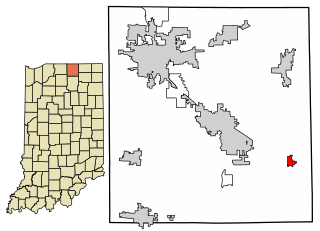
Millersburg is a town in Clinton and Benton townships, Elkhart County, Indiana, United States. The population was 903 at the 2010 census.

<span class="mw-page-title-main">Millersburg, Ohio</span> Village in Ohio, United States

Millersburg is a village and the county seat of Holmes County, Ohio, United States. Located 66 miles (106 km) south of Cleveland, it is in the heart of Ohio's Amish Country and is part of a large regional tourism industry. The population was 3,151 at the 2020 census. Holmes County Airport, located two miles southwest of Millersburg, serves the county.

References

  1. "ArcGIS REST Services Directory". United States Census Bureau. Retrieved October 12, 2022.
  2. 1 2 U.S. Geological Survey Geographic Names Information System: Millersburg, Oregon
  3. 1 2 "Census Population API". United States Census Bureau. Retrieved October 12, 2022.
  4. 1 2 "U.S. Census website". United States Census Bureau . Retrieved January 31, 2008.
  5. Lathrop, Steve (May 19, 2014). "Millersburg council holding forums on utility". Albany Democrat-Herald .
  6. "Paper mill to close near Albany". The Oregonian. October 23, 2009. Retrieved August 11, 2010.
  7. Implosion of part of the Millersburg Paper Mill. YouTube . Archived from the original on December 11, 2021.
  8. "IP's Albany Mill: A demolition update". May 18, 2018. Retrieved August 6, 2023.
  9. "Peak Sun Silicon: Polysilicon from Oregon" . Retrieved August 11, 2010.
  10. "Peak Sun Silicon falls hard as state begins foreclosure".
  11. "US Gazetteer files 2010". United States Census Bureau. Archived from the original on July 2, 2012. Retrieved December 21, 2012.
  12. "Census of Population and Housing". Census.gov. Retrieved June 4, 2015.
  13. "U.S. Census website". United States Census Bureau . Retrieved December 21, 2012.