Sweet Home, Oregon

Last updated

Sweet Home, Oregon
Weddle Bridge in Sweet Home, Oregon.jpg
The Weddle Bridge spans Ames Creek in Sweet Home, Oregon.
Motto(s): 
Sweet Home: Oregon at its Best
Gateway to the Santiam Playground
Linn County Oregon Incorporated and Unincorporated areas Sweet Home Highlighted.svg
Location in Oregon
Coordinates: 44°24′05″N122°43′12″W / 44.40139°N 122.72000°W / 44.40139; -122.72000
Country United States
State Oregon
County Linn
Incorporated 1893
Government
  TypeCouncil-Manager
   Mayor Susan Coleman (R) [1]
Area
[2]
  Total5.76 sq mi (14.91 km2)
  Land5.30 sq mi (13.73 km2)
  Water0.46 sq mi (1.18 km2)
Elevation
[3]
604 ft (184 m)
Population
 (2020) [4]
  Total9,828
  Estimate 
(2023) [5]
10,156
  Density1,853.64/sq mi (715.65/km2)
Time zone UTC-8 (Pacific)
  Summer (DST) UTC-7 (Pacific)
ZIP code
97386
Area code(s) 458 and 541
FIPS code 41-71950 [6]
GNIS feature ID2412022 [3]
Website www.sweethomeor.gov

Sweet Home is a city in Linn County, Oregon, United States, with a population of 9,828 at the 2020 census. [7] Sweet Home is referred to as the 'Gateway to the Santiam Playground' due to its proximity to nearby lakes, rivers and the Cascade Mountains. [8]

Contents

History

Settlers first arrived in the Sweet Home Valley in the early 1850s. A community known as Buckhead developed near the mouth of Ames Creek and the South Santiam River. Buckhead was named after a saloon that featured a set of elk antlers on the gable end of its building. East of Buckhead, a community called Mossville developed with a store and post office. In 1874, the two communities merged to become one community called Sweet Home. In 1893, the city of Sweet Home was incorporated. [9]

The Santiam Wagon Road, a toll road connecting the Willamette Valley with central Oregon, was opened in 1865. The road extended from the Sweet Home Valley across the Santiam Pass in the Cascades to Camp Polk near Sisters. The Santiam Wagon Road was a vital means of supplying livestock and goods from western Oregon to central Oregon and transporting wool from east of the Cascades back to Willamette Valley woolen mills. [10] Competition with railroads that extended south from the Columbia River into central Oregon and the newly opened McKenzie Pass Highway made the wagon road obsolete by the late 1930s. U.S. Route 20 was constructed across much of the same route as the Santiam Wagon Road. [11]

Sweet Home experienced significant growth during the 1940s due to the demand for timber from local forests. Further growth occurred when construction began on nearby Green Peter Dam in 1962 and continued as construction began on Foster Dam in 1966. [12]

During the 1980s, Sweet Home experienced a number of sawmill and plywood mill closures due to economic cycles, increased competition, increased productivity, and logging restrictions placed on nearby forests resulting from environmental concerns for endangered species. [13] [14] In response, community members sought out other economic development opportunities such as the Oregon Jamboree country music and camping festival. [15]

Geography

Foster Lake is on the eastern edge of Sweet Home. Foster Lake.jpg
Foster Lake is on the eastern edge of Sweet Home.

According to the United States Census Bureau, the city has a total area of 5.75 square miles (14.89 km2), of which 5.30 square miles (13.73 km2) is land and 0.45 square miles (1.17 km2) is water. [16]

The intersection Oregon Route 228 and U.S. Route 20 occurs at the Western end of Sweet Home. [17]

The South Santiam River flows from Foster Reservoir along the northern city limits of Sweet Home. Ames Creek and Wiley Creek flow into the South Santiam River within the city limits. [18]

Sweet Home is built on a prehistoric petrified forest. In addition to fossil wood, the area includes a variety of agate, jasper, crystals and minerals. [19] The abundant petrified wood at Holleywood Ranch (between Sweet Home and Holley, Oregon) was the subject of an episode of the Travel Channel program Cash and Treasures . [20]

Climate

The region experiences warm (but not hot) and dry summers, with no average monthly temperatures above 71.6 °F (22.0 °C). According to the Köppen Climate Classification system, Sweet Home has a warm-summer Mediterranean climate, abbreviated "Csb" on climate maps. [21]

Climate data for Foster Dam, Oregon (1991–2020 normals, extremes 1969–present)
MonthJanFebMarAprMayJunJulAugSepOctNovDecYear
Record high °F (°C)67
(19)
71
(22)
79
(26)
86
(30)
96
(36)
112
(44)
106
(41)
105
(41)
102
(39)
93
(34)
73
(23)
69
(21)
112
(44)
Mean maximum °F (°C)60.1
(15.6)
63.6
(17.6)
71.2
(21.8)
77.6
(25.3)
85.1
(29.5)
89.8
(32.1)
96.1
(35.6)
97.1
(36.2)
91.8
(33.2)
79.7
(26.5)
65.9
(18.8)
59.2
(15.1)
99.5
(37.5)
Mean daily maximum °F (°C)47.5
(8.6)
51.2
(10.7)
55.5
(13.1)
60.3
(15.7)
67.0
(19.4)
72.9
(22.7)
81.7
(27.6)
82.6
(28.1)
76.4
(24.7)
64.1
(17.8)
52.9
(11.6)
46.5
(8.1)
63.2
(17.3)
Daily mean °F (°C)40.9
(4.9)
42.8
(6.0)
46.2
(7.9)
49.9
(9.9)
55.5
(13.1)
60.4
(15.8)
66.4
(19.1)
66.4
(19.1)
61.6
(16.4)
53.0
(11.7)
45.3
(7.4)
40.4
(4.7)
52.4
(11.3)
Mean daily minimum °F (°C)34.3
(1.3)
34.5
(1.4)
36.9
(2.7)
39.6
(4.2)
43.9
(6.6)
47.9
(8.8)
51.0
(10.6)
50.3
(10.2)
46.8
(8.2)
41.9
(5.5)
37.6
(3.1)
34.3
(1.3)
41.6
(5.3)
Mean minimum °F (°C)22.7
(−5.2)
24.4
(−4.2)
27.2
(−2.7)
31.1
(−0.5)
34.6
(1.4)
40.3
(4.6)
43.8
(6.6)
42.2
(5.7)
38.0
(3.3)
31.1
(−0.5)
26.1
(−3.3)
22.0
(−5.6)
18.1
(−7.7)
Record low °F (°C)0
(−18)
2
(−17)
19
(−7)
22
(−6)
26
(−3)
35
(2)
39
(4)
36
(2)
31
(−1)
20
(−7)
16
(−9)
0
(−18)
0
(−18)
Average precipitation inches (mm)7.15
(182)
5.56
(141)
6.26
(159)
5.37
(136)
3.80
(97)
2.46
(62)
0.54
(14)
0.64
(16)
1.99
(51)
4.64
(118)
7.64
(194)
8.40
(213)
54.45
(1,383)
Average snowfall inches (cm)0.1
(0.25)
0.0
(0.0)
0.0
(0.0)
0.0
(0.0)
0.0
(0.0)
0.0
(0.0)
0.0
(0.0)
0.0
(0.0)
0.0
(0.0)
0.0
(0.0)
0.0
(0.0)
0.0
(0.0)
0.1
(0.25)
Average precipitation days (≥ 0.01 in)19.116.818.617.912.89.22.83.06.813.118.420.0158.5
Average snowy days (≥ 0.1 in)0.00.00.00.00.00.00.00.00.00.00.00.00.0
Source: NOAA [22] [23]

Demographics

Historical population
CensusPop.Note
1910 202
1920 175−13.4%
1930 1898.0%
1940 1,090476.7%
1950 3,603230.6%
1960 3,353−6.9%
1970 3,79913.3%
1980 6,92182.2%
1990 6,850−1.0%
2000 8,01617.0%
2010 8,92511.3%
2020 9,82810.1%
U.S. Decennial Census [24] [4]

The median income for a household in the city was $43,589; 20.7% of persons were below the poverty line. [7]

2020 census

As of the census [25] of 2020, there were 9,828 people, 3,721 households, and 2,315 families residing in the city. The population density was 1,684.0 inhabitants per square mile (650.2/km2). There were 4,037 housing units at an average density of 710.9 per square mile (274.5/km2). The racial makeup of the city was 93.3% White, 0.3% African American, 1.3% Native American, 0.8% Asian, 0.1% Pacific Islander, 1.1% from other races, and 3.0% from two or more races. Hispanic or Latino of any race were 4.7% of the population.

There were 3,721 households, of which 24.7% had children under the age of 18 living with them, 38.7% were married couples living together, 27.1% had a female householder with no spouse present, and 23.2% had a male householder with no spouse present. 25.7% of all households were made up of individuals, and 11.4% had someone living alone who was 65 years of age or older. The average household size was 2.57 and the average family size was 3.00.

The median age in the city was 39.0 years. 24.7% of residents were under the age of 18. The gender makeup of the city was 51.6% male and 48.4% female.

Economy

Major employers in Sweet Home include Ti Squared Technologies, a titanium foundry; White's Electronics, a metal detector manufacturer; [26] HEVI-Shot, a manufacturer of shotshell ammunition; [27] Cascade Timber Consulting, a timber investment management organization; [28] United States Forest Service, Radiator Supply House, Murphy Plywood, McCool Millworks and the Sweet Home School District.

Arts and culture

Country music fans watch an evening concert at The Oregon Jamboree in Sweet Home. Oregon Jamboree Crowd.jpg
Country music fans watch an evening concert at The Oregon Jamboree in Sweet Home.

Annual cultural events

Covered bridges

The Weddle Covered Bridge, relocated from Thomas Creek near Scio, crosses Ames Creek at Sankey Park in Sweet Home. [29] The Crawfordsville Covered Bridge spans the Calapooia River 8 miles (13 km) southwest of Sweet Home and the Short Covered Bridge crosses the South Santiam River 12 miles (19 km) east of Sweet Home. [30] [31]

2018 U.S. Capitol Christmas Tree

The 2018 Capitol Christmas Tree, which comes from a different national forest every year, was acquired by the Sweet Home Ranger District (it is named after the town in which it is headquartered). The ranger district, part of the Willamette National Forest, was awarded the opportunity to present the tree to the American people for the 2018 Christmas season. [32]

Recreation

Fly fishing on the South Santiam River near Sweet Home Fly fishing on the South Santiam.jpg
Fly fishing on the South Santiam River near Sweet Home

Sweet Home has seven city parks within city limits, [33] [34] but most recreational opportunities occur outside of town; the nearby wilderness supports boating, hunting, fishing, hiking, white-water sports, camping and gold panning. [35] [36] For this reason, Sweet Home describes itself as the "Gateway to the Santiam Playground." [37]

Foster Reservoir on the South Santiam River has boat ramps and a year-round marina while Green Peter Reservoir provides two improved boat ramps. [38] [39] The South Santiam River offers salmon and steelhead fishing while Quartzville Creek is recognized for Class 4 and Class 5 kayaking. [40]

The South Santiam also supports gold panning, [40] and petrified wood deposits nearby continue to draw attention. [20]

Hiking trails include Horse Rock Ridge, Soda Creek Falls Trail at Cascadia State Park and numerous trails throughout the Willamette National Forest. The Menagerie Wilderness has rock faces amenable to climbing.

An 18-hole golf course, Mallard Creek Golf Club, is 11 miles (18 km) northwest of Sweet Home. The nearest ski resort, Hoo Doo Ski Bowl, is 52 miles (84 km) to the east, near Santiam Pass.

Transportation

Sweet Home public transportation service is provided by Linn Shuttle. [41]

Education

Sweet Home High School Sweet Home High School.jpg
Sweet Home High School

Sweet Home is served by the Sweet Home School District. The district includes Sweet Home High School, a junior high school and four elementary schools. The district covers Sweet Home, Cascadia, Crawfordsville, Holley, Liberty, Pleasant Valley and other surrounding communities. [42]

Linn–Benton Community College operates a branch campus in Sweet Home. [43]

Media

The New Era newspaper is published weekly. The daily Albany Democrat-Herald also serves the city. [44] [45]

Notable people

People born or who lived in Sweet Home:

Related Research Articles

<span class="mw-page-title-main">Linn County, Oregon</span> County in Oregon, United States

Linn County is one of the 36 counties in the U.S. state of Oregon. As of the 2020 census, the population was 128,610. The county seat is Albany. The county is named in the honor of Lewis F. Linn, a U.S. Senator from Missouri who advocated the American settlement of the Oregon Country. Linn County comprises the Albany, OR Metropolitan Statistical Area, which is included in the Portland-Vancouver-Salem, OR-WA Combined Statistical Area. It is located in the Willamette Valley. In 2010, the center of population of Oregon was located in Linn County, near the city of Lyons.

<span class="mw-page-title-main">Oakridge, Oregon</span> City in Oregon, United States

Oakridge is a city in Lane County, Oregon, United States. The population was 3,205 as of the 2010 census. It is located east of Westfir on Oregon Route 58, about 40 miles (64 km) east of Eugene and 150 miles (240 km) southeast of Portland. Surrounded by the Willamette National Forest and the Cascade Range, Oakridge is popular with outdoor enthusiasts for its hiking, mountain biking, wildflowers, fly fishing, birding, watersports, and the nearby Willamette Pass Resort.

<span class="mw-page-title-main">Lebanon, Oregon</span> City in Oregon, United States

Lebanon is a city in Linn County, Oregon, United States. Lebanon is located in northwest Oregon, southeast of Salem. The population was 19,690 at the 2020 census. Lebanon sits beside the South Santiam River on the eastern edge of the Willamette Valley, close to the Cascade Range and a 25-minute drive to either of the larger cities of Corvallis and Albany. Lebanon is known for its foot-and-bike trails, its waterside parks, and its small-town character.

<span class="mw-page-title-main">Albany, Oregon</span> City in Oregon, United States

Albany is the county seat of Linn County, Oregon, and is the 11th most populous city in the state. Albany is located in the Willamette Valley at the confluence of the Calapooia River and the Willamette River in both Linn and Benton counties, just east of Corvallis and south of Salem. It is predominantly a farming and manufacturing city that settlers founded around 1848. As of the 2020 United States Census, the population of Albany, Oregon was 56,472.

<span class="mw-page-title-main">Mill City, Oregon</span> City in Oregon, United States

Mill City is a city in Linn and Marion counties in the U.S. state of Oregon on Oregon Route 22. The population was 1,971 at the 2020 census. It is on the North Santiam River, downstream from Detroit Lake.

<span class="mw-page-title-main">Santiam River</span> River in Oregon, United States

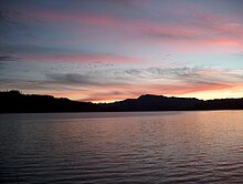
The Santiam River is a tributary of the Willamette River, about 12 miles (19 km) long, in western Oregon in the United States. Through its two principal tributaries, the North Santiam and the South Santiam rivers, it drains a large area of the Cascade Range at the eastern side of the Willamette Valley east of Salem and Corvallis.

<span class="mw-page-title-main">Calapooia River</span> River in Oregon, United States of America

The Calapooia River is an 80-mile (130 km) tributary of the Willamette River in the U.S. state of Oregon.

<span class="mw-page-title-main">North Santiam River</span> River in Oregon, United States

The North Santiam River is a 92-mile (148 km) tributary of the Santiam River in western Oregon in the United States. It drains 766 square miles (1,980 km2) of the Cascade Range on the eastern side of the Willamette Valley east of Salem.

<span class="mw-page-title-main">South Santiam River</span> River in Oregon, United States

The South Santiam River is a tributary of the Santiam River, about 69 miles (111 km) long, in western Oregon in the United States. It drains an area of the Cascade Range into the Willamette Valley east of Corvallis.

<span class="mw-page-title-main">Middle Santiam River</span> Tributary of the South Santiam River in America

The Middle Santiam River is a tributary of the South Santiam River, 38.5 miles (62.0 km) long, in western Oregon in the United States. It drains a remote area of the Cascade Range east of Sweet Home in the watershed of the Willamette River.

<span class="mw-page-title-main">Willamette National Forest</span> United States national forest in Oregon

The Willamette National Forest is a National Forest located in the central portion of the Cascade Range of the U.S. state of Oregon. It comprises 1,678,031 acres (6,790.75 km2). Over 380,000 acres are designated wilderness which include seven major mountain peaks. There are also several National Wild and Scenic Rivers within the forest. The forest is named for the Willamette River, which has its headwaters in the forest. The forest's headquarters are located in the city of Springfield. There are local ranger district offices in McKenzie Bridge, Detroit, Sweet Home, and Westfir.

Breitenbush is an unincorporated community in Marion County, Oregon, United States, located approximately 10 miles NE of Detroit, Oregon, and 10 miles NW of Mt. Jefferson. The community is situated on private land, encompassed entirely by the Willamette National Forest, and is notable for having several hot springs, both nearby and on the property. It is said to have been originally homesteaded in 1888, and its hot springs have seen varied degrees of development and use since that time. In its heyday as a resort, the community was served by a post office, which operated between 1928 and 1953.

<span class="mw-page-title-main">Santiam State Forest</span> State forest in Oregon, United States

Santiam State Forest is one of six state forests managed by the Oregon Department of Forestry. The forest is located approximately 25 miles (40 km) southeast of Salem, Oregon, and includes 47,871 acres (193.73 km2) on the western slope of the Cascade Mountains in three Oregon counties: Clackamas, Linn, and Marion. It is bounded on the east by the Willamette National Forest and Mount Hood National Forest. Silver Falls State Park is located west of the forest. The rest of the land surrounding the forest belongs to the Bureau of Land Management or is privately owned. The forest is managed as part of the Department of Forestry's North Cascade District.

<span class="mw-page-title-main">Quartzville Creek</span> River in Oregon, United States

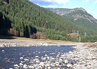
Quartzville Creek is a 28-mile (45 km) tributary of the Middle Santiam River in Linn County in the U.S. state of Oregon. It is paralleled by the Quartzville Back Country Byway and used for recreation, including camping, fishing, hunting, kayaking, and gold panning. The lower 12 miles (19 km) of the creek, from the Willamette National Forest boundary to Green Peter Reservoir, was designated Wild and Scenic in 1988.

<span class="mw-page-title-main">Marion Forks, Oregon</span> Unincorporated community in the state of Oregon, United States

Marion Forks is an unincorporated community on the North Santiam Highway, 15 miles (24 km) south of the city of Detroit, in Linn County, Oregon, United States.

<span class="mw-page-title-main">Crabtree, Oregon</span> Unincorporated community in the state of Oregon, United States

Crabtree is an unincorporated community and census-designated place in Linn County, Oregon, United States. As of the 2010 census, it had a population of 391. It has a post office with a ZIP code of 97335. Crabtree lies off Oregon Route 226 about 10 miles (16 km) east of Albany.

<span class="mw-page-title-main">Cascadia State Park</span> State park in Oregon, United States

Cascadia State Park is a state park in the U.S. state of Oregon near Sweet Home along the South Santiam River at Cascadia. The park includes a day use area, campsites, hiking trails and 150 foot Lower Soda Creek Falls.

<span class="mw-page-title-main">Elkhorn Creek (Marion County, Oregon)</span> River in Oregon, United States

Elkhorn Creek is a 7.6-mile (12 km) long stream in Marion County, Oregon, United States. Its source is on the northern edge of the Willamette National Forest, about 3.5 miles (5.6 km) north of Big Cliff Reservoir. The creek flows mostly west, receiving Big Twelve Creek, Buckhorn Creek, and Buck Creek all from the south, and it enters the Little North Santiam River just south of Elkhorn Woods Park, about 5 miles (8.0 km) north of the city of Gates. The stream's valley is surrounded by the western Cascade foothills, covered with coniferous trees characteristic of the Pacific Northwest, and lined with red alders at the water's edge. The creek supports runs of rainbow and coastal cutthroat trout, as well as Pacific giant salamanders. On September 30, 1996, a 6.4-mile (10.3 km) portion of the stream, from the mouth nearly to the source, was protected as part of the National Wild and Scenic Rivers System.

<span class="mw-page-title-main">Suttle Lake (Oregon)</span> Lake in Oregon, United States of America

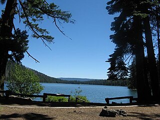
Suttle Lake is a natural lake near the crest of the Cascade Range in central Oregon, United States, covering 253 acres (1.02 km2). It was named in honor of John Settle, whose name was misspelled when the lake was officially recorded as a geographic feature. Today, the lake is located within the Deschutes National Forest and serves as one of central Oregon's most popular outdoor recreation sites, with three large campgrounds and two day-use areas along the north, west, and south shores of the lake. The Oregon Department of Fish and Wildlife regularly stocks the lake with rainbow trout.

<span class="mw-page-title-main">Thomas Creek (Linn County, Oregon)</span> River in Oregon, United States

Thomas Creek is a stream, about 35 miles (56 km) long, in Linn County in the U.S. state of Oregon. Beginning in Willamette National Forest on the western slopes of the Cascade Range, the creek flows generally west through Santiam State Forest and farmland to meet the South Santiam River west of Scio.

References

  1. "Susan Coleman".
  2. "ArcGIS REST Services Directory". United States Census Bureau. Retrieved October 12, 2022.
  3. 1 2 U.S. Geological Survey Geographic Names Information System: Sweet Home, Oregon
  4. 1 2 "Census Population API". United States Census Bureau. Retrieved October 12, 2022.
  5. "Sweet Home, Oregon Population 2023".
  6. "U.S. Census website". United States Census Bureau . Retrieved January 31, 2008.
  7. 1 2 "Sweet Home (city) QuickFacts from the US Census Bureau". Quickfacts.census.gov. Retrieved February 23, 2024.
  8. Paul, Alex (October 29, 2017). "Past, present meet in Sweet Home murals". Albany Democrat Herald . Retrieved February 23, 2024.
  9. "City of Sweet Home - History". Sweet-home.or.us. Retrieved March 12, 2012.
  10. "Santiam Wagon Road" . Retrieved March 20, 2012.
  11. "Santiam Wagon Road, 1865-1939". Oregon Historic Trails Fund. Retrieved April 21, 2013.
  12. "History of The Willamette National Forest (Chapter 5)". Foresthistory.org. Retrieved March 12, 2012.
  13. "Historical Look at Oregon's Wood Products Industry". State of Oregon. January 23, 2012. Archived from the original on March 3, 2016. Retrieved February 28, 2014.
  14. Stein, Mark A. (July 14, 1989). "Industry Fears Environmentalists : Loggers See Spotted Owl as a Harbinger of Doom". Los Angeles Times. Retrieved March 12, 2012.
  15. 1 2 "About the Oregon Jamboree". Oregon Jamboree. Retrieved April 21, 2013.
  16. "US Gazetteer files 2010". United States Census Bureau. Archived from the original on July 2, 2012. Retrieved December 21, 2012.
  17. "Sweet Home, OR". Google Maps. Retrieved April 21, 2013.
  18. "South Santiam River". Geographic Names Information System . United States Geological Survey, United States Department of the Interior. November 28, 1980. Retrieved April 21, 2013.
  19. Gregory, Irene (April 1968). "The Fossil Woods near Holley in the Sweet Home Petrified Forest, Linn County, Oregon" (PDF). The Ore Bin. State of Oregon Department of Geology and Mineral Industries. 30 (4): 57–76. Retrieved April 21, 2013.
  20. 1 2 Ast, Ellen (December 27, 2007). "Rockin' in the tree world". Albany Democrat-Herald. Albany, Oregon. Retrieved March 20, 2012.
  21. "Sweet Home, Oregon Köppen Climate Classification (Weatherbase)". Weatherbase.
  22. "NowData – NOAA Online Weather Data". National Oceanic and Atmospheric Administration. Retrieved March 24, 2023.
  23. "Summary of Monthly Normals 1991–2020". National Oceanic and Atmospheric Administration. Retrieved March 24, 2023.
  24. "Census of Population and Housing". Census.gov. Retrieved June 4, 2015.
  25. "U.S. Census website". United States Census Bureau . Retrieved December 21, 2012.
  26. "White's Metal Detectors". Whiteselectronics.com. Retrieved March 12, 2012.
  27. "Welcome to HEVI-ShotÂŽ". Hevishot.com. Retrieved March 12, 2012.
  28. "Cascade Timber Consulting, Inc". Cascadetimber.com. Retrieved March 12, 2012.
  29. Lair, Patrick (September 28, 2005). "Weddle Bridge closes". Albany Democrat-Herald. Albany, Oregon. Retrieved April 21, 2013.
  30. Klindt, Robert S. (December 3, 1989). "Oregon's bridges uncover simpler times". San Jose Mercury News. San Jose, California. Retrieved April 21, 2013.
  31. "South Fork Santiam River (Short) Covered Bridge" (PDF). Oregon Department of Transportation. Retrieved April 21, 2013.
  32. "2018 US Capitol Christmas Tree Selection" . Retrieved August 6, 2023.
  33. "Parks". Sweet Home, Oregon. Retrieved April 30, 2020.
  34. "City of Sweet Home Park System" . Retrieved March 20, 2012.
  35. "Welcome to Sweet Home". Oregon Jamboree. Retrieved April 21, 2013.
  36. Hyer Waibel, Mona. "Quartzville Gold". OregonPioneers.com. Retrieved April 21, 2013.
  37. "Police Chief: City of Sweet Home, Oregon" (PDF). City of Sweet Home. p. 2. Retrieved April 21, 2013.
  38. "Boat Escape to Foster Lake". BoatEscape.com. Retrieved April 21, 2013.
  39. "Green Peter Lake and Foster Lake, Oregon" (PDF). U.S. Army Corps of Engineers. 2009. Retrieved April 21, 2013.
  40. 1 2 Yuskavitch, Jim (2008). Fishing Oregon: An Angler's Guide to Top Fishing Spots (2nd ed.). Guilford, Connecticut: Lyons Press. p.  120. ISBN   978-0-7627-4145-8. OCLC   213838754.
  41. "Transportation in Sweet Home". Sweet Home, Oregon. Retrieved April 30, 2020.
  42. "Our District". Sweethome.k12.or.us. Retrieved March 12, 2012.
  43. "LBCC: Sweet Home Center". Linnbenton.edu. January 2, 2012. Archived from the original on February 24, 2012. Retrieved March 12, 2012.
  44. Era, The New. "The New Era Homepage". The New Era.
  45. "Albany Democrat-Herald". Albany Democrat-Herald. Retrieved April 21, 2013.
  46. "Ghosts of Highway 20".
  47. Eckler Jr., A. Ross (May 2010). "Howard Bergerson". Word Ways: The Journal of Recreational Linguistics . 43 (2): 82–88.
  48. Baker, Billy (April 7, 2008). "A witness to global warming". Boston Globe . Retrieved March 14, 2018.
  49. Morgan, Sean (March 14, 2018). "SHHS alum, Harvard prof, wins 'Nobel Prize for the Environment'". Sweet Home New Era . Retrieved March 14, 2018.
  50. Gary Bedore (May 22, 2022). "Kansas Jayhawks baseball coach Ritch Price announces retirement after 20 seasons". www.kansas.com. Wichita Eagle. Retrieved May 23, 2022.
  51. Gehrett, Les (July 29, 2011). "Former Sweet Home player goes back to work for Jets". Albany Democrat-Herald. Retrieved March 12, 2012.
  52. Gehlken, Michael (May 7, 2016). "Chargers secure veteran C Matt Slauson". The San Diego Union Tribune. Retrieved June 6, 2016.