Millsap, Texas

Last updated

Millsap, Texas
Millsap Texas (1 of 1).jpg
Millsap Park (demolished in 2019)
TXMap-doton-Millsap.PNG
Location of Millsap, Texas
Parker County Milsap.svg
Coordinates: 32°44′47″N98°0′35″W / 32.74639°N 98.00972°W / 32.74639; -98.00972
Country United States
State Texas
County Parker
Area
[1]
  Total1.47 sq mi (3.82 km2)
  Land1.47 sq mi (3.80 km2)
  Water0.01 sq mi (0.02 km2)
Elevation
817 ft (249 m)
Population
 (2010)
  Total403
  Estimate 
(2019) [2]
461
  Density314.03/sq mi (121.25/km2)
Time zone UTC-6 (Central (CST))
  Summer (DST) UTC-5 (CDT)
ZIP code
76066 [3]
Area code 940
FIPS code 48-48564 [4]
GNIS feature ID1341692 [5]

Millsap is a town in Parker County, Texas, United States. Its population was 403 at the 2010 census.

Contents

History

Originally, Millsap was established as a relay station on the stagecoach route that ran from Weatherford to Palo Pinto. The town was named for Fuller Millsap, who moved to Texas in 1849 and to Parker County in 1856. A Millsap post office opened in 1877.

In 1880, the tracks of the Texas and Pacific Railway arrived. By the 1890s, Millsap was serving area farmers as a retail and shipping point. Within a decade the town had a bank, more than a dozen other businesses, three churches, a ten-grade educational institution called Millsap College, and a weekly newspaper, the Millsap News. The community population increased from an estimated 100 in 1890 to 800 in 1920.

Following World War II, however, Millsap declined, reaching a low of 261 by 1968. In 1988, 412 residents were reported, and in 1990 an estimated 485 residents lived there. By 2000, the population dropped to 353.

Geography

Millsap is located at 32°44′47″N98°0′35″W / 32.74639°N 98.00972°W / 32.74639; -98.00972 (32.746527, –98.009714). [6] These coordinates place Millsap on Farm to Market Road 113, 15 miles west of Weatherford, in western Parker County. According to the United States Census Bureau, the town has a total area of 1.3 square miles (3.4 km2), of which 99.24% is land and 0.76% is covered by water.

The climate in this area is characterized by relatively high temperatures and evenly distributed precipitation throughout the year. The Köppen climate classification describes the weather as humid subtropical, Cfa. [7]

Climate data for Millsap, Texas
MonthJanFebMarAprMayJunJulAugSepOctNovDecYear
Mean daily maximum °C (°F)14
(57)
17
(62)
21
(69)
26
(78)
29
(85)
33
(92)
36
(97)
36
(96)
32
(89)
26
(79)
20
(68)
15
(59)
26
(78)
Mean daily minimum °C (°F)0
(32)
3
(37)
7
(44)
12
(53)
17
(62)
21
(69)
22
(72)
22
(72)
18
(65)
12
(54)
6
(43)
2
(35)
12
(53)
Average precipitation mm (inches)43
(1.7)
48
(1.9)
64
(2.5)
79
(3.1)
100
(4.1)
81
(3.2)
61
(2.4)
53
(2.1)
74
(2.9)
79
(3.1)
48
(1.9)
38
(1.5)
770
(30.4)
Source: Weatherbase [8]

Demographics

Historical population
CensusPop.Note
1980 439
1990 48510.5%
2000 353−27.2%
2010 40314.2%
2019 (est.)461 [2] 14.4%
U.S. Decennial Census [9]

As of the census [4] of 2000, there were 353 people, 135 households, and 103 families residing in the town. The population density was 268.5 inhabitants per square mile (103.7/km2). There were 154 housing units at an average density of 117.1 per square mile (45.2/km2). The racial makeup of the town was 90.93% White, 0.28% Asian, 7.65% from other races, and 1.13% from two or more races. Hispanic or Latino of any race were 13.03% of the population.

There were 135 households, out of which 37.0% had children under the age of 18 living with them, 61.5% were married couples living together, 12.6% had a female householder with no husband present, and 23.7% were non-families. 20.7% of all households were made up of individuals, and 10.4% had someone living alone who was 65 years of age or older. The average household size was 2.61 and the average family size was 3.01.

In the town, the population was spread out, with 28.9% under the age of 18, 6.5% from 18 to 24, 26.3% from 25 to 44, 27.5% from 45 to 64, and 10.8% who were 65 years of age or older. The median age was 38 years. For every 100 females, there were 100.6 males. For every 100 females age 18 and over, there were 94.6 males.

The median income for a household in the town was $40,694, and the median income for a family was $43,229. Males had a median income of $30,714 versus $19,821 for females. The per capita income for the town was $15,699. About 4.4% of families and 6.6% of the population were below the poverty line, including 5.1% of those under age 18 and 13.8% of those age 65 or over.

Education

Millsap is served by the Millsap Independent School District.

Related Research Articles

<span class="mw-page-title-main">Clayhatchee, Alabama</span> Town in Alabama, United States

Clayhatchee is a town in Dale County, Alabama, United States. At the 2010 census the population was 589, up from 501 in 2000. It was incorporated in April 1967. It is part of the Ozark Micropolitan Statistical Area.

<span class="mw-page-title-main">Delta, Louisiana</span> Village in Louisiana, United States

Delta is a village in Madison Parish, Louisiana, United States. The population was 232 at the 2020 census. It is part of the Tallulah Micropolitan Statistical Area.

<span class="mw-page-title-main">Mayville, Michigan</span> Village in Michigan, United States

Mayville is a village in Tuscola County, in the U.S. state of Michigan. The population was 948 at the 2010 census. The village is within Fremont Township along the boundary with Dayton Township.

<span class="mw-page-title-main">Hickory Flat, Mississippi</span> Town in Mississippi, United States

Hickory Flat is a town in Benton County, Mississippi, United States. The population was 601 at the 2010 census.

<span class="mw-page-title-main">Moore, Montana</span> Town in Montana, United States

Moore is a town in Fergus County, Montana, United States. The population was 194 at the 2020 census.

<span class="mw-page-title-main">Roby, Texas</span> City in Texas, United States

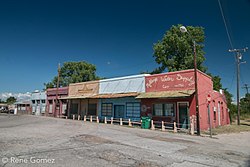
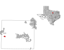
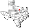
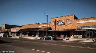
Roby is a city in and the county seat of Fisher County, Texas, United States. The population was 591 at the 2020 census.

<span class="mw-page-title-main">Turkey, Texas</span> City in Texas, United States

Turkey is a city in Hall County, Texas, United States. The population was 317 at the 2020 census, down from 421 at the 2000 census.

<span class="mw-page-title-main">Jewett, Texas</span> City in Texas, United States

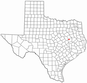
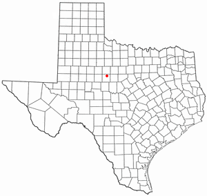
Jewett is a city in Leon County, Texas, United States. The population was 1,167 at the 2010 census. It was laid out in 1871 by the International Railroad Company.

<span class="mw-page-title-main">Slaton, Texas</span> City in Texas, United States

Slaton is a city in Lubbock County, Texas, United States. Founded by German immigrants, Slaton was the westernmost German settlement in Texas. The population was 6,121 at the 2010 census. Slaton is part of the Lubbock Metropolitan Statistical Area.

<span class="mw-page-title-main">Frost, Texas</span> City in Texas, United States

Frost is a city in Navarro County, Texas, United States. The population was 643 at the 2010 census.

<span class="mw-page-title-main">Powell, Texas</span> Town in Texas, United States

Powell is a town in Navarro County, Texas, United States. The population was 136 at the 2010 census.

<span class="mw-page-title-main">Gary City, Texas</span> Town in Texas, United States

Gary City is a town in Panola County, Texas, United States. The population was 336 as of the 2020 census.

<span class="mw-page-title-main">Cool, Texas</span> City in Texas, United States

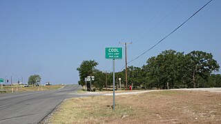
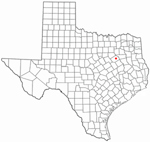
Cool is a city in Parker County, Texas, United States. The population was 211 at the 2020 census.

<span class="mw-page-title-main">Emory, Texas</span> City in Texas, United States

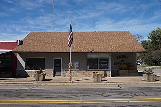
Emory is a city in Rains County, Texas, United States. The population was 1,239 at the 2010 census. It is the county seat of Rains County. Previously known as Springville, the city and county are named after Emory Rains, who was a legislator from the area. Rains was the author of the Homestead Law of Texas, which was later used as a model for the protection of homesteads throughout the United States. Special legislation passed to create Rains County called for the citizens to vote on the location of the county seat and for that selected town to be named Emory.

<span class="mw-page-title-main">Tye, Texas</span> City in Texas, United States

Tye is a city in Taylor County, Texas, United States. The population was 1,242 at the 2010 census. It is part of the Abilene, Texas Metropolitan Statistical Area.

<span class="mw-page-title-main">Burnsville, West Virginia</span> Town in West Virginia, United States

Burnsville is a town in Braxton County, West Virginia, United States, at the confluence of the Little Kanawha River and Saltlick Creek. The population was 401 at the 2020 census. Burnsville was incorporated in 1902 by the Circuit Court and named for Captain John Burns who operated the first sawmill in that section of the state and who established the town shortly after the close of the American Civil War. It was named "All West Virginia City" in 1976.

<span class="mw-page-title-main">Beech Bottom, West Virginia</span> Village in West Virginia, United States

Beech Bottom is a village in Brooke County, West Virginia, United States, situated along the Ohio River. The population was 523 at the 2010 census. It is part of the Weirton–Steubenville metropolitan area.

<span class="mw-page-title-main">Hamlin, West Virginia</span> Town in West Virginia, United States

Hamlin is a town in and the county seat of Lincoln County, West Virginia, United States, along the Mud River. The population was recorded as 1,040 at the 2020 census. It is part of the Huntington–Ashland metropolitan area.

<span class="mw-page-title-main">Ackerly, Texas</span> City in Texas, United States

Ackerly is a city in Dawson and Martin Counties in the U.S. state of Texas. As of the 2020 Census, the population was 264. The Martin county portion of Ackerly is part of the Midland-Odessa metropolitan area.

<span class="mw-page-title-main">Mineral Wells, Texas</span> City in Texas, United States

Mineral Wells is a city in Palo Pinto and Parker Counties in the U.S. state of Texas. The population was 14,820 at the 2020 census. The city is named for mineral wells in the area, which were highly popular in the early 1900s.

References

  1. "2019 U.S. Gazetteer Files". United States Census Bureau. Retrieved August 7, 2020.
  2. 1 2 "Population and Housing Unit Estimates". United States Census Bureau. May 24, 2020. Retrieved May 27, 2020.
  3. United States Postal Service (2012). "USPS - Look Up a ZIP Code" . Retrieved February 15, 2012.
  4. 1 2 "U.S. Census website". United States Census Bureau . Retrieved January 31, 2008.
  5. "US Board on Geographic Names". United States Geological Survey. October 25, 2007. Retrieved January 31, 2008.
  6. "US Gazetteer files: 2010, 2000, and 1990". United States Census Bureau. February 12, 2011. Retrieved April 23, 2011.
  7. Climate Summary for Millsap, Texas
  8. "Weatherbase.com". Weatherbase. 2013. Retrieved on September 8, 2013.
  9. "Census of Population and Housing". Census.gov. Retrieved June 4, 2015.