True to its name, the street, which began as a Native American trail, eventually leads north to the state of Wisconsin and through Kenosha and Racine towards Milwaukee, though not directly. Starting with a short section at N. Canal and W. Lake Streets, it begins in earnest at the corner of N. Des Plaines and W. Kinzie Streets and heads northwest for about 40 miles (64km), eventually following Illinois Route 21 before joining Skokie Highway (U.S. Route 41) in Gurnee, Illinois, which eventually merges at Interstate 94 where Skokie Highway and the Tri-State Tollway split off, continuing to Milwaukee. From Harlem Avenue to Riverside Drive, it is Illinois Route 21.
Milwaukee Avenue is a popular route for bicyclists. The southeastern end of Milwaukee Avenue is the most heavily bicycled stretch of road in Chicago, with cyclists accounting for 22% of all traffic there on a randomly selected day in September.[1]
The street is lined with storefronts, restaurants and the occasional art gallery through most of the city.
The CTA's Blue Line runs beneath or alongside Milwaukee Avenue from its beginning at Canal and Lake Streets out to Logan Boulevard, with stations at Grand Avenue, Chicago Avenue, Division Street, Damen Avenue (in the Wicker Park neighborhood), Western Avenue, California Avenue and Logan Square. The Kennedy Expressway (Interstate 90) roughly parallels Milwaukee Avenue as well.
Milwaukee Avenue passing through downtown Libertyville
Sections of the movie High Fidelity were filmed in buildings along Milwaukee Avenue, including the Double Door and the fictional record store that is the nexus of the character's lives. Although the movie Wicker Park was filmed in Canada, the story is set in this area of Wicker Park, Chicago. The busy six corner intersection of Damen Avenue, North Avenue, and Milwaukee is the center of the "24 hour" Wicker Park scene with dozens of bars and restaurants, making for popular nightlife. The Flat Iron Arts Center, built in 1913 and designed by Holabird & Roche, is sited at this intersection.[3]
In 2015, the Spike Lee movie Chiraq was being filmed in Chicago, with a scene including rapper actor Nick Cannon filmed at the Double Door on Milwaukee Avenue.[4]
The movie palace Congress Theater, a designed Chicago landmark built in 1926, is located at 2135 N. Milwaukee.
Logan Square
Logan square in 1993
Just northwest of Bucktown, Milwaukee Avenue traverses the heart of Logan Square, Chicago, a gentrifying neighborhood. Milwaukee Avenue runs on a diagonal through the parkway of the boulevards, Logan Boulevard and Kedzie Avenue at a traffic circle surrounding the Illinois Centennial Monument.
CTA 56 Milwaukee The 56 Milwaukee runs on the road from Desplaines Street to Jefferson Park Transit Center. CTA BLUE LINE - The CTA Blue line runs under Milwaukee from Desplaines street to Kimball Avenue in Chicago.
PACE Pace has multiple routes on Milwaukee Avenue PACE 270 - The Pace 270 route runs on the road from the Jefferson Park Transit Center to Euclid Ave in Glenview PACE 272 - The Pace 272 route runs on the road from Golf Mill Station to Townline Road in Vernon hills PACE 100 - [7] This route used Transit Signal Priority (TSP), level boarding and skipped stops to provide express service from Jefferson Park Transit Center to Golf Mill Station. These improvements ended up shaving 9 minutes off of the running time. This brought the running time from 30 minutes to 21 minutes.
METRA MD-N - The Milwaukee District North Line has two stops on Milwaukee Avenue at Grayland and Libertyville. UP-NW - The Union Pacific Northwest Line crosses Milwaukee Avenue at the Jefferson Park Transit Center.
The Yellow Line, alternatively known as the Skokie Swift, is a branch of the Chicago "L" train system in Chicago, Illinois. The 4.7-mile (7.6 km) route runs from the Howard Terminal on the north side of Chicago, through the southern part of Evanston and to the Dempster Terminal in Skokie, Illinois, making one intermediate stop at Oakton Street in Skokie.
The Blue Line is a 26.93-mile-long (43.34 km) Chicago "L" line which extends through The Loop from O'Hare International Airport at the far northwest end of the city, through downtown via the Milwaukee–Dearborn subway and across the West Side to its southwest end at Forest Park, with a total of 33 stations. At about 27 miles, it is the longest line on the Chicago "L" system and second busiest, and one of the longest local subway/elevated lines in the world. It has an average of 64,978 passengers boarding each weekday in 2022.
Pace is the suburban bus and regional paratransit division of the Regional Transportation Authority serving the Chicago metropolitan area. It was created in 1983 by the RTA Act, which established the formula that provides funding to the CTA, Metra, and Pace. The various agencies providing bus service in the Chicago suburbs were merged under the Suburban Bus Division, which rebranded as Pace in 1984. In 2022, Pace had 18.041 million riders.
Logan Square is an official community area, historical neighborhood, and public square on the northwest side of the City of Chicago. The Logan Square community area is one of the 77 city-designated community areas established for planning purposes. The Logan Square neighborhood, located within the Logan Square community area, is centered on the public square that serves as its namesake, located at the three-way intersection of Milwaukee Avenue, Logan Boulevard and Kedzie Boulevard.
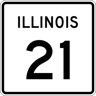
Illinois Route 21 is an arterial north–south state highway in northeastern Illinois. It runs from Illinois Route 43 in Niles to U.S. Route 41 north of Gurnee. Illinois 21 is 28.13 miles (45.27 km) long.
The Chicago North Shore and Milwaukee Railroad, also known as the North Shore Line, was an interurban railroad that operated passenger and freight service over an 88.9-mile (143.1 km) route between the Chicago Loop and downtown Milwaukee, as well as an 8.6-mile (13.8 km) branch line between the villages of Lake Bluff and Mundelein, Illinois. The North Shore Line also provided streetcar, city bus and motor coach services along its interurban route.
Howard is an 'L' station in Chicago, Illinois on the North Side Main Line. It is the northern terminus of the Red Line and the southeastern terminus of the Yellow Line; it also serves the Purple Line, for which it is the southern terminus at non-rush hour times on weekdays and all day on weekends. Trains on the Chicago North Shore and Milwaukee Railroad also stopped at Howard from 1926 until that line was abandoned in 1963.
Western Avenue is a street within the city of Chicago. Western Avenue extends south as a continuous road to the Dixie Highway at Sibley Boulevard in Dixmoor, giving the road a total length of 27.38 miles (44.06 km). Western Avenue, after becoming into Asbury Ave, runs out on the north side at Howard Street Road in Chicago and on the south side at Crete-Monee Road in Crete. However, Western Avenue extends intermittently through the Southland to the Will/Kankakee county border in unincorporated Will Township. Within Chicago's grid street system, Western Avenue is 2400 West, three miles west of State Street. Western Avenue is the longest continuous road in Chicago.
Wicker Park is a neighborhood in the West Town community area of Chicago, Illinois, west of the Kennedy Expressway, east of Humboldt Park, and south of the Bloomingdale Trail, known for its hipster culture, art community, nightlife, and food scene.
Dempster–Skokie, formerly known as Dempster, or Skokie, is an 'L' station on the CTA's Yellow Line at 5005 Dempster Street in Skokie, Illinois. It is one of three stops on the Yellow Line, and the line’s western terminus, Dempster–Skokie is one of two CTA rail stations in Skokie, and is at grade level.
Six Corners is a shopping district in the Portage Park neighborhood of Chicago's Northwest Side.
Austin is a station on the Chicago Transit Authority's 'L' system. It is located between the Ridgeland and Central stations on the Green Line, which runs from Harlem/Lake and to Ashland/63rd and Cottage Grove. The station is located at the intersection of Austin Boulevard and Corcoran Place in the Austin neighborhood on Chicago's West Side and borders the village of Oak Park.
Rosemont, formerly River Road, is a Chicago "L" station at the intersection of River Road and I-190 in the suburb of Rosemont, Illinois. It is located in the median of I-190 with one island platform serving two tracks, 16 miles (26 km) northwest of The Loop. Trains are scheduled to depart from Rosemont every 2–7 minutes during rush-hour periods, and take about 36 minutes to travel to the Loop. The station is 7 blocks east and 2 blocks north of O'Hare International Airport. Rosemont is the busiest station outside the city limits of Chicago, with 2,090,977 passenger entries in 2014.
Cumberland is a station on the Chicago Transit Authority's 'L' system. Situated on the Blue Line between Rosemont and Harlem, the station is located in the median of the Kennedy Expressway at Cumberland Avenue in the O'Hare community area on Chicago's Northwest Side. It is also in close proximity to both the Norwood Park neighborhood and the city of Park Ridge as well as the village of Norridge. The area surrounding the station consists of mixed commercial and residential development.
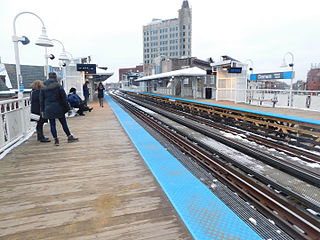
Western is an elevated rapid transit station on the Chicago "L"'s Blue Line, where it is located on the O'Hare branch. The station, opened in 1895, is located within the Bucktown neighborhood in the larger Logan Square community area. It has two side platforms at track level with a station house at street level.
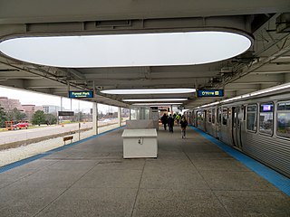
Damen is a rapid transit station on the Chicago "L", currently serving the O'Hare branch of its Blue Line. Opened on May 6, 1895, as Robey, it is the oldest station on the Blue Line. The station serves the popular Bucktown and Wicker Park neighborhoods, and is consistently in the top 40 highest-ridership "L" stations. It has two wooden side platforms and a brick station house at street level. The west platform, serving southbound trains, contains a tower that has never been used but is a relic of the station's past. The station is served by three bus routes on Damen, Milwaukee, and North Avenues, which are each descended from streetcar lines on those streets in the early 20th century. The Blue Line has owl service; while the surrounding streetcar lines also had owl service in the early 20th century, the modern bus services do not.
Pulaski Road is a major north-south street in the city of Chicago, at 4000 W., or exactly five miles west of State Street. It is named after Polish hero of the American Revolutionary War Casimir Pulaski.
The Jefferson Park Transit Center is an intermodal passenger transport hub in the Jefferson Park neighborhood of Chicago, Illinois. It serves as a station for rail and also as a bus terminal. Jefferson Park Transit Center's railroad station is on Metra's Union Pacific Northwest Line, with the station located at 4963 North Milwaukee Avenue. Jefferson Park is 9.1 miles (14.6 km) away from Ogilvie Transportation Center in downtown Chicago, the inbound terminus of the Union Pacific Northwest Line. Under Metra's zone-based fare system, Jefferson Park is in zone 2. As of 2018, Jefferson Park is the 97th busiest of Metra's 236 non-downtown stations, with an average of 510 weekday boardings.
Oakton–Skokie is an 'L' station on the CTA's Yellow Line, which serves downtown Skokie. Previously, a station existed at this location which was in operation as part of the North Shore Line's Niles Center Route from 1925 until 1948, and later demolished in 1964. The current station opened on April 30, 2012.
Damen Avenue is a street in Chicago, where it is 2000 West in the grid. It is 2.5 miles (4.0 km) west of State Street, the city's north–south baseline. Known as Robey Street for politician James Robey prior to 1927, it was renamed in honor of Father Arnold Damen. However, the Robey name is retained in Harvey and Dixmoor as Robey Avenue.
This page is based on this Wikipedia article Text is available under the CC BY-SA 4.0 license; additional terms may apply. Images, videos and audio are available under their respective licenses.