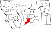
Rapelje is an unincorporated community and census-Designated Place in northern Stillwater County, Montana, United States. Rapelje was named for J. M. Rapelje, general manager and vice president of the Northern Pacific Railway. Rapelje had a population of approximately 110 people as of the 2000 census. Rapelje is located 24 miles north of Columbus on Montana Secondary Highway 306.

Lake Ariel is a village in Lake and Salem Townships, Wayne County, Pennsylvania, United States.
Sumner is a community and Census Designated Place located in Noble County, Oklahoma, United States, ten miles east of Perry and two miles north of U.S. Route 64. Established prior to statehood along the St. Louis-San Francisco Railway, the post office opened on May 23, 1894. The town was named for Henry T. Sumner, a businessman from Perry. Per the 1905 Oklahoma Territorial Census, Sumner had sixty-four residents. The post office closed July 27, 1957.

Raynesford is an unincorporated community in Judith Basin County, Montana, United States. Its elevation is 4,042 feet (1,232 m), and it is located at 47°16′12″N110°43′48″W. The community includes a community center, a catholic church, a fire department, and a post office. The post office was established under the name of "Spion Kop" on March 31, 1906; its name was changed to Raynesford exactly three years later.
Wesley is an unincorporated community in Wayne Township, Montgomery County, in the U.S. state of Indiana.

Effner is an unincorporated community on the border of the U.S. states of Illinois and Indiana. It lies principally in Iroquois County, Illinois and partially in Newton County, Indiana.
Edgar is a census-designated place and unincorporated community in Carbon County, Montana, United States. As of the 2010 census it had a population of 114. Edgar has a post office with a ZIP code 59026. The post office was established May 28, 1909 with John J. Thornton as its first postmaster. Thornton named the town after his brother.

South Woodstock is an unincorporated village and census-designated place (CDP) in the town of Woodstock in Windsor County, Vermont, United States. Its elevation is 1,040 feet (320 m), and it is located at 43°33′56″N72°31′56″W, in the Kedron Valley.

Cecil Township is a civil township in Bottineau County in the U.S. state of North Dakota. As of the 2000 census, its population was 28.
Coffee Creek is an unincorporated community in Fergus County, Montana, United States. It is located along Montana Highway 81 in west central Fergus County, several miles northwest of Denton. Coffee Creek has a post office with the ZIP code 59424.
Comanche is an unincorporated community in Yellowstone County, Montana, United States. It lies on Montana Highway 3, 16 miles northwest of the city of Billings and shares a postal ZIP code with Acton (59002). Comanche is at an elevation of 3,747 ft. ; its coordinates are 45|59|51|N|108|46|24|W
Quietus is the site of a former town, centered on a post office now closed, and a community in the surrounding area. It was located in Big Horn County, Montana, United States. No one lives at the site of the former town. The surrounding area is now an unincorporated community. It appears on the U.S. Geological Survey Map.
Corinth is an unincorporated community and Ghost Town in Big Horn County, Montana, United States.
Limestone is a ghost Town located in Stillwater County, Montana, United States.
Beehive is an unincorporated community located in Stillwater County, Montana, United States, which shares the ZIP code with Absarokee of 59001.
Dean is an unincorporated community located in Stillwater County, Montana, United States.
Wheat Basin is a ghost town in Stillwater County, Montana, United States. Wheat Basin is sourced from the USGS. The town has a total area of 6.5 acres.
Nibbe is an unincorporated community located in Yellowstone County, Montana and shares a postal ZIP code with Pompey's Pillar (59064).
Osborn is a populated place and ghost town located in Yellowstone County, Montana, United States.
Zurich is an unincorporated community in Blaine County, Montana, United States, located at 48°35′4″N109°1′50″W. Located along the Hi-Line of Montana, between Harlem and Chinook, along U.S. Route 2. It has a post office with the ZIP code of 59547, and a public school serving grades PK through 8. There is also a bar; the store and bank are closed and abandoned, as are two grain elevators and other business buildings. Various online sources give the population as 22-23 residents.


