Related Research Articles

Delta County is a county located in the U.S. state of Texas. As of the 2020 census, its population was 5,230. Its county seat and largest city is Cooper. The county was founded in 1870 and is named for its triangular shape, which resembles the Greek letter delta.

Ashley is a town in Indiana located on the border of Smithfield Township, DeKalb County and Steuben Township, Steuben County. The population was 983 at the 2010 census.
Memorial Stadium is the home of the University of North Dakota (UND) track and field teams. It is located on the campus of UND in Grand Forks, North Dakota. The stadium holds 10,000 people and opened in 1927. Memorial Stadium was home of the UND football from 1927 until 2001. Today, the football team plays in the nearby Alerus Center; however, the team continues to utilize Memorial Stadium for team offices, training, and practices.

Bushland is an unincorporated community and census-designated place (CDP) in southwestern Potter County, Texas, United States. A small portion of the CDP extends south into Randall County. According to the Handbook of Texas, the community had an estimated population of 130 in 2000. The community is part of the Amarillo, Texas Metropolitan Statistical Area.
WCHY is a radio station licensed to Cheboygan, Michigan, United States. The station airs a format consisting of local talk shows and oldies and is currently owned by Michigan Broadcasters LLC. The station previously aired a country music format branded as "Straits Country", which originated on WWSS 95.3 FM in Tuscarora Township and moved to WCHY on March 12, 2018.
Algoa is an unincorporated community in Galveston County, Texas, United States. The population was 125 according to the 2000 census. The 2010 census did not record the population of Algoa.
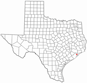
Coady is an unincorporated community in east central Harris County, Texas, United States.
Barker is an unincorporated community in western Harris County, Texas, United States. It lies along local roads off Interstate 10 and seventeen miles west of downtown Houston. Its elevation is 102 feet (31 m), and it is located at 29°47′4″N95°41′6″W.
McGillivray Pass is a mountain pass in the Pacific Ranges of southwestern British Columbia, Canada, located about 30 miles west of the town of Lillooet and immediately west of the upper end of Anderson Lake, above the former resort community of McGillivray. The pass connects the head of McGillivray Creek with the head of Standard Creek, a tributary of Cadwallader Creek and was used as a route by prospectors, miners and hunters heading for the upper Bridge River Country beyond the pass. The pass was proposed at one time for a cog railway to connect the mines at Bralorne and Pioneer with the Pacific Great Eastern Railway (now part of CN but the project never went forward. There are private ski cabins near the summit area of the pass, which is the division between the Bendor Range to the east and the Cadwallader Range to the west.

Cormier Woods is a 175-acre (71 ha) open space preserve and historic 18th-century farm complex in Uxbridge, Massachusetts, USA, within the Blackstone River Valley National Heritage Corridor. The property is named for James Cormier, the former owner of the property. It was acquired in 2008 by the land conservation non-profit organization The Trustees of Reservations.
Harmaston is a place in unincorporated northeast Harris County, Texas, United States that used to be a distinct community in Texas.
Sawyer is a hamlet in the town of Wheatfield in Niagara County, New York, United States.

Forte de São Fernando is a fort in the Azores. It is located in Angra do Heroísmo, on the island of Terceira.
Thompson is an unincorporated community in Trinity County, Texas. The community has a church and some homes; it once had a school, which opened in the 1880s. It is incorrectly sometimes referred as Brush Prairie, which was a town right beside Zion Hill.
Creek, also known as Georgia Camp, is an unincorporated community in Houston County, Texas, United States. Creek is located on Farm to Market Road 1280 15 miles (24 km) southwest of Crockett. The community was founded after the Civil War, and by the 1880s it had a school and a post office. At its peak in the 1890s, the community had a population of 150 and many businesses; by the 1990s, its population was scattered and it had only retained its church and cemetery.
Red Branch is an unincorporated community in Trinity County, Texas, United States, near the Houston County line. Red Branch is located on Texas State Highway 19 16 miles (26 km) west of Groveton. Red Branch had a school, which opened before 1896 and was consolidated in 1938. By the 1990s, all that remained of the community were some dispersed homes.
Prairie Point, also known as Prairie, is a ghost town in Houston County, Texas, United States. It is located at the intersection on FM 230 and County roads 3615 and 3520.
Saron was a sawmill town in Trinity County, Texas. It was located on Texas highway 94 about 8 miles from Groveton. Now a farming community, the estimated population is 5.
Plain was a rural community 4 miles east of Tadmor in the Davy Crockett National Forest, in eastern Houston County, Texas. It was founded in the 1880s and was deserted by 1990.
Germania is a ghost town in Midland County, Texas, United States.
References
- ↑ "The Handbook of Texas Online". Handbook of Texas. Texas State Historical Association. ISBN 0-87611-151-7 . Retrieved 2017-02-19.
Municipalities and communities of Cherokee County, Texas, United States | ||
|---|---|---|
| Cities |  | |
| Towns | ||
| CDP | ||
| Other communities | ||
| Ghost towns | ||
| Footnotes | ‡This populated place also has portions in an adjacent county or counties | |
31°35′38″N95°03′53″W / 31.59389°N 95.06472°W
 | This article about a location in Cherokee County, Texas is a stub. You can help Wikipedia by expanding it. |