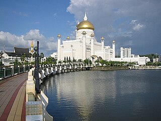
Brunei-Muara District or simply Brunei-Muara is one of the four districts of Brunei. It has the smallest area among the four districts, with 571 square kilometres (220 sq mi), yet is the most populous, with 289,630 people as of 2016. Bandar Seri Begawan, the country's capital, is located in this district, which is also de facto the district's capital. It is also home to Brunei International Airport, the country's only international airport, as well as Muara Port, the main and only deep-water port in the country. The Brunei River flows within this district and is home to Kampong Ayer, the traditional historic settlement on stilts above the river.

Tutong District or simply Tutong is one of the four districts of Brunei. It has an area of 1,166 square kilometres (450 sq mi); the population was 48,313 in 2016. The administrative town is Pekan Tutong. It is home to Tasek Merimbun, the country's largest natural lake.

Mukim Labi is a mukim in the interior of Belait District, Brunei. It has an area of 361.8 square kilometres (139.7 sq mi); the population was 1,216 in 2016.

Mukim Bukit Sawat is a mukim in Belait District, Brunei. It had a population of 794 in 2016.

Mukim Pengkalan Batu is a mukim in Brunei-Muara District, Brunei. The population was 14,492 in 2016.

Mukim Sengkurong is a mukim in Brunei-Muara District, Brunei. The population was 31,493 in 2016.
Mukim Keriam is a mukim in Tutong District, Brunei. The population was 9,707 in 2016.

Mukim Rambai is a mukim in Tutong District, Brunei. The population was 1,404 in 2016.
Mukim Telisai is a mukim in Tutong District, Brunei. The population was 10,095 in 2016.

Mukim Amo is a mukim in Temburong District, Brunei. It has an area of 542 square kilometres (209 sq mi); the population was 1,657 in 2021.
Mukim Batu Apoi is a mukim in Temburong District, Brunei. It has an area of 222 square kilometres (86 sq mi); as of 2021, the population was 1,355.
Kampong Mentiri or simply known as Mentiri, is a village in the north-east of Brunei-Muara District, Brunei. It has an area of 322.29 hectares ; the population was 1,215 in 2016.
Kampong Kiudang or simply known as Kiudang, is a village in Tutong District, Brunei, about 24 kilometres (15 mi) from the district town Pekan Tutong. The population was 1,258 in 2016.

Kampong Telisai, also simply known as Telisai, is a coastal village in Tutong District, Brunei, about 17 kilometres (11 mi) from the district town Pekan Tutong. The village also encompasses the public housing area STKRJ Kampong Telisai. The population was 2,293 in 2016. It is one of the villages within Mukim Telisai. The postcode is TC1145.

Kampong Bukit Udal or simply known as Bukit Udal, is a village in Tutong District, Brunei, about 11 kilometres (6.8 mi) from the district town Pekan Tutong. It has an area of 13 square kilometres ; the population was 1,306 in 2016. It is one of the villages within Mukim Tanjong Maya, a mukim in the district.

Kampong Sungai Liang or simply Sungai Liang, is a village in Belait District, Brunei, about 40 kilometres (25 mi) from the district's principal town Kuala Belait and 20 kilometres (12 mi) from the oil town Seria. The population was 910 in 2016. It is one of the villages within Mukim Liang. The postcode is KC1135.
Kampong Batong is a village in the south-west of Brunei-Muara District, Brunei, about 20.5 kilometres (12.7 mi) from the capital Bandar Seri Begawan. It has an area of 978.07 hectares ; the population was 1,225 in 2016. It is one of the villages within Mukim Pengkalan Batu. The postcode is BH2923.
Kampong Wasan or simply known as Wasan, is a village in the south-west of Brunei-Muara District, Brunei. The population was 482 in 2016. It is one of the villages within Mukim Pengkalan Batu. The postcode is BH2523.
Kampong Panchor Murai is a village in the south-west of Brunei-Muara District, Brunei, about 22 kilometres (14 mi) from the capital Bandar Seri Begawan. The population was 523 in 2016. It is one of the villages within Mukim Pengkalan Batu. The postcode is BH3123. Notably, the village is the namesake of the Brunei Super League's Panchor Murai FC.

Kampong Belimbing or silly known as Belimbing, is a village in Brunei-Muara District, Brunei. It is also a neighbourhood in the capital Bandar Seri Begawan. The population was 2,721 in 2016. It is one of the villages within Mukim Kota Batu. The postcode is BD2917.
