Municipalities of Quintana Roo

Last updated

Map of Mexico with Quintana Roo highlighted Quintana Roo in Mexico (location map scheme).svg
Map of Mexico with Quintana Roo highlighted

Quintana Roo is a state in southeast Mexico established out of the Quintana Roo Territory in 1974 with seven municipalities, which has since grown into eleven municipalities. According to the 2020 Mexican census, it has the twenty-fourth largest population of all states with 1,857,985 inhabitants and is the 19th largest by land area spanning 44,705.2 square kilometres (17,260.8 sq mi). [1] [2]

Contents

Municipalities in Quintana Roo are administratively autonomous of the state according to the 115th article of the 1917 Constitution of Mexico. [3] Their legal framework derives from the state Constitution. [4] Every three years, citizens elect a municipal president (Spanish: presidente municipal) by a plurality voting system. The president heads a concurrently elected municipal council (ayuntamiento) responsible for providing public services for their constituents. The municipal council consists of trustees and councillors (regidores y síndicos). [5] Municipalities are responsible for public services (such as water and sewerage), street lighting, public safety, traffic, and the maintenance of public parks, gardens and cemeteries. [6] They may also assist the state and federal governments in education, emergency fire and medical services, environmental protection and maintenance of monuments and historical landmarks. Since 1984, they have had the power to collect property taxes and user fees, although more funds are obtained from the state and federal governments than locally. [6]

As of 2020, the largest municipality by population is Benito Juárez with 911,503 residents while the smallest is Isla Mujeres with 22,686 residents. [1] The largest municipality by land area is Felipe Carrillo Puerto which spans 12,939.30 km2 (4,995.89 sq mi), and the smallest is Cozumel with 488.00 km2 (188.42 sq mi). [2] The newest municipality is Puerto Morelos which was created out of Benito Juárez in 2016. [7]

Municipalities

Map of municipalities of Quintana Roo. 1: Cozumel. 2: Felipe Carrillo Puerto. 3: Isla Mujeres. 4: Othon P. Blanco. 5: Benito Juarez. 6: Jose Maria Morelos. 7: Lazaro Cardenas. 8: Solidaridad. 9: Tulum. 10: Bacalar. 11: Puerto Morelos. Municipios de Quintana Roo.svg
Map of municipalities of Quintana Roo. 1: Cozumel. 2: Felipe Carrillo Puerto. 3: Isla Mujeres. 4: Othón P. Blanco. 5: Benito Juárez. 6: José María Morelos. 7: Lázaro Cárdenas. 8: Solidaridad. 9: Tulum. 10: Bacalar. 11: Puerto Morelos.


  State capital

Municipalities of Quintana Roo
NameMunicipal seatPopulation
(2020) [1]
Population
(2010) [8]
ChangeLand area [2] Population density
(2020)
Incorporation date [9]
km2sq mi
Bacalar [lower-alpha 1] Bacalar 41,7546,058.52,339.2February 2, 2011 [10]
Benito Juárez Cancún 911,503661,176+37.9%930.7359.3January 12, 1975
Cozumel San Miguel de Cozumel 88,62679,535+11.4%488.0188.4April 21, 1862
Felipe Carrillo Puerto [lower-alpha 2] Felipe Carrillo Puerto 83,99075,026+11.9%12,938.34,995.5February 27, 1904
Isla Mujeres Isla Mujeres 22,68616,203+40.0%862.5333.0July 24, 1867
José María Morelos José María Morelos 39,16536,179+8.3%4,850.01,872.6January 12, 1975
Lázaro Cárdenas Kantunilkín 29,17125,333+15.2%3,593.31,387.4January 12, 1975
Othón P. Blanco [lower-alpha 3] Chetumal 233,648244,553−4.5%9,909.83,826.2February 27, 1904
Puerto Morelos Puerto Morelos 26,9211,040.5401.7January 6, 2016 [7]
Solidaridad Playa del Carmen 333,800159,310+109.5%2,014.9778.0July 28, 1993
Tulum Tulum 46,72128,263+65.3%2,018.6779.4March 13, 2008 [11]
Quintana Roo 1,857,9851,325,578+40.2%44,705.217,260.8
Mexico 126,014,024112,336,538+12.2%1,960,646.7757,010

Notes

  1. Bacalar previously existed as a municipality from 1825 to 1929 [9] and was recreated in 2011 from the territory of Othón P. Blanco. [10]
  2. Felipe Carrilo Puerto was originally incorporated as Santa Cruz, changing its name on August 1, 1934. [9]
  3. Othón P. Blanco was originally incorporated as Payo Obispo, changing its name on January 12, 1975. [9]

Related Research Articles

<span class="mw-page-title-main">Quintana Roo</span> State of Mexico

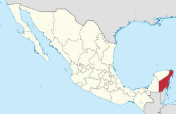
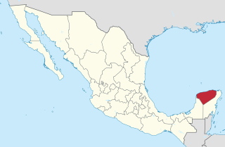
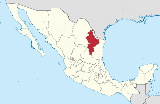
Quintana Roo, officially the Free and Sovereign State of Quintana Roo, is one of the 31 states which, with Mexico City, constitute the 32 federal entities of Mexico. It is divided into 11 municipalities, and its capital city is Chetumal.

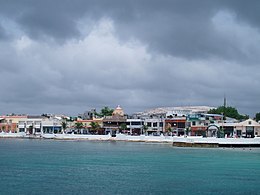
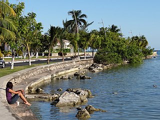
Bacalar is the municipal seat and largest city in Bacalar Municipality in the Mexican state of Quintana Roo, about 40 kilometres (25 mi) north of Chetumal. In the 2010 census the city had a population of 11,084 people. At that time it was still a part of Othón P. Blanco, and was its second-largest city (locality), after Chetumal.

<span class="mw-page-title-main">Benito Juárez Municipality, Quintana Roo</span> Municipality in Mexico

Benito Juárez is one of the eleven municipalities of the Mexican state of Quintana Roo. Most of its population reside in the municipal seat, Cancún. It is named after the 19th century president and statesman Benito Juárez.

<span class="mw-page-title-main">Municipalities of Veracruz</span>

Veracruz is a state in central eastern Mexico that is divided into 212 municipalities. According to the 2020 Mexican census, it is the fourth most populated state with 8,062,579 inhabitants and the 11th largest by land area spanning 71,823.5 square kilometres (27,731.2 sq mi).

<span class="mw-page-title-main">Solidaridad Municipality</span> Municipality in Quintana Roo, Mexico

Solidaridad is one of the eleven municipalities that make up the Mexican state of Quintana Roo. Its municipal seat is the town of Playa del Carmen.

<span class="mw-page-title-main">Municipalities of Yucatán</span>

Yucatán is a state in southeastern Mexico that is divided into 106 municipalities, organized into 7 administrative regions. According to the 2020 Mexican census, it is the twenty-second most populated state with 2,320,898 inhabitants and the 20th largest by land area spanning 39,524.4 square kilometres (15,260.5 sq mi).

<span class="mw-page-title-main">Municipalities of Tlaxcala</span>

Tlaxcala is a state in Central Mexico that is divided into 60 municipalities. According to the 2020 Mexican census, it is the fifth least populated state with 1,342,977 inhabitants and the 2nd smallest by land area spanning 3,996.6 square kilometres (1,543.1 sq mi).

<span class="mw-page-title-main">Municipalities of Puebla</span>

Puebla is a state in central Mexico that is divided into 217 municipalities. According to the 2020 Mexican census, it is the fifth most populated state with 6,583,278 inhabitants and the 21st largest by land area spanning 34,309.6 square kilometres (13,247.0 sq mi).

<span class="mw-page-title-main">Municipalities of Morelos</span>

Morelos is a state in South Central Mexico that is currently divided into 36 municipalities. According to the 2020 Mexican census, it is the twenty-third most populated state with 1,971,520 inhabitants and the third smallest by land area spanning 4,878.9 square kilometres (1,883.8 sq mi).

<span class="mw-page-title-main">Municipalities of Nuevo León</span>

Nuevo León is a state in Northeast Mexico that is divided into 51 municipalities. According to the 2020 Mexican census, it is the seventh most populated state with 5,784,442 inhabitants and the 13th largest by land area spanning 64,156.2 square kilometres (24,770.8 sq mi).

<span class="mw-page-title-main">Municipalities of Zacatecas</span>

Zacatecas is a state in North Central Mexico that is divided into 58 municipalities. According to the 2020 Mexican census, it is the state that has the 7th smallest population with 1,622,138 inhabitants and the 8th largest by land area spanning 75,275.3 square kilometres (29,064.0 sq mi).

<span class="mw-page-title-main">Municipalities of Tamaulipas</span>

Tamaulipas is a state in Northeast Mexico that is divided into 43 municipalities. According to the 2020 Mexican census, it is the fourteenth most populated state with 3,527,735 inhabitants and the sixth largest by land area spanning 80,249.3 square kilometres (30,984.4 sq mi).

<span class="mw-page-title-main">Calakmul Municipality</span> Municipality in Campeche, Mexico

Calakmul is a municipality in the Mexican state of Campeche, situated in the central part of the Yucatán Peninsula.

<span class="mw-page-title-main">Municipalities of Mexico</span> Municipio: mexican administrative country subdivisions

Municipalities are the second-level administrative divisions of Mexico, where the first-level administrative division is the state. They should not be confused with cities or towns that may share the same name as they are distinct entities and do not share geographical boundaries. As of January 2021, there are 2,454 municipalities in Mexico, excluding the 16 boroughs of Mexico City. If all 16 boroughs of Mexico City are counted, the total of municipalities will be 2,470.

<span class="mw-page-title-main">Othón P. Blanco, Quintana Roo</span> Municipality in Quintana Roo, Mexico

Othón P. Blanco is one of the eleven subdivisions (municipios) of the Mexican state of Quintana Roo. It had a 2020 census population of 233,648 people. Its municipal seat is the city of Chetumal, which also serves as the state capital. The municipality is named after Othón P. Blanco Núñez de Cáceres.

<span class="mw-page-title-main">Felipe Carrillo Puerto Municipality</span> Municipality in Quintana Roo, Mexico

Felipe Carrillo Puerto is a municipality in the south-central part of the Mexican state of Quintana Roo. The municipal seat is the city of the same name. It was named after the assassinated local politician Felipe Carrillo Puerto. According to the 2009, 2019 census, the municipality's population was 83,990 inhabitants, living on an area of 13,806 square kilometres (5,331 sq mi).

Same-sex marriage is performed and recognized in all municipalities of the state of Quintana Roo. The first two same-sex marriages occurred in Kantunilkin on 28 November 2011 after it was discovered that the state's Civil Code does not specify sex or gender requirements for marriage. However, future same-sex marriages were suspended in January 2012 upon review by the state's Secretary General of Government. The two same-sex marriages in the state were annulled by the Governor of Quintana Roo, Roberto Borge Angulo, in April 2012, but these annulments were reversed by the Secretary General of Government on 3 May. The Secretary's decision allows for future same-sex marriages to be performed in Quintana Roo.

<span class="mw-page-title-main">Puerto Morelos Municipality</span> Municipality in Quintana Roo, Mexico

Puerto Morelos is one of the eleven municipalities of the Mexican state of Quintana Roo, on the Yucatán Peninsula. It was formed in 2016 from the localities of Puerto Morelos, Leona Vicario and Central Vallarta previously belonging to the municipality of Benito Juárez. In the 2010 census, these three localities recorded a total of 15,725 inhabitants.

References

  1. 1 2 3 "Censo de Población y Vivienda 2020SCITEL" [Population and Housing Census 2020] (in Spanish). Mexico: INEGI. Retrieved January 27, 2021.
  2. 1 2 3 "México en cifras - Medio Ambiente - Quintana Roo" (in Spanish). Mexico: INEGI. Retrieved February 12, 2021.
  3. "Constitución Política de los Estados Unidos Mexicanos" [Political Constitution of the United Mexican States]. Article 115, of 1917 (in Spanish). Retrieved September 27, 2017.
  4. "Constitución Política del Estado libre y soberano de Quintana Roo" [Political Constitution of the free and sovereign State of Quintana Roo]. Act of October 19, 2018 (PDF) (in Spanish). Retrieved March 24, 2021.
  5. OECD (November 12, 2004). New Forms of Governance for Economic Development. OECD Publishing. p. 121. ISBN   978-9-2640-1532-6.
  6. 1 2 International Business Publications (2009). Mexico Company Laws and Regulations Handbook. p. 42. ISBN   978-1-4330-7030-3.{{cite book}}: |last= has generic name (help)
  7. 1 2 "Por el que se crea el municipio de Puerto Morelos del Estado de Quintana Roo." [Why the municipality of Puerto Morelos is created in the State of Quintana Roo.]. Directive No. 342 of January 6, 2016 (PDF) (in Spanish). p. 5.
  8. "Censo de Población y Vivienda 2010SCITEL" [Population and Housing Census 2010] (in Spanish). Mexico: INEGI. Retrieved January 27, 2021.
  9. 1 2 3 4 Estado de Quintana Roo División Territorial de 1810 a 1995 [State of Quintana Roo Territorial Division from 1810 to 1995](PDF) (in Spanish). Mexico: INEGI. 1996. ISBN   970-13-1510-3.
  10. 1 2 Silvia Hernández (February 2, 2011). "Bacalar, el décimo municipio de Q. Roo". El Universal . Retrieved May 2, 2011.
  11. "Discuten por nuevo municipioRiviera Maya" (in Spanish). Noticaribe. Archived from the original on 2008-10-09. Retrieved April 16, 2011.