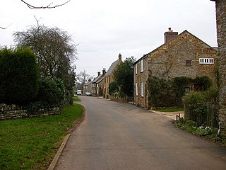
Hanging Houghton is a small village and former civil parish, now in the parish of Lamport, in the West Northamptonshire district, in the ceremonial county of Northamptonshire, England. It is on the A508 road between Brixworth and Lamport. In 1931 the parish had a population of 84.

Cold Hesledon is a village and former civil parish, now in the parishes of Murton and Dalton-le-Dale, in the County Durham district, in the ceremonial county of Durham, England. It is situated a short distance to the east of Murton. In 1961 the parish had a population of 997.
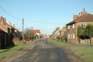
Lissett is a village and former civil parish, now in the parish of Ulrome, in the Holderness area of the East Riding of Yorkshire, England. It is situated 6 miles (10 km) south of Bridlington town centre and 13 miles (21 km) north-east of Beverley town centre on the A165 road that connects the two towns. In 1931 the parish had a population of 95.

Burland is a village and former civil parish, now in the parish of Burland and Acton, in the unitary authority area of Cheshire East and the ceremonial county of Cheshire, England, about 2+1⁄2 miles west of Nantwich. The civil parish also included the small settlements of Burland Lower Green, Burland Upper Green, Hollin Green and Stoneley Green, as well as parts of Gradeley Green and Swanley. The eastern part of the village of Ravensmoor also falls within the civil parish.
Northowram is a village and former civil parish, now in the unparished area of Halifax, in Calderdale, West Yorkshire, England. It stands to the east of Halifax on the north side of Shibden valley. Southowram stands on the southern side of the valley.

Hartley is a village and former civil parish, now in the parish of Seaton Valley in Northumberland, England. The village lies on the A193 road 4 miles (6 km) south of Blyth and 4 miles north of Tynemouth. It was a farming and later colliery village but today is part of Seaton Sluice. However it has given its name to the ward of Hartley which covers Seaton Sluice and New Hartley. The population of this ward at the 2011 Census was 4,923. Hartley is sometimes called Old Hartley to distinguish it from New Hartley.

Gembling is a hamlet and former civil parish, now in the parish of Foston, in the East Riding of Yorkshire, England. It is situated approximately 8 miles (13 km) south-west from the coastal resort of Bridlington and 2.5 miles (4 km) north from the village of North Frodingham. In 1931 the parish had a population of 80.

Knedlington is a small hamlet and former civil parish, now in the parish of Asselby, in the East Riding of Yorkshire, England. It is situated approximately 1 mile (1.6 km) west of the market town of Howden and lies to the west of the B1228 road. The M62 motorway is just over 1 mile to the south-east. Village landmarks include Knedlington Manor, Knedlington Hall, and woodland. Knedlington Hall was protected as a Grade II* listed building in 1966. In 1931 the parish had a population of 86.

Wansford is a village and former civil parish, now in the parish of Skerne and Wansford, in the East Riding of Yorkshire, England. It is situated on the B1249 road and just to the north of the River Hull and the Driffield Canal. It is approximately 2.5 miles (4 km) south-east of Driffield and 3 miles (4.8 km) north-west of North Frodingham.

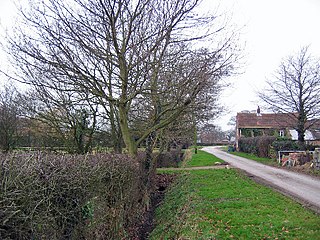
South Newbald is a hamlet and former civil parish, now in the parish of Newbald, in the East Riding of Yorkshire, England. It is situated approximately 12 miles (19 km) north-west of Hull city centre, 2.5 miles (4 km) north of South Cave and 4 miles (6.4 km) south of Market Weighton. It lies to the east of the A1034 road. The larger village of North Newbald is just to the north. In 1931 the parish had a population of 173.
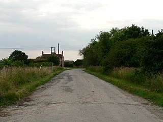
Saltmarshe is a hamlet and former civil parish, now in the parish of Laxton, in the East Riding of Yorkshire, England. It is situated on the north bank of the River Ouse, downstream from York, Selby and Goole. Saltmarshe is approximately 3 miles (5 km) south-east from Howden and 21 miles (34 km) south-east from York. In 1931 the parish had a population of 82.

Low Catton is a village and former civil parish, now in the parish of Catton, in the East Riding of Yorkshire, England. It is situated approximately 7 miles (11 km) north-west of the market town of Pocklington and about 1 mile (1.6 km) south of the village of Stamford Bridge. In 1931 the parish had a population of 85. Low Catton became a civil parish in 1866, on 1 April 1935 the parish was abolished and merged with High Catton to form "Catton".
High Catton is a village and former civil parish, now in the parish of Catton, in the East Riding of Yorkshire, England. It is situated approximately 6 miles (10 km) north-west of the market town of Pocklington and about 1 mile (1.6 km) south of the village of Stamford Bridge. The village of Low Catton and the River Derwent are 1 mile to the west. In 1931 the parish had a population of 174. From 1866 High Catton was a civil parish in its own right, on 1 April 1935 the parish was abolished and merged with Low Catton to form "Catton".

Laytham is a village and former civil parish, now in the parish of Foggathorpe, in the East Riding of Yorkshire, England. It is situated approximately 6 miles (9.7 km) north of Howden town centre and 3 miles (5 km) west of Holme-on-Spalding-Moor. In 1931 the parish had a population of 63.

Eastburn is a hamlet and former civil parish, now in the parish of Kirkburn, in the East Riding of Yorkshire, England. It is situated in the Yorkshire Wolds on the A164 road, approximately 2.5 miles (4 km) south-west of Driffield town centre and 3 miles (5 km) north-west of the village of Hutton Cranswick. In 1931 the parish had a population of 27.
Balkholme is a hamlet and former civil parish, now in the parish of Kilpin and the East Riding of Yorkshire, England. In 1931 the parish had a population of 78.
Harlthorpe is a hamlet and former civil parish, now in the parish of Foggathorpe, in the East Riding of Yorkshire, England. It is situated approximately 8 miles (13 km) north-east of Selby town centre and 6 miles (9.7 km) north of Howden town centre. It lies on the A163 road. In 1931 the parish had a population of 53.

Haisthorpe is a village and former civil parish, now in the parish of Carnaby, in the East Riding of Yorkshire, England. It is situated approximately 4 miles (6 km) south-west of Bridlington town centre. It lies on the A614. In 1931 the parish had a population of 127.

Gransmoor is a hamlet and former civil parish, now in the parish of Burton Agnes, in the East Riding of Yorkshire, England. It is situated approximately 6 miles (10 km) south-west of the town of Bridlington and 3 miles (5 km) south-east of the village of Burton Agnes. In 1931 the parish had a population of 83.

Bolton is a village and former civil parish, now in the parish of Fangfoss, in the East Riding of Yorkshire, England. It is situated approximately 10 miles (16 km) to the east of the city of York and 3 miles (5 km) north-west of the town of Pocklington. In 1931 the parish had a population of 130. Bolton was formerly a township in the parish of Bishop Wilton, from 1866 Bolton was a civil parish in its own right, on 1 April 1935 the parish was abolished and merged with Fangfoss, part also went to form Bishop Wilton.

