Nazareth, Texas

Last updated
Nazareth, Texas
City
Nazareth Texas City Hall 2009.jpg
Nazareth City Hall
Relief map of Texas.png
Red pog.svg
Nazareth
Coordinates: 34°32′39″N102°06′10″W / 34.54417°N 102.10278°W / 34.54417; -102.10278 [1]
CountryFlag of the United States.svg  United States
StateFlag of Texas.svg  Texas
County Castro
Region Llano Estacado
Established1902
Founded byJoseph Reisdorff
Area
[2]
  Total0.36 sq mi (0.94 km2)
  Land0.36 sq mi (0.94 km2)
  Water0.00 sq mi (0.00 km2)
Elevation
[1]
3,760 ft (1,150 m)
Population
 (2010)
  Total311
  Estimate 
(2019) [3]
291
  Density801.65/sq mi (309.36/km2)
Time zone UTC-6 (CST)
ZIP code
79063
Area code 806
FIPS code 48-50496

Nazareth is a city in Castro County, Texas, United States. The population was 311 at the 2010 census, [4] down from 356 at the 2000 census.

Contents

Geography

Nazareth is located in eastern Castro County on the high plains of the Llano Estacado at 34°32′39″N102°06′10″W / 34.54417°N 102.10278°W / 34.54417; -102.10278 . [1] It is 12 miles (19 km) east of Dimmitt, the county seat, and 20 miles (32 km) west of Tulia.

According to the United States Census Bureau, Nazareth has a total area of 0.36 square miles (0.94 km2), all land. [4]

History

The town of Nazareth was established through the efforts of a Catholic priest, Joseph Reisdorff, who moved to the site in 1902 with four farmers interested in purchasing land in the area. Father Reisdorff named his colony after the biblical Nazareth and advertised for settlers in several midwestern German Catholic newspapers. By September 1902 the first settlers had begun to arrive. A post office was established in 1903, and later that year the Catholic community finished building its first church. Nazareth had 71 residents by January 1904, and the town was platted latter that year. By 1905, in addition to the church, the settlement included a blacksmith shop, a store, and a school; when the community's cemetery was consecrated in 1906, it became the only Catholic cemetery in the area. For many years local church officials supplied what little government the community desired.

In 1914 Nazareth had an estimated 50 residents, and about 150 people were living there by 1927. During the Dust Bowl of the 1930s the area was swept by huge dust storms that uprooted crops and made farming unprofitable; in 1933, the town was estimated to have only 50 residents. Agriculture in Castro County revived during the 1940s, however, and by 1941 about 200 people were living there. The population fluctuated during the 1950s and 1960, dropping to about 75 in 1955, then rising to an estimated 275 by 1964; the census found 274 people living in the town in 1970 and 299 in 1980. As late as the mid-1980s about 85 percent of the town's residents were Catholics, and church activities helped to bond the community together. In 1990 the population stood at 293. [5]

Demographics

Historical population
CensusPop.Note
1980 299
1990 293−2.0%
2000 35621.5%
2010 311−12.6%
2019 (est.)291 [3] −6.4%
U.S. Decennial Census [6]

As of the census [7] of 2000, there were 356 people, 125 households, and 93 families residing in the city. The population density was 1,022.1 inhabitants per square mile (394.6/km2). There were 140 housing units at an average density of 402.0 per square mile (155.2/km2). The racial makeup of the city was 96.91% White, 1.12% from other races, and 1.97% from two or more races. Hispanic or Latino of any race were 5.90% of the population.

There were 125 households, out of which 46.4% had children under the age of 18 living with them, 68.8% were married couples living together, 2.4% had a female householder with no husband present, and 24.8% were non-families. 24.0% of all households were made up of individuals, and 8.0% had someone living alone who was 65 years of age or older. The average household size was 2.85 and the average family size was 3.43.

In the city, the population was spread out, with 34.3% under the age of 18, 5.1% from 18 to 24, 32.3% from 25 to 44, 16.3% from 45 to 64, and 12.1% who were 65 years of age or older. The median age was 32 years. For every 100 females, there were 114.5 males. For every 100 females age 18 and over, there were 112.7 males.

The median income for a household in the city was $36,875, and the median income for a family was $46,375. Males had a median income of $28,438 versus $21,000 for females. The per capita income for the city was $15,756. About 2.9% of families and 4.6% of the population were below the poverty line, including 4.2% of those under age 18 and 7.8% of those age 65 or over.

Education

The city of Nazareth is served by the Nazareth Independent School District.

The Nazareth Swiftettes basketball team have won 25 state championships in a 47-year span (1977–2023), a current public school national record. In 2023, the Swiftettes won their fifth state title in seven years, and seventh in 10 years. The Swiftettes have also represented their region in the Final Four of the Texas state tournament 31 times since 1976. A 2007 article on ESPN.com documented the town and the women's basketball team. [8]

The Nazareth Swifts have also had tremendous success in basketball. They have, by a significant margin, more Regional Titles (18) and State Titles (6) than any other Texas 1A team since 1983.

Climate

According to the Köppen Climate Classification system, Nazareth has a semi-arid climate, abbreviated "BSk" on climate maps. [9]

See also

Related Research Articles

<span class="mw-page-title-main">Texico, New Mexico</span> City in New Mexico, United States

Texico is a city in Curry County, New Mexico, United States. Its population was 1,130 at the 2010 census. The city is located on the Texas-New Mexico border with the town of Farwell across the border.

<span class="mw-page-title-main">Estacada, Oregon</span> City in Oregon, USA

Estacada is a city in Clackamas County, Oregon, United States, about 30 miles (48 km) southeast of Portland. The 2020 population is estimated to be 3,700. According to the 2010 census, the population in 2010 was 2,695.

<span class="mw-page-title-main">Dimmitt, Texas</span> City in Texas, United States

Dimmitt is a city and county seat in Castro County, Texas, United States. Its population was 4,393 at the 2010 census.

<span class="mw-page-title-main">Hart, Texas</span> City in Texas, United States

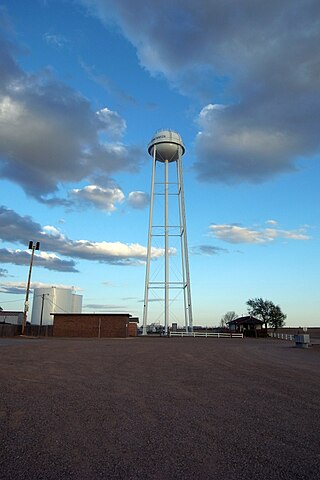
Hart is a city in Castro County, Texas, United States. The population was 1,114 at the 2010 census.

<span class="mw-page-title-main">Whiteface, Texas</span> Community in Texas, United States

Whiteface is a town in Cochran County, Texas, United States. The population was 449 at the 2010 census.

<span class="mw-page-title-main">Paducah, Texas</span> Town in Texas, United States

Paducah is a town in Cottle County, Texas, United States. The population was 1,186 at the 2010 census, down from 1,498 in 2000. It is the county seat of Cottle County. It is just south of the Texas Panhandle and east of the Llano Estacado.

<span class="mw-page-title-main">Ralls, Texas</span> City in Texas, United States

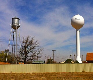
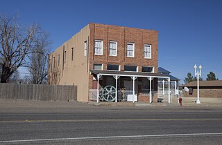
Ralls is a city in Crosby County, Texas, United States. It was named after John Robinson Ralls, who with the help of W.E. McLaughlin, laid out the townsite in July 1911. As of the 2010 census, it had a population of 1,944, down from 2,252 at the 2000 census. Ralls is surrounded by productive farm lands that primarily produce cotton and grains, with lesser amounts of soybean, sunflower seed, and vegetables.

<span class="mw-page-title-main">Hereford, Texas</span> City in Texas, United States of America

Hereford is a city in and county seat of Deaf Smith County, Texas, United States. It is 48 miles southwest of Amarillo. Its population was 15,370 at the 2010 census. It is the only incorporated locality named "Hereford" in the country.

<span class="mw-page-title-main">Lockney, Texas</span> Town in Texas, United States

Lockney is a town in Floyd County, Texas, United States. The population was 1,842 at the 2010 census, down from 2,056 at the 2000 census.

<span class="mw-page-title-main">Anton, Texas</span> City in Texas, United States

Anton is a city in Hockley County, Texas, United States. The population was 1,126 at the 2010 census.

<span class="mw-page-title-main">Ropesville, Texas</span> City in Texas, United States

Ropesville is a city in Hockley County, Texas, United States. Its population was 434 at the 2010 census, down from 517 at the 2000 census.

<span class="mw-page-title-main">Amherst, Texas</span> City in Texas, United States

Amherst is a city in Lamb County, Texas, United States. The population was 721 at the 2010 census.

<span class="mw-page-title-main">Earth, Texas</span> City in Texas, United States

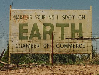
Earth is a small, rural city in Lamb County, West Texas, United States. As of the 2010 Census, the population was 1,065.

<span class="mw-page-title-main">Olton, Texas</span> City in Texas, United States

Olton is a city in Lamb County, Texas, United States. The population was 2,215 at the 2010 census.

New Deal is a U.S. town in Lubbock County, Texas. The population was 794 at the 2010 census. It is part of the Lubbock Metropolitan Statistical Area and the Llano Estacado region.

<span class="mw-page-title-main">Ransom Canyon, Texas</span> Town in Texas, United States

Ransom Canyon is a town in Lubbock County of West Texas, United States. The population was 1,096 at the 2010 census. It is part of the Lubbock Metropolitan Statistical Area.

<span class="mw-page-title-main">Shallowater, Texas</span> Community in Texas, United States

Shallowater is a city in Lubbock County, Texas, United States. Shallowater is on U.S. Route 84 and the Burlington Northern Santa Fe line, 12 miles (19 km) northwest of Lubbock. Its population was 2,484 at the 2010 census. It is part of the Lubbock metropolitan statistical area.

<span class="mw-page-title-main">Slaton, Texas</span> City in Texas, United States

Slaton is a city in Lubbock County, Texas, United States founded by German immigrants. Slaton was the westernmost German settlement in Texas. The population was 6,121 at the 2010 census. Slaton is part of the Lubbock Metropolitan Statistical Area.

<span class="mw-page-title-main">Wolfforth, Texas</span> City in Texas, United States

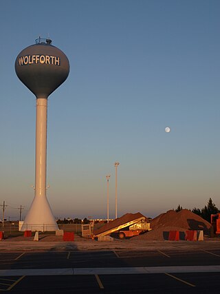
Wolfforth is a small town located in Lubbock County. The town was named for 2 brothers, George Wolffarth who was a rancher in the area, and Eastin Wolffarth who was Lubbock County Sherriff around 1900. The population was 3,670 at the 2010 census.

<span class="mw-page-title-main">New Home, Texas</span> City in Texas, United States

New Home is a small city in Lynn County, Texas, United States. The population was 334 at the 2010 census.

References

  1. 1 2 3 "Nazareth". Geographic Names Information System . United States Geological Survey, United States Department of the Interior.
  2. "2019 U.S. Gazetteer Files". United States Census Bureau. Retrieved August 7, 2020.
  3. 1 2 "Population and Housing Unit Estimates". United States Census Bureau. May 24, 2020. Retrieved May 27, 2020.
  4. 1 2 "Geographic Identifiers: 2010 Census Summary File 1 (G001): Nazareth city, Texas". U.S. Census Bureau, American Factfinder. Archived from the original on February 13, 2020. Retrieved July 24, 2015.
  5. John Leffler. "Nazareth, TX". Handbook of Texas. Retrieved May 28, 2013.
  6. "Census of Population and Housing". Census.gov. Retrieved June 4, 2015.
  7. "U.S. Census website". United States Census Bureau . Retrieved 2008-01-31.
  8. ESPN article
  9. Climate Summary for Nazareth, Texas