Canton is an unincorporated community in Jackson and Jones counties, Iowa, United States. There is a restaurant there, and no other businesses or services.
Augusta is an unincorporated community situated on the Skunk River in Des Moines County, Iowa, United States. It is located 10 miles southwest of Burlington and nine miles north of Fort Madison, off U.S. Route 61 and Iowa Highway 16. The community is part of the Burlington, IA–IL Micropolitan Statistical Area.
Killduff is an unincorporated community in southeastern Jasper County, Iowa, United States. It lies along local roads southeast of the city of Newton, the county seat of Jasper County.
Conroy is an unincorporated community and census-designated place (CDP) in central Iowa County, Iowa, United States. It lies along local roads southeast of the city of Marengo, the county seat of Iowa County. Its elevation is 879 feet (268 m). Conroy has a post office with the ZIP Code of 52220, which opened on 5 January 1885. As of the 2010 census the population was 259.
Pilot Grove is an unincorporated community in northern Lee County, Iowa, United States. It lies along local roads northwest of the city of Fort Madison, the county seat of Lee County. Its elevation is 643 feet (196 m).
Charleston is an unincorporated community in Lee County, Iowa, United States, in the state's southeastern corner. Charleston is located at 40°35′27″N91°31′53″W.
Plato is an unincorporated community in Cedar County, Iowa, United States. Plato is located at 41°44′17″N91°18′31″W.
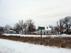
Buchanan is an unincorporated community in Cedar County, Iowa, United States.
Osborne is an unincorporated community in Clayton County, Iowa, United States.
Barney is an unincorporated community in Madison County, Iowa, in the United States.
Maud is an unincorporated community in Allamakee County, Iowa, United States.
Elon is an unincorporated community in Allamakee County, Iowa, United States.
Olaf is an unincorporated community in Wright County, Iowa, United States.
Croton is an unincorporated community in southwestern Lee County, Iowa, United States. The Des Moines River flows past the southwest side of the community along the Iowa-Missouri border.
Albaton is an unincorporated community in Fairview Township, Monona County, Iowa, United States. Albaton is located in the northwest corner of the county, 4.8 miles (7.7 km) southwest of Sloan.
Lyman is an unincorporated community in Noble Township, Cass County, Iowa, United States. Lyman is located along U.S. Route 71 and Iowa Highway 92, 12 miles (19 km) south of Atlantic.
Ladoga is an unincorporated community in Washington Township, Taylor County, Iowa, United States. Ladoga is located along County Route J35, 3 miles (4.8 km) west-southwest of Gravity.
Brainard is an unincorporated community in Fayette County, Iowa, United States. It is located at the junction of Echo Valley Road and F Avenue, four miles southwest of Elgin.
Lima is an unincorporated community in Fayette County, Iowa, United States. It is located at the junction of Ivy Road and Heron Road, four miles northeast of Fayette. and within a mile of the abandoned settlement of Albany.
Douglas is an unincorporated community in Fayette County, Iowa, United States. It is located near the junction of County Road B44 and Maple Road, three miles southwest of Eldorado.