The Big Dig was a megaproject in Boston that rerouted the then elevated Central Artery of Interstate 93 that cut across Boston into the O'Neill Tunnel and built the Ted Williams Tunnel to extend Interstate 90 to Logan International Airport. Those two projects were the origin of the official name, the Central Artery/Tunnel Project. Additionally, the project constructed the Zakim Bunker Hill Bridge over the Charles River, created the Rose Kennedy Greenway in the space vacated by the previous I-93 elevated roadway, and funded more than a dozen projects to improve the region's public transportation system. Planning for the project began in 1982; the construction work was carried out between 1991 and 2006; and the project concluded on December 31, 2007. The project's general contractor was Bechtel and Parsons Brinckerhoff was the engineer, who worked as a consortium, both overseen by the Massachusetts Highway Department.

The Massachusetts Turnpike is a controlled-access toll road in the US state of Massachusetts that is maintained by the Massachusetts Department of Transportation (MassDOT). The turnpike begins at the New York state line in West Stockbridge, linking with the Berkshire Connector portion of the New York State Thruway. Spanning 138 miles (222 km) along an east–west axis, the turnpike constitutes the Massachusetts section of Interstate 90 (I-90). The turnpike is the longest Interstate Highway in Massachusetts, while I-90, in full, is the longest Interstate Highway in the United States.

The Blue Line is a rapid transit line in the Greater Boston metropolitan area, one of four rapid transit lines operated by the Massachusetts Bay Transportation Authority (MBTA). It runs from Bowdoin station in downtown Boston under Boston Harbor to East Boston and Revere on the inner North Shore, where it terminates at Wonderland. The stop at Airport Station, by way of a free shuttle bus, is one of two rapid transit connections to Logan International Airport. In 1967, during a systemwide rebranding, the line was assigned the blue color because it passes under the Boston Harbor. With an end-to-end travel time of less than twenty minutes, the Blue Line is the shortest of Boston's heavy-rail lines and the only line to have both third rail and overhead catenary sections.

The Dewey Square Tunnel in Boston, Massachusetts, is part of Interstate 93, running under the heart of the city's financial district, including Dewey Square. Built in 1959, it was part of Boston's Central Artery freeway construction project of the 1950s. Known to locals as the South Station Tunnel, the Dewey Square Tunnel is of cut-and-cover design, and originally was six lanes wide, with no breakdown lanes.

The North End is a neighborhood of Boston, Massachusetts, United States. It has the distinction of being the city's oldest residential community, which has been inhabited since it was colonized in the 1630s. It is only 0.36 square miles (0.93 km2), yet the neighborhood has nearly one hundred establishments and a variety of tourist attractions. It is known for its Italian American population and Italian restaurants.

Route 1A is a north–south state highway in Massachusetts, United States. It is an alternate route to U.S. 1 with three signed sections and two unsigned sections where the highway is concurrent with its parent. Due to the reconfiguration of tunnel interchanges brought on by the completion of the Big Dig, Route 1A is discontinuous in the downtown Boston area. Vehicles entering Downtown Boston via the Sumner Tunnel must take I-93 north to the exit for Government Center and make a U-turn to access the entrance ramp to I-93 south and vice versa.

Government Center station is an MBTA subway station in Boston, Massachusetts. It is located at the intersection of Tremont, Court and Cambridge Streets in the Government Center area. It is a transfer point between the light rail Green Line and the rapid transit Blue Line. With the Green Line platform having opened in 1898, the station is the third-oldest operating subway station in the MBTA system; only Park Street and Boylston are older. The station previously served Scollay Square before its demolition for the creation of Boston City Hall Plaza.

The Lieutenant William F. Callahan Jr. Tunnel is one of four tunnels, and one of three road tunnels, beneath Boston Harbor in Boston, Massachusetts. It carries motor vehicles from the North End to Logan International Airport and Route 1A in East Boston. Ordinarily, this tunnel is only used to carry traffic out of the city, and with the completion of the Big Dig it only collects traffic from I-93 southbound and downtown Boston; northbound traffic uses the Ted Williams Tunnel. As of 2016, a toll of $1.50 is charged for non-commercial two-axle vehicles with a Massachusetts E-ZPass, while non-Massachusetts E-ZPass holders are charged $1.75. Vehicles without E-ZPass are charged $2.05 through MassDOT's Pay By Plate MA program. For residents of certain Boston ZIP codes, a discount is in effect using an E-ZPass transponder, costing $0.20.

The Sumner Tunnel is a road tunnel in Boston, Massachusetts, United States. It carries traffic under Boston Harbor in one direction, from Logan International Airport and Route 1A in East Boston. The tunnel originally deposited traffic at the west side of the North End, but with the completion of the Big Dig, it was modified to have two exits. One exit connects to I-93 northbound and downtown Boston near Haymarket Station. The other exit connects to Storrow Drive and Nashua St., connecting Cambridge via Route 28. Traffic headed for I-93 southbound and the Massachusetts Turnpike (I-90) westbound is normally routed to the Ted Williams Tunnel.
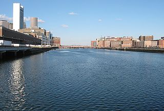
Fort Point Channel is a maritime channel separating South Boston from downtown Boston, Massachusetts, feeding into Boston Harbor. The south part of it has been gradually filled in for use by the South Bay rail yard and several highways. At its south end, the channel once widened into South Bay, from which the Roxbury Canal continued southwest where the Massachusetts Avenue Connector is now. The Boston Tea Party occurred at its northern end. The channel is surrounded by the Fort Point neighborhood, which is also named after the same colonial-era fort.
Dewey Square is a square in downtown Boston, Massachusetts which lies at the intersection of Atlantic Avenue, Summer Street, Federal Street, Purchase Street and the John F. Kennedy Surface Road, with the Central Artery (I-93) passing underneath in the Dewey Square Tunnel, which was built in the Big Dig. South Station is on the southeast corner of the square, with Amtrak and MBTA Commuter Rail services, as well as Red Line subway trains and Silver Line bus rapid transit underneath.
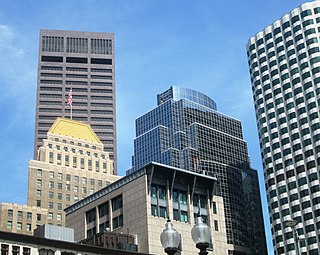
The Central Artery is a section of freeway in downtown Boston, Massachusetts; it is designated as Interstate 93, US 1 and Route 3.

Bowdoin station is a Massachusetts Bay Transportation Authority (MBTA) rapid transit station in Bowdoin Square in Boston, Massachusetts. The station is the downtown terminus of the Blue Line, part of the MBTA subway system. It has a single wedge-shaped island platform located inside a balloon loop. Bowdoin is the only Blue Line station that is not accessible.

Route 28 is a 151.93-mile-long (244.51 km) nominally south–north state highway in the U.S. state of Massachusetts, running from the town of Eastham via Boston to the New Hampshire state line in Methuen. Following the route from its nominally southern end, Route 28 initially heads south to the town of Chatham then turns west to follow along the south shore of Cape Cod. In Falmouth, Route 28 turns north and continues through the western part of Plymouth County and the eastern part of Norfolk County; it then passes through downtown Boston before heading north via Lawrence to the New Hampshire state line, where it continues as New Hampshire Route 28.

Boston's diverse neighborhoods serve as a political and cultural organizing mechanism. The City of Boston's Office of Neighborhood Services has designated 23 Neighborhoods in the city:

The Thomas P. "Tip" O'Neill Jr. Tunnel is a highway tunnel built as part of the Big Dig in Boston, Massachusetts. It carries the Central Artery underneath downtown Boston, and is numbered as Interstate 93 (I-93), U.S. Route 1 (US 1), and Route 3. It roughly follows the route of the old elevated Central Artery, though the northbound entrance, at the corner of Kneeland Street and Atlantic Avenue, is somewhat east of the southbound exit to allow for a reconfigured interchange with the Massachusetts Turnpike. It runs from the Zakim Bunker Hill Bridge at its north portal—barely 165 feet (50 m) east of the TD Garden sports facility's eastern corner—to Boston's Chinatown at its south portal. The tunnel is named for Tip O'Neill, former Speaker of the United States House of Representatives, whose constituency included several of the surrounding communities in Metro Boston.
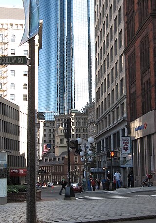
Court Street is located in the Financial District of Boston, Massachusetts. Prior to 1788, it was called Prison Lane (1634–1708) and then Queen Street (1708–1788). In the 19th century it extended beyond its current length, to Bowdoin Square. In the 1960s most of Court Street was demolished to make way for the construction of Government Center. The remaining street extends a few blocks, near the Old State House on State Street.

Hanover Street is located in the North End of Boston, Massachusetts.

Congress Street in Boston, Massachusetts, is located in the Financial District and South Boston. It was first named in 1800. It was extended in 1854 as far as Atlantic Avenue, and in 1874 across Fort Point Channel into South Boston. Today's Congress Street consists of several segments of streets, previously named Atkinson's Street, Dalton Street, Gray's Alley, Leverett's Lane, Quaker Lane, and Shrimpton's Lane.

This is a list of roundabouts in the state of Massachusetts in the United States. Intersections that are called traffic circles or roundabouts in the rest of the US are referred to as "rotaries" in Massachusetts, as well as other parts of New England including parts of Connecticut, New Hampshire, Maine Rhode Island, & Vermont.

