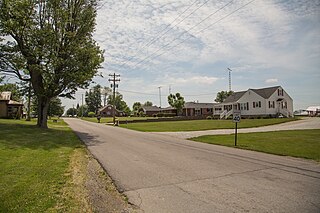
Elizabethtown is a town in Sand Creek Township, Bartholomew County, in the U.S. state of Indiana. The population was 504 at the 2010 census. It is part of the Columbus, Indiana metropolitan statistical area.

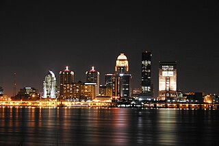
The Louisville metropolitan area is the 43rd largest metropolitan statistical area (MSA) in the United States. It had a population of 1,395,855 in 2020 according to the latest official census, and its principal city is Louisville, Kentucky.

Harrison Township is one of fourteen townships in Miami County, Indiana, United States. As of the 2010 census, its population was 759 and it contained 281 housing units.

Jackson Township is one of fourteen townships in Madison County, Indiana, United States. As of the 2010 census, its population was 1,904 and it contained 789 housing units.

Mount Auburn is an unincorporated community in Jackson Township, Shelby County, in the U.S. state of Indiana.
Cleveland is an unincorporated community in Jackson Township, Hancock County, Indiana.

Dudleytown is an unincorporated community in Washington Township, Jackson County, Indiana.
Hangman Crossing is an unincorporated community in Jackson Township, Jackson County, Indiana, United States.
Kriete Corner is an unincorporated community in Jackson Township, Jackson County, Indiana, United States.
New Farmington is an unincorporated community in Jackson Township, Jackson County, Indiana.
Retreat is an unincorporated community in Vernon Township, Jackson County, Indiana.
Rockford is an unincorporated community in Redding Township, Jackson County, Indiana.

Tampico is an unincorporated community in Grassy Fork Township, Jackson County, Indiana.
Uniontown is an unincorporated community in Vernon Township, Jackson County, Indiana.
Fleming is an unincorporated community in Redding Township, Jackson County, Indiana.
Kitt is an unincorporated community in Jackson Township, Jay County, Indiana.
Chelsea is an unincorporated community in Saluda Township, Jefferson County, Indiana.

Paynesville is an unincorporated community in Saluda Township, Jefferson County, Indiana.
Belleview is an unincorporated community in Monroe Township, Jefferson County, Indiana.
Cortland is an unincorporated community in eastern Hamilton Township, Jackson County, Indiana, United States. It lies along State Road 258, northwest of the city of Seymour. Cortland's elevation is 561 feet (171 m), and it is located at 38°58′23″N85°57′51″W. Although Cortland is unincorporated, it has a post office, with the ZIP code of 47228.


