
Frankfort is the capital city of the U.S. state of Kentucky and the seat of Franklin County. It is a home rule-class city. The population was 28,602 at the 2020 United States census. Located along the Kentucky River, Frankfort is the principal city of the Frankfort, Kentucky Micropolitan Statistical Area, which includes all of Franklin and Anderson counties. It is the 4th least populous state capital in the United States, and the 13th most populous city in Kentucky.

Montgomery County is a county located in the U.S. state of Kentucky. As of the 2020 census, the population was 28,114. Its county seat is Mount Sterling. With regard to the sale of alcohol, it is classified as a moist county—a county in which alcohol sales are prohibited, but containing a "wet" city where package alcohol sales are allowed, in this case Mount Sterling. Montgomery County is part of the Mount Sterling, KY Micropolitan Statistical Area, which is also included in the Lexington-Fayette–Richmond–Frankfort, KY combined statistical area.

Franklin County is a county located in the U.S. state of Kentucky. As of the 2020 census, the population was 51,541, making it the 2nd least populous capital county in the United States after Hughes County, South Dakota. Its county seat is Frankfort, the state capital. The county was formed in 1795 from parts of Woodford, Mercer and Shelby counties, and was named after the American inventor and statesman Benjamin Franklin. Franklin County is part of the Frankfort, Kentucky Micropolitan Statistical Area. It shares a name with Franklin County in Ohio, where Columbus is located. This makes it one of two pairs of capital cities in counties of the same name, along with Marion Counties in Oregon and Indiana.

Breckinridge County is a county located in the Commonwealth of Kentucky. As of the 2020 census, the population was 20,432. Its county seat is Hardinsburg, Kentucky. The county was named for John Breckinridge (1760–1806), a Kentucky Attorney General, state legislator, United States Senator, and United States Attorney General. It was the 38th Kentucky county in order of formation. Breckinridge County is now a wet county, following a local-option election on January 29, 2013, but it had been a dry county for the previous 105 years.

Scouting in Kentucky has a long history, from the 1910s to the present day, serving thousands of youth in programs that suit the environment in which they live. Kentucky has a very early Scouting heritage, as the home state of Daniel Carter Beard.
Frankfort is a village in Will County and Cook County in the U.S. state of Illinois. It is a southern suburb of Chicago, and is approximately 28 miles south of the city. As of the 2020 census, the population was 20,296.

Frankfort is a city in Clinton County, Indiana, United States. It had a population of 16,715 as of the 2020 census. The city is the county seat of Clinton County.

Georgetown is a home rule-class city in Scott County, Kentucky, United States. The population was 37,086 at the 2020 census. It is the 6th-largest city by population in the U.S. state of Kentucky. It is the seat of its county. It was originally called Lebanon when founded by Rev. Elijah Craig and was renamed in 1790 in honor of President George Washington. Historically, settlers were drawn to Georgetown for its Royal Spring.
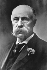
Joseph Clay Stiles Blackburn was a Democratic Representative and Senator from Kentucky. Blackburn, a skilled and spirited orator, was also a prominent trial lawyer known for his skill at swaying juries.

James Turner Morehead was a United States Senator and the 12th Governor of Kentucky. He was the first native-born Kentuckian to hold the governorship of the state. A member of Henry Clay's National Republican Party, Morehead entered politics just as his party was beginning to challenge the Democratic Party's dominance in the state.

Louisville in the American Civil War was a major stronghold of Union forces, which kept Kentucky firmly in the Union. It was the center of planning, supplies, recruiting and transportation for numerous campaigns, especially in the Western Theater. By the end of the war, Louisville had not been attacked once, although skirmishes and battles, including the battles of Perryville and Corydon, Indiana, took place nearby.

Pigeon Roost State Historic Site is located between Scottsburg and Henryville, Indiana, United States. A one-lane road off U.S. Route 31 takes the visitor to the site of a village where Native Americans massacred 24 settlers shortly after the War of 1812 began.

James Edwards Cantrill was elected the 22nd Lieutenant Governor of Kentucky serving from 1879 to 1883 under Governor Luke P. Blackburn. He also served as a circuit court judge starting in 1892, and in 1898 was elected to the Court of Appeals bench.

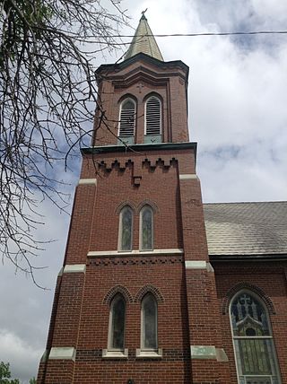
The Frankfort Cemetery is a historic rural cemetery located on East Main Street in Frankfort, Kentucky. The cemetery is the burial site of Daniel Boone and contains the graves of other famous Americans including seventeen Kentucky governors and a Vice President of the United States.

Johnson Township is one of fourteen townships in Clinton County, Indiana. As of the 2010 census, its population was 511 and it contained 209 housing units. The township was named for Richard M. Johnson, a military officer and later vice president of the United States.

The Vincennes Trace was a major trackway running through what are now the American states of Kentucky, Indiana, and Illinois. Originally formed by millions of migrating bison, the Trace crossed the Ohio River near the Falls of the Ohio and continued northwest to the Wabash River, near present-day Vincennes, before it crossed to what became known as Illinois. This buffalo migration route, often 12 to 20 feet wide in places, was well known and used by American Indians. Later European traders and American settlers learned of it, and many used it as an early land route to travel west into Indiana and Illinois. It is considered the most important of the traces to the Illinois country.
During the War of 1812, Kentucky supplied numerous troops and supplies to the war effort. Because Kentucky did not have to commit manpower to defending fortifications, most Kentucky troops campaigned actively against the enemy. This led to Kentucky seeing more battle casualties than all other states combined.

U.S. Route 231 in Kentucky runs 86.465 miles (139.152 km) from the Tennessee state line near Adolphus to the William H. Natcher Bridge on the Ohio River near Rockport, Indiana. It crosses the state mainly in the west-central region, traversing Allen, Warren, Butler, Ohio, and Daviess Counties.

U.S. Route 421 (US 421) in the U.S. state of Kentucky is a 250.536-mile-long (403.199 km) north–south United States highway that traverses twelve counties in the central and eastern parts of the state. It travels in a southeast-to-northwest path from the Virginia state line near Pennington Gap to the Indiana state line, on the Ohio River at Milton, Kentucky and Madison, Indiana.
New Frankfort is an unincorporated community in Saline County, in the U.S. state of Missouri.


