New Paris, Indiana

Last updated

New Paris, Indiana
Comm Bldg & IOOF 1317.jpg
Main Street, New Paris, Indiana
Elkhart County Indiana Incorporated and Unincorporated areas New Paris Highlighted 1853370.svg
Location of New Paris in Elkhart County, Indiana
Coordinates: 41°29′48″N85°49′30″W / 41.49667°N 85.82500°W / 41.49667; -85.82500
Country United States
State Indiana
County Elkhart
Area
[1]
  Total1.33 sq mi (3.45 km2)
  Land1.33 sq mi (3.45 km2)
  Water0.00 sq mi (0.00 km2)
Elevation
[2]
820 ft (250 m)
Population
 (2020)
  Total1,587
  Density1,190.55/sq mi (459.82/km2)
Time zone UTC-5 (Eastern (EST))
  Summer (DST) UTC-4 (EDT)
ZIP code
46553
Area code 574
FIPS code 18-53370 [3]
GNIS feature ID2393148 [2]

New Paris is a census-designated place (CDP) in Elkhart County, Indiana, United States. The population was 1,494 at the 2010 census. [4]

Contents

History

New Paris was laid out in 1839 by settlers from Preble County, Ohio. [5] It was likely named after New Paris, Ohio. [6] By the 1890s, New Paris had become a shipping point at the junction of two railroads. [7]

Geography

New Paris is located in Jackson Township (T35N R6E). [8]

According to the United States Census Bureau, the CDP has a total area of 1.4 square miles (3.5 km2), all land. [9]

Demographics

Historical population
CensusPop.Note
2020 1,587
U.S. Decennial Census [10]

As of the census [3] of 2000, there were 1,006 people, 377 households, and 286 families residing in the CDP. The population density was 1,209.3 inhabitants per square mile (466.9/km2). There were 390 housing units at an average density of 468.8 per square mile (181.0/km2). The racial makeup of the CDP was 97.71% White, 0.10% Native American, 1.19% from other races, and 0.99% from two or more races. Hispanic or Latino of any race were 1.99% of the population.

There were 377 households, out of which 34.7% had children over the age of 18 living with them, 63.1% were married couples living together, 8.2% had a female householder with no husband present, and 23.9% were non-families. 20.7% of all households were made up of individuals, and 6.9% had someone living alone who was 65 years of age or older. The average household size was 2.67 and the average family size was 3.09.

In the CDP, the population was spread out, with 29.7% under the age of 18, 7.0% from 18 to 24, 28.4% from 25 to 44, 20.3% from 45 to 64, and 14.6% who were 65 years of age or older. The median age was 35 years. For every 100 females, there were 95.3 males. For every 100 females age 18 and over, there were 93.2 males.

The median income for a household in the CDP was $42,446, and the median income for a family was $47,917. Males had a median income of $36,250 versus $24,038 for females. The per capita income for the CDP was $17,270. About 4.3% of families and 5.0% of the population were below the poverty line, including 7.9% of those under age 18 and none of those age 65 or over.

Schools

New Paris Elementary School was built in 1920 and served originally as a K-12 school. Fairfield Junior-Senior High School was created in 1968, and subsequently served as the secondary school fed by New Paris and Millersburg Elementary School. In 1999, a new elementary school named Benton Elementary School opened to serve the rural areas of New Paris and Millersburg. The enrollment at New Paris Elementary dropped as a result of Benton, but over time enrollment returned to historic levels. In 2004, construction began on a new elementary school that was in a more rural area of New Paris.

Sunnyside Park

The park is a lightly stocked fishing and recreational pond with a nearby park building and several veterans' memorials. There is also a playground and outdoor pavilion.

In 2007, the park building was renovated and the parking areas were paved.

Related Research Articles

<span class="mw-page-title-main">Elkhart County, Indiana</span> County in Indiana, United States

Elkhart County is a county located in the U.S. state of Indiana. As of 2020, the county's population was 207,047. The county seat is Goshen. Elkhart County is part of the Elkhart-Goshen Metropolitan Statistical Area, which in turn is part of the South Bend-Elkhart-Mishawaka Combined Statistical Area. It is also considered part of the broader region of Northern Indiana known as Michiana, and is 20 miles (32 km) east of South Bend, Indiana, 110 miles (180 km) east of Chicago, Illinois, and 150 miles (240 km) north of Indianapolis, Indiana. The area is referred to by locals as the recreation vehicle (RV) capital of the world and is known for its sizable Amish and Old Order Mennonite population.

<span class="mw-page-title-main">Prairie Creek, Arkansas</span> CDP in Arkansas, United States

Prairie Creek is a census-designated place (CDP) in Benton County, Arkansas, United States. Per the 2020 census, the population was 2,217. It is a lakefront community adjacent to Beaver Lake and Rogers within the Northwest Arkansas region.

<span class="mw-page-title-main">Salem, Saline County, Arkansas</span> CDP in Arkansas, United States

Salem is a census-designated place (CDP) in Saline County, Arkansas, United States. Per the 2020 census, the population was 2,544. It is part of the Little Rock–North Little Rock–Conway Metropolitan Statistical Area.

<span class="mw-page-title-main">New Washington, Indiana</span> CDP in Indiana, United States

New Washington is a census-designated place (CDP) in Clark County, Indiana, United States. As of the 2010 census, the population was 566.

<span class="mw-page-title-main">Dunlap, Indiana</span> Census-designated place in Indiana, United States

Dunlap is a census-designated place (CDP) in Elkhart County, Indiana, United States. The population was 6,235 at the 2010 census. Once a small farming community, by the 1980s it had become a suburb of Elkhart and Goshen, Indiana. Most of the town was destroyed by two violent F4 tornadoes during the Palm Sunday Tornado Outbreak on April 11, 1965.

<span class="mw-page-title-main">Simonton Lake, Indiana</span> Census-designated place in Indiana, United States

Simonton Lake is a census-designated place (CDP) in Elkhart County, Indiana, United States. The population was 4,678 at the 2010 census.

<span class="mw-page-title-main">Galena, Indiana</span> Census-designated place in Indiana, United States

Galena is a census-designated place (CDP) in Floyd County, Indiana, United States. The population was 1,818 at the 2010 census. The CDP includes the town of Galena as well as the nearby town of Floyds Knobs and their immediate surroundings.

<span class="mw-page-title-main">Granger, Indiana</span> Census-designated place in Indiana, United States

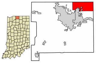
Granger is a census-designated place (CDP) in Clay and Harris townships, St. Joseph County, in the U.S. state of Indiana. The population was 30,465 at the 2010 census. Penn-Harris-Madison School Corporation and the South Bend Community School Corporation maintain the public schools in the area. Granger is part of the South Bend–Mishawaka metropolitan area as well as the larger Michiana region.

<span class="mw-page-title-main">Millersburg, Iowa</span> City in Iowa, United States

Millersburg is a city in Iowa County, Iowa, United States. The population was 135 at the time of the 2020 census.

<span class="mw-page-title-main">Benton Heights, Michigan</span> Census-designated place & unincorporated community in Michigan, United States

Benton Heights is an unincorporated community in Berrien County in the U.S. state of Michigan. It is also a census-designated place (CDP) for statistical purposes without any legal status as an incorporated municipality. Per the 2020 Census, the population was 3,652. The community is a part of Benton Charter Township and is adjacent to the city of Benton Harbor.

<span class="mw-page-title-main">Morganville, New Jersey</span> Populated place in Monmouth County, New Jersey, US

Morganville is an unincorporated community and census-designated place (CDP) within Marlboro Township, in Monmouth County, New Jersey. As of the 2010 United States Census, the CDP's population was 5,040.

<span class="mw-page-title-main">Ross, Ohio</span> Census-designated place in Ohio, United States

Ross is a census-designated place (CDP) in Ross Township, Butler County, Ohio, United States. The population was 3,478 at the 2020 census. Ross sits along U.S. Route 27 between Cincinnati, Ohio and Oxford, Ohio. Ross is part of the Cincinnati metropolitan area.

<span class="mw-page-title-main">Park Layne, Ohio</span> Census-designated place in Ohio, United States

Park Layne is a census-designated place (CDP) in Bethel Township, Clark County, Ohio, United States. The population of the CDP was 4,248 at the 2020 census. It is part of the Springfield, Ohio Metropolitan Statistical Area. Park Layne became a CDP in the 1980 United States Census.

<span class="mw-page-title-main">Chesterland, Ohio</span> Census-designated place in Ohio, United States

Chesterland is a census-designated place (CDP) in Geauga County, Ohio, United States. As of the 2020 census, the CDP had a population of 7,074.

<span class="mw-page-title-main">Greentown, Ohio</span> Census-designated place in Ohio, United States

Greentown is a census-designated place in northern Stark County, Ohio, United States. The population was 3,382 at the 2020 census. It is part of the Canton–Massillon metropolitan area.

<span class="mw-page-title-main">Landen, Ohio</span> CDP in Ohio, United States

Landen is a census-designated place (CDP) in Deerfield Township, Warren County, Ohio, United States. The population was 6,995 at the 2020 census. It is located around Columbia Road and Montgomery Road in the southeastern part of the township. It surrounds Twenty Mile Stand and near Fosters.

<span class="mw-page-title-main">Devola, Ohio</span> CDP in Ohio, United States

Devola is a census-designated place (CDP) in Washington County, Ohio, United States, along the Muskingum River. It is part of the Parkersburg-Marietta-Vienna, WV-OH Metropolitan Statistical Area. The population was 2,639 at the 2020 census.

<span class="mw-page-title-main">Lugoff, South Carolina</span> Census-designated place in South Carolina, United States

Lugoff is an unincorporated community and census-designated place (CDP) in Kershaw County, South Carolina, United States. The population was 9,990 at the 2020 census, up from 7,434 at the 2010 census. It is part of the Columbia, South Carolina Metropolitan Statistical Area.

<span class="mw-page-title-main">Millersburg, Indiana</span> Town in Indiana, United States

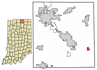
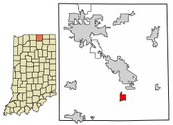
Millersburg is a town in Clinton and Benton townships, Elkhart County, Indiana, United States. The population was 903 at the 2010 census.

<span class="mw-page-title-main">Millersburg, Ohio</span> Village in Ohio, United States

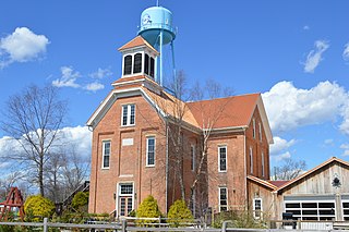
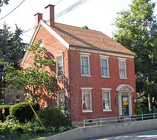
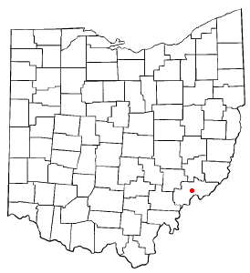
Millersburg is a village and the county seat of Holmes County, Ohio, United States. Located 66 miles (106 km) south of Cleveland, it is in the heart of Ohio's Amish Country and is part of a large regional tourism industry. The population was 3,151 at the 2020 census. Holmes County Airport, located two miles southwest of Millersburg, serves the county.

References

  1. "2020 U.S. Gazetteer Files". United States Census Bureau. Retrieved March 16, 2022.
  2. 1 2 U.S. Geological Survey Geographic Names Information System: New Paris, Indiana
  3. 1 2 "U.S. Census website". United States Census Bureau . Retrieved January 31, 2008.
  4. "Profile of General Population and Housing Characteristics: 2010 Demographic Profile Data (DP-1): New Paris CDP, Indiana". United States Census Bureau . Retrieved July 12, 2012.
  5. History of Elkhart County, Indiana. Chas. C. Chapman Co. 1881. pp.  1006.
  6. Baker, Ronald L. (October 1995). From Needmore to Prosperity: Hoosier Place Names in Folklore and History . Indiana University Press. p.  240. ISBN   978-0-253-32866-3. ...probably via New Paris, Ohio...
  7. Deahl, Anthony (1905). A Twentieth Century History and Biographical Record of Elkhart County, Indiana. Lewis Publishing Company. pp.  121.
  8. "US Gazetteer files: 2010, 2000, and 1990". United States Census Bureau. February 12, 2011. Retrieved April 23, 2011.
  9. "Geographic Identifiers: 2010 Demographic Profile Data (G001): New Paris CDP, Indiana". United States Census Bureau . Retrieved July 12, 2012.
  10. "Census of Population and Housing". Census.gov. Retrieved June 4, 2016.