Related Research Articles

The Bronx is a borough of New York City, coextensive with Bronx County, in the U.S. state of New York. It is south of Westchester County; north and east of the New York City borough of Manhattan, across the Harlem River; and north of the New York City borough of Queens, across the East River. The Bronx has a land area of 42 square miles (109 km2) and a population of 1,472,654 in the 2020 census. If each borough were ranked as a city, the Bronx would rank as the ninth-most-populous in the U.S. Of the five boroughs, it has the fourth-largest area, fourth-highest population, and third-highest population density. The population density of the Bronx was 32,718.7 inhabitants per square mile (12,632.8/km2) in 2022, the third-highest population density of any county in the United States, behind Manhattan and Brooklyn. It is the only borough of New York City not primarily on an island. With a population that is 54.8% Hispanic as of 2020, it is the only majority-Hispanic county in the Northeastern United States and the fourth-most-populous nationwide.

Riverdale is a residential neighborhood in the northwestern portion of the New York City borough of the Bronx. Riverdale, which had a population of 47,850 as of the 2000 United States Census, contains the city's northernmost point at the College of Mount Saint Vincent. Riverdale's boundaries are disputed, but it is commonly agreed to be bordered by Yonkers to the north, Van Cortlandt Park and Broadway to the east, the Kingsbridge neighborhood to the southeast, either the Harlem River or the Spuyten Duyvil neighborhood to the south, and the Hudson River to the west. Riverdale Avenue is the primary north–south thoroughfare through Riverdale.
Morrisania is a residential neighborhood in the southwestern Bronx, New York City, New York. Its boundaries are the Cross-Bronx Expressway to the north, Crotona-Prospect Avenue to the east, East 162nd Street to the south, and Webster Avenue to the west. Third Avenue is the primary thoroughfare through Morrisania.

Throggs Neck is a neighborhood and peninsula in the south-eastern portion of the borough of the Bronx in New York City. It is bounded by the East River and Long Island Sound to the south and east, Westchester Creek on the west, and Baisley Avenue and the Bruckner Expressway on the north.
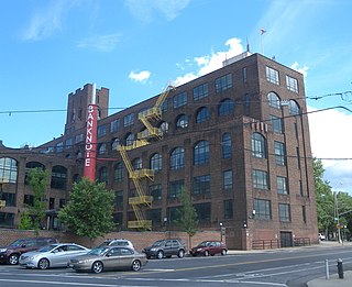
Hunts Point is a neighborhood located on a peninsula in the South Bronx of New York City. It is the location of one of the largest food distribution facilities in the world, the Hunts Point Cooperative Market. Its boundaries are the Bruckner Expressway to the west and north, the Bronx River to the east, and the East River to the south. Hunts Point Avenue is the primary street through Hunts Point.

The Longwood Avenue station is a local station on the IRT Pelham Line of the New York City Subway. It is served by the 6 train at all times and is located at Longwood Avenue and Southern Boulevard in the Longwood neighborhood of the Bronx. The station opened in 1919 as part of an extension of the Pelham Line of the Interborough Rapid Transit Company, and had its platforms extended in the 1960s. Further renovations were completed in 2019 and 2020.
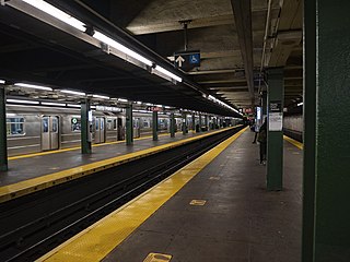
The Hunts Point Avenue station is an express station on the IRT Pelham Line of the New York City Subway, served by the 6 train at all times and the <6> train on weekdays in the peak direction. It is located at Hunts Point Avenue and Southern Boulevard in the Longwood neighborhood in the Bronx.

Eric Sheridan Prydz, also known by his many aliases including Pryda and Cirez D, is a Swedish DJ and music producer. He rose to fame with his 2004 hit single "Call on Me", and saw continued chart success with "Proper Education" in 2007, "Pjanoo" in 2008, and "Opus" in 2015. In 2016, he released his debut studio album, Opus.

Longwood is a mixed-use neighborhood in the southwest Bronx in New York City. Its boundaries, starting from the north and moving clockwise are East 167th Street to the north, the Bronx River and the Bruckner Expressway to east, East 149th Street to the south, and Saint Anns Avenue to the west. Southern Boulevard is the primary thoroughfare through Longwood.

Soundview is a neighborhood on the Clason Point peninsula, on the southern section of the borough of the Bronx in New York City. Its boundaries, starting from the north and moving clockwise, are the Cross-Bronx Expressway to the north, White Plains Road to the east, Lacombe Avenue to the south, and the Bronx River to the west. The Bruckner Expressway bisects the neighborhood horizontally along the center and the Bronx River Parkway runs north to south. Soundview Avenue is the primary thoroughfare through Soundview.

Norwood, also known as Bainbridge, is a residential neighborhood in the northwest Bronx, New York City, U.S. It is bound by Van Cortlandt Park and Woodlawn Cemetery to the north, the Bronx River to the east, and Mosholu Parkway to the southwest. The area is dominated topographically by what was once Valentine's Hill, the highest point being near the intersection of 210th Street and Bainbridge Avenue, where Gun Hill Road intersects, and around the Montefiore Medical Center, the largest landowner and employer of the neighborhood. Norwood's main commercial arteries are Gun Hill Road, Jerome Avenue, Webster Avenue, and Bainbridge Avenue.

Van Nest is a working-class neighborhood geographically located in the East Bronx section of the Bronx, New York City. Going clockwise, its boundaries are Bronxdale Avenue to the northeast, the Amtrak tracks to the southeast, and Bronx Park to the west. Van Nest predated Morris Park by 20 years and is considered the older of the two communities. Morris Park Avenue and White Plains Road are the primary commercial thoroughfares through Van Nest.

Parkchester is a planned community and neighborhood originally developed by the Metropolitan Life Insurance Company and located in the central Bronx, New York City. The immediate surrounding area also takes its name from the complex. Its boundaries, starting from the north and moving clockwise, are East Tremont Avenue to the north, Castle Hill Avenue to the east, Westchester Avenue to the south, East 177th Street/Cross Bronx Expressway to the southwest, and White Plains Road to the west. Metropolitan Avenue, Unionport Road, and White Plains Road are the primary thoroughfares through Parkchester.

Pelham Parkway is a working- and middle-class residential neighborhood geographically located in the center of the Bronx, a borough of New York City in the United States. Its boundaries, starting from the north and moving clockwise are: Waring Avenue to the north, the IRT Dyre Avenue Line tracks to the east, Neill Avenue to the South, and Bronx River Parkway to the west. White Plains Road is the primary commercial thoroughfare through Pelham Parkway. The neighborhood is named after Pelham Parkway, a major west–east parkway that travels through the East Bronx.

West Farms is a residential neighborhood in The Bronx, New York City. Its boundaries, are: Bronx Park to the north, the Bronx River Parkway to the east, the Cross-Bronx Expressway to the south, and Southern Boulevard to the west. East Tremont Avenue is the primary thoroughfare through West Farms.

Castle Hill is a neighborhood located in the southeast section of the borough of the Bronx in New York City. Its boundaries are Waterbury Avenue and Westchester Avenue to the north, Westchester Creek to the east, the East River to the south, and White Plains Road to the west. Unionport is a subsection of Castle Hill, typically considered north of Lafayette Avenue.

Belmont is a primarily residential neighborhood in the Bronx in New York City. Its boundaries are Fordham Road to the north, Bronx Park to the east, East 181st Street to the south, and Third Avenue to the west. These boundaries give the neighborhood a crescent-like shape. The neighborhood is noted for its "close-knit community" and "small-town feel", and as a result of its cultural history and wide array of Italian businesses, is widely known as the "Little Italy of the Bronx". Arthur Avenue, noted for its local restaurants and markets, is its primary thoroughfare.

Bronx Academy of Arts and Dance, also referred to as BAAD!, is a New York performing and visual art workshop space and performance venue located in The Bronx. The Academy is home to the Arthur Aviles Typical Theatre and The Bronx Dance Coalition.

NYC Health + Hospitals/North Central Bronx, better known as North Central Bronx Hospital, is a municipal hospital founded in 1976 and operated by NYC Health + Hospitals. The 17 story Brutalist style building is located next to the Montefiore Medical Center in the Norwood neighborhood of The Bronx in New York City.

The South Bronx is an area of the New York City borough of the Bronx. The area comprises neighborhoods in the southern part of the Bronx, such as Concourse, Mott Haven, Melrose, and Port Morris.
References
- ↑ "Shuttered fertilizer plant now huge events venue – Hunts Point Express". Huntspointexpress.com. Retrieved April 3, 2020.
- 1 2 "Hunts Point waterfront venue to become temporary hospital – Hunts Point Express". Huntspointexpress.com. Retrieved April 3, 2020.
- ↑ Mitchell, Alex (April 18, 2018). "Port Morris, Hunts Point develop trendy music venues – Bronx Times". Bxtimes.com. Retrieved April 3, 2020.
- ↑ Alex Mitchell. "How Eric Prydz and a legendary club owner just made The Bronx an EDM hot spot - amNewYork". Amny.com. Retrieved April 3, 2020.