Niagara, New York

Last updated

Niagara
Onguiaahra (Iroquoian languages)
Town of Niagara
NY 61 sb approaching NY 31, July 2023.jpg
Hyde Park Boulevard (NY 61) southbound on the border of the town of Niagara and city of Niagara Falls (town on left)
Motto(s): 
A Great Place to Live, Work & Shop
Niagara County New York incorporated and unincorporated areas Niagara highlighted.svg
Location in Niagara County and the state of New York.
USA New York location map.svg
Red pog.svg
Niagara
Location within the state of New York
Coordinates: 43°6′58″N78°59′22″W / 43.11611°N 78.98944°W / 43.11611; -78.98944
Country Flag of the United States.svg  United States
State Flag of New York.svg  New York
County Niagara
Government
  Type Town Council
   Town Supervisor Lee Wallace (D)
   Town Council
Members' List
Area
[1]
  Total9.48 sq mi (24.56 km2)
  Land9.48 sq mi (24.56 km2)
  Water0.00 sq mi (0.00 km2)
Elevation
623 ft (190 m)
Population
 (2010)
  Total8,378
  Estimate 
(2016) [2]
8,081
  Density852.07/sq mi (329.00/km2)
Time zone UTC-5 (Eastern (EST))
  Summer (DST) UTC-4 (EDT)
ZIP Code
14305
Area code 716
FIPS code 36-51033
GNIS feature ID0979275

Niagara is a town in Niagara County, New York, United States. At the time of the 2010 census, the town had a total population of 8,378. The town is named after the famous waterfall Niagara Falls.

Contents

The Town of Niagara is in the southwestern portion of Niagara County, borders the City of Niagara Falls (which is next to the famed Niagara Falls). Also located partially within the town is Niagara Falls International Airport, which serves the Niagara County area.

It is served by the LaSalle Post Office on Niagara Falls Boulevard (U.S. Route 62) in adjacent Niagara Falls, New York. Residents use a mailing address of "Niagara Falls, NY" because of this. Neither "Niagara, NY," nor "Town of Niagara, NY" are acceptable postal addresses, according to the United States Postal Service.

History

The Town of Niagara was founded in 1812 (originally as the "Town of Schlosser" after the local fortification Fort Schlosser and after Captain Joseph Schlosser, a German officer in the British Army) from the Town of Cambria. [3] In 1836 eastern parts of the town were organized as the Town of Wheatfield, New York.

In 1892, the City of Niagara Falls was formed from the western end of town, taking about half of its land. In 1897, the Village of LaSalle was incorporated in what was then the southeast corner of the town. [4] LaSalle was in turn annexed by the City of Niagara Falls in 1927, reducing the size of the Town of Niagara to 9.4 square miles (24 km2). [4] Its borders have remained the same since.

Geography

According to the United States Census Bureau, the town has a total area of 9.4 square miles (24 km2), all land.

Adjacent cities and towns

Major highways in the Town of Niagara

Notable person

Demographics

Historical population
CensusPop.Note
1820 484
1830 1,401189.5%
1840 1,277−8.9%
1850 1,95152.8%
1860 6,603238.4%
1870 6,8323.5%
1880 7,4328.8%
1890 10,97947.7%
1900 1,066−90.3%
1910 1,64854.6%
1920 4,173153.2%
1930 865−79.3%
1940 2,618202.7%
1950 4,72980.6%
1960 7,50358.7%
1970 8,36811.5%
1980 9,64815.3%
1990 9,8802.4%
2000 8,978−9.1%
2010 8,378−6.7%
2016 (est.)8,081 [2] −3.5%
U.S. Decennial Census [5]

As of the census [6] of 2000, there were 8,978 people, 3,611 households, and 2,480 families residing in the town. The population density was 955.8 inhabitants per square mile (369.0/km2). There were 3,879 housing units at an average density of 412.9 per square mile (159.4/km2). The racial makeup of the town was 92.99% White, 3.02% African American, 1.47% Native American, 0.56% Asian, 0.02% Pacific Islander, 0.22% from other races, and 1.72% from two or more races. Hispanic or Latino of any race were 1.17% of the population.

There were 3,611 households, out of which 29.6% had children under the age of 18 living with them, 51.1% were married couples living together, 13.0% had a female householder with no husband present, and 31.3% were non-families. 26.1% of all households were made up of individuals, and 9.9% had someone living alone who was 65 years of age or older. The average household size was 2.49 and the average family size was 2.99.

In the town, the population was spread out, with 23.4% under the age of 18, 8.9% from 18 to 24, 28.0% from 25 to 44, 25.1% from 45 to 64, and 14.6% who were 65 years of age or older. The median age was 39 years. For every 100 females, there were 95.1 males. For every 100 females age 18 and over, there were 92.3 males.

The median income for a household in the town was $37,327, and the median income for a family was $43,689. Males had a median income of $35,657 versus $25,358 for females. The per capita income for the town was $17,500. About 7.1% of families and 9.3% of the population were below the poverty line, including 14.6% of those under age 18 and 3.9% of those age 65 or over.

Communities

Government

The Town is governed by the Town Supervisor form of government led by an elected Supervisor and four Town Council members.

The Town of Niagara Police Department is a separate agency from that of the Niagara Falls Police Department serviving the City of Niagara Falls, New York. [7]

Economy

Major employers in Niagara are retail stores along major routes in town, including:

Services

Niagara Active Hose Company provides fire protection to Niagara from their fire hall on Lockport Road.

Town of Niagara Police Dept Serves and Protects the town community by enforcing local and state law. The department is located at 7105 Lockport Road

Related Research Articles

<span class="mw-page-title-main">Niagara County, New York</span> County in New York, United States

Niagara County is in the U.S. state of New York. As of the 2020 census, the population was 212,666. The county seat is Lockport. The county name is from the Iroquois word Onguiaahra; meaning the strait or thunder of waters. The county is part of the Western New York region of the state.

<span class="mw-page-title-main">Grand Island, New York</span> Island town in Erie County, New York

Grand Island is an island town in Erie County, New York, United States. As of the 2020 census, the town's population was 21,389 representing an increase of 5.00% from the 2010 census figure. The town's name is derived from the French name La Grande Île; Grand Island is the largest island in the Niagara River and the third largest in New York state. The phrase La Grande Île appears on the town seal.

<span class="mw-page-title-main">Cambria, New York</span> Town in New York, United States

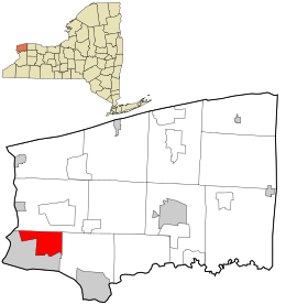
Cambria is a town in Niagara County, New York, United States. The population was 5,743 at the 2020 census. Cambria is an early name for Wales.

<span class="mw-page-title-main">Hartland, New York</span> Town in New York, United States

Hartland is a town in Niagara County, New York, United States. The population was 4,117 at the 2010 census. The town is named after Hartland, Vermont, the homeplace of some early settlers.

<span class="mw-page-title-main">Niagara Falls, New York</span> City in New York, United States

Niagara Falls is a city in Niagara County, New York, United States. As of the 2020 census, the city had a total population of 48,671. It is adjacent to the Niagara River, across from the city of Niagara Falls, Ontario, and named after the famed Niagara Falls which they share. The city is within the Buffalo–Niagara Falls metropolitan area and the Western New York region.

<span class="mw-page-title-main">North Tonawanda, New York</span> City in New York, United States

North Tonawanda is a city in Niagara County, New York, United States. The population was 31,568 at the 2010 census. It is part of the Buffalo–Niagara Falls Metropolitan Statistical Area. The city is named after Tonawanda Creek, its south border.

<span class="mw-page-title-main">Pendleton, New York</span> Town in New York, United States

Pendleton is a town on the southern edge of Niagara County, New York, United States. It is east of the city of Niagara Falls and southwest of the city of Lockport. The population was 6,397 at the 2010 census.

<span class="mw-page-title-main">Porter, New York</span> Town in New York, United States

Porter is a town in Niagara County, New York, United States. The population was 6,771 at the 2010 census. The town was named after Judge Augustus Porter.

<span class="mw-page-title-main">Ransomville, New York</span> CDP in New York, United States

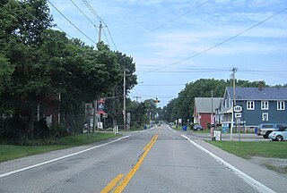
Ransomville is a hamlet located in the Town of Porter in Niagara County, New York, United States. The population was 1,419 at the 2010 census. Portions of the hamlet are also in Town of Wilson and Town of Cambria. Ransomville is north of the City of Niagara Falls and is part of the Buffalo–Niagara Falls Metropolitan Statistical Area.

<span class="mw-page-title-main">Royalton, New York</span> Town in New York, United States

Royalton is a town in Niagara County, New York, United States. The population was 7,660 at the 2010 census.

<span class="mw-page-title-main">Somerset, New York</span> Town in New York, United States

Somerset is a town in Niagara County, New York, United States. The population was 2,662 at the 2010 census. The town is believed to be named after Somerset, New Jersey, the source of some early settlers.

<span class="mw-page-title-main">Wheatfield, New York</span> Town in New York, United States

Wheatfield is a town in Niagara County, New York, United States. The population was 18,117 at the 2010 census. The name stems from the agricultural use of the town lands, the growing of wheat.

<span class="mw-page-title-main">Youngstown, New York</span> Village in New York, United States

Youngstown is a village in Niagara County, New York, United States. The population was 1,935 at the 2010 census. It is part of the Buffalo–Niagara Falls Metropolitan Statistical Area.

<span class="mw-page-title-main">Ulysses, New York</span> Town in New York, United States

Ulysses is a town located in northwest Tompkins County, New York, U.S. The population was 4,940 at the 2020 census. The town was named after the hero of the Odyssey.

<span class="mw-page-title-main">Lewiston, New York</span> Town in New York, United States

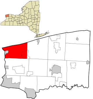
Lewiston is a town in Niagara County, New York, United States. The population was 15,944 at the 2020 census. The town and its contained village are named after Morgan Lewis, a governor of New York.

<span class="mw-page-title-main">Lockport (town), New York</span> Town in New York, United States

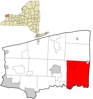
Lockport is a town in Niagara County, New York, United States. The population was 20,529 at the 2010 census. The name is derived from the series of canal locks on the Erie Canal. The locks lift boats from the lowland of Lake Ontario past the Niagara Escarpment.

<span class="mw-page-title-main">Wilson, New York</span> Town in New York, United States

Wilson is a town in Niagara County, New York, United States. The population was 5,993 at the 2010 census. The town was named after an early settler, Reuben Wilson, who built and dwelt in a log cabin on the shore of Lake Ontario at the site of what would become the Village of Wilson.

<span class="mw-page-title-main">Newfane, New York</span> Town in New York, United States

Newfane is a town in Niagara County, New York, United States. The population was 9,666 at the 2010 census.

<span class="mw-page-title-main">New York State Route 265</span> State highway in western New York, US

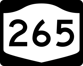
New York State Route 265 (NY 265) is a 19.75-mile (31.78 km) long state highway located in the western part of New York in the United States. NY 265 is a north–south route that roughly parallels the western parts of the Niagara River in Erie County and Niagara County. For much of its southern course, it is more frequently referred to by its longtime name, Military Road, which dates back to 1801 as a road to connect the city of Black Rock and Fort Niagara near Lake Ontario.

References

  1. "2016 U.S. Gazetteer Files". United States Census Bureau. Retrieved July 5, 2017.
  2. 1 2 "Population and Housing Unit Estimates" . Retrieved June 9, 2017.
  3. 1 2 3 4 "Town of Niagara | Town of Niagara". www.townofniagara.com. Retrieved August 16, 2023.
  4. 1 2 "120th anniversary lecture of incorporation of Village of LaSalle".
  5. "Census of Population and Housing". Census.gov. Retrieved June 4, 2015.
  6. "U.S. Census website". United States Census Bureau . Retrieved January 31, 2008.
  7. "Police Department | Town of Niagara".