Related Research Articles

A geographic information system (GIS) consists of integrated computer hardware and software that store, manage, analyze, edit, output, and visualize geographic data. Much of this often happens within a spatial database, however, this is not essential to meet the definition of a GIS. In a broader sense, one may consider such a system also to include human users and support staff, procedures and workflows, the body of knowledge of relevant concepts and methods, and institutional organizations.
In computing, GeoServer is an open-source server written in Java that allows users to share, process and edit geospatial data. Designed for interoperability, it publishes data from any major spatial data source using open standards. GeoServer has evolved to become an easy method of connecting existing information to virtual globes such as Google Earth and NASA World Wind as well as to web-based maps such as OpenLayers, Leaflet, Google Maps and Bing Maps. GeoServer functions as the reference implementation of the Open Geospatial Consortium Web Feature Service standard, and also implements the Web Map Service, Web Coverage Service and Web Processing Service specifications.
A GIS software program is a computer program to support the use of a geographic information system, providing the ability to create, store, manage, query, analyze, and visualize geographic data, that is, data representing phenomena for which location is important. The GIS software industry encompasses a broad range of commercial and open-source products that provide some or all of these capabilities within various information technology architectures.
The Commission for Environmental Cooperation was established by Canada, Mexico, and the United States to implement the North American Agreement on Environmental Cooperation (NAAEC), the environmental side accord to the North American Free Trade Agreement. The CEC's mission is to facilitate cooperation and public participation to foster conservation, protection and enhancement of the North American environment for the benefit of present and future generations, in the context of increasing economic, trade and social connections among Canada, Mexico and the United States.
The Vector Map (VMAP), also called Vector Smart Map, is a vector-based collection of geographic information system (GIS) data about Earth at various levels of detail. Level 0 (low resolution) coverage is global and entirely in the public domain. Level 1 (global coverage at medium resolution) is only partly in the public domain.
Pennsylvania Spatial Data Access (PASDA) is Pennsylvania's official public access geospatial information clearinghouse. PASDA serves as Pennsylvania's node on the National Spatial Data Infrastructure (NSDI). PASDA is a cooperative effort of the Pennsylvania Geospatial Technologies Office of the Office of Information Technology and the Pennsylvania State University Institute of Energy and the Environment.
The Open Source Geospatial Foundation (OSGeo), is a non-profit non-governmental organization whose mission is to support and promote the collaborative development of open geospatial technologies and data. The foundation was formed in February 2006 to provide financial, organizational and legal support to the broader Free and open-source geospatial community. It also serves as an independent legal entity to which community members can contribute code, funding and other resources.

The National Atlas of the United States was an atlas published by the United States Department of the Interior from 1874 to 1997.
Geospatial metadata is a type of metadata applicable to geographic data and information. Such objects may be stored in a geographic information system (GIS) or may simply be documents, data-sets, images or other objects, services, or related items that exist in some other native environment but whose features may be appropriate to describe in a (geographic) metadata catalog.

Web mapping or an online mapping is the process of using, creating, and distributing maps on the World Wide Web, usually through the use of Web geographic information systems. A web map or an online map is both served and consumed, thus, web mapping is more than just web cartography, it is a service where consumers may choose what the map will show.
TOXMAP was a geographic information system (GIS) from the United States National Library of Medicine (NLM) that was deprecated on December 16, 2019. The application used maps of the United States to help users explore data from the United States Environmental Protection Agency's (EPA) Toxics Release Inventory (TRI) and Superfund programs with visual projections and maps.
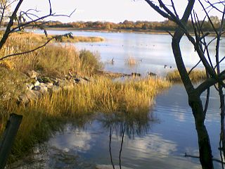
Wetlands of the United States are defined by the United States Army Corps of Engineers and the United States Environmental Protection Agency as "those areas that are inundated or saturated by surface or ground water at a frequency and duration sufficient to support, and that under normal circumstances do support, a prevalence of vegetations typically adapted for life in saturated soils. Wetlands generally include swamps, marshes, bogs, and similar areas." Wetlands can be valued in terms of their contributions to ecological, economic and social systems. Wetlands service these systems through multiple processes including water filtration, water storage and biological productivity. They also contribute the functions of flood control, providing a nutrient sink, groundwater recharge and habitat.

Geographic Information Systems (GIS) has become an integral part of aquatic science and limnology. Water by its very nature is dynamic. Features associated with water are thus ever-changing. To be able to keep up with these changes, technological advancements have given scientists methods to enhance all aspects of scientific investigation, from satellite tracking of wildlife to computer mapping of habitats. Agencies like the US Geological Survey, US Fish and Wildlife Service as well as other federal and state agencies are utilizing GIS to aid in their conservation efforts.
Circumarctic Environmental Observatories Network (CEON) is a network of terrestrial and freshwater observation platforms, science experts and network partners promoting the collection and dissemination of environmental data from the Arctic. CEON observation platforms include land and freshwater observatories, research infrastructures, former research sites where retrospective analyses are being or can be undertaken, data and image archive centers and community monitoring programs.
The Texas Slavery Project is a digital history project created by Andrew J. Torget, currently Assistant Professor of History at the University of North Texas. It aims to explore the expansion of slavery between the years 1837 and 1845 in the lands in and around what would eventually become the state of Texas. It has been listed as among "the best and most important new work" in the developing digital history medium. The project was presented at the 2007 Nebraska Digital Workshop held by the Center for Digital Research in the Humanities at the University of Nebraska-Lincoln.
The National Hydrography Dataset (NHD) is a digital database of surface water features used to make maps. It contains features such as lakes, ponds, streams, rivers, canals, dams and stream gages for the United States.
Geographic information systems (GIS) play a constantly evolving role in geospatial intelligence (GEOINT) and United States national security. These technologies allow a user to efficiently manage, analyze, and produce geospatial data, to combine GEOINT with other forms of intelligence collection, and to perform highly developed analysis and visual production of geospatial data. Therefore, GIS produces up-to-date and more reliable GEOINT to reduce uncertainty for a decisionmaker. Since GIS programs are Web-enabled, a user can constantly work with a decision maker to solve their GEOINT and national security related problems from anywhere in the world. There are many types of GIS software used in GEOINT and national security, such as Google Earth, ERDAS IMAGINE, GeoNetwork opensource, and Esri ArcGIS.
Global Map is a set of digital maps that accurately cover the whole globe to express the status of global environment. It is developed through the cooperation of National Geospatial Information Authorities (NGIAs) in the world. An initiative to develop Global Map under international cooperation, the Global Mapping Project, was advocated in 1992 by Ministry of Construction, Japan (MOC) at the time.
The LANDFIRE Program produces geo-spatial products and databases covering the United States. LANDFIRE is a partnership between the wildland fire management programs of the United States Department of Interior, the USDA Forest Service and the Nature Conservancy. LANDFIRE was chartered to create a nationally complete, comprehensive, and consistent set of products that support cross-country planning, and fire and natural resource management. This multi-partner Program produces consistent, comprehensive, geospatial data and databases that describe vegetation, wildland fuel, and fire regimes across the United States and insular areas. LANDFIRE's mission is to provide agency leaders and managers with a common "all-lands" data set of vegetation and wildland fire/fuels information for strategic fire and resource management planning and analysis.

The Global Solar Atlas (GSA) is a free, online, map-based application that provides information on solar resource and photovoltaic power potential globally. It features the online interactive map tools, simplified photovoltaic (PV) power calculator, reporting tools and the extensive download section. It is intended to provide policy makers, academia, and renewable energy stakeholders to raise awareness in the solar energy domain, support the development of policies and plans, and for initial zoning and site identification purposes.
References
- ↑ Pasos, Mireille. "North American Environmental Atlas". Commission for Environmental Cooperation. Retrieved 2024-02-20.
- ↑ "North American Environmental Atlas - ScienceBase-Catalog". www.sciencebase.gov. Retrieved 2024-02-20.