
Prairies are ecosystems considered part of the temperate grasslands, savannas, and shrublands biome by ecologists, based on similar temperate climates, moderate rainfall, and a composition of grasses, herbs, and shrubs, rather than trees, as the dominant vegetation type. Temperate grassland regions include the Pampas of Argentina, Brazil and Uruguay, and the steppe of Ukraine, Russia and Kazakhstan. Lands typically referred to as "prairie" tend to be in North America. The term encompasses the area referred to as the Interior Lowlands of Canada, the United States, and Mexico, which includes all of the Great Plains as well as the wetter, hillier land to the east.

Pleasant Prairie is a village in the U.S. state of Wisconsin. Located in Kenosha County along the southwestern shoreline of Lake Michigan, Pleasant Prairie was home to 21,250 people at the 2020 census. The village is positioned directly south of the city of Kenosha and directly north of the Illinois border. Although located just 37 miles south of Milwaukee, it is part of the United States Census Bureau's Chicago combined statistical area (CSA) and metropolitan statistical area despite being 57 miles north of that city. Among its notable features are the RecPlex and Chiwaukee Prairie.

A national grassland is an area of protected and managed federal lands in the United States authorized by Title III of the Bankhead–Jones Farm Tenant Act of 1937. For administrative purposes, they are essentially identical to national forests, except that grasslands are areas primarily consisting of prairie. Like national forests, national grasslands may be open for hunting, grazing, mineral extraction, recreation and other uses. Various national grasslands are typically administered in conjunction with nearby national forests.

The tallgrass prairie is an ecosystem native to central North America. Historically, natural and anthropogenic fire, as well as grazing by large mammals provided periodic disturbances to these ecosystems, limiting the encroachment of trees, recycling soil nutrients, and facilitating seed dispersal and germination. Prior to widespread use of the steel plow, which enabled large scale conversion to agricultural land use, tallgrass prairies extended throughout the American Midwest and smaller portions of southern central Canada, from the transitional ecotones out of eastern North American forests, west to a climatic threshold based on precipitation and soils, to the southern reaches of the Flint Hills in Oklahoma, to a transition into forest in Manitoba.

The Midewin National Tallgrass Prairie (MNTP) is a tallgrass prairie reserve and similarly preserved as United States National Grassland operated by the United States Forest Service. The first national tallgrass prairie ever designated in the U.S. and the largest conservation site in the Chicago Wilderness region, it is located on the site of the former Joliet Army Ammunition Plant between the towns of Elwood, Manhattan and Wilmington in northeastern Illinois. Since 2015, it has hosted a conservation herd of American bison to study their interaction with prairie restoration and conservation.

The Upper Mississippi River National Wildlife and Fish Refuge is a 240,000-acre (970 km2), 261-mile long (420 km) National Wildlife Refuge located in and along the Upper Mississippi River. It runs from Wabasha, Minnesota in the north to Rock Island, Illinois in the south.

The Rock Island Trail State Park is a 26-mile (42 km) long public rail trail in the west-central region of the U.S. state of Illinois. It was designated a National Recreation Trail in 2003.
The Jim Edgar Panther Creek State Fish and Wildlife Area (JEPC) is a conservation area located within Cass County in the U.S. state of Illinois. It is 16,550 acres (6,698 ha) in size. A mix of plowed upland prairie and Panther Creek woodlands, the site is managed by the Illinois Department of Natural Resources. It is drained by the Sangamon River. It is named for former Governor of Illinois Jim Edgar.
Sand Ridge State Forest is a conservation area located in the U.S. state of Illinois. Containing 7,200 acres (2,900 ha), it is the largest state forest in Illinois. It is located in northern Mason County. The nearest town is Manito, Illinois, and the nearest numbered highway is U.S. Highway 136. It is located on a low bluff, or "sand ridge", overlooking the Illinois River, hence the name. The sand ridge is believed to be an artifact of the post-glacial Kankakee Torrent.

Adeline Jay Geo-Karis Illinois Beach State Park, part of the Illinois state park system, is located along Lake Michigan in northern Lake County in northeast Illinois. Together with lands to the north, including Chiwaukee Prairie, it forms the Chiwaukee Prairie Illinois Beach Lake Plain, an internationally recognized wet-land of importance under the Ramsar Convention. The park is broken into two units that encompass an area of 4,160 acres (1,683 ha) and contains over six miles of Lake Michigan shoreline. In 2010, it was renamed for former state senator Adeline Geo-Karis.

Goose Lake Prairie State Natural Area is a 2,537-acre (1,027 ha) state park and listed state nature preserve. More than half of the state park is a tallgrass prairie maintained as a natural area of Illinois. It is located in Grundy County near the town of Morris approximately 50 miles (80 km) southwest of Chicago.

Prairie State College is a public community college in Chicago Heights, Illinois. It is the only college operated by Illinois Community College District 515.
Ramsey Lake State Recreation Area is a 1,980-acre (800 ha) state park located in Fayette County, Illinois, United States. The nearest town is Ramsey, Illinois, and the park is adjacent to U.S. Highway 51. The park is managed by the Illinois Department of Natural Resources (IDNR).

Silver Springs State Fish and Wildlife Area is an Illinois state park on 1,350 acres (550 ha) in Kendall County, Illinois, United States. The park was established in the late 1960s and is named for the natural spring within its boundaries. The park has two artificial lakes and the Fox River flows through the northern end of the park. Silver Springs hosts a variety of activities including fishing, hunting, boating and hiking. The park has areas of native prairie restoration, a sledding hill and a seven-mile (11 km) equestrian trail. The prairie restoration areas hold many species of plants including lead plant, and purple coneflower.

Fults Hill Prairie State Natural Area, also known as the Fults Hill Prairie Nature Preserve, is an Illinois Nature Preserve on 997 acres (403 ha) in Monroe County, Illinois, United States. A key feature of the preserve is a 532-acre (215 ha) hill prairie located on the east bluff of the Mississippi River overlooking the American Bottom near Fults, Illinois. The Fults Hill Prairie has been listed as a National Natural Landmark.

Kidd Lake State Natural Area is a protected area of Illinois on 800 acres (324 ha) in Monroe County, Illinois, United States, adjacent to the Fults Hill Prairie State Natural Area.
Prairie View is an unincorporated community located in northeastern Illinois, in southern Lake County. It is a part of Vernon Township. Prairie View has not been annexed entirely by either Lincolnshire or Buffalo Grove, although tiny portions of it have been.
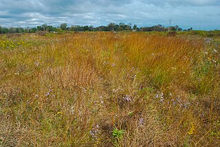
Chiwaukee Prairie is a 485-acre (1.96 km2) prairie in Pleasant Prairie, Wisconsin managed by the Wisconsin Department of Natural Resources. It is located on Lake Michigan at the Illinois state line and includes grassy wetlands, wooded areas, and the Kenosha Sand Dunes at its northern tip. It is home to an abundance of wildlife. It was designated a Wisconsin State Natural Area in 1967 and a National Natural Landmark in 1973.
The Prairie Ridge State Natural Area is a 4,101-acre (1,660 ha) collaborative natural area managed by the Illinois Department of Natural Resources. It is managed for the benefit of endangered, threatened, watch list, and area sensitive species associated with the tallgrass prairie habitat of south-central Illinois, especially the greater prairie chicken. The natural area is split between land parcels in Jasper County and Marion County, in the U.S. state of Illinois.


