North Tustin, California Tustin Foothills (until 2005) | |
---|---|
Clockwise from top: Fairmont Private Schools campus, Foothill High School gym, Manassero Farms | |
Coordinates: 33°45′54″N117°47′57″W / 33.76500°N 117.79917°W | |
Country | United States |
State | California |
County | Orange |
Area | |
• Total | 6.673 sq mi (17.284 km2) |
• Land | 6.673 sq mi (17.284 km2) |
• Water | 0 sq mi (0 km2) 0% |
Elevation | 256 ft (78 m) |
Population | |
• Total | 25,718 |
• Density | 3,900/sq mi (1,500/km2) |
Time zone | UTC-8 (PST) |
• Summer (DST) | UTC-7 (PDT) |
ZIP code | 92705, 92780 |
Area code | 714 |
FIPS code | 06-52379 |
GNIS feature IDs | 1867065, 2408951 |
North Tustin [4] is an unincorporated community and census designated place (CDP) in Orange County, California. The population was 25,718 at the 2020 census, up from 24,917 in 2010. For statistical purposes, the United States Census Bureau has defined North Tustin as a census-designated place (CDP). It is both the largest CDP and largest unincorporated community in Orange County. The CDP's name was changed from Tustin Foothills in 2005. Located outside the city limits of Tustin, North Tustin has 92705 and 92780 ZIP Codes.
According to the United States Census Bureau, the CDP has a total area of 6.7 square miles (17 km2), all of it land.
North Tustin is bordered by the city of Tustin to the south, east, and west, and by the city of Orange to the north.
Within North Tustin are the distinct unincorporated communities of Cowan Heights, East Tustin, Lemon Heights, North Tustin, Panorama Heights, and Red Hill[ citation needed ]. While there is no local government authority, some social and community services are provided by The Foothill Communities Association (FCA), a nonprofit corporation begun in the 1960s to preserve the living environment in those communities. [5] FCA also advocates for or against some development projects within the North Tustin area depending on the impact on the community.
Census | Pop. | Note | %± |
---|---|---|---|
1970 | 26,598 | — | |
1980 | 26,174 | −1.6% | |
1990 | 24,358 | −6.9% | |
2000 | 24,044 | −1.3% | |
2010 | 24,917 | 3.6% | |
2020 | 25,718 | 3.2% | |
source: [6] [7] [8] |
The 2010 United States Census [9] reported that North Tustin had a population of 24,917. The population density was 3,733.7 inhabitants per square mile (1,441.6/km2). The racial makeup of North Tustin was 20,836 (83.6%) White (75.4% Non-Hispanic White), [10] 148 (0.6%) African American, 104 (0.4%) Native American, 1,994 (8.0%) Asian, 52 (0.2%) Pacific Islander, 908 (3.6%) from other races, and 875 (3.5%) from two or more races. Hispanic or Latino of any race were 3,260 persons (13.1%).
The Census reported that 24,726 people (99.2% of the population) lived in households, 161 (0.6%) lived in non-institutionalized group quarters, and 30 (0.1%) were institutionalized.
There were 8,580 households, out of which 3,036 (35.4%) had children under the age of 18 living in them, 5,971 (69.6%) were opposite-sex married couples living together, 685 (8.0%) had a female householder with no husband present, 310 (3.6%) had a male householder with no wife present. There were 200 (2.3%) unmarried opposite-sex partnerships, and 69 (0.8%) same-sex married couples or partnerships. 1,276 households (14.9%) were made up of individuals, and 764 (8.9%) had someone living alone who was 65 years of age or older. The average household size was 2.88. There were 6,966 families (81.2% of all households); the average family size was 3.19.
The population was spread out, with 5,857 people (23.5%) under the age of 18, 1,709 people (6.9%) aged 18 to 24, 4,613 people (18.5%) aged 25 to 44, 7,979 people (32.0%) aged 45 to 64, and 4,759 people (19.1%) who were 65 years of age or older. The median age was 45.6 years. For every 100 females, there were 96.3 males. For every 100 females age 18 and over, there were 94.0 males.
There were 8,866 housing units at an average density of 1,328.5 per square mile (512.9/km2), of which 7,676 (89.5%) were owner-occupied, and 904 (10.5%) were occupied by renters. The homeowner vacancy rate was 0.9%; the rental vacancy rate was 3.4%. 22,095 people (88.7% of the population) lived in owner-occupied housing units and 2,631 people (10.6%) lived in rental housing units.
According to the 2010 United States Census, North Tustin had a median household income of $119,207, with 3.0% of the population living below the federal poverty line. [10]
As of the census [11] of 2000, there were 24,044 people, 8,269 households, and 6,945 families residing in the CDP. The population density was 3,590.5 inhabitants per square mile (1,386.3/km2). There were 8,417 housing units at an average density of 1,256.9 per square mile (485.3/km2). The racial makeup of the CDP was 86.80% White, 0.56% African American, 0.36% Native American, 7.05% Asian, 0.13% Pacific Islander, 2.62% from other races, and 2.48% from two or more races. Hispanic or Latino of any race were 8.47% of the population.
There were 8,269 households, out of which 34.9% had children under the age of 18 living with them, 74.2% were married couples living together, 7.0% had a female householder with no husband present, and 16.0% were non-families. 11.9% of all households were made up of individuals, and 6.7% had someone living alone who was 65 years of age or older. The average household size was 2.89 and the average family size was 3.12.
In the CDP, the population was spread out, with 25.0% under the age of 18, 5.4% from 18 to 24, 24.6% from 25 to 44, 28.2% from 45 to 64, and 16.8% who were 65 years of age or older. The median age was 42 years. For every 100 females, there were 96.6 males. For every 100 females age 18 and over, there were 94.4 males.
The median income for a household in the CDP is one of the highest in Orange County and was $96,230, and the median income for a family was $103,257. Males had a median income of $71,688 versus $42,785 for females. The per capita income for the CDP was $42,656. About 2.2% of families and 3.3% of the population were below the poverty line, including 3.2% of those under age 18 and 1.9% of those age 65 or over.
In the California State Legislature, North Tustin is in the 37th Senate District , represented by Democrat Dave Min, and in the 59th Assembly District , represented by Republican Phillip Chen. [12]
In the United States House of Representatives, North Tustin is in California's 40th congressional district , represented by Republican Young Kim. [13]
Primary and secondary education is overseen by the Orange Unified School District (north of Fairhaven Ext. and east of Crawford Canyon Rd.) and Tustin Unified School District, which also serves the incorporated City of Tustin. It has one of the highest accelerated learning percentages in the US.
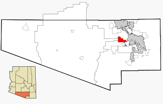
Tucson Estates is a census-designated place (CDP) in Pima County, Arizona, United States. The population was 9,755 at the 2000 census.
Palermo is a census-designated place (CDP) in Butte County, California, United States. The population was 5,382 at the 2010 census, down from 5,720 at the 2000 census.
Citrus is a census-designated place (CDP) in Los Angeles County, California, United States. It is located in the San Gabriel Valley between Azusa to the north and west, Glendora to the east, and Covina to the south. The population was 10,866 at the 2010 census, up from 10,581 at the 2000 census. Citrus is named after Citrus Avenue, which passes through the community.
East Pasadena is an unincorporated community in Los Angeles County, California, United States. The population was 6,021 at the 2020 census, down from 6,144 at the 2010 census. For statistical purposes, the United States Census Bureau has defined East Pasadena as a census-designated place (CDP).
Tamalpais-Homestead Valley is a census-designated place (CDP) in Marin County, California, United States. The population was 11,492 at the 2020 census.
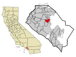
Prunedale is a unincorporated community in Monterey County, California, United States. It is located 8 miles (13 km) north of Salinas at an elevation of 92 feet (28 m). The population was 18,885 as of the 2020 census, up from 17,560 in 2010. For statistical purposes, the United States Census Bureau has defined Prunedale as a census-designated place (CDP). Plum trees were grown in Prunedale in the early days of its founding, but the trees died soon after due to poor irrigation and fertilizer.
Lake of the Pines is a census-designated place (CDP) and a gated residential community in Nevada County, California, United States. The population was 3,917 at the 2010 census.
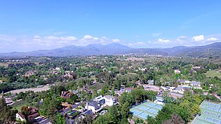
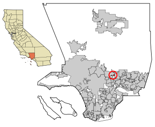
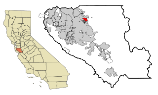
Coto de Caza is a census-designated place (CDP) and guard-gated private community in Orange County, California, United States. The population was 14,710 at the 2020 census.
Foothill Ranch is a neighborhood of the city of Lake Forest in Orange County, California, United States. The population was 10,899 at the 2000 census. The master planned community was a census-designated place prior to being incorporated into the city in 2000.
Tustin is a city located in Orange County, California, United States, within the Los Angeles metropolitan area. In 2020, Tustin had a population of 80,276. The city does not include the unincorporated community of North Tustin.
Foothill Farms is a census-designated place (CDP) and unincorporated community in Sacramento County, California, USA. It is part of the Sacramento–Arden-Arcade–Roseville Metropolitan Statistical Area. The population was 33,121 at the 2010 census, up from 17,426 at the 2000 census. Foothill Farms is part of the greater North Highlands-Foothill Farms community, and comprises the zip codes 95841 and 95842. Susan Ual services as President of the New Foothill Farms Community Association while Michael Baker services as the President of the Old Foothill Farms Community Association
www.oldfoothillfarms.org
Orangevale is a census-designated place (CDP) in Sacramento County, California, United States. It is part of the Sacramento–Arden-Arcade–Roseville Metropolitan Statistical Area. The population was 33,960 at the 2010 census, up from 26,705 at the 2000 census. It is located approximately 25 miles (40 km) northeast of Sacramento. The community is known for its rolling hills that offer the best views of the Sierra Nevada mountain range, its foothills, and a rural environment in the middle of a growing metropolitan area. Some residential properties in the area are zoned to accommodate horses and orchards. It has a ZIP Code of 95662.
Rancho Murieta is a census-designated place (CDP) and guard-gated community in Sacramento County, California, United States. It is part of the Sacramento–Arden-Arcade–Roseville Metropolitan Statistical Area. The population was 5,488 at the 2010 census, up from 4,193 at the 2000 census. It is located in the foothills of the Sierra Nevada range, about 25 miles (40 km) east of Sacramento.
San Antonio Heights is a census-designated place (CDP) in the San Bernardino County, California. It is in the northern Pomona Valley and the foothills of the San Gabriel Mountains. The population was 3,371 at the 2010 census, up from 3,122 at the 2000 census.
East Foothills is a census-designated place (CDP) in Santa Clara County, California, United States and a neighborhood of San Jose. The population was 8,269 at the 2010 census and it is located about 4 miles east of downtown San Jose.
San Martin or San Martín is a village and census-designated place (CDP) in Santa Clara County, California, in the southern Santa Clara Valley. Located to the south of Morgan Hill and north of Gilroy, San Martin is characterized by ranches, wineries, and orchards, as well as large estates in the foothills of the Santa Cruz Mountains.
Twain Harte is a census-designated place (CDP) in Tuolumne County, California, United States. The population was 2,226 at the 2010 census, down from 2,586 at the 2000 census. Its name is derived from the last names of two famous authors who lived in California, Mark Twain and Bret Harte.
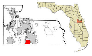
Meadow Woods is a census-designated place (CDP) and an unincorporated suburban development area located in southern Orange County, Florida, United States, between Orlando International Airport and Kissimmee. It is part of the Orlando–Kissimmee–Sanford, Florida Metropolitan Statistical Area. As of 2020, the population was 43,790.
Housatonic is a census-designated place (CDP) in the town of Great Barrington in Berkshire County, Massachusetts, United States. It is part of the Pittsfield, Massachusetts Metropolitan Statistical Area. The population was 1,109 at the 2010 census. It was named after the Housatonic River.
Mulberry is a census-designated place (CDP) in Wilkes County, North Carolina, United States. The population was 2,332 at the 2010 U.S. Census. The community was given its name by the first European pioneers to settle the area in the 1750s. These settlers called the region "Mulberry Fields", after the many mulberry trees in the area. Mulberry Creek, one of the largest streams in Wilkes County, takes its name from the community of Mulberry, and flows through the area.