Northeast Madison Township, Pennsylvania

Last updated

Northeast Madison Township,
Pennsylvania
Waggoners Bridge.JPG
Map of Perry County, Pennsylvania Highlighting Northeast Madison Township.PNG
Map of Perry County, Pennsylvania highlighting Northeast Madison Township
Map of Pennsylvania highlighting Perry County.svg
Map of Perry County, Pennsylvania
Country United States
State Pennsylvania
County Perry
Settled1755
Incorporated1755
Area
[1]
  Total25.80 sq mi (66.84 km2)
  Land25.77 sq mi (66.74 km2)
  Water0.04 sq mi (0.10 km2)
Population
 (2020) [2]
  Total828 Increase2.svg
  Estimate 
(2021) [2]
831
  Density30.58/sq mi (11.81/km2)
Time zone UTC-5 (Eastern (EST))
  Summer (DST) UTC-4 (EDT)
Area code 717
FIPS code 42-099-54968

Northeast Madison Township is a township in Perry County, Pennsylvania, United States. The population was 828 at the 2020 census. [2]

Contents

History

The Waggoner Covered Bridge was added to the National Register of Historic Places in 1980. [3]

Geography

According to the United States Census Bureau, the township has a total area of 25.8 square miles (66.8 km2), of which 25.8 square miles (66.8 km2) is land and 0.04% is water.

Demographics

Historical population
CensusPop.Note
2010 786
2020 8285.3%
2021 (est.)831 [2] 0.4%
U.S. Decennial Census [4]

As of the census [5] of 2000, there were 856 people, 265 households, and 215 families living in the township. The population density was 33.2 inhabitants per square mile (12.8/km2). There were 400 housing units at an average density of 15.5/sq mi (6.0/km2). The racial makeup of the township was 90.77% White, 5.26% African American, 0.35% Native American, 0.23% Asian, 0.12% Pacific Islander, 1.75% from other races, and 1.52% from two or more races. Hispanic or Latino of any race were 3.27% of the population.

There were 265 households, out of which 35.8% had children under the age of 18 living with them, 75.5% were married couples living together, 4.9% had a female householder with no husband present, and 18.5% were non-families. 16.6% of all households were made up of individuals, and 5.7% had someone living alone who was 65 years of age or older. The average household size was 2.85 and the average family size was 3.22.

In the township the population was spread out, with 34.0% under the age of 18, 8.5% from 18 to 24, 23.6% from 25 to 44, 23.9% from 45 to 64, and 9.9% who were 65 years of age or older. The median age was 33 years. For every 100 females, there were 137.8 males. For every 100 females age 18 and over, there were 119.0 males.

The median income for a household in the township was $37,125, and the median income for a family was $45,000. Males had a median income of $31,500 versus $21,923 for females. The per capita income for the township was $13,083. About 15.0% of families and 19.1% of the population were below the poverty line, including 26.7% of those under age 18 and 21.4% of those age 65 or over.

Related Research Articles

Newton Township is a township in Otter Tail County, Minnesota, United States. The population was 751 at the 2000 census.

Watopa Township is a township in Wabasha County, Minnesota, United States. The population was 265 at the 2000 census.

<span class="mw-page-title-main">Woodbury Township, Bedford County, Pennsylvania</span> Township in Pennsylvania, United States

Woodbury Township is a township that is located in Bedford County, Pennsylvania, United States. As of the 2020 census, the population was 1,180.

<span class="mw-page-title-main">Conyngham Township, Columbia County, Pennsylvania</span> Township in Pennsylvania, United States

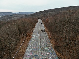
Conyngham Township is a township in Columbia County, Pennsylvania, United States. It is part of Northeastern Pennsylvania. The population was 689 at the 2020 census. Conyngham Township surrounds the famous borough of Centralia, and part of the mine fire is located here. The abandoned town of Byrnesville is located here.

<span class="mw-page-title-main">North Centre Township, Pennsylvania</span> Township in Pennsylvania, United States

North Centre Township is a township in Columbia County, Pennsylvania. It is part of Northeastern Pennsylvania. The population was 2,039 at the 2020 census.

<span class="mw-page-title-main">Roaring Creek Township, Pennsylvania</span> Township in Pennsylvania, United States

Roaring Creek Township is a township in Columbia County, Pennsylvania. It is part of Northeastern Pennsylvania. The population was five hundred and forty-five at the time of the 2010 census.

<span class="mw-page-title-main">South Centre Township, Pennsylvania</span> Township in Pennsylvania, United States

South Centre Township is a township in Columbia County, Pennsylvania. It is part of Northeastern Pennsylvania. The population was 1,908 at the 2020 census.

<span class="mw-page-title-main">Walker Township, Juniata County, Pennsylvania</span> Township in Pennsylvania, United States

Walker Township is a township in Juniata County, Pennsylvania, United States. The population was 2,797 at the 2020 census.

<span class="mw-page-title-main">Penn Township, Lancaster County, Pennsylvania</span> Township in Pennsylvania, United States

Penn Township is a township that is located in north central Lancaster County, Pennsylvania, United States. The population was 10,224 at the time of the 2020 census.

<span class="mw-page-title-main">Oakwood, Pennsylvania</span> Census-designated place in Pennsylvania, United States

Oakwood is an unincorporated area and census-designated place (CDP) in Lawrence County, Pennsylvania, United States. The population was 2,270 at the 2010 census.

<span class="mw-page-title-main">Hempfield Township, Mercer County, Pennsylvania</span> Township in Pennsylvania, United States

Hempfield Township is a township in Mercer County, Pennsylvania, United States. The population was 3,734 at the 2020 census, a decline from the figure of 3,741 in 2010.

<span class="mw-page-title-main">Mill Creek Township, Mercer County, Pennsylvania</span> Township in Pennsylvania, United States

Mill Creek Township is a township in Mercer County, Pennsylvania, United States. The population was 776 at the 2020 census, down from 721 in 2010.

<span class="mw-page-title-main">Sugar Grove Township, Mercer County, Pennsylvania</span> Township in Pennsylvania, United States

Sugar Grove Township is a township in Mercer County, Pennsylvania. The population was 950 at the 2020 census, a decrease from 971 in 2010.

<span class="mw-page-title-main">Bratton Township, Pennsylvania</span> Township in Pennsylvania, United States

Bratton Township is a township in Mifflin County, Pennsylvania, United States. The population was 1,192 at the 2020 census.

<span class="mw-page-title-main">Oliver Township, Mifflin County, Pennsylvania</span> Township in Pennsylvania, United States

Oliver Township is a township in Mifflin County, Pennsylvania, United States. The population was 2,060 at the time of the 2020 census.

<span class="mw-page-title-main">Wayne Township, Mifflin County, Pennsylvania</span> Township in Pennsylvania, United States

Wayne Township is a township in Mifflin County, Pennsylvania, United States. The population was 2,362 at the time of the 2020 census.

<span class="mw-page-title-main">Howe Township, Perry County, Pennsylvania</span> Township in Pennsylvania, United States

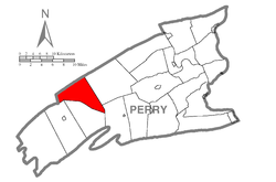
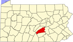
Howe Township is a township in Perry County, Pennsylvania, United States. The population was 375 at the 2020 census.

<span class="mw-page-title-main">Reilly Township, Pennsylvania</span> Township in Pennsylvania, United States

Reilly Township is a township that is located in Schuylkill County, Pennsylvania, United States. The population was 641 at the time of the 2020 census.

<span class="mw-page-title-main">Pinegrove Township, Pennsylvania</span> Township in Pennsylvania, United States

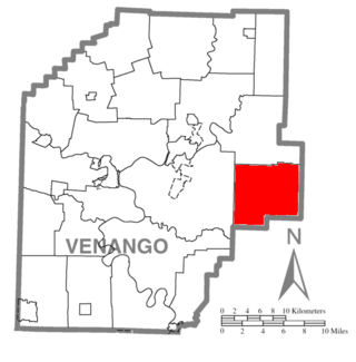
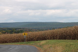
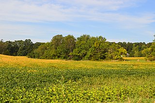
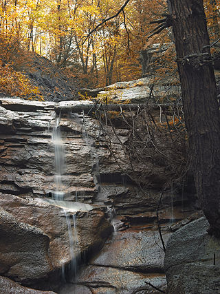
Pinegrove Township is a township in Venango County, Pennsylvania. The population was 1,327 at the 2020 census, a decrease from the figure of 1,354 in 2010, which was an increase over the tabulation of 1,338 as of the 2000 census.

<span class="mw-page-title-main">Chesterfield Court House, Virginia</span> Unincorporated community in Virginia, United States

Chesterfield Court House is an unincorporated community and census-designated place that is the county seat of Chesterfield County, Virginia, United States. It was a census-designated place (CDP) at the 2020 census. It was not delineated as a CDP for the 2010 census. The Chesterfield County Courthouse and Courthouse Square are listed in the National Register of Historic Places. The area is also home of the Chesterfield County Government Complex.

References

  1. "2016 U.S. Gazetteer Files". United States Census Bureau. Retrieved August 14, 2017.
  2. 1 2 3 4 Bureau, US Census. "City and Town Population Totals: 2020-2021". Census.gov. US Census Bureau. Retrieved July 12, 2022.
  3. "National Register Information System". National Register of Historic Places . National Park Service. July 9, 2010.
  4. "Census of Population and Housing". Census.gov. Retrieved June 4, 2016.
  5. "U.S. Census website". United States Census Bureau . Retrieved January 31, 2008.

40°22′29″N77°22′35″W / 40.37472°N 77.37639°W / 40.37472; -77.37639