
The Shubenacadie Canal is a canal in central Nova Scotia, Canada. It links Halifax Harbour with the Bay of Fundy by way of the Shubenacadie River and Shubenacadie Grand Lake. Begun in 1826, it was not completed until 1861 and was closed in 1871. Currently small craft use the river and lakes, but only one lock is operational. Three of the nine locks have been restored to preserve their unique fusion of British and North American construction techniques. More extensive restoration is planned.
Highway 102 is a north–south highway in the Canadian province of Nova Scotia that runs from Halifax to Onslow, immediately north of the town of Truro. It is the busiest highway in Atlantic Canada.

Nova Scotia Trunk 7 is part of the Canadian province of Nova Scotia's system of Trunk Highways. The route runs from Bedford to Antigonish, along the Eastern Shore for a distance of 269 kilometres (167 mi). Part of Trunk 7 is known as the Marine Drive.

Lantz is a designated place located on the Shubenacadie River between the communities of Milford and Elmsdale, in the Municipality of East Hants and the Halifax Regional Municipality, Nova Scotia, Canada. Lantz was considered by Statistics Canada as a "Retired population centre."

Trunk 2 is part of the Canadian province of Nova Scotia's system of Trunk Highways. The route runs from Halifax to Fort Lawrence on the New Brunswick border. Until the 1960s, Trunk 2 was the Halifax area's most important highway link to other provinces, and was part of a longer Interprovincial Highway 2 which ended in Windsor, Ontario. The controlled access Highway 102 and Highway 104 now carry most arterial traffic in the area, while Trunk 2 serves regional and local traffic.

Trunk 8 is part of the Canadian province of Nova Scotia's system of Trunk Highways. The route runs from Liverpool to Annapolis Royal, a distance of 113 kilometres (70 mi). Trunk 8 is also known as the Kejimkujik Scenic Drive.

Trunk 10 is part of the Canadian province of Nova Scotia's system of Trunk Highways. This rural road runs from Bridgewater to Middleton, a distance of 88 kilometres (55 mi).

Trunk 22 is part of the Canadian province of Nova Scotia's system of trunk highways. The route runs from Sydney to Louisbourg, a distance of 36 kilometres (22 mi).
The Glooscap Trail is a scenic roadway in the Canadian province of Nova Scotia.
Route 224 is a collector road in the Canadian province of Nova Scotia. It is located in the Halifax Regional Municipality and Colchester County, connecting Sheet Harbour at Trunk 7 with Milford Station at Exit 9 of Highway 102 and Trunk 14. The route passes through the upper half of the Musquodoboit Valley.

Route 209 is a collector road in the Canadian province of Nova Scotia.
Route 376 is a collector road in the Canadian province of Nova Scotia.
Route 242 is a collector road in the Canadian province of Nova Scotia.
Route 245 is a collector road in the Canadian province of Nova Scotia. Route 245 is part of the Sunrise Trail.
Route 301 is a collector road in the Canadian province of Nova Scotia.
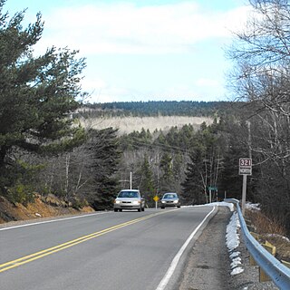
Route 321 is a collector road in the Canadian province of Nova Scotia.

Route 256 is a collector road in the Canadian province of Nova Scotia.
Route 312 is a collector road in the Canadian province of Nova Scotia.
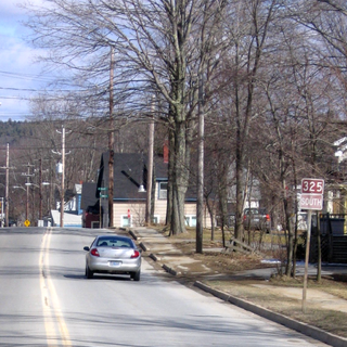
Route 325 is a collector road in the Canadian province of Nova Scotia. It is located in Lunenburg County and connects Colpton at Route 208 with Mahone Bay at Trunk 3.