
Highway 111 is a 13-kilometre (8 mi) controlled-access highway in Halifax Regional Municipality, Nova Scotia, Canada.

The Shubenacadie Canal is a canal in central Nova Scotia, Canada. It links Halifax Harbour with the Bay of Fundy by way of the Shubenacadie River and Shubenacadie Grand Lake. Begun in 1826, it was not completed until 1861 and was closed in 1871. Currently small craft use the river and lakes, but only one lock is operational. Three of the nine locks have been restored to preserve their unique fusion of British and North American construction techniques. More extensive restoration is planned.
Cherry Brook is a predominantly African Canadian rural community located to the north of Trunk 7 between Lake Loon and Lake Major, and just a few miles east of Dartmouth, Nova Scotia.

Cole Harbour is a former village and current community located in Nova Scotia, Canada that is part of the Halifax Regional Municipality.

Highway 107 in Nova Scotia runs through the eastern suburbs of the Halifax Regional Municipality, from the Burnside Industrial Park in Dartmouth to an intersection with Trunk 7 in Musquodoboit Harbour. It is 43.2 km (26.8 mi) long, and is mostly two lane, controlled access highway.

Highway 118 is a short suburban freeway connecting (officially) Victoria Road via Woodland Avenue in Dartmouth with Highway 102 at Fall River, 14 kilometres (8.7 mi) to the north in the Canadian province of Nova Scotia. The highway crosses the Historic Shubenacadie Canal and also runs along the western shore of Lake Micmac and the western edge of Shubie Park and is known as Lakeview Drive. Running parallel to the highway from the Waverley Road to exit 14 is a portion of the Halifax Lateral of the Maritimes & Northeast Pipeline. The highway serves both as an "A-Train and B-Train" route between the Burnside Industrial Park and Highway 102. The highway has the only collector-express section in Atlantic Canada at the exit 12 Dartmouth Crossing interchange.

The Eastern Shore is a region of the Canadian province of Nova Scotia. It is the Atlantic coast running northeast from Halifax Harbour to the eastern end of the peninsula at the Strait of Canso.
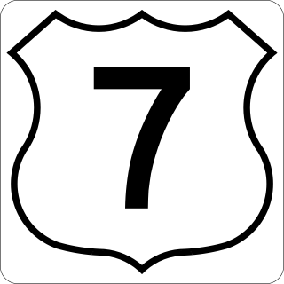
Nova Scotia Trunk 7 is part of the Canadian province of Nova Scotia's system of Trunk Highways. The route runs from Bedford to Antigonish, along the Eastern Shore for a distance of 269 kilometres (167 mi). Part of Trunk 7 is known as the Marine Drive.

Trunk 2 is part of the Canadian province of Nova Scotia's system of Trunk Highways. The route runs from Halifax to Fort Lawrence on the New Brunswick border. Until the 1960s, Trunk 2 was the Halifax area's most important highway link to other provinces, and was part of a longer Interprovincial Highway 2 which ended in Windsor, Ontario. The controlled access Highway 102 and Highway 104 now carry most arterial traffic in the area, while Trunk 2 serves regional and local traffic.
Route 322 is a collector road in the Canadian province of Nova Scotia.
Mineville, Nova Scotia is a suburban community in the east of Halifax Regional Municipality, Nova Scotia, Canada, between Lake Echo on Trunk 7, Highway 107 and Upper Lawrencetown on Route 207. The main road is Mineville Road. The other road is Candy Mountain Road. The community has two lakes: Lawrencetown Lake and Lake Echo.

Route 207 is a collector road in the Canadian province of Nova Scotia. It is located in the Halifax Regional Municipality and connects Dartmouth to Porters Lake on the Eastern Shore.
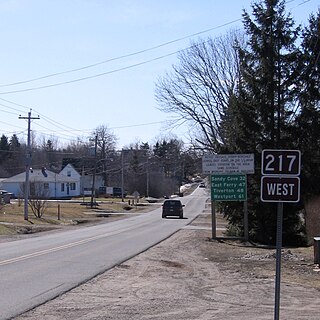
Route 217 is a collector road in the Canadian province of Nova Scotia.

Port Wallace is an urban locality in Halifax, Nova Scotia, Canada.
Westphal is an unincorporated community located in Dartmouth, Nova Scotia and outside of Dartmouth, Nova Scotia. Some of Westphal is considered part of Dartmouth, Nova Scotia and some of it is considered separate from Dartmouth, Nova Scotia. The area is bound by Port Wallace in the north, Waverley Road in the west, Lake Major Road in the east, and Main Street in the south. The area also includes the watershed and water filtration plant for the Halifax Regional Water Commission that supplies drinking water for the residents of Dartmouth and surrounding communities east of Halifax Harbour.
Montague Gold Mines is a rural community in the Halifax Regional Municipality of Nova Scotia, located on the Montague Road off of exit 14 of Highway 107 three kilometers from Dartmouth.
Porters Lake is a rural community in the Eastern Shore region of the Halifax, Nova Scotia, Canada, between Trunk 7 and Route 207, 27.8 km from Halifax. The residents mainly commute to jobs in Dartmouth, Burnside Industrial Park or in Downtown Halifax. The community is built around the lake from which it takes its name.
Lake Charles is a small lake in Nova Scotia’s Halifax Regional Municipality between the communities of Dartmouth and Waverley. It is situated between Port Wallace in the south and Nova Scotia Highway 107 in the North, Nova Scotia Highway 118 in the west and Nova Scotia Route 318 to the east. It is the summit of the Shubenacadie Canal, where the level of the surface is 31 m above sea level. Located in the Shubenacadie watershed, it ultimately feeds into the Bay of Fundy. However, it also feeds into Halifax Harbour through the canal locks at Shubie Park.
The Musquodoboit Trailway is a 14.5-kilometre-long (9.0 mi) multiuse rail trail located in Halifax County, Nova Scotia, running the distance from Gibralter to Musquodoboit Harbour. The entire route is part of the Halifax spur of The Great Trail, and follows Nova Scotia Route 357 for its length.
