Oklahoma State Highway 152

Last updated

Oklahoma State Highway 152.svg

State Highway 152

Oklahoma State Highway 152
SH-152 highlighted in red
Route information
Maintained by ODOT
Length149.2 mi [1]  (240.1 km)
Major junctions
West endTexas 152.svg SH 152 at the Texas state line
Major intersectionsI-40.svg I-40 in Sayre
US 183.svg US 183 in New Cordell
US 281.svgOklahoma State Highway 8.svg US 281  / SH-8 in Binger
US 81.svg US 81 from Minco to Union City
East endI-240 (long).svgI-344 (long).svgKilpatrick Turnpike.svg I-240  / I-344  / Kilpatrick Turnpike in Oklahoma City in Oklahoma City
Location
Country United States
State Oklahoma
Highway system
  • Oklahoma State Highway System
Oklahoma State Highway 151.svg SH-151 Oklahoma State Highway 153.svg SH-153

State Highway 152 (abbreviated SH-152) is a state highway running through west-central Oklahoma. It begins at the Texas state line, serving as a continuation of Texas State Highway 152, and continues east to end at Interstate 344/Interstate 240(I-344/I-240) in southwest Oklahoma City, a length of 145 miles (233 km). Along its route it serves three county seats: Sayre, Cordell, and Oklahoma City (which is also the state capital). Near the east end, it passes through in the Oklahoma City suburb of Mustang before being its terminus on the east side of that town.

Contents

The easternmost 5.2 miles (8.4 km) of the route is a freeway linking Will Rogers World Airport to the Interstate system, this section was truncated in 2024 and will be a part of I-240. SH-152 has no lettered spur routes.

SH-152 was originally designated around 1927. It was initially numbered SH-41, and connected Sayre to Minco. SH-41 was extended east to Oklahoma City around 1934 and west to the Texas state line around 1938. The highway was renumbered to SH-152 in 1954.

Route description

SH-152 in Caddo County OK-152 Red Rock Canyon.jpg
SH-152 in Caddo County

SH-152 begins at the Texas state line in Roger Mills County. It runs just north of the county line, crossing State Highway 30, and continues east until it meets SH-6's northern terminus, where it turns toward the southeast, entering Beckham County. It straightens out to head through Sayre running eastwest, where it meets both U.S. Highway 283 and Interstate 40. Six miles later it crosses State Highway 34 and six miles (10 km) after that it meets SH-6 again.

SH-152 then crosses into Washita County and intersects State Highway 44 and 42. It then meets US-183 in a roundabout in Cordell. East of Cordell, it has a 7-mile (11 km) concurrency with the northern State Highway 54 and, after it splits off, it intersects State Highway 115.

Right after entering Caddo County, it has a 2-mile (3.2 km) concurrency with State Highway 58, and then it meets State Highway 146 near Binger. At Binger, it begins to overlap U.S. Highway 281 and SH-8. It splits off on its own again five miles (8 km) later. 9 miles (14 km) later, it meets the western State Highway 37 at Cogar, which it then overlaps for 11 miles (18 km). (Located at this intersection is an abandoned Apco station, which was used in a scene from the movie "Rain Man"). North of Minco, it meets US-81. At this T-intersection, SH-37 heads south and SH-152 heads north.

After crossing the Canadian River into Canadian County, SH-152 splits off from US-81 in Union City. In downtown Mustang, it overlaps SH-4.

In Oklahoma County, it heads northeast to connect to the Airport Road freeway, which provides access to Will Rogers World Airport, the main airport for Oklahoma City and most of central Oklahoma. SH-152 then ends at Interstate 44.

History

Circle sign 41.svg

The first addition of any part of what is now SH-152 to the state highway system occurred between May 1, 1926, and November 1, 1927. Sometime between these dates, State Highway 41 was commissioned to run between US-66 in Sayre and SH-2 (now US-81) near Minco. [2] SH-41 was extended east to Oklahoma City sometime between August 1933 and October 1935. [3] SH-41's eastern terminus now fell at the intersection with US-62/277. [4] The current western terminus was established between April 1938 and April 1939, when the highway was extended west from Sayre, through Sweetwater, to the Texas state line, where it connected to Texas's SH-152. [5] On December 6, 1954, SH-41 in its entirety was renumbered to SH-152. [6]

US-62 was moved to the Will Rogers Expressway (present day I-44 south of I-240) on September 4, 1963. [6] SH-152 was extended over former US-62/277 to end at the intersection of S.W. 29th Street and May Avenue in Oklahoma City. At the time, this intersection carried SH-3 and SH-74. [7] On March 5, 1979, the eastern terminus was pushed back a half-mile west, to the intersection of Interstate 44 and S.W. 29th. [6]

The most recent alteration to SH-152 came on February 2, 2004. On this date, SH-152 was removed from Newcastle Boulevard and placed on the newly extended Airport Road freeway. [6] The freeway previously carried no numbered route designation. This placed the highway's eastern terminus at its current location, and no changes have been made since.

Future

On August 2, 2021, the Oklahoma Transportation Commission approved an extension to the Interstate 240 designation to form a beltway around Oklahoma City. Starting in the existing eastern terminus, I-240 will run concurrent with I-40 to the Kickapoo Turnpike, then turn north and follow the Kickapoo Turnpike north to I-44 (the Turner Turnpike), then turn west along I-44 to the Kilpatrick Turnpike, following that road west and south to its current southern terminus at SH-152, then turning east along SH-152 and following that road east to I-44, which it will overlap until reaching the current western terminus of I-240. The designation must be approved by the American Association of State Highway and Transportation Officials (AASHTO) and the Federal Highway Administration (FHWA) to take effect. [8]

In Fall 2023, the AASHTO approved an application from ODOT for an interstate designation on the Kickapoo Turnpike and the Kilpatrick Turnpike. However, the designations were assigned as I-335 and I-344 respectively; I-240 would not be extended along the turnpikes. [9] In March 2024, the OTA announced that it would extend I-240 along Airport Road to the junction with the Kilpatrick Turnpike when the turnpike was designated as I-344. SH-152's eastern terminus will be truncated to the junction between the turnpike and I-240. [10]

SH-42

Oklahoma State Highway 42.svg

State Highway 42

Location Dill City
Length1.43 mi [11]  (2.30 km)
ExistedJuly 20, 1939–present

State Highway 42 is a short state highway in Washita County. It is 1.43 miles (2.30 km) [11] long and connects SH-152 to Dill City. SH-42 begins on the east edge of Dill City. It heads west along Orient Avenue through town, until it reaches Rambo Street. It then continues north on Rambo Street. The SH-42 designation then ends at SH-152. The SH-152 junction is SH-42's only intersection with another highway.

SH-42 was first added to the state highway system on July 20, 1939, at which time it had been graded, but not yet surfaced. At the time that SH-42 was commissioned, its northern terminus was at SH-41, which was later renumbered to SH-152. [12] The highway first appeared on the 1944 state map. [13]

Browse numbered routes
I-40.svg I-40 OK Oklahoma State Highway 43.svg SH-43

Junction list

CountyLocationmi [1] kmDestinationsNotes
Roger Mills 0.000.00West plate.svg
Texas 152.svg
SH 152 west
Continuation into Texas
Sweetwater 5.18.2Oklahoma State Highway 30.svg SH-30
9.114.6South plate.svg
Oklahoma State Highway 6.svg
SH-6 south
Northern terminus of SH-6
Beckham Sayre 25.440.9Business Loop 40.svgUS 283.svg I-40 BL  / US 283 (Fourth Street)
26.542.6I-40.svg I-40  Oklahoma City, Amarillo I-40 exit 23
33.053.1Oklahoma State Highway 34.svg SH-34
39.062.8Oklahoma State Highway 6.svg SH-6
Washita 52.083.7Oklahoma State Highway 44.svg SH-44
Dill City 54.086.9South plate.svg
Oklahoma State Highway 42.svg
SH-42 south
Northern terminus of SH-42
New Cordell 62.3100.3US 183.svg US 183 (Glenn English Street) Clinton, Hobart
69.9112.5South plate.svg
Oklahoma State Highway 54.svg
SH-54 south
Western end of SH-54 concurrency
76.9123.8North plate.svg
Oklahoma State Highway 54.svg
SH-54 north
Eastern end of SH-54 concurrency
77.9125.4South plate.svg
Oklahoma State Highway 115.svg
SH-115 south
Northern terminus of SH-115
Caddo 83.9135.0South plate.svg
Oklahoma State Highway 58.svg
SH-58 south
Western end of SH-58 concurrency
85.8138.1North plate.svg
Oklahoma State Highway 58.svg
SH-58 north
Eastern end of SH-58 concurrency
94.7152.4South plate.svg
Oklahoma State Highway 146.svg
SH-146 south
Northern terminus of SH-146
Binger 99.0159.3US 281.svgNorth plate.svg
Oklahoma State Highway 8.svg
US 281  / SH-8 north (Broadway)
Western end of US-281/SH-8 concurrency
103.6166.7US 281.svgSouth plate.svg
Oklahoma State Highway 8.svg
US 281 / SH-8 south
Eastern end of US-281/SH-8 concurrency
Cogar 112.5181.1North plate.svg
Oklahoma State Highway 37.svg
SH-37 north
Western end of SH-37 concurrency
Grady Minco 123.2198.3US 81.svgSouth plate.svg
Oklahoma State Highway 37.svg
US 81  / SH-37 south
Eastern end of SH-37 concurrency; southern end of US-81 concurrency
Canadian Union City 127.5205.2US 81.svg US 81 (N. Main Street)Northern end of US-81 concurrency
Mustang 139.5224.5North plate.svg
Oklahoma State Highway 4.svg
SH-4 north (Mustang Road)
Western end of SH-4 concurrency
140.5226.1South plate.svg
Oklahoma State Highway 4.svg
SH-4 south (Sara Road)
Eastern end of SH-4 concurrency
Oklahoma Oklahoma City 145.0233.4West plate blue.svg
Toll plate yellow.svg
I-344.svg
I-344 Toll west (Kilpatrick Turnpike) Yukon
East plate blue.svg
I-240 (long).svg
I-240 east
Eastern terminus; [14] eastbound exit ramp to I-344 west still under construction; highway continues east toll-free as I-240 (Airport Road)
1.000 mi = 1.609 km; 1.000 km = 0.621 mi

Related Research Articles

<span class="mw-page-title-main">U.S. Route 283</span> Highway in the United States

U.S. Route 283 is a spur of U.S. Route 83. It currently runs for 731 miles (1,175 km) from Brady, Texas at U.S. Route 87 to Lexington, Nebraska at U.S. Route 30. It passes through the states of Texas, Oklahoma, Kansas, and Nebraska.

<span class="mw-page-title-main">John Kilpatrick Turnpike</span> Highway in Oklahoma

The John Kilpatrick Turnpike, pending Interstate 344 (I-344) signage as of Spring of 2024, is a controlled-access toll road in Oklahoma City, Oklahoma. The turnpike forms a partial beltway that runs from State Highway 152 (SH-152) and Interstate 240 (I-240) to an interchange with Interstate 35 (I-35) and Interstate 44 (I-44). At the eastern terminus, traffic continuing east merges with I-44 traffic, forming the Turner Turnpike. The Kilpatrick Turnpike is 31.0 miles (49.9 km) long.

<span class="mw-page-title-main">Oklahoma State Highway 66</span> Highway in Oklahoma

State Highway 66 is a 192.7-mile (310.1 km) state highway in the U.S. state of Oklahoma, beginning at U.S. Highway 81 in El Reno and ending at U.S. Highway 60 near White Oak. The highway was designated in 1985 as a replacement for the decommissioned U.S. Highway 66. Although most of the highway follows Historic Route 66, the highway follows US 66's final alignment, joining Interstate 44 through Tulsa and Oklahoma City, while older versions of the route follow various city streets through both cities.

<span class="mw-page-title-main">Interstate 240 (Oklahoma)</span> Highway in Oklahoma

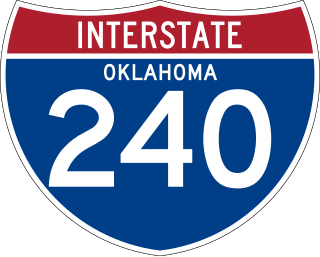
Interstate 240 (I-240) is an Interstate Highway in southern Oklahoma City, Oklahoma, United States, that runs 26.8 miles (43.1 km) from I-40 to I-344 /SH-152. The Interstate overlaps State Highway 3 (SH-3) the longest Oklahoma state highway, for most of its length and functions as a southern bypass around the Downtown area.

<span class="mw-page-title-main">Oklahoma State Highway 74</span> Highway in Oklahoma

State Highway 74, usually abbreviated as SH-74 or OK-74 is the numbering of two different highways maintained by the U.S. state of Oklahoma. These highways were once a single major north–south route, connecting Oklahoma City to more rural parts of the state. The original road stretched from SH-7 near Tatums to SH-11 west of Deer Creek.

<span class="mw-page-title-main">Oklahoma State Highway 7</span> State highway in Oklahoma, United States

State Highway 7 is a 150.5-mile (242.2 km) highway in southern Oklahoma. This lengthy highway connects many towns in Oklahoma's "Little Dixie" area. It runs from Interstate 44 in Lawton to U.S. 69/US-75 in Atoka.

<span class="mw-page-title-main">Oklahoma State Highway 4</span> State highway in Oklahoma, United States

State Highway 4, abbreviated as SH-4 or OK-4, is a designation for two distinct highways maintained by the U.S. state of Oklahoma. One of them serves as an important route through the suburbs west of Oklahoma City, while the other connects US-259 to the Arkansas state line west of Cove, Arkansas. SH-4 has no lettered spur routes.

<span class="mw-page-title-main">Oklahoma State Highway 77H</span> State highway in Oklahoma, United States

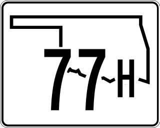
State Highway 77H is a spur that runs from US-77 in Norman, north through a small piece of unincorporated Cleveland County and Moore, to Oklahoma City. The state highway designation ends at I-240, although Sooner Road continues north to its terminus at I-35, I-44, Turner Turnpike, Kilpatrick Turnpike, and SH-66.

<span class="mw-page-title-main">Oklahoma State Highway 6</span> Highway in Oklahoma

State Highway 6, abbreviated SH-6 or OK-6, is a state highway in Oklahoma. It runs in a 121.8 miles (196.0 km) crescent through the southwestern part of the state, running from the Texas state line north of Quanah, Texas, to SH-152 in the unincorporated town of Sweetwater. There are no letter-suffixed spur branching from SH-6.

<span class="mw-page-title-main">Oklahoma State Highway 37</span> State highway in Oklahoma, United States

State Highway 37 is a designation for two separate highways in the state of Oklahoma. The northern section runs between Hinton and Moore in central Oklahoma, while the southern section runs from the Texas state line at the Red River to Idabel, in southeastern Oklahoma. The northern section of SH-37 runs 65.8 miles (105.9 km) from US-281 in Hinton to Sunnylane Road in Moore. The southern section of SH-37 is 12.54 miles (20.18 km) long.

<span class="mw-page-title-main">Oklahoma State Highway 44</span> Highway in Oklahoma

State Highway 44 is a state highway in the western portion of the U.S. state of Oklahoma. It runs for 59.2 miles (95.3 km), beginning north of Blair in Greer County, and proceeding north to Butler in Custer County. It is not to be confused with Interstate 44. The highway has one lettered spur route, SH-44A.

<span class="mw-page-title-main">Oklahoma State Highway 54</span> State highway in Oklahoma, United States

State Highway 54 is a state highway in western Oklahoma. Running north–south, it exists in two parts, which lie at approximately the same longitude. The southern section's length is 9.96 miles (16.03 km), while the northern section runs for 85.5 miles (137.6 km), for a combined length of 95.5 miles (153.7 km). The northern section has two lettered spur routes.

<span class="mw-page-title-main">Interstate 40 in Oklahoma</span> Highway in Oklahoma

Interstate 40 (I-40) is an Interstate Highway in Oklahoma that runs 331 miles (533 km) across the state from Texas to Arkansas. West of Oklahoma City, it parallels and replaces old U.S. Highway 66 (US-66), and, east of Oklahoma City, it parallels US-62, US-266, and US-64. I-40 is the longest Interstate highway in Oklahoma.

<span class="mw-page-title-main">U.S. Route 62 in Oklahoma</span> Highway in Oklahoma

In Oklahoma, U.S. Highway 62 (US 62) runs diagonally across the state, from the Texas state line in far southwestern Oklahoma to the Arkansas state line near Fayetteville. US-62 spends a total of 402.48 miles (647.73 km) in the Sooner State. The highway passes through fifteen of Oklahoma's counties. Along the way the route serves two of Oklahoma's largest cities, Lawton and Oklahoma City, as well as many regionally important cities, like Altus, Chickasha, Muskogee, and Tahlequah. Despite this, US-62 has no lettered spur routes like many other U.S. routes in Oklahoma do.

<span class="mw-page-title-main">U.S. Route 70 in Oklahoma</span> Highway in Oklahoma

U.S. Route 70 is a transcontinental U.S. highway extending from Globe, Arizona to Atlantic, North Carolina. Along the way, 289.81 miles (466.40 km) of its route passes through the state of Oklahoma. Entering the state south of Davidson, the highway serves Oklahoma's southern tier before exiting the state east of Broken Bow. It serves the cities of Ardmore, Durant, Hugo, and Idabel, as well as Tillman, Cotton, Jefferson, Carter, Marshall, Bryan, Choctaw, and McCurtain counties.

<span class="mw-page-title-main">U.S. Route 81 in Oklahoma</span> Segment of American highway

U.S. Route 81 (US-81) is a north–south U.S. highway running through the central United States' Great Plains region, from Fort Worth, Texas to the U.S.–Canadian border at Pembina, North Dakota. A 229.28-mile (368.99 km) segment of the highway lies within the state of Oklahoma. US-81 crosses the Red River from Texas south of Terral, passing through several Oklahoma cities, such as Chickasha, El Reno, Kingfisher, and Enid, before entering Kansas north of Renfrow.

<span class="mw-page-title-main">U.S. Route 412 in Oklahoma</span> Highway in Oklahoma

U.S. Route 412 is a U.S. highway in the south-central portion of the United States, connecting Springer, New Mexico to Columbia, Tennessee. A 504.11-mile (811.29 km) section of the highway crosses the state of Oklahoma, traversing the state from west to east. Entering the state southwest of Boise City, US-412 runs the length of the Oklahoma Panhandle and serves the northern portion of the state's main body, before leaving the state at West Siloam Springs. Along the way, the route serves many notable cities and towns, including Boise City, Guymon, Woodward, Enid, and the state's second-largest city, Tulsa.

<span class="mw-page-title-main">U.S. Route 64 in Oklahoma</span> Highway in Oklahoma

U.S. Route 64 (US-64) is a U.S. highway running from the Four Corners area to the Outer Banks of North Carolina. Between these two points, the highway passes through the entire width of Oklahoma; a total of 591.17 miles (951.40 km) of US-64 lies in the state of Oklahoma. US-64 enters the state from New Mexico, crossing the line between the two states between Clayton, New Mexico, and Boise City in Cimarron County. The route runs the full length of the Oklahoma Panhandle, then serves the northernmost tier of counties in the main body of the state before dipping southeastward to Tulsa, the state's second-largest city. From Tulsa, the highway continues southeast, leaving Oklahoma just west of Fort Smith, Arkansas. In addition to Tulsa, US-64 serves fifteen Oklahoma counties and the cities of Guymon, Woodward, Enid, and Muskogee.

<span class="mw-page-title-main">U.S. Route 75 Alternate (Beggs–Sapulpa, Oklahoma)</span> Alternate highway route in Oklahoma, United States

U.S. 75 Alternate is a 30.15-mile (48.52 km) highway near Tulsa. The southern terminus is at U.S. Highway 75 and SH-16 east of Beggs. The northern terminus is signed at State Highway 66 and State Highway 97 in Sapulpa. However, the highway continues unsigned along SH-66, ending at the north terminus of the Turner Turnpike, where SH-66 merges onto the free portion of I-44. It runs parallel to US-75 for its entire length.

<span class="mw-page-title-main">Business routes of Interstate 40</span> Highway system

Interstate business routes are roads connecting a central or commercial district of a city or town with an Interstate bypass. These roads typically follow along local streets often along a former U.S. Route or state highway that had been replaced by an Interstate. Interstate business route reassurance markers are signed as either loops or spurs using a green shield shaped and numbered like the shield of the parent Interstate highway.

References

  1. 1 2 Google (February 24, 2014). "Oklahoma State Highway 152" (Map). Google Maps . Google. Retrieved February 24, 2014.
    Google (March 1, 2014). "Oklahoma State Highway 152" (Map). Google Maps . Google. Retrieved March 1, 2014.
  2. Oklahoma State Highway System (PDF) (Map) (1927 ed.). Oklahoma State Highway Department. Retrieved 2009-01-28.
  3. Map Showing Condition of Improvement of the State Highway System (PDF) (Map) (October 1935 ed.). Oklahoma Department of Highways. Retrieved 2009-01-28.
  4. Oklahoma (Map) (1961 ed.). Cartography by Rand McNally. Standard Oil.
  5. Map Showing Condition of Improvement of the State Highway System (PDF) (Map) (April 1939 ed.). Oklahoma Department of Highways. Retrieved 2009-01-28.
  6. 1 2 3 4 Oklahoma Department of Transportation, Planning & Research Division. "Memorial Dedication & Revision History - SH-152" . Retrieved 2009-01-28.
  7. Highway Map of Oklahoma (Map) (1966 ed.). Cartography by Diversified Map Co. Skelly Oil Company. § 11C.
  8. Oklahoma Transportation Commission (2 August 2021). "ODOT Commission Meeting" . Retrieved 2 August 2021.
  9. Special Committee on U.S. Route Numbering (November 2023). "2023 Fall Meeting Report to the Council on Highways and Streets" (PDF) (Report). Washington, DC: American Association of State Highway and Transportation Officials. p. 5. Archived (PDF) from the original on December 5, 2023.
  10. Humphrey, Spencer (March 7, 2024). "Multiple OKC-area highways, turnpikes to be designated as interstates in coming month". KFOR.com Oklahoma City. Retrieved March 10, 2024.
  11. 1 2 Oklahoma Department of Transportation (n.d.). Control Section Maps: Washita County (PDF) (Map) (2010–2011 ed.). Scale not given. Oklahoma City: Oklahoma Department of Transportation. Retrieved 2012-04-28.
  12. Moon, Van T. (1939-07-20). "Minutes—Washita County" (PDF). Retrieved 2012-08-30.
  13. Map Showing Condition of Improvement of the State Highway System (PDF) (Map) (1944 ed.). Oklahoma Department of Highways. Retrieved 2008-04-16.
  14. "Southwest JKT Extension" (PDF). Driving Forward OK. Oklahoma Turnpike Authority . Retrieved April 13, 2018.
Template:Attached KML/Oklahoma State Highway 152
KML is not from Wikidata