Oklahoma State Highway 4

Last updated

Oklahoma State Highway 4.svg

State Highway 4

Oklahoma State Highway 4
OK 4 mainline in red
Route information
Maintained by ODOT OTA
History1941–present (western SH-4) [1]
1963–present (eastern SH-4) [2]
Section 1
Length37.3 mi (60.0 km)
South endUS 62.svgUS 277.svgOklahoma State Highway 9.svg US 62  / US 277  / SH-9 south of Newcastle
North endEdmond Road / NW 178th Street in Piedmont
Section 2
Length12.01 mi [3]  (19.33 km)
West endUS 259.svg US 259 in Smithville
East endArkansas 4.svg AR 4 at the Arkansas state line
Location
Country United States
State Oklahoma
Highway system
  • Oklahoma State Highway System
Oklahoma State Highway 3.svg SH-3 Oklahoma State Highway 5.svg SH-5

State Highway 4, abbreviated as SH-4 or OK-4, is a designation for two distinct highways maintained by the U.S. state of Oklahoma. One of them serves as an important route through the suburbs west of Oklahoma City, while the other connects US-259 to the Arkansas state line west of Cove, Arkansas. SH-4 has no lettered spur routes.

Contents

The two SH-4s were never connected. The Central Oklahoma highway was established in 1941 and gradually extended to its present extent between then and 2003. The Eastern Oklahoma highway was originally numbered SH-21, and was renumbered to SH-4 in 1963.

Route description

Central Oklahoma

The northern end of SH-4 in Piedmont. 004ok end.jpg
The northern end of SH-4 in Piedmont.

The western Highway 4 is 37.3 miles (60.0 km) long.[ citation needed ] It begins at the eastern terminus of the H.E. Bailey Turnpike Spur south of Newcastle, Oklahoma. Beyond the western terminus of the tolled spur, SH-4 turns northward as a two-lane road until it reaches SH-37, where it expands to four lanes. Seven miles (11 km) later, it joins with SH-152 in the town of Mustang. [4] One mile (1.6 km) later, SH-4 continues northward along Mustang Road toward Interstate 40 and Yukon. [4]

After crossing I-40, SH-4 becomes a two-lane road once again until entering Yukon, at which point it becomes a four-lane road again. It meets SH-66, once Route 66, in Yukon. Seven miles (11 km) later, it meets the Northwest Expressway (SH-3). [4] It lasts for just three miles (4.8 km) longer until ending at Edmond Road in Piedmont. [4]

Just after crossing SH-3, there is a standard distance sign listing Piedmont and "END OF ROUTE", giving the distance to the terminus of SH-4. This is a relative rarity on Oklahoma highways.

Eastern Oklahoma

The eastern Highway 4 is 12.01 miles (19.33 km) long. [3] It begins at US-259 and goes generally eastwest, passing through the unincorporated communities of Smithville and Watson. After crossing the Arkansas state line, it becomes Highway 4.

History

Central Oklahoma

The western SH-4 was assigned in 1941 to a previously unnumbered roadway between U.S. Highway 66 in Yukon and Piedmont. [1] [5] A continuation of SH-4 east to North May Avenue in Oklahoma City along Ranchwood Boulevard and NW 10th Street had been designated as a farm-to-market road four years earlier. [6] [7] In 1954, SH-4 was extended eastward along the farm-to-market road to a terminus at State Highway 3 and State Highway 74 (May Avenue) southwest of downtown Oklahoma City. [8] [9]

SH-4 remained unchanged until 1979 when it was truncated to its former southern terminus at US-66 in Yukon. [10] The route was then extended to Mustang in 1982, following Ranchwood Boulevard and Mustang Road south to a new terminus at State Highway 152. [11] Construction on a southward extension of SH-4 to State Highway 37 near Tuttle began in 2001 [12] and was completed a year later, as was a new segment between SH-37 and the H.E. Bailey Turnpike (Interstate 44). [13] SH-4 was originally signed only as far south as SH-37; the designation was extended south to I-44 in early 2003.

On August 9, 2021, the Oklahoma Transportation Commission voted to approve the addition of the State Highway 4 designation to the H.E. Bailey Spur.

Eastern Oklahoma

What is now the eastern SH-4 became part of State Highway 21 in 1927 when SH-21 was rerouted north of Bethel to follow modern U.S. Highway 259 and SH-4 to the Arkansas state line. [14] [15] The SH-21 designation was removed in 1963 and replaced with SH-4 from Smithville east to the state line near Watson. Only minor realignments, such as the straightening of the roadway near Smithville and the replacement of a historic truss bridge by a modern span have occurred since. [2]

Junction list

Central Oklahoma

CountyLocationmikmDestinationsNotes
McClain US 62.svgUS 277.svgOklahoma State Highway 9.svg US 62  / US 277  / SH-9 Southern terminus
See H. E. Bailey Norman Spur
Grady 0.000.00 H.E. Bailey SpurBlanchard, Norman Tolled
I-44.svg I-44 (H.E. Bailey Turnpike) Oklahoma City, Chickasha, Lawton
CR 1226 westLast free junction southbound
Tuttle 4.06.4Oklahoma State Highway 37.svg SH-37
Canadian Mustang 9.615.4East plate.svg
Oklahoma State Highway 152.svg
SH-152 east
Southern terminus of SH-152 concurrency
10.617.1West plate.svg
Oklahoma State Highway 152.svg
SH-152 west
Northern terminus of SH-152 concurrency
Oklahoma City 16.125.9I-40.svgUS 270.svg I-40  / US 270  Amarillo, Oklahoma City I-40 EB exit 138A, WB exit 139
Yukon 19.230.9East plate.svg
Oklahoma State Highway 66.svg
SH-66 east (Main Street east)
Southern terminus of SH-66 concurrency
19.531.4West plate.svg
Oklahoma State Highway 66.svg
SH-66 west (Main Street west)
Northern terminus of SH-66 concurrency; Main St. is former US 66
Oklahoma City 26.242.2Oklahoma State Highway 3.svg SH-3 (Northwest Expressway)
Piedmont 29.547.5NW 178th Street / Edmond RoadNorthern terminus; road continues as Piedmont Road
1.000 mi = 1.609 km; 1.000 km = 0.621 mi

Eastern Oklahoma

The entire route is in McCurtain County. [16]

Location [16] mi [3] kmDestinationsNotes
Smithville 0.000.00US 259.svg US 259 Western terminus
12.0119.33East plate.svg
Arkansas 4.svg
AR 4 east
Continuation into Arkansas
1.000 mi = 1.609 km; 1.000 km = 0.621 mi

Related Research Articles

<span class="mw-page-title-main">U.S. Route 259</span> U.S. Numbered Highway in Texas and Oklahoma in the United States

U.S. Route 259 is a north–south spur of U.S. Route 59 that runs for 250 miles (400 km) through rural areas of northeastern Texas and southeastern Oklahoma. The highway's southern terminus is near Nacogdoches, Texas, at an interchange with its parent route, US 59. Its northern terminus is in the Ouachita Mountains, approximately 15 miles (24 km) south of Heavener, Oklahoma, where it reunites with US 59. For most of its length, US 259 lies 30–50 miles (48–80 km) to the west of its parent route.

<span class="mw-page-title-main">Oklahoma State Highway 97</span> State highway in Oklahoma, United States

State Highway 97 is a 19.86-mile (31.96 km) state highway, maintained by the U.S. state of Oklahoma. It connects two towns in the northeast part of the state: Sapulpa and Sand Springs. Several communities of West Tulsa are along the road between these two towns, including Pretty Water, Allen, and Prattville.

<span class="mw-page-title-main">Cimarron Turnpike</span> Toll road in Oklahoma, US

The Cimarron Turnpike is a controlled-access toll road in north-central Oklahoma. The route travels 67 miles (108 km), from an interchange with Interstate 35 (I-35) north of Perry, to Westport, just west of Tulsa. The route also consists of a 7.2-mile (11.6 km) spur which runs from the mainline southwest to an interchange with U.S. Route 177 (US-177) north of Stillwater.

<span class="mw-page-title-main">Oklahoma State Highway 66</span> Highway in Oklahoma

State Highway 66 is a 192.7-mile (310.1 km) state highway in the U.S. state of Oklahoma, beginning at U.S. Highway 81 in El Reno and ending at U.S. Highway 60 near White Oak. The highway was designated in 1985 as a replacement for the decommissioned U.S. Highway 66. Although most of the highway follows Historic Route 66, the highway follows US 66's final alignment, joining Interstate 44 through Tulsa and Oklahoma City, while older versions of the route follow various city streets through both cities.

<span class="mw-page-title-main">Oklahoma State Highway 74</span> Highway in Oklahoma

State Highway 74, usually abbreviated as SH-74 or OK-74 is the numbering of two different highways maintained by the U.S. state of Oklahoma. These highways were once a single major north–south route, connecting Oklahoma City to more rural parts of the state. The original road stretched from SH-7 near Tatums to SH-11 west of Deer Creek.

<span class="mw-page-title-main">Oklahoma State Highway 9</span> Highway in Oklahoma

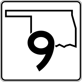
State Highway 9, abbreviated as SH-9, OK-9, or simply Highway 9, is a major east–west highway in the U.S. state of Oklahoma. Spanning across the central part of the state, SH-9 begins at the Texas state line west of Vinson, Oklahoma, and ends at the Arkansas state line near Fort Smith, Arkansas. State Highway 9 is a major highway around the Norman area. At 348.1 miles (560.2 km), SH-9 is Oklahoma's second-longest state highway.

<span class="mw-page-title-main">Oklahoma State Highway 7</span> State highway in Oklahoma, United States

State Highway 7 is a 150.5-mile (242.2 km) highway in southern Oklahoma. This lengthy highway connects many towns in Oklahoma's "Little Dixie" area. It runs from Interstate 44 in Lawton to U.S. 69/US-75 in Atoka.

<span class="mw-page-title-main">Oklahoma State Highway 98</span> Highway in Oklahoma

State Highway 98, also abbreviated to SH-98 or OK-98, is a highway maintained by the U.S. state of Oklahoma. It travels for 19.67 miles (31.66 km) through McCurtain County It has one unsigned spur route, SH-98S.

<span class="mw-page-title-main">Oklahoma State Highway 77H</span> State highway in Oklahoma, United States

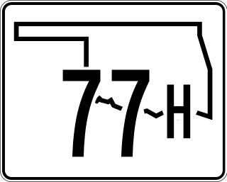
State Highway 77H is a spur that runs from US-77 in Norman, north through a small piece of unincorporated Cleveland County and Moore, to Oklahoma City. The state highway designation ends at I-240, although Sooner Road continues north to its terminus at I-35, I-44, Turner Turnpike, Kilpatrick Turnpike, and SH-66.

<span class="mw-page-title-main">Oklahoma State Highway 8</span> Highway in Oklahoma

State Highway 8, also abbreviated as SH-8 or OK-8, is a highway maintained by the U.S. state of Oklahoma. Because it runs mainly north–south, it has an even number. Highway 8 runs from U.S. Highway 277 in Cyril, Oklahoma to the state line south of Kiowa, Kansas, for a total length of 179.1 miles (288.2 km) The highway has two lettered spur routes.

<span class="mw-page-title-main">Oklahoma State Highway 10</span> Highway in Oklahoma

State Highway 10 is a state highway in northeastern Oklahoma. It makes a 233.1 miles (375.1 km) crescent through the northeast corner of the state, running from SH-99 in Osage County to Interstate 40 (I-40) near Gore. It has two lettered spur routes.

<span class="mw-page-title-main">Oklahoma State Highway 152</span> Highway in Oklahoma

State Highway 152 is a state highway running through west-central Oklahoma. It begins at the Texas state line, serving as a continuation of Texas State Highway 152, and continues east to end at Interstate 44 (I-44) in southwest Oklahoma City, a length of 149.2 miles (240.1 km). Along its route it serves three county seats: Sayre, Cordell, and Oklahoma City. Near its eastern end, it passes through the Oklahoma City suburb of Mustang. The easternmost 5.2 miles (8.4 km) of the route is a freeway linking Will Rogers World Airport to the Interstate system. SH-152 has no lettered spur routes.

<span class="mw-page-title-main">Oklahoma State Highway 22</span>

State Highway 22 is a state highway in Oklahoma. It runs in a 47.4-mile (76.3 km) west-to-east pattern through the south-central part of the state, running from SH-1 at Ravia to US-70 at Bokchito. There are no letter-suffixed spur highways branching from SH-22.

<span class="mw-page-title-main">Oklahoma State Highway 100</span> Highway in Oklahoma

State Highway 100 is a 54.9-mile (88.4 km) long (88.4 km) state highway in eastern Oklahoma. It connects Interstate 40 with the Arkansas state line near Stilwell. It has no lettered spur routes.

<span class="mw-page-title-main">Oklahoma State Highway 87</span> State highway in Oklahoma, United States

State Highway 87 is a highway in southeastern Oklahoma, running for 14.58 miles (23.46 km). It passes through the extreme southeastern corner of the state, running entirely through McCurtain Co. It has no lettered spur routes.

<span class="mw-page-title-main">Oklahoma State Highway 128</span> State highway in Oklahoma, United States

State Highway 128 is a 9.81-mile-long (15.79 km) state highway in Le Flore County, Oklahoma. It connects U.S. Route 59 in Heavener to the Arkansas state line, where it becomes Arkansas Highway 28. It has no lettered spur routes.

<span class="mw-page-title-main">Oklahoma State Highway 58</span> Highway in Oklahoma

State Highway 58 is the name of two state highways in Oklahoma. One of them runs for 72.7 miles (117.0 km) from Medicine Park to the Blaine–Custer County line near Hydro, and the other connects US-270/281/SH-3/33 to the Kansas state line, a length of 105.9 mi (170.4 km). The northern section has one lettered spur route, SH-58A.

<span class="mw-page-title-main">Oklahoma State Highway 63</span> State highway in Oklahoma, United States

State Highway 63 is a 96.7 mile (155.6 km) state highway in southeastern Oklahoma. It runs from U.S. Highway 69 in Kiowa to the Arkansas state line. SH-1 forms a concurrency with SH-63 for 37.8 miles (60.8 km), nearly 40 percent of the highway's length. SH-63 has one spur route, designated as SH-63A.

<span class="mw-page-title-main">Oklahoma State Highway 95</span>

State Highway 95 is a state highway in the Panhandle region of the U.S. state of Oklahoma. This route, which is 42.1 miles (67.8 km) long, runs entirely through western Texas County. SH-95 does not have any lettered spur routes.

<span class="mw-page-title-main">U.S. Route 412 in Oklahoma</span> Highway in Oklahoma

U.S. Route 412 is a U.S. highway in the south-central portion of the United States, connecting Springer, New Mexico to Columbia, Tennessee. A 504.11-mile (811.29 km) section of the highway crosses the state of Oklahoma, traversing the state from west to east. Entering the state southwest of Boise City, US-412 runs the length of the Oklahoma Panhandle and serves the northern portion of the state's main body, before leaving the state at West Siloam Springs. Along the way, the route serves many notable cities and towns, including Boise City, Guymon, Woodward, Enid, and the state's second-largest city, Tulsa.

References

  1. 1 2 Map Showing Condition of Improvement of the State Highway System (PDF) (Map). Oklahoma Department of Highways. 1941. Retrieved 2007-12-07.
  2. 1 2 Oklahoma (PDF) (Map). Oklahoma Department of Highways. 1963. Retrieved 2007-12-07.
  3. 1 2 3 Oklahoma Department of Transportation (n.d.). Control Section Maps: McCurtain County (PDF) (Map). Scale not given. Oklahoma City: Oklahoma Department of Transportation. Retrieved 2010-06-28.
  4. 1 2 3 4 Official State Map (PDF) (Map) (2009–10 ed.). Oklahoma Department of Transportation. Retrieved 2010-06-29.
  5. Map Showing Condition of Improvement of the State Highway System (PDF) (Map). Oklahoma Department of Highways. 1940. Retrieved 2007-12-07.
  6. Map Showing Condition of Improvement of the State Highway System and Landing Fields (PDF) (Map). Oklahoma Department of Highways. 1936. Retrieved 2007-12-07.
  7. Map Showing Condition of Improvement of the State Highway System (PDF) (Map). Oklahoma Department of Highways. 1937. Retrieved 2007-12-07.
  8. Highways of Oklahoma (PDF) (Map). Oklahoma Department of Highways. 1954. Retrieved 2007-12-07.
  9. Highways of Oklahoma (back side) (PDF) (Map). Oklahoma Department of Highways. 1954. Retrieved 2007-12-07.
  10. Official State Map (PDF) (Map). Oklahoma Department of Transportation. 1979. Retrieved 2007-12-07.
  11. Official State Map (PDF) (Map). Oklahoma Department of Transportation. 1982. Retrieved 2007-12-07.
  12. Official State Map (PDF) (Map) (2001-2002 ed.). Oklahoma Department of Transportation . Retrieved 2007-12-07.
  13. The Road Atlas - Large Scale - United States (Map). Rand McNally. 2002. p. 168. § G13.
  14. Oklahoma State Highway System (PDF) (Map). Oklahoma Department of Highways. 1926. Retrieved 2007-12-07.
  15. Oklahoma State Highway System (PDF) (Map). Oklahoma Department of Highways. 1927. Retrieved 2007-12-07.
  16. 1 2 Geography Division (2016). "Oklahoma Governmental Unit Reference Map". United States Census Bureau . Retrieved January 27, 2017.
Template:Attached KML/Oklahoma State Highway 4
KML is from Wikidata