Oldenburg, Indiana

Last updated

Oldenburg, Indiana
Oldenburg, Indiana.jpg
Franklin County Indiana Incorporated and Unincorporated areas Oldenburg Highlighted 1856286.svg
Location of Oldenburg in Franklin County, Indiana.
Coordinates: 39°20′20″N85°12′15″W / 39.33889°N 85.20417°W / 39.33889; -85.20417
Country United States
State Indiana
County Franklin
Township Ray
Area
[1]
  Total0.43 sq mi (1.12 km2)
  Land0.43 sq mi (1.11 km2)
  Water0.00 sq mi (0.01 km2)
Elevation
[2]
879 ft (268 m)
Population
 (2020)
  Total647
  Density1,504.65/sq mi (581.15/km2)
Time zone UTC-5 (Eastern (EST))
  Summer (DST) UTC-4 (EDT)
ZIP code
47036
Area code 812
FIPS code 18-56286 [3]
GNIS feature ID2396831 [2]
Website www.freudenfest.com

Oldenburg is a town in Ray Township, Franklin County, Indiana, United States. The population was 674 at the 2010 census.

Contents

Geography

According to the 2010 census, Oldenburg has a total area of 0.43 square miles (1.11 km2), all land. [4]

History

Interior of Holy Family Catholic Church in Oldenburg Holy Family Catholic Church (Oldenburg, Indiana) - interior, nave before a wedding Mass.jpg
Interior of Holy Family Catholic Church in Oldenburg

Oldenburg was founded in 1837 by a group of German settlers. [5] The town was named after Oldenburg, in Germany. [6] Incorporated in 1881, [7] Oldenburg is called the "Village of Spires" because of its churches and religious educational institutions. In 1851, Mother Theresa Hackelmeier (1827-1860) founded the Sisters of St. Francis of Oldenburg who would open numerous schools in the Midwest.

The Oldenburg Historic District was listed on the National Register of Historic Places in 1983. [8]

Fly-over view of Oldenburg Oldenburg-indiana-from-above.jpg
Fly-over view of Oldenburg

Demographics

Historical population
CensusPop.Note
1860 300
1870 160−46.7%
1880 673320.6%
1890 6902.5%
1900 95738.7%
1910 956−0.1%
1920 628−34.3%
1930 575−8.4%
1940 533−7.3%
1950 59110.9%
1960 69417.4%
1970 7589.2%
1980 7701.6%
1990 715−7.1%
2000 647−9.5%
2010 6744.2%
2020 647−4.0%
U.S. Decennial Census [9]

2010 census

As of the census [10] of 2010, there were 674 people, 235 households, and 156 families living in the town. The population density was 1,567.4 inhabitants per square mile (605.2/km2). There were 268 housing units at an average density of 623.3 per square mile (240.7/km2). The racial makeup of the town was 98.5% White, 0.1% African American, 0.6% from other races, and 0.7% from two or more races. Hispanic or Latino of any race were 1.9% of the population.

There were 235 households, of which 30.6% had children under the age of 18 living with them, 52.3% were married couples living together, 10.6% had a female householder with no husband present, 3.4% had a male householder with no wife present, and 33.6% were non-families. 29.4% of all households were made up of individuals, and 14.9% had someone living alone who was 65 years of age or older. The average household size was 2.39 and the average family size was 2.97.

The median age in the town was 51 years. 20.6% of residents were under the age of 18; 5.8% were between the ages of 18 and 24; 17.3% were from 25 to 44; 26.7% were from 45 to 64; and 29.5% were 65 years of age or older. The gender makeup of the town was 39.3% male and 60.7% female.

2000 census

As of the census [3] of 2000, there were 647 people, 215 households, and 135 families living in the town. The population density was 1,554.2 inhabitants per square mile (600.1/km2). There were 228 housing units at an average density of 547.7 per square mile (211.5/km2). The racial makeup of the town was 98.92% White, 0.46% Asian, and 0.62% from two or more races. Hispanic or Latino of any race were 0.15% of the population.

There were 215 households, out of which 27.4% had children under the age of 18 living with them, 54.4% were married couples living together, 7.0% had a female householder with no husband present, and 37.2% were non-families. 34.4% of all households were made up of individuals, and 19.5% had someone living alone who was 65 years of age or older. The average household size was 2.31 and the average family size was 3.01.

In the town, the population was spread out, with 17.3% under the age of 18, 5.1% from 18 to 24, 21.2% from 25 to 44, 21.8% from 45 to 64, and 34.6% who were 65 years of age or older. The median age was 49 years. For every 100 females, there were 63.0 males. For every 100 females age 18 and over, there were 55.5 males.

The median income for a household in the town was $42,292, and the median income for a family was $56,042. Males had a median income of $36,635 versus $28,571 for females. The per capita income for the town was $19,620. About 2.3% of families and 17.7% of the population were below the poverty line, including 1.8% of those under age 18 and 41.6% of those age 65 or over.

Notable natives of Oldenburg

Related Research Articles

<span class="mw-page-title-main">Bethany, Indiana</span> Town in Indiana, United States

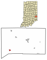
Bethany is a town in Clay Township, Morgan County, in the U.S. state of Indiana. The population was 95 at the 2020 census.

<span class="mw-page-title-main">Paragon, Indiana</span> Town in Indiana, United States

Paragon is a town in Ray Township, Morgan County, in the U.S. state of Indiana. The population was 556 at the 2020 census, down from 659 in 2010.

<span class="mw-page-title-main">Hersey, Maine</span> Town in the state of Maine, United States

Hersey is a town in Aroostook County, Maine, United States. The population was 73 at the 2020 census.

<span class="mw-page-title-main">Island Falls, Maine</span> Town in the state of Maine, United States

Island Falls is a town in Aroostook County, Maine, United States. The population was 758 at the 2020 census. The primary village of Island Falls in the town is situated at a falls in the West Branch Mattawamkeag River.

<span class="mw-page-title-main">Linneus, Maine</span> Town in the state of Maine, United States

Linneus is a town in Aroostook County, Maine, United States. The population was 947 at the 2020 census. It is named after Carl Linnaeus.

Carrabassett Valley is a town in Franklin County, Maine, United States. The population was 673 at the 2020 census.

Greenwood is a town in Oxford County, Maine, United States. The population was 774 at the 2020 census. The town was named for surveyor Alexander Greenwood. The village of Locke Mills, on State Route 26 in the northern part of Greenwood, is the town's urban center and largest settlement.

Lowell is a town in Penobscot County, Maine, United States. The population was 368 at the 2020 census.

<span class="mw-page-title-main">Burnham, Maine</span> Town in the state of Maine, United States

Burnham is a town in Waldo County, Maine, United States. The population was 1,096 at the 2020 census.

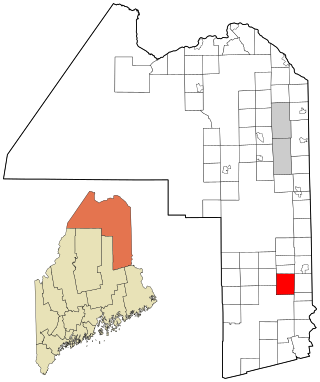
Crawford is a town in Washington County, Maine, United States. The town was named after William H. Crawford, Secretary of the Treasury. The population was 93 at the 2020 census.

<span class="mw-page-title-main">Nashwauk, Minnesota</span> City in Minnesota, United States

Nashwauk is a town in Itasca County, Minnesota, United States. The population was 970 at the 2020 census.

<span class="mw-page-title-main">Lewis and Clark Village, Missouri</span> Village in Missouri, United States

Lewis and Clark Village is a village in Buchanan County, Missouri, United States. The population was 96 at the 2020 census. It is part of the St. Joseph, MO–KS Metropolitan Statistical Area.

<span class="mw-page-title-main">Scotsdale, Missouri</span> Village in Missouri, United States

Scotsdale is a village in Jefferson County, Missouri, United States. The population was 222 at the 2010 census.

<span class="mw-page-title-main">Junior, West Virginia</span> Town in West Virginia, United States

Junior is a town in Barbour County, West Virginia, United States, situated along the Tygart Valley River. The population was 384 at the 2020 census.

<span class="mw-page-title-main">Leon, West Virginia</span> Town in West Virginia, United States

Leon is a town in Mason County, West Virginia, United States, situated along the Kanawha River. The population was 137 at the 2020 census. It is part of the Point Pleasant, WV–OH Micropolitan Statistical Area.

<span class="mw-page-title-main">Davy, West Virginia</span> Town in West Virginia, United States

Davy is a town in McDowell County, West Virginia, United States. The population was 420 at the 2010 census. Founded in 1873, the town was originally called Hallsville but the name would change to Davy by 1901. Davy was officially incorporated in 1948. It is a mostly residential community in a coal mining district along the main line of the Norfolk Southern Railway.

<span class="mw-page-title-main">Peterstown, West Virginia</span> Town in West Virginia, United States

Peterstown is a town in Monroe County, West Virginia, United States. The population was 456 at the 2020 census.

<span class="mw-page-title-main">Newburg, West Virginia</span> Town in West Virginia, United States

Newburg is a town in western Preston County, West Virginia, United States. The population was 275 at the 2020 census. It is part of the Morgantown metropolitan area.

<span class="mw-page-title-main">Montrose, West Virginia</span> Town in West Virginia, United States

Montrose is a town in Randolph County, West Virginia, United States. The population was 141 at the 2020 census.

<span class="mw-page-title-main">Hambleton, West Virginia</span> Town in West Virginia, United States

Hambleton is a town in Tucker County, West Virginia, United States. The population was 216 at the 2020 census. Hambleton was established in 1889, but not incorporated until 1905. It was named by then United States Senator Stephen B. Elkins in honor of a stockholder by this name in the West Virginia Central Railroad Company. The town was previously known as Hulings.

References

  1. "2020 U.S. Gazetteer Files". United States Census Bureau. Retrieved March 16, 2022.
  2. 1 2 U.S. Geological Survey Geographic Names Information System: Oldenburg, Indiana
  3. 1 2 "U.S. Census website". United States Census Bureau . Retrieved January 31, 2008.
  4. "G001 - Geographic Identifiers - 2010 Census Summary File 1". United States Census Bureau. Archived from the original on February 13, 2020. Retrieved July 17, 2015.
  5. Hunter, David (October 1, 2003). Shifra Stein's Day Trips from Cincinnati: Getaways Less Than Two Hours Away. Globe Pequot. p. 8. ISBN   9780762727490 . Retrieved April 26, 2013.
  6. "Oldenburg". Franklin County Historical Society. Retrieved July 23, 2015.
  7. Reifel, August Jacob (1915). History of Franklin County, Indiana. Windmill Publications. pp.  168.
  8. "National Register Information System". National Register of Historic Places . National Park Service. July 9, 2010.
  9. "Census of Population and Housing". Census.gov. Retrieved June 4, 2015.
  10. "U.S. Census website". United States Census Bureau . Retrieved December 11, 2012.