Brookville, Indiana

Last updated

Brookville, Indiana
Town of Brookville
Brookville, Indiana (2023).jpg
Main Street in Brookville
Franklin County Indiana Incorporated and Unincorporated areas Brookville Highlighted 1808182.svg
Location of Brookville in Franklin County, Indiana.
Coordinates: 39°25′35″N85°00′12″W / 39.42639°N 85.00333°W / 39.42639; -85.00333
Country United States
State Indiana
County Franklin
Township Brookville
Area
[1]
  Total1.45 sq mi (3.75 km2)
  Land1.40 sq mi (3.62 km2)
  Water0.05 sq mi (0.13 km2)
Elevation
[2]
627 ft (191 m)
Population
 (2020)
  Total2,622
  Density1,876.88/sq mi (724.62/km2)
Time zone UTC-5 (EST)
  Summer (DST) UTC-5 (EST)
ZIP code
47012
Area code 765
FIPS code 18-08182 [3]
GNIS feature ID2396609 [2]
Website brookvilleindiana.org

Brookville is a town in Brookville Township, Franklin County, Indiana, United States. The town is the county seat of and the largest community entirely within Franklin County. The population was 2,596 at the 2010 census. [4] [5]

Contents

History

Brookville was platted in 1808 by Thomas Manwarring. [6] The town derives its name from Brooks, the maiden name of a settler's mother. [7] A post office has been in operation at Brookville since 1816. [8]

Geography

Brookville contains the confluence of the East and West forks of the Whitewater River; the East Fork forms a portion of the eastern boundary of the town. Brookville is also at the southern end of Brookville Lake, impounded in 1974 by the United States Army Corps of Engineers.

According to the 2010 census, Brookville has a total area of 1.54 square miles (3.99 km2), of which 1.5 square miles (3.88 km2) (or 97.4%) is land and 0.04 square miles (0.10 km2) (or 2.6%) is water. [9]

Climate

The climate in this area is characterized by hot, humid summers and generally mild to cool winters. According to the Köppen Climate Classification system, Brookville has a humid subtropical climate, abbreviated "Cfa" on climate maps. [10]

Climate data for Brookville, Indiana (1991–2020 normals, extremes 1925–present)
MonthJanFebMarAprMayJunJulAugSepOctNovDecYear
Record high °F (°C)75
(24)
78
(26)
88
(31)
89
(32)
96
(36)
105
(41)
108
(42)
108
(42)
104
(40)
94
(34)
86
(30)
76
(24)
108
(42)
Mean maximum °F (°C)60.4
(15.8)
65.6
(18.7)
75.4
(24.1)
83.4
(28.6)
89.1
(31.7)
93.4
(34.1)
95.0
(35.0)
94.2
(34.6)
92.4
(33.6)
85.4
(29.7)
73.3
(22.9)
64.2
(17.9)
96.5
(35.8)
Mean daily maximum °F (°C)38.1
(3.4)
42.4
(5.8)
53.0
(11.7)
65.8
(18.8)
75.6
(24.2)
83.6
(28.7)
87.1
(30.6)
86.4
(30.2)
80.5
(26.9)
68.3
(20.2)
54.3
(12.4)
42.6
(5.9)
64.8
(18.2)
Daily mean °F (°C)29.3
(−1.5)
32.5
(0.3)
41.8
(5.4)
53.2
(11.8)
63.4
(17.4)
71.9
(22.2)
75.4
(24.1)
74.4
(23.6)
67.5
(19.7)
55.3
(12.9)
43.4
(6.3)
34.1
(1.2)
53.5
(11.9)
Mean daily minimum °F (°C)20.5
(−6.4)
22.6
(−5.2)
30.6
(−0.8)
40.5
(4.7)
51.2
(10.7)
60.1
(15.6)
63.7
(17.6)
62.3
(16.8)
54.5
(12.5)
42.4
(5.8)
32.6
(0.3)
25.5
(−3.6)
42.2
(5.7)
Mean minimum °F (°C)−1.5
(−18.6)
4.1
(−15.5)
14.3
(−9.8)
26.3
(−3.2)
36.1
(2.3)
48.0
(8.9)
53.9
(12.2)
51.7
(10.9)
40.9
(4.9)
28.6
(−1.9)
19.4
(−7.0)
8.0
(−13.3)
−4.4
(−20.2)
Record low °F (°C)−31
(−35)
−22
(−30)
−9
(−23)
16
(−9)
25
(−4)
36
(2)
44
(7)
40
(4)
23
(−5)
15
(−9)
−7
(−22)
−20
(−29)
−31
(−35)
Average precipitation inches (mm)3.36
(85)
2.67
(68)
3.58
(91)
4.60
(117)
4.79
(122)
4.89
(124)
3.89
(99)
3.00
(76)
2.96
(75)
3.30
(84)
3.40
(86)
3.37
(86)
43.81
(1,113)
Average snowfall inches (cm)6.1
(15)
5.0
(13)
2.1
(5.3)
0.0
(0.0)
0.0
(0.0)
0.0
(0.0)
0.0
(0.0)
0.0
(0.0)
0.0
(0.0)
0.1
(0.25)
0.3
(0.76)
4.0
(10)
17.6
(45)
Average precipitation days (≥ 0.01 in)10.59.310.911.912.711.09.88.37.88.79.511.3121.7
Average snowy days (≥ 0.1 in)3.83.51.40.20.00.00.00.00.00.10.53.012.5
Source: NOAA [11] [12]

Demographics

Historical population
CensusPop.Note
1850 1,177
1860 1,2849.1%
1880 1,813
1890 2,02811.9%
1900 2,0370.4%
1910 2,1696.5%
1920 2,2202.4%
1930 2,148−3.2%
1940 2,1942.1%
1950 2,53815.7%
1960 2,5962.3%
1970 2,86410.3%
1980 2,9804.1%
1990 2,529−15.1%
2000 2,6524.9%
2010 2,596−2.1%
2020 2,6221.0%
U.S. Decennial Census [13]

2010 census

As of the census [14] of 2010, there were 2,596 people, 1,160 households, and 673 families living in the town. The population density was 1,730.7 inhabitants per square mile (668.2/km2). There were 1,307 housing units at an average density of 871.3 per square mile (336.4/km2). The racial makeup of the town was 97.5% White, 0.3% African American, 0.3% Native American, 0.2% Asian, 0.8% from other races, and 0.9% from two or more races. Hispanic or Latino of any race were 1.6% of the population.

There were 1,160 households, of which 29.2% had children under the age of 18 living with them, 39.4% were married couples living together, 12.7% had a female householder with no husband present, 5.9% had a male householder with no wife present, and 42.0% were non-families. 37.8% of all households were made up of individuals, and 20.7% had someone living alone who was 65 years of age or older. The average household size was 2.24 and the average family size was 2.91.

The median age in the town was 39.6 years. 24.1% of residents were under the age of 18; 9.2% were between the ages of 18 and 24; 22.4% were from 25 to 44; 24% were from 45 to 64; and 20.2% were 65 years of age or older. The gender makeup of the town was 46.8% male and 53.2% female.

2000 census

As of the census [3] of 2000, there were 2,652 people, 1,145 households, and 683 families living in the town. The population density was 1,982.4 inhabitants per square mile (765.4/km2). There were 1,276 housing units at an average density of 953.8/mi2 (367.7/km2). The racial makeup of the town was 98.91% White, 0.04% African American, 0.19% Native American, 0.34% Asian, 0.19% from other races, and 0.34% from two or more races. Hispanic or Latino of any race were 0.53% of the population.

There were 1,145 households, out of which 26.3% had children under the age of 18 living with them, 43.8% were married couples living together, 12.2% had a female householder with no husband present, and 40.3% were non-families. 36.5% of all households were made up of individuals, and 21.0% had someone living alone who was 65 years of age or older. The average household size was 2.24 and the average family size was 2.93.

In the town, the population was spread out, with 23.5% under the age of 18, 8.3% from 18 to 24, 26.7% from 25 to 44, 19.8% from 45 to 64, and 21.6% who were 65 years of age or older. The median age was 39 years. For every 100 females, there were 85.1 males. For every 100 females age 18 and over, there were 84.7 males.

The median income for a household in the town was $29,390, and the median income for a family was $37,212. Males had a median income of $29,009 versus $23,910 for females. The per capita income for the town was $17,360. About 4.4% of families and 8.0% of the population were below the poverty line, including 6.6% of those under age 18 and 8.6% of those age 65 or over.

Arts and culture

The Brookville Historic District, Franklin County Seminary, The Hermitage, and Whitewater Canal Historic District are listed on the National Register of Historic Places. [15]

The town has a free lending library, the Franklin County Public Library District. [16]

Infrastructure

Transportation

The main mode of transportation is by road. Major routes running through the town include U.S. Route 52, State Road 1, State Road 101, and State Road 252.

Brookville Reservoir is registered with the Federal Aviation Administration [17] and the International Civil Aviation Organization as a civil airport assigned ICAO code K12I. It is only suitable for aircraft capable of water landing because there are no paved runways. Brookville Reservoir Airport is owned by the Indiana Department of Natural Resources.

Notable people

See also

Related Research Articles

<span class="mw-page-title-main">Union County, Indiana</span> County in Indiana, United States

Union County is a county in the U.S. state of Indiana. As of the 2020 United States census, the population was 7,087. The county seat is Liberty.

<span class="mw-page-title-main">Franklin County, Indiana</span> County in Indiana, United States

Franklin County is a county on the eastern border of the U.S. state of Indiana. In the 2020 United States Census, the county population was 22,785. The county seat is the town of Brookville. Franklin County is part of the Cincinnati, OH–KY–IN Metropolitan Statistical Area. The only incorporated city in Franklin County is Batesville, which lies mostly in adjoining Ripley County.

<span class="mw-page-title-main">Fayette County, Indiana</span> County in Indiana, United States

Fayette County is one of 92 counties in U.S. state of Indiana located in the east central portion of the state. As of 2020, the population was 23,398. Most of the county is rural; land use is farms, pasture and unincorporated woodland. The county seat and only incorporated town is Connersville, which holds a majority of the county's population.

<span class="mw-page-title-main">Jonesville, Indiana</span> Town in Indiana, United States

Jonesville is a town in Wayne Township, Bartholomew County, in the U.S. state of Indiana. The population was 177 at the 2010 census. It is part of the Columbus, Indiana metropolitan statistical area.

<span class="mw-page-title-main">English, Indiana</span> Town in Indiana, United States

English is a town and the county seat of Crawford County, Indiana, United States. The population was 645 at the 2010 census, making it one of Indiana's smallest county seats. The settlement was named Hartford (1839-1884) prior to its incorporation.

<span class="mw-page-title-main">Cedar Grove, Indiana</span> Town in Indiana, United States

Cedar Grove is a town in Highland Township, Franklin County, Indiana, United States. The population was 156 at the 2010 census.

<span class="mw-page-title-main">Laurel, Indiana</span> Town in Indiana, United States

Laurel is a town in Laurel Township, Franklin County, Indiana, United States. The population was 512 at the 2010 census.

<span class="mw-page-title-main">Mount Carmel, Indiana</span> Town in Indiana, United States

Mount Carmel is a town in Springfield Township, Franklin County, Indiana, United States. The population was 86 at the 2010 census.

<span class="mw-page-title-main">Bargersville, Indiana</span> Town in Indiana, United States

Bargersville is a town in White River and Union townships, Johnson County, Indiana, United States. The population was 9,560 at the 2020 census.

<span class="mw-page-title-main">Shoals, Indiana</span> Town in Indiana, United States

Shoals is a town in Center and Halbert townships and the county seat of Martin County, in the U.S. state of Indiana. The population was 677 at the 2020 census, down from 756 in 2010.

<span class="mw-page-title-main">Spencer, Indiana</span> Town in Indiana, United States

Spencer is a town in Washington Township, Owen County, in the U.S. state of Indiana. The population was 2,217 at the 2010 census. It is the county seat of Owen County.

<span class="mw-page-title-main">Rockville, Indiana</span> Town in Indiana, United States

Rockville is a town in Adams Township, Parke County, in the U.S. state of Indiana. The population was 2,607 at the 2010 census. The town is the county seat of Parke County. It is known as "The Covered Bridge Capital of the World".

<span class="mw-page-title-main">Sunman, Indiana</span> Town in Indiana, United States

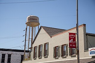
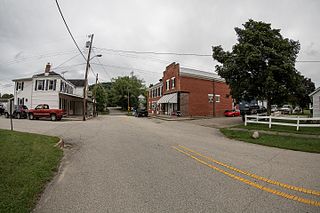
Sunman is a town in Adams Township, Ripley County, in the U.S. state of Indiana. The population was 1,049 at the 2010 census.

<span class="mw-page-title-main">Whitewater, Indiana</span> Town in Indiana, United States

Whitewater is a town in Franklin Township, Wayne County, in the U.S. state of Indiana. The population was 83 at the 2010 census.

<span class="mw-page-title-main">Brookville, Kansas</span> City in Saline County, Kansas

Brookville is a city in Saline County, Kansas, United States. As of the 2020 census, the population of the city was 247.

<span class="mw-page-title-main">New Sharon, Maine</span> Town in the state of Maine, United States

New Sharon is a town in Franklin County, Maine, incorporated in 1794. The population was 1,458 at the 2020 census. The town is roughly bisected by the Sandy River, a tributary of the Kennebec River.

<span class="mw-page-title-main">Harrison, Ohio</span> City in Ohio, United States

Harrison is a city in western Hamilton County, Ohio, United States. The population was 12,563 at the 2020 census. It is part of the Cincinnati metropolitan area.

<span class="mw-page-title-main">Franklin Township, Butler County, Pennsylvania</span> Township in Pennsylvania, United States

Franklin Township is a township in Butler County, Pennsylvania, United States. The population was 2,596 at the 2020 census.

<span class="mw-page-title-main">Eleanor, West Virginia</span> Town in West Virginia, United States

Eleanor is a town in Putnam County, West Virginia, United States, along the Kanawha River. Its population was 1,548 at the 2020 census. It is part of the Huntington–Ashland metropolitan area. The town, named for Eleanor Roosevelt, was established as a New Deal project in the 1930s like other Franklin D. Roosevelt towns around the nation.

Whitewater is a town in Walworth County, Wisconsin, United States. The population was 1,433 at the 2020 census.

References

  1. "2020 U.S. Gazetteer Files". United States Census Bureau. Retrieved March 16, 2022.
  2. 1 2 U.S. Geological Survey Geographic Names Information System: Brookville, Indiana
  3. 1 2 "U.S. Census website". United States Census Bureau . Retrieved January 31, 2008.
  4. "Profile of General Population and Housing Characteristics: 2010 Demographic Profile Data (DP-1): Brookville town, Indiana". United States Census Bureau . Retrieved October 3, 2012.
  5. "Find a County". National Association of Counties. Archived from the original on May 31, 2011. Retrieved June 7, 2011.
  6. Reifel, August Jacob (1915). History of Franklin County, Indiana. Windmill Publications. pp.  193.
  7. "Brookville". Franklin County Historical Society. Retrieved July 23, 2015.
  8. "Franklin County". Jim Forte Postal History. Retrieved September 7, 2014.
  9. "G001 - Geographic Identifiers - 2010 Census Summary File 1". United States Census Bureau. Archived from the original on February 13, 2020. Retrieved July 13, 2015.
  10. Climate Summary for Brookville, Indiana
  11. "NOWData – NOAA Online Weather Data". National Oceanic and Atmospheric Administration. Retrieved November 14, 2023.
  12. "Summary of Monthly Normals 1991–2020". National Oceanic and Atmospheric Administration. Retrieved November 14, 2023.
  13. "Census of Population and Housing". Census.gov. Retrieved June 4, 2015.
  14. "U.S. Census website". United States Census Bureau . Retrieved December 11, 2012.
  15. "National Register Information System". National Register of Historic Places . National Park Service. July 9, 2010.
  16. "Indiana public library directory" (PDF). Indiana State Library. Archived from the original (PDF) on February 18, 2017. Retrieved March 7, 2018.
  17. "Indiana ICAO Location Finder". Archived from the original on September 25, 2006. Retrieved October 5, 2009.