Kentland, Indiana

Last updated

Kentland, Indiana
Town
Town of Kentland
Kentland panorama.jpg
Downtown Kentland, Indiana
Newton County Indiana Incorporated and Unincorporated areas Kentland Highlighted 1839546.svg
Location of Kentland in Newton County, Indiana.
Coordinates: 40°46′26″N87°26′47″W / 40.77389°N 87.44639°W / 40.77389; -87.44639
CountryUnited States
State Indiana
County Newton
Township Jefferson
Area
[1]
  Total1.35 sq mi (3.50 km2)
  Land1.35 sq mi (3.50 km2)
  Water0.00 sq mi (0.00 km2)
Elevation
[2]
676 ft (206 m)
Population
 (2020)
  Total1,641
  Density1,215.56/sq mi (469.41/km2)
Time zone UTC-6 (Central (CST))
  Summer (DST) UTC-5 (CDT)
ZIP code
47951
Area code 219
FIPS code 18-39546 [3]
GNIS feature ID2397015 [2]

Kentland is a town in Jefferson Township, Newton County, in the U.S. state of Indiana. [2] The population was 1,641 at the 2020 census.

Contents

History

The town was founded in 1860 as "Kent", though this name was soon lengthened to Kentland. The name honors Alexander J. Kent, [4] who acquired the then marshy plat and prepared it for development. The town is the county seat of Newton County. [5]

Kentland is the birthplace of famous turn-of-the-century humorist George Ade, author of such plays as The College Widow , Artie, and The Sultan of Sulu. Purdue University's Ross–Ade Stadium, home of the Boilermakers football team, is named for him and fellow Purdue benefactor David Ross. Disgraced Indiana governor Warren McCray, convicted of mail fraud and forced to resign in 1924, also hailed from Kentland.

The Newton County Courthouse was listed on the National Register of Historic Places in 2008. [6]

Geography

According to the 2010 census, Kentland has a total area of 1.53 square miles (3.96 km2), all land. [7]

The Kentland crater, a probable meteorite impact crater, is located between Kentland and Goodland.

Demographics

Historical population
CensusPop.Note
1870 802
1880 98222.4%
1890 918−6.5%
1900 1,0069.6%
1910 1,20920.2%
1920 1,2836.1%
1930 1,3555.6%
1940 1,60818.7%
1950 1,6331.6%
1960 1,7839.2%
1970 1,8644.5%
1980 1,9363.9%
1990 1,798−7.1%
2000 1,8221.3%
2010 1,748−4.1%
2020 1,641−6.1%
U.S. Decennial Census [8]

2010 census

As of the census [9] of 2010, there were 1,748 people, 695 households, and 450 families living in the town. The population density was 1,142.5 inhabitants per square mile (441.1/km2). There were 782 housing units at an average density of 511.1 per square mile (197.3/km2). The racial makeup of the town was 94.2% White, 0.8% African American, 0.1% Native American, 0.5% Asian, 2.6% from other races, and 1.8% from two or more races. Hispanic or Latino of any race were 8.0% of the population.

There were 695 households, of which 30.5% had children under the age of 18 living with them, 46.9% were married couples living together, 11.9% had a female householder with no husband present, 5.9% had a male householder with no wife present, and 35.3% were non-families. 30.9% of all households were made up of individuals, and 13.4% had someone living alone who was 65 years of age or older. The average household size was 2.46 and the average family size was 3.02.

The median age in the town was 40.9 years. 24.7% of residents were under the age of 18; 7.7% were between the ages of 18 and 24; 21.4% were from 25 to 44; 30.3% were from 45 to 64; and 15.8% were 65 years of age or older. The gender makeup of the town was 49.0% male and 51.0% female.

2000 census

As of the census [3] of 2000, there were 1,822 people, 733 households, and 477 families living in the town. The population density was 1,250.5 inhabitants per square mile (482.8/km2). There were 793 housing units at an average density of 544.3 per square mile (210.2/km2). The racial makeup of the town was 98.30% White, 0.11% African American, 0.27% Asian, 0.82% from other races, and 0.49% from two or more races. Hispanic or Latino of any race were 2.96% of the population.

There were 733 households, out of which 29.7% had children under the age of 18 living with them, 50.3% were married couples living together, 10.8% had a female householder with no husband present, and 34.9% were non-families. 30.4% of all households were made up of individuals, and 14.3% had someone living alone who was 65 years of age or older. The average household size was 2.42 and the average family size was 3.03.

In the town, the population was spread out, with 24.7% under the age of 18, 9.4% from 18 to 24, 27.2% from 25 to 44, 22.1% from 45 to 64, and 16.6% who were 65 years of age or older. The median age was 39 years. For every 100 females there were 96.8 males. For every 100 females age 18 and over, there were 90.3 males.

The median income for a household in the town was $34,732, and the median income for a family was $45,043. Males had a median income of $32,734 versus $20,714 for females. The per capita income for the town was $17,797. About 4.7% of families and 7.5% of the population were below the poverty line, including 5.6% of those under age 18 and 13.8% of those age 65 or over.

Education

The town has a lending library, the Kentland-Jefferson Township Public Library. [10]

Notable people

Related Research Articles

<span class="mw-page-title-main">Newton County, Indiana</span> County in Indiana, United States

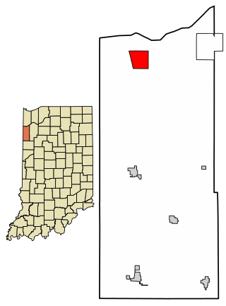
Newton County is a county located near the northwestern corner of the U.S. state of Indiana. As of 2020, the population was 13,830. This county is part of Northwest Indiana as well as the Chicago metropolitan area. The county seat is Kentland. The county is divided into 10 townships which provide local services.

<span class="mw-page-title-main">Monroe, Adams County, Indiana</span> Town in Indiana, United States

Monroe is a town in Washington and Monroe townships, Adams County, Indiana, United States. The population of the town was 945 residents at the 2019 census. Adams Central Community Schools is located in Monroe.

<span class="mw-page-title-main">Thorntown, Indiana</span> Town in Indiana, United States

Thorntown is a town in Sugar Creek Township, Boone County, Indiana. The population was 1,520 at the time of the 2010 census. Thorntown is located in northwestern Boone County, about halfway between Lafayette and Indianapolis.

<span class="mw-page-title-main">Onward, Indiana</span> Town in Indiana, United States

Onward is a town in Tipton Township, Cass County, Indiana, United States. The population was 100 at the 2010 census.

<span class="mw-page-title-main">Milltown, Indiana</span> Town in Indiana, United States

Milltown is a town in Whiskey Run Township in Crawford County, Indiana and in Blue River and Spencer townships in Harrison County. The population was 818 at the time of the 2010 census.

<span class="mw-page-title-main">Shirley, Indiana</span> Town in Indiana, United States

Shirley is a town in Brown Township, Hancock County and Greensboro Township, Henry County, Indiana, United States. The population was 830 at the 2010 census.

<span class="mw-page-title-main">Lanesville, Indiana</span> Town in Indiana, United States

Lanesville is a town in Franklin Township, Harrison County, Indiana, United States. The population was 935 at the 2010 census.

<span class="mw-page-title-main">Remington, Indiana</span> Town in Indiana, United States

Remington is a town in Carpenter Township, Jasper County, Indiana, United States. The population was 1,185 at the 2010 census.

<span class="mw-page-title-main">Roselawn, Indiana</span> Census-designated place in Indiana, United States

Roselawn is a census-designated place (CDP) in Newton and Jasper counties in the U.S. state of Indiana. The population was 4,131 at the 2010 census.

<span class="mw-page-title-main">Silver Lake, Indiana</span> Town in Indiana, United States

Silver Lake is a town in Lake Township, Kosciusko County, in the U.S. state of Indiana. The population was 915 at the 2010 census.

<span class="mw-page-title-main">Kingsbury, Indiana</span> Town in Indiana, United States

Kingsbury is a town in Washington Township, LaPorte County, Indiana, just northwest of the intersection of U.S. Route 35 and U.S. Route 6. The town was founded in 1835 and incorporated on March 3, 1941. During 1940 - 1941, the Kingsbury Ordnance Plant (KOP) was built for use during World War II. The plant closed after the war but reopened during the Korean War, closing permanently in 1959. The population was 242 at the 2010 census. It is included in the Michigan City, Indiana-La Porte, Indiana Metropolitan Statistical Area. The town has its own fire department, KVFD, and a Greek revival style First Baptist church built in 1851 with its own graveyard and Winchell Cemetery.

<span class="mw-page-title-main">Westville, Indiana</span> Town in Indiana, United States

Westville is a town in New Durham Township, LaPorte County, Indiana, United States. The population, as of the 2020 census is 5257. It is included in the Michigan City, Indiana-La Porte, Indiana Metropolitan Statistical Area. Westville is located in Northwest Indiana, also known as The Region.

<span class="mw-page-title-main">Brook, Indiana</span> Town in Indiana, United States

Brook is a town in Iroquois Township, Newton County, in the U.S. state of Indiana. The population was 997 at the 2010 census.

<span class="mw-page-title-main">Goodland, Indiana</span> Town in Indiana, United States

Goodland is a town in Grant Township in Newton County, Indiana. The population was 1,043 at the 2010 census.

<span class="mw-page-title-main">Lake Village, Indiana</span> CDP in Newton County, Indiana, United States

Lake Village is a census-designated place (CDP) in Lake Township, Newton County, in the U.S. state of Indiana. The population was 765 at the 2010 census.

<span class="mw-page-title-main">Morocco, Indiana</span> Town in Indiana, United States

Morocco is a town in Beaver Township, Newton County, in the U.S. state of Indiana. The population was 1,129 at the 2010 census.

<span class="mw-page-title-main">Mount Ayr, Indiana</span> Town in Indiana, United States

Mount Ayr is a town in Jackson Township, Newton County, in the U.S. state of Indiana. The population was 122 at the 2010 census.

<span class="mw-page-title-main">Burns Harbor, Indiana</span> Town in Indiana, United States

Burns Harbor is a town in Westchester Township, Porter County, Indiana, United States on the shores of Lake Michigan in Northwest Indiana. It is part of the Chicago metropolitan area. The population was 1,156 at the 2010 census. Burns Harbor is located adjacent to the Indiana Dunes, an area that conservationists have fought hard to preserve.

<span class="mw-page-title-main">Milton, Indiana</span> Town in Indiana, United States

Milton is a town in Washington Township, Wayne County, in the U.S. state of Indiana. The population was 490 at the 2010 census.

<span class="mw-page-title-main">Meridian Hills, Indiana</span> Town in Indiana, United States

Meridian Hills is a town in Washington Township, Marion County, Indiana, about 8 miles (13 km) north of downtown Indianapolis. It had a population of 1,774 at the 2020 census, up from 1,616 in 2010.

References

  1. "2020 U.S. Gazetteer Files". United States Census Bureau. Retrieved March 16, 2022.
  2. 1 2 3 U.S. Geological Survey Geographic Names Information System: Kentland, Indiana
  3. 1 2 "U.S. Census website". United States Census Bureau . Retrieved January 31, 2008.
  4. Ade, John (1911). Newton County: A Collection of Historical Facts and Personal Recollections Concerning Newton County, Indiana, from 1853 to 1911. Bobbs-Merrill. pp.  192.
  5. "Find a County". National Association of Counties. Archived from the original on May 31, 2011. Retrieved June 7, 2011.
  6. "National Register Information System". National Register of Historic Places . National Park Service. July 9, 2010.
  7. "G001 - Geographic Identifiers - 2010 Census Summary File 1". United States Census Bureau. Archived from the original on February 13, 2020. Retrieved July 17, 2015.
  8. "Census of Population and Housing". Census.gov. Retrieved June 4, 2015.
  9. "U.S. Census website". United States Census Bureau . Retrieved December 11, 2012.
  10. "Indiana public library directory" (PDF). Indiana State Library. Archived from the original (PDF) on February 18, 2017. Retrieved March 10, 2018.