Rising Sun, Indiana

Last updated

Rising Sun, Indiana
Main Street, Rising Sun, IN (48361726816).jpg
Main Street in Downtown Rising Sun
Ohio County Indiana Incorporated and Unincorporated areas Rising Sun Highlighted 1864674.svg
Location of Rising Sun in Ohio County, Indiana.
USA Indiana location map.svg
Red pog.svg
Rising Sun
Usa edcp location map.svg
Red pog.svg
Rising Sun
Coordinates: 38°57′0″N84°51′24″W / 38.95000°N 84.85667°W / 38.95000; -84.85667
Country United States
State Indiana
County Ohio
Township Randolph
Government
   Mayor Steve Slack (R)
Area
[1]
  Total1.63 sq mi (4.23 km2)
  Land1.50 sq mi (3.89 km2)
  Water0.13 sq mi (0.34 km2)  7.64%
Elevation
[2]
502 ft (153 m)
Population
 (2020)
  Total2,248
  Density1,496.67/sq mi (577.81/km2)
Time zone UTC-5 (EST)
  Summer (DST) UTC-4 (EDT)
ZIP code
47040
Area code 812
FIPS code 18-64674 [3]
GNIS feature ID 449718
Website www.cityofrisingsun.com

Rising Sun is a city in Randolph Township and the county seat of Ohio County, Indiana, United States, [4] along the Ohio River. It is also the only incorporated community in the county. The population of Rising Sun was 2,304 at the 2010 census.

Contents

History

The town was registered in 1816 by John James, originally of Frederick County, Maryland. [5] At the time, it had a population of about 700. Many German immigrants settled in Rising Sun. [6] The Rising Sun post office has been in operation since 1844. [7]

In the 1830s, Rising Sun was a seasonal stop for hundreds of flatboats daily heading down the Ohio River. [8]

The Clore Plow Works-J.W. Whitlock and Company and Rising Sun Historic District are listed on the National Register of Historic Places. [9]

Joseph Barricklow (18671924), Illinois lawyer and state legislator, was born in Rising Sun. [10]

Geography

Rising Sun is located at 38°57′0″N84°51′24″W / 38.95000°N 84.85667°W / 38.95000; -84.85667 (38.949867, -84.856782). [11]

According to the 2010 census, Rising Sun has a total area of 1.569 square miles (4.06 km2), of which 1.45 square miles (3.76 km2) (or 92.42%) is land and 0.119 square miles (0.31 km2) (or 7.58%) is water. [12]

Casino

The Rising Star Casino Resort (formerly known as Grand Victoria Casino & Resort) was opened in October 1996 by an affiliate of Hyatt Corporation with a 2,700-passenger riverboat and 40,000 square feet of gaming space. [13]

Demographics

Historical population
CensusPop.Note
1850 1,674
1860 1,7333.5%
1870 1,7601.6%
1880 1,8062.6%
1890 1,689−6.5%
1900 1,548−8.3%
1910 1,513−2.3%
1920 1,411−6.7%
1930 1,379−2.3%
1940 1,54512.0%
1950 1,93024.9%
1960 2,23015.5%
1970 2,3053.4%
1980 2,4787.5%
1990 2,311−6.7%
2000 2,4706.9%
2010 2,304−6.7%
2020 2,248−2.4%
U.S. Decennial Census [14]

2010 census

As of the census [15] of 2010, there were 2,304 people, 1,004 households, and 591 families living in the city. The population density was 1,589.0 inhabitants per square mile (613.5/km2). There were 1,124 housing units at an average density of 775.2 per square mile (299.3/km2). The racial makeup of the city was 97.8% White, 0.7% African American, 0.1% Native American, 0.4% Asian, 0.4% from other races, and 0.6% from two or more races. Hispanic or Latino of any race were 1.8% of the population.

There were 1,004 households, of which 26.0% had children under the age of 18 living with them, 41.2% were married couples living together, 12.5% had a female householder with no husband present, 5.2% had a male householder with no wife present, and 41.1% were non-families. 36.7% of all households were made up of individuals, and 16.9% had someone living alone who was 65 years of age or older. The average household size was 2.24 and the average family size was 2.90.

The median age in the city was 43.9 years. 19.6% of residents were under the age of 18; 9.5% were between the ages of 18 and 24; 22.1% were from 25 to 44; 29.1% were from 45 to 64; and 19.8% were 65 years of age or older. The gender makeup of the city was 47.7% male and 52.3% female.

2000 census

As of the census [3] of 2000, there were 2,470 people, 1,034 households, and 645 families living in the city. The population density was 1,664.4 inhabitants per square mile (642.6/km2). There were 1,119 housing units at an average density of 754.0 per square mile (291.1/km2). The racial makeup of the city was 98.02% White, 0.97% African American, 0.24% Native American, 0.16% Asian, 0.04% Pacific Islander, 0.04% from other races, and 0.53% from two or more races. Hispanic or Latino of any race were 0.73% of the population.

Rising Sun, on the Ohio River. Rising-sun-indiana-ohio-river--from-above.jpg
Rising Sun, on the Ohio River.

There were 1,034 households, out of which 29.0% had children under the age of 18 living with them, 48.0% were married couples living together, 10.8% had a female householder with no husband present, and 37.6% were non-families. 32.2% of all households were made up of individuals, and 15.5% had someone living alone who was 65 years of age or older. The average household size was 2.34 and the average family size was 3.00.

In the city, the population was spread out, with 24.0% under the age of 18, 9.4% from 18 to 24, 27.4% from 25 to 44, 21.1% from 45 to 64, and 18.1% who were 65 years of age or older. The median age was 38 years. For every 100 females, there were 89.9 males. For every 100 females age 18 and over, there were 86.1 males.

The median income for a household in the city was $33,750, and the median income for a family was $46,731. Males had a median income of $35,213 versus $23,438 for females. The per capita income for the city was $17,221. 10.3% of the population and 7.0% of families were below the poverty line. Out of the total people living in poverty, 12.1% are under the age of 18 and 15.1% are 65 or older.

Education

The town has a lending library, the Ohio County Public Library. [16]

See also

Related Research Articles

<span class="mw-page-title-main">Williams County, Ohio</span> County in Ohio, United States

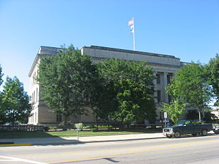
Williams County is a county located in the U.S. state of Ohio. As of the 2020 census, the population was 37,102. Its county seat is Bryan. The county was created in 1820 and later organized in 1824. It is named for David Williams, one of the captors of John André in the American Revolutionary War.

<span class="mw-page-title-main">Preble County, Ohio</span> County in Ohio, United States

Preble County is a county located in the U.S. state of Ohio. As of the 2020 census, the population was 40,999, down 3.0% from the 2010 census population of 42,270. Its county seat is Eaton. The county was formed on February 15, 1808, from portions of Butler and Montgomery Counties. It is named for Edward Preble, a naval officer who fought in the American Revolutionary War and against the Barbary Pirates.

<span class="mw-page-title-main">Champaign County, Ohio</span> County in Ohio, United States

Champaign County is a county located in the U.S. state of Ohio. As of the 2020 census, the population was 38,714. Its county seat and largest city is Urbana. The county takes its name from the French word for "open level country". Champaign County became the 18th of 88 Ohio counties on March 1, 1805. It was formed from parts of Greene and Franklin counties by legislative action.

<span class="mw-page-title-main">Ohio County, Indiana</span> County in Indiana, United States

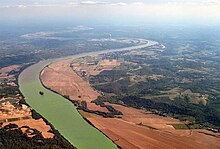
Ohio County is a county located in southeastern Indiana. With a 2020 population of 5,940, and an area of just 87 square miles, Ohio County is the smallest county in Indiana by area and the least populous. The county seat and only incorporated municipality is Rising Sun. The county was officially established in 1844 and was one of the last Indiana counties to be created. Ohio County borders the state of Kentucky across the Ohio River for which it was named. It is part of the Cincinnati, OH-KY-IN Metropolitan Statistical Area. The county is divided into four townships which provide local services. Three state roads pass through or into the county.

<span class="mw-page-title-main">Dearborn County, Indiana</span> County in Indiana, United States

Dearborn County is one of 92 counties of the U.S. state of Indiana located on the Ohio border near the southeast corner of the state. It was formed in 1803 from a portion of Hamilton County, Ohio. In 2020, the population was 50,679. The county seat and largest city is Lawrenceburg. Dearborn County is part of the Cincinnati, OH-KY-IN Metropolitan Statistical Area.

<span class="mw-page-title-main">Greendale, Indiana</span> City in Indiana, United States

Greendale is a city in Dearborn County, Indiana, United States. The population was 4,520 at the 2010 census.

<span class="mw-page-title-main">West Harrison, Indiana</span> Town in Indiana, United States

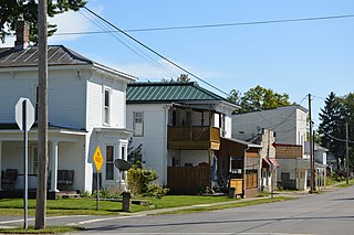
West Harrison is a town in Harrison Township, Dearborn County, Indiana, United States. The population was 289 at the 2010 census.

<span class="mw-page-title-main">Roselawn, Indiana</span> Census-designated place in Indiana, United States

Roselawn is a census-designated place (CDP) in Newton and Jasper counties in the U.S. state of Indiana. The population was 4,131 at the 2010 census.

<span class="mw-page-title-main">French Lick, Indiana</span> Town in Indiana, United States

French Lick is a town in French Lick Township, Orange County, Indiana. The population was 1,807 at the time of the 2010 census.

<span class="mw-page-title-main">Cannelton, Indiana</span> City in Indiana, United States

Cannelton is a city in Troy Township, Perry County, in the U.S. state of Indiana, along the Ohio River. The population was 1,563 at the 2010 census. Cannelton, which was the smallest incorporated city in the state until 2010, was formerly the county seat of Perry County until the seat was relocated to Tell City.

<span class="mw-page-title-main">Reed City, Michigan</span> City in Michigan, United States

Reed City is a city in the U.S. state of Michigan. The population was 2,425 at the 2010 census. It is located in southwestern Osceola County and is the county seat.

<span class="mw-page-title-main">Derma, Mississippi</span> Town in Mississippi, United States

Derma is a town in Calhoun County, Mississippi, United States. The population was 1,025 at the 2010 census.

<span class="mw-page-title-main">Union City, Ohio</span> Village in Ohio, United States

Union City is a village in Darke County, Ohio, United States. The population was 1,582 at the 2020 census. It is directly across the state line from its twin city of Union City, Indiana.

<span class="mw-page-title-main">Magnetic Springs, Ohio</span> Village in Ohio, United States

Magnetic Springs is a village in Leesburg Township, Union County, Ohio, United States. The population was 268 at the 2010 census. The village supports a post office that has the ZIP Code of 43036.

<span class="mw-page-title-main">Risingsun, Ohio</span> Village in Ohio, United States

Risingsun is a village in Wood County, Ohio, United States. The population was 606 at the 2010 census.

<span class="mw-page-title-main">Gaskill Township, Jefferson County, Pennsylvania</span> Township in Pennsylvania, United States

Gaskill Township is a township in Jefferson County, Pennsylvania, United States. The population was 675 at the 2020 census. It was named for Charles C. Gaskill, agent of the Holland Land Company.

<span class="mw-page-title-main">Strasburg Township, Lancaster County, Pennsylvania</span> Township in Pennsylvania, United States

Strasburg Township is a township in south central Lancaster County, Pennsylvania, United States. The population was 4,467 at the 2020 census.

<span class="mw-page-title-main">Oswayo Township, Potter County, Pennsylvania</span> Township in Pennsylvania, United States

Oswayo Township is a township in Potter County, Pennsylvania, United States. The population was 224 at the 2020 census.

<span class="mw-page-title-main">College Corner, Ohio</span> Village in Ohio, United States

College Corner is a village in Butler and Preble counties in the southwestern part of the U.S. state of Ohio, 5 miles (8 km) northwest of Oxford. The population was 387 at the 2020 census. The village lies on the state line with Indiana, where it borders the town of West College Corner. The public school, part of the Union County–College Corner Joint School District, is bisected by the state line and is operated jointly with Indiana authorities.

Wilton is a town in Monroe County, Wisconsin, United States. The population was 925 at the 2000 census. The Village of Wilton is located partially within the town.

References

  1. "2020 U.S. Gazetteer Files". United States Census Bureau. Retrieved March 16, 2022.
  2. "US Board on Geographic Names". United States Geological Survey. October 25, 2007. Retrieved August 25, 2016.
  3. 1 2 "U.S. Census website". United States Census Bureau . Retrieved January 31, 2008.
  4. "Find a County". National Association of Counties. Retrieved June 7, 2011.
  5. History of Dearborn and Ohio Counties, Indiana. Chicago: F. E. Weakley & Company. 1885. p.  448. In the year 1807 John James, from Frederick County, Md., settled at Lawrenceburgh, and two years later exchanged his lands located there, with Col. Chambers for the land on which Rising Sun now stands.
  6. "History". City of Rising Sun, Indiana. 2013. Retrieved May 11, 2014.
  7. "Ohio County". Jim Forte Postal History. Retrieved August 25, 2016.
  8. Wissing, Douglas (March 1, 2001). Indiana. Globe Pequot. p. 14. ISBN   9781560449065 . Retrieved October 16, 2013.
  9. "National Register Information System". National Register of Historic Places . National Park Service. July 9, 2010.
  10. 'Official Directory of the Fortieth Illinois General Assembly 1897,' J.L. Pickering, Springfield, Illinois: 1897, Biographical Sketch of Joseph P. Barricklow, pg. 54-55
  11. "US Gazetteer files: 2010, 2000, and 1990". United States Census Bureau. February 12, 2011. Retrieved April 23, 2011.
  12. "G001 - Geographic Identifiers - 2010 Census Summary File 1". United States Census Bureau. Archived from the original on February 13, 2020. Retrieved July 29, 2015.
  13. "Rising Star Casino Resort". Full House Resorts. Retrieved July 1, 2023.
  14. "Census of Population and Housing". Census.gov. Retrieved June 4, 2015.
  15. "U.S. Census website". United States Census Bureau . Retrieved December 11, 2012.
  16. "Indiana public library directory" (PDF). Indiana State Library. Retrieved March 14, 2018.