Connersville is a city in Fayette County, east central Indiana, United States, 66 miles (106km) east by southeast of Indianapolis. The population was 13,324 at the 2020 census. The city is the county seat of and the largest and only incorporated town in Fayette County.[4] The city is in the center of a large rural area of east central Indiana; the nearest significant city is Richmond, 26 miles (42km) to the northeast by road. Connersville is home to the county's only high school. The local economy relies on manufacturing, retail, and healthcare to sustain itself. However, there has been a consistent decline in both employment and population since the 1960s, placing it among the least affluent areas in the state, as indicated by measures such as median household income and other economic indicators.
Connersville is named for settler John Conner, older brother of William Conner, an early Indiana settler and politician.[5] There was also, at least through 1795, Connerstown, a small Shawnee village near Lancaster, Ohio, named for John's father, Richard Conner.
The Whitewater River Valley running north-south through eastern Indiana and southwestern Ohio was created by the Late Wisconsin Glaciation ending 13,600 years ago. Fayette County was at the southern fringe of the glaciation at that time. The Ice Age was punctuated by several prolonged warm periods during which the glaciers disappeared entirely from the temperate latitudes and a climate similar to today or even warmer prevailed. The flood waters produced resulted in lakes; breaching of the lakes resulted in rivers and streams carving the hills and valleys we see today.
In the Northwest Territory during the latter half of the 18th century, the Miami Indians were dominant in the region, but the Potawatomi and Shawnee had a significant presence. Delaware Indians, displaced from their eastern homelands by European settlement, migrated west and settled along the forks of the Whitewater River. The Whitewater Valley and Ohio River Valley area had also been inhabited earlier by other Native Americans called mound builders for their characteristic large burial mounds still in evidence today.
The geological aspects of the Whitewater River Valley contributed to early settlement after defeat of the Delaware Indians by Gen. Anthony Wayne at Fallen Timbers in 1794, followed on August 3, 1795, by the Treaty of Greenville (Ohio) ceding most of Ohio and a sliver of southeastern Indiana to the United States. The valley, running south and southeasterly from east central Indiana to the Ohio River Valley, provided a convenient conduit for migration through Fort Washington (Cincinnati) from points east, settlements on the Ohio River, and settlers from Kentucky to northern and central Indiana Territory. Squatters engaged in agriculture and trading were occupying federal lands well before land sales in Indiana Territory began in 1801. An Indian trail paralleled the river from the Ohio Valley northward to the forks, then went along the East Fork to Eli Creek, thence taking a northwesterly direction passing through what was later Connersville, and then on to the Delaware villages strung along the White River from north of present-day Indianapolis to modern Muncie.
Conner's Post
John Conner, his brother William, and others arrived in the Whitewater Valley from south central Ohio in 1802, establishing a fur trading post in an unpopulated area near what was later to become Cedar Grove on the Whitewater River (Franklin County) at the very fringe of the European penetration into the wilderness of Indiana. By 1808, as a result of reduction of Indian hunting grounds by treaty, the trading post, known as "Conner's Post", had been relocated 20 miles (32km) north at the Whitewater River junction with an Indian trail between the Ohio River 70 miles (110km) to the southeast and hunting grounds to the north. According to research by J. L. Heineman, the trading post was located in the middle of what is now Eastern Avenue, at the west end of Charles Street. At that time, the region was inhabited by Delaware Indians. In 1809, the Treaty of Fort Wayne was signed, by the terms of which the land locally known as the "Twelve Mile Purchase" was ceded by the Indians to the government. This tract included a strip twelve miles (19km) in width lying west of the 1795 Greenville treaty line that ran from the midpoint of the Indiana/Ohio border southwest to the Ohio River, cutting off a thin wedge of southeastern Indiana. The strip included most of Fayette County except the extreme northern portion (part of the later "New Purchase"). Sales of public land by the United States government in Indiana began in 1801. In that year the Cincinnati, Ohio, Land Office began selling land in a wedge of government land in southeastern Indiana known as the "Gore" (organized as Dearborn County in 1803) which included all of what is today Fayette County. Conner obtained title to his plat in 1811.
First 50 years – through the Civil War
The exodus of the Delaware Indians from Indiana after the War of 1812, completed by June 1813, deprived John Conner of his field for trading. After 1812, Indian resistance to settlement in the Indiana Territory became nearly non-existent, so Conner busied himself with another task.
John Conner laid out the town on the north side of the west fork of the Whitewater River in March 1813, adjacent to the fur trading post. The original plat was for 62 lots bounded by what are today Central Avenue to the west and Water Street to the east, Third Street to the south, and Sixth Street to the north. The first constructions in the town were a saw mill and grist mill north of town utilizing water power, and a general store and distillery in town. The influx of settlers was initially sparse – as late as 1815, there were only four cabins in the town. The boundary lines for Fayette County were established in December 1818, and Connersville was chosen as the county seat.
Conner served briefly as sheriff of the newly organized Fayette County. In 1820, John Conner helped plat the new capital of Indianapolis, and in 1822 relocated his fur trading business to Noblesville, north of Indianapolis. He also served as state senator and representative. He died in Indianapolis in April 1826 and was buried there. No trace remains of his grave.
The first post office in Connersville opened in January, 1818.[6] The first courthouse was started in 1819 and finished in 1822.[7] The first newspaper, the Indiana Statesman, was started in 1824. The first church in the village was Presbyterian, constructed in 1824. A seminary building was constructed in 1828, later razed, and the first regular school building in Connersville was constructed on the site in 1858. The Indiana Gazetteer in 1833 stated the population of Connersville as 500. The village was incorporated as a town in 1841. Connersville served as an important link on the Whitewater Canal linking the Whitewater River to the Ohio River, opened in 1847.[8] The canal ceased to be used for through traffic in 1849, though limited local commerce continued. The first railroad, the Cincinnati, Hamilton and Indianapolis Railroad, reached Connersville in 1862. It extended from Rushville through Connersville and Oxford to Hamilton, Ohio.
For many years prior to the Civil War, and even for some time after, the main industries of the town were milling, pork packing, and woolen manufacturing.
In 1857, a separate village, East Connersville, was platted on the south bank of the west fork of the Whitewater River, and had its own government. It was annexed by Connersville some time in the 1920s.
Early growth – pre-industrial age
The Roots blower, a type of air turbine, was invented by the Roots brothers in Connersville in the 1850s, patented in 1859, and manufactured in Connersville for over 150 years.
The town of Connersville became a chartered city in June 1869, and William H. Beck was chosen as its first mayor. The first high school opened in 1875. In 1882, James H. Fearis of Connersville started the Bell telephone exchange. The Connersville Electric Light Company commenced operations in August 1890 as the first supplier of electric power in the city. Central Avenue was paved with brick in 1902, and became the first paved street in the city.
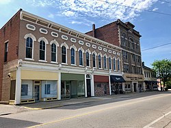
Prior to the advent of automotive manufacturing, Connersville for decades was colloquially known as the "furniture and buggy town" because of the dominance of those two industries in the town.
In 1898, Stant was founded in Connersville, and became the world's largest producer of piano tuning pins.
In the early 20th century, the town became known as "Little Detroit" because of its importance to the automobile industry, with over 500,000 jeep bodies produced in the town during the Second World War. Automobiles manufactured in Connersville include Auburn, Cord, Duesenberg, Ansted, Empire, Lexington, and McFarlan. The Willys MB Jeep body was manufactured in Connersville during the 1940s.[10] Much of the western portion of town was occupied by light industry for the 150 years prior to 1990. Companies included Roots Blower (later Dresser Industries), Stant, McQuay Norris, Design & Manufacturing Co. (D&M), H.H. Robertson, Visteon, Philco Ford.
McQuay-Norris, manufacturer of auto parts based in St. Louis, got its start in Connersville in 1921 by the acquisition of Wainwright Engineering, a privately held local company manufacturing automotive engines. In 1969, it was acquired by Eaton, Yale & Towne, and closed its Connersville and Indianapolis plants in 1983.
Design & Manufacturing (D&M) company got its start when Rex Regenstrief purchased American Kitchens in 1958 and renamed the company. By 1972, D&M controlled 25% of the nation’s dishwasher market. Design & Manufacturing’s assets were sold to White Consolidated Industries in 1987 and the firm was dissolved in 1990.
Architectural Products Division of H. H. Robertson purchased land owned by the defunct Lexington Motor Car Company in February 1960. Robertson was a victim of hard times for the industry in the late 1980s and the Connersville plant was merged with operations in Pittsburgh, Pennsylvania, starting in 1986.
Decline from 1960s onward
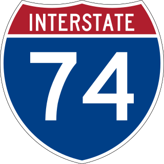
The 1980s were the beginning of the end for Connersville automotive manufacturing, which had been on the wane for more than a decade. Due to high cost of local union labor and economies of scale elsewhere, most industry departed in the 1980s and 1990s. Connersville union labor went down from a high of 10,000 to about 600 workers in 2012. Connersville’s role in automobile manufacturing ceased when the Visteon factory shut down in 2007. Part of the decline may be logistical – with the construction of the interstate highway system in the 1950s, Connersville found itself not directly in line with routes between major cities: I-70 from Indianapolis to Columbus, I-74 from Indianapolis to Cincinnati, and U.S. 40 from Indianapolis to Richmond, none intersecting Connersville. The former Roots Blower/Dresser Industries, now GE Energy, remains, but with a skeleton staff of fewer than 100 full-time employees. Stant also remains with a little over 200 employees. There are still some furniture making, machine shops, and other local manufacturing establishments.
In March 2014, the city declared a fiscal emergency when revenue fell short of expenses, and the city nearly fell into bankruptcy.
Geography
Connersville is oriented roughly north-south. The center of town is roughly Central Ave and 5th street in the southern portion.
According to the 2010 census, Connersville has a total area of 7.755 square miles (20.09km2), of which 7.74 square miles (20.05km2) (or 99.81%) is land and 0.015 square miles (0.04km2) (or 0.19%) is water.[11]
Demographics
Connersville from the air, looking west. The Whitewater River is in the foreground, and Roberts Park Grandstand and Race Track are at the bottom right. The Park is home to the Fayette County Free Fair, one of the last free fairs remaining in the state.
As of 2019, the population is estimated to be 12,796 people. About 55% of Fayette county's population lives in the town.
2010 census
As of the census[12] of 2010, there were 13,481 people, 5,582 households, and 3,506 families residing in the city. The population density was 1,739.5 inhabitants per square mile (671.6/km2). There were 6,450 housing units at an average density of 832.3 per square mile (321.4/km2). The racial makeup of the city was 95.7% White, 2.1% African American, 0.2% Native American, 0.3% Asian, 0.3% from other races, and 1.3% from two or more races. Hispanic or Latino of any race were 1.0% of the population.
There were 5,582 households, of which 31.1% had children under the age of 18 living with them, 41.9% were married couples living together, 15.2% had a female householder with no husband present, 5.8% had a male householder with no wife present, and 37.2% were non-families. 31.6% of all households were made up of individuals, and 13.8% had someone living alone who was 65 years of age or older. The average household size was 2.37 and the average family size was 2.95.
The median age in the city was 39.4 years. 24.2% of residents were under the age of 18; 8.2% were between the ages of 18 and 24; 24.3% were from 25 to 44; 25.6% were from 45 to 64; and 17.7% were 65 years of age or older. The gender makeup of the city was 47.7% male and 52.3% female.
2000 census
As of the census[3] of 2000, there were 15,411 people, 6,382 households, and 4,135 families residing in the city.
Religion
About 44% of the population is affiliated with a religious congregation. 25% are Roman Catholic, followed by United Methodist, Southern Baptist, and non-denominational Christian.[citation needed] In town, there are churches representing Catholic, Methodist, Baptist, Lutheran, Presbyterian, Reformed Episcopal and Church of Jesus Christ of Latter-Day Saint faiths, as well as about a dozen non-denominational Christian churches. There are also a number of Pentecostal (including Charismatic and Revival) churches and organizations.
Culture
Fayette County Public Library is located in the city.[13]
A golf course west of town is known as Willowbrook Country Club.
Connersville has an indoor movie theater, Showtime Cinemas.
There is a basketball stadium at the old high school at 19th and Grand ave, and a football field at the high school on Ranch Road where high school events are held. Both are available for other events, gymnastics, track and field, etc.
Overnight and long-term camping are available at the Whitewater River Campground south of town. The Heritage MusicFest takes place every year in June at the campground. Local bands ranging in style from bluegrass to rock perform.
Parks and preserves
Roberts Park, located in the northeast corner of town, contains a public pool, community center, grandstand, and racetrack. It hosts the annual Fayette County Free Fair, a week-long event held late in the summer.
Manlove Park, about 8 miles (13km) northwest of downtown near Milton, is a recreation area around Manlove Lake.
Shrader-Weaver Woods Nature Preserve, about 4 miles (6.4km) northwest of Connersville, is 108 acres of pristine old growth woodland offering hiking, sightseeing and bird watching.
The Mary Gray Bird Sanctuary, over 700 acres (280ha) of forest, meadow, prairie, and ponds, provides hiking, picnicking, camping. and bird watching. It is located about 5 miles (8.0km) southwest of Connersville.
Doc-O-Lake, a 50-acre (20ha) lake and recreation area 7 miles (11km) north of town, features camping, boating and limited fishing (not a stocked lake).
Cemeteries
Connersville City Cemetery in the middle of town, Dale Cemetery just west of downtown, and Tullis Chapel Cemetery 3 miles (4.8km) southwest of town, are the only local cemeteries. There are a few private and church cemeteries located in outlying unincorporated areas.
There is no commercial air or bus service to Connersville. There is Amtrak (passenger) and CSX (freight) rail service. The Whitewater River, while mostly navigable, is not commercially viable as a means of transportation.
Freight moves into and out of Connersville by truck, principally via State Road 1 north and Interstate 70 to Indianapolis, and State Road 1 south, U.S. Route 52, and Interstate 74 to Cincinnati. State Road 44 is mostly local and in-county traffic. SR 1 and SR 44 are both narrow two-lane state roads. The nearest large cities are Cincinnati58 miles (93km) to the southeast; Indianapolis 66 miles (106km) to the west; Dayton, Ohio, 60 miles (97km). to the east; Louisville, Kentucky, 127 miles (204km) to the south; and Columbus, Ohio, 135 miles (217km) to the east.
Amtrak, the national passenger rail system, provides service to Connersville. Each of two trains provides service three days a week. The westbound train provides service to Indianapolis, Lafayette, and Chicago. The eastbound train provides service to Cincinnati, cities in Kentucky, and points east ending at New York City.
Bus and taxi service
There is no transit bus service to Connersville, but local public transit is available to all residents by calling the public transit office. There is 1 local taxi service in town.
Highways
Indiana State Road 1 runs north-south through downtown Connersville north to beyond Fort Wayne and south to Lawrenceburg
Indiana State Road 44 runs east-west through downtown Connersville west to Martinsville and east to the Ohio state line
Indiana State Road 121 runs north-south from intersection with SR44 in downtown Connersville south to Metamora
Interstate 70, 14 miles (23km) to the north via SR1 runs east-west from Indianapolis to Columbus, Ohio
U.S. Route 40, 12 miles (19km) to the north via SR1 runs east-west from just south of Indianapolis to Richmond, IN
Education
All public schools belong to the Fayette County School Corporation. There are about 1,200 students in high school, 700 in middle school, 1,800 in public elementary schools, and 300 in parochial elementary schools (as of 2012). Public elementary schools and some parochial elementary schools include kindergarten. The Whitewater Technical Career Center is a secondary school including grades 11–12 with an enrollment of over 500; it prepares non-college-bound students for careers in the trades. There are no institutions of higher learning in Connersville. The Connersville Center offers extension courses through Indiana University East. The nearest four-year colleges are IU East and Earlham College in Richmond, Indiana, and Miami University in Oxford, Ohio, all about 25 miles (40km) away by road.
The Fayette County School Corporation garnered national attention in November 2017 with a series of articles on CBS News on the subject of school nutrition programs, nationwide—featuring Connersville schools' partnership with a food service company, Chartwell's, to offer free breakfast, lunch and supper services to all children in their schools—integrating breakfasts with classroom learning activity, offering a "second chance" breakfast for teens, and providing after-school movies with a free supper.[18]
Connersville Middle School (formerly Junior High North formerly Connersville Sr. High)
Whitewater Career Center (formerly Connersville Area Vocational School)
Elementary schools
Eastview
Grandview
Frazee
Fayette Central
Everton
Parochial elementary schools
St. Gabriel's (Catholic)
Community (Christian)
Faith (Christian)
Healthcare
Reid Health operates the hospital and associated entities in Connersville, having purchased most of the assets of the former Fayette Regional Health System after it filed for bankruptcy in 2018.[19]
Media
Connersville has a daily newspaper called The News Examiner in continuous publication (including predecessor papers) since 1849.[20]
Radio station WLPK-AM 1580, owned by Rodgers Broadcasting Corporation and licensed to Connersville, operates with local programming and a classic hits format; the station simulcasts on FM frequency 106.9. For many years Connersville simulcast AM/FM WCNB/WIFE radio. The FM which was located at 100.3 was sold to Radio One Communications for $18 million in 2006 and re-located to Cincinnati, Ohio. There is now a WIFE-FM radio station (94.3), whose tower is located in Rush County, Indiana.
Connersville High School's daily TV news program, CHS Today, was the first student-produced TV news program in the United States.[21] It began in 1970 with presenters Dennis Sullivan and Ron Stevens. At first, it was broadcast only to the school via closed-circuit TV. Later it expanded and now airs live at 11:00a.m. weekdays to the community and re-airs twice in the evening at 6:45 and 10:45pm via TV3 on local cable.
Notable people
E. L. Cord, Industrialist and automaker and founded American Airlines in Dallas, Texas.
Howard Garns, creator of the logic game Sudoku, was born in Connersville on March 2, 1905.
Finly H. Gray was a US Congressman for Indiana's 6th and 10th Districts.
Union County is a county in the U.S. state of Indiana. As of the 2020 United States census, the population was 7,087. The county seat is Liberty.
Gibson County is a county in the southwestern part of the U.S. state of Indiana. As of the 2020 United States Census, the population was 33,011. The county seat is Princeton.
Franklin County is a county on the eastern border of the U.S. state of Indiana. In the 2020 United States Census, the county population was 22,785. The county seat is the town of Brookville. Franklin County is part of the Cincinnati, OH–KY–IN Metropolitan Statistical Area. The only incorporated city in Franklin County is Batesville, which lies mostly in adjoining Ripley County.
Fayette County is one of 92 counties in U.S. state of Indiana located in the east central portion of the state. As of 2020, the population was 23,398. Most of the county is rural; land use is farms, pasture and unincorporated woodland. The county seat and only incorporated town is Connersville, which holds a majority of the county's population.
Fishers is a city in Fall Creek and Delaware townships, Hamilton County, Indiana, United States. As of the 2010 census the population was 76,794, and by 2019 the estimated population was 95,310. A suburb of Indianapolis, Fishers has grown rapidly in recent decades: about 350 people lived there in 1963, 2,000 in 1980, and only 7,500 as recently as 1990.
Noblesville is a city in and the county seat of Hamilton County, Indiana, United States, a part of the north Indianapolis suburbs along the White River. The population was 69,604 at the 2020 census, making it the state's 10th most populous city, up from 14th in 2010. The city is part of Delaware, Fall Creek, Noblesville, and Wayne townships.
Greenfield is a city in and the county seat of Hancock County, Indiana, United States It lies in Center Township and is part of the Indianapolis metropolitan area. The population was 23,488 at the 2020 census.
Madison is a city in and the county seat of Jefferson County, Indiana, United States, along the Ohio River. As of the 2010 United States Census its population was 11,967. Over 55,000 people live within 15 miles (24 km) of downtown Madison. Madison is the largest city along the Ohio River between Louisville and Cincinnati. Madison is one of the core cities of the Louisville-Elizabethtown-Madison metroplex, an area with a population of approximately 1.5 million. In 2006, the majority of Madison's downtown area was designated a National Historic Landmark—133 blocks of the downtown area is known as the Madison Historic Landmark District.
Sidney is a city in and the county seat of Shelby County, Ohio, United States, located approximately 36 miles (58 km) north of Dayton and 100 miles (160 km) south of Toledo. The population was 20,421 at the time of the 2020 census. It is named after English poet Philip Sidney, and many of the city's elementary schools are named after famous writers, including Ralph Waldo Emerson, Henry Wadsworth Longfellow, and John Greenleaf Whittier. Sidney was the recipient of the 1964 All-America City Award. In 2009, it was the subject of the documentary film 45365.
The Wabash and Erie Canal was a shipping canal that linked the Great Lakes to the Ohio River via an artificial waterway. The canal provided traders with access from the Great Lakes all the way to the Gulf of Mexico. Over 460 miles long, it was the longest canal ever built in North America.
The Great Miami River is a tributary of the Ohio River, approximately 160 miles (260 km) long, in southwestern Ohio and Indiana in the United States. The Great Miami originates at the man-made Indian Lake and flows south through the cities of Sidney, Piqua, Troy, Dayton, Middletown and Hamilton.
The Whitewater Valley Railroad is a heritage railroad in southeastern Indiana between Connersville and Metamora.
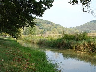
The Whitewater River is a 101-mile-long (163 km) southerly flowing right tributary of the Great Miami River in southeastern Indiana and southwestern Ohio in the United States. It is formed by the confluence of two forks, the West Fork and East Fork. The name is a misnomer, as there is no true white water on the river. However, there are many rapids due to the steep gradient present - the river falls an average of six feet per mile (1.1 m/km). The gradient rendered upstream navigation impossible, and in the mid-nineteenth century resulted in the construction of the Whitewater Canal paralleling the river from north of Connersville, Indiana, to the Ohio River.
The Whitewater Canal, which was built between 1836 and 1847, spanned a distance of 76 miles (122 km) and stretched from Lawrenceburg, Indiana on the Ohio River to Hagerstown, Indiana near the West Fork of the White River.
Metamora is an unincorporated town and census-designated place in Metamora Township, Franklin County, Indiana. The town was once a stop along the Whitewater Canal and is now primarily dependent on tourism. As of the 2010 census, it had a population of 188.
Strawtown is an unincorporated community in White River Township, Hamilton County, Indiana.
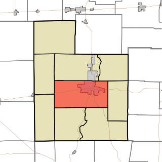
Connersville Township is one of nine townships in Fayette County, Indiana. As of the 2010 census, its population was 12,282 and it contained 5,573 housing units.
Alpine is an unincorporated community in Columbia Township, Fayette County, Indiana.
Interstate 74 (I-74) in the US state of Indiana traverses central parts of the state from west to east. It connects Champaign, Illinois, with Indianapolis in the center of the state, and Indianapolis with Cincinnati, Ohio. I-74 covers 171.54 miles (276.07 km) across Indiana, a portion of which is concurrently routed through Indianapolis along the southern and western legs of I-465.
Indiana is a state in the Midwestern region of the United States. It borders Lake Michigan to the northwest, Michigan to the north and northeast, Ohio to the east, the Ohio River and Kentucky to the south and southeast, and the Wabash River and Illinois to the west. Nicknamed "the Hoosier State", Indiana is the 38th-largest by area and the 17th-most populous of the 50 states. Its capital and largest city is Indianapolis. Indiana was admitted to the United States as the 19th state on December 11, 1816.
This page is based on this Wikipedia article Text is available under the CC BY-SA 4.0 license; additional terms may apply. Images, videos and audio are available under their respective licenses.