Brazil, Indiana

Last updated

Brazil, Indiana
West National in downtown Brazil.jpg
Downtown Brazil
City of Brazil.jpg
Clay County Indiana Incorporated and Unincorporated areas Brazil Highlighted 1807174.svg
Location of Brazil in Clay County, Indiana.
Coordinates: 39°31′30″N87°07′39″W / 39.52500°N 87.12750°W / 39.52500; -87.12750
Country United States
State Indiana
County Clay
Government
   Mayor Brian Wyndham (D)
Area
[1]
  Total3.72 sq mi (9.63 km2)
  Land3.69 sq mi (9.55 km2)
  Water0.03 sq mi (0.08 km2)
Elevation
[2]
656 ft (200 m)
Population
 (2022)
  Total8,176
  Density2,200/sq mi (850/km2)
Time zone UTC-5 (EST)
  Summer (DST) UTC-4 (EDT)
ZIP code
47834
Area code 812
FIPS code [2] [3] 18-07174
GNIS ID [2] [3] 431462
Website Official website OOjs UI icon edit-ltr-progressive.svg

Brazil is a city in Clay County, Indiana, United States. The population was 8,176 at the 2022 census. [4] The city is the county seat of Clay County. [5] It is part of the Terre Haute Metropolitan Statistical Area.

Contents

History

In the 1840s, the owners of the farm which would later become the city of Brazil decided to name their farm after the country of Brazil, because that country was often the subject of news at the time. [6] The city was founded in 1866 under the name of that farm. [7] As of 2024, Brazil is a part of the Terre Haute Metropolitan Statistical Area. Clay county, which was formed in 1825, originally had Bowling Green as its county seat. The county seat was relocated to Brazil in 1876, following the city's development. [8]

The Chafariz dos Contos (from "contos de réis", a former Brazilian currency) was given to the city by the country of Brazil as a symbol of friendship. It was assembled in Forest Park in 1956. It is a replica of the original fountain located in Ouro Preto, State of Minas Gerais, Brazil, built in 1745. [9]

In 2010, Brazil gained national attention for having accepted money from Kentucky Fried Chicken for the rights to display the KFC and Fiery Grilled Wings logos on city fire hydrants. [10]

The Brazil Downtown Historic District, Clay County Courthouse, Clay County Hospital, Meridian-Forest Historic District, and US Post Office-Brazil are listed on the National Register of Historic Places. [11]

Geography

Brazil is located at 39°31′30″N87°7′39″W / 39.52500°N 87.12750°W / 39.52500; -87.12750 (39.525000, -87.127500). [12]

According to the 2010 census, Brazil has a total area of 3.058 square miles (7.92 km2), of which 3.03 square miles (7.85 km2) (or 99.08%) is land and 0.028 square miles (0.07 km2) (or 0.92%) is water. [13]

Demographics

Historical population
CensusPop.Note
1850 84
1870 2,186
1880 3,44157.4%
1890 5,90571.6%
1900 7,78631.9%
1910 9,34020.0%
1920 9,293−0.5%
1930 8,744−5.9%
1940 8,126−7.1%
1950 8,4343.8%
1960 8,8535.0%
1970 8,163−7.8%
1980 7,852−3.8%
1990 7,640−2.7%
2000 8,1887.2%
2010 7,912−3.4%
2020 8,1813.4%
U.S. Decennial Census [14]

2020 census

As of the 2020 census, [15] there were 8,181 people, 3,664 households, and 3282 families living in the city. The racial makeup of the city was 94.0% White, 0.9% African American, 0.0% Native American, 0.0% Asian, 3.9% of households with two or more races. Hispanic or Latino of any race were 2.0% of the population.


2010 census

As of the 2010 census, [15] there were 7,912 people, 3,154 households, and 2,018 families living in the city. The population density was 2,611.2 inhabitants per square mile (1,008.2/km2). There were 3,583 housing units at an average density of 1,182.5 per square mile (456.6/km2). The racial makeup of the city was 97.1% White, 0.6% African American, 0.1% Native American, 0.5% Asian, 0.6% from other races, and 1.0% from two or more races. Hispanic or Latino of any race were 1.6% of the population.

There were 3,154 households, of which 35.1% had children under the age of 18 living with them, 41.7% were married couples living together, 16.7% had a female householder with no husband present, 5.5% had a male householder with no wife present, and 36.0% were non-families. 30.1% of all households were made up of individuals, and 12.5% had someone living alone who was 65 years of age or older. The average household size was 2.46 and the average family size was 3.04.

The median age in the city was 36.2 years. 26% of residents were under the age of 18; 9.4% were between the ages of 18 and 24; 26.2% were from 25 to 44; 23.9% were from 45 to 64; and 14.4% were 65 years of age or older. The gender makeup of the city was 48.0% male and 52.0% female.

2000 census

As of the 2000 census, [16] there were 8,188 people, 3,383 households, and 2,151 families living in the city. The population density was 2,450.6 inhabitants per square mile (946.2/km2). There were 3,740 housing units at an average density of 1,119.3 per square mile (432.2/km2). The racial makeup of the city was 97.80% White, 0.64% African American, 0.37% Native American, 0.17% Asian, 0.02% Pacific Islander, 0.28% from other races, and 0.72% from two or more races. Hispanic or Latino of any race were 0.61% of the population.

There were 3,383 households, out of which 30.2% had children under the age of 18 living with them, 46.7% were married couples living together, 13.1% had a female householder with no husband present, and 36.4% were non-families. 32.2% of all households were made up of individuals, and 17.3% had someone living alone who was 65 years of age or older. The average household size was 2.38 and the average family size was 3.01.

In the city, the population was spread out, with 25.8% under the age of 18, 9.5% from 18 to 24, 26.8% from 25 to 44, 20.6% from 45 to 64, and 17.3% who were 65 years of age or older. The median age was 36 years. For every 100 females, there were 89.7 males. For every 100 females age 18 and over, there were 86.1 males.

The median income for a household in the city was $30,902, and the median income for a family was $37,569. Males had a median income of $29,693 versus $20,215 for females. The per capita income for the city was $15,123. About 10.7% of families and 13.2% of the population were below the poverty line, including 18.5% of those under age 18 and 12.8% of those age 65 or over.

Poverty

A 2018 study by 24/7 Wall Street found that Brazil is the poorest city in Indiana. At the time of the study 31.6% of Brazil's population lived below the poverty line. [17]

Government

The government consists of a mayor and a city council. The mayor is elected in a citywide vote. The city council consists of five members. Four are elected from individual districts while one is elected at-large. [18] The current chief executive of Brazil is Mayor Brian Wyndham (D). [19]

Education

The city has a free lending library, the Brazil Public Library. [20]

Transportation

Airport

The Brazil Clay County Airport is a public-use airport located in Clay County, 3 nautical miles (5.6 km; 3.5 mi) south of Brazil's central business district. [21]

Notable people

Climate

Climate is characterized by relatively high temperatures and evenly distributed precipitation throughout the year. The Köppen Climate Classification subtype for this climate is "CFA" (humid subtropical climate). [22]

See also

Related Research Articles

<span class="mw-page-title-main">Eagle, Idaho</span> City in Idaho, United States

Eagle is a city in Ada County, Idaho 10 miles (16 km) northwest of Boise. The population was 30,346 at the 2020 census.

<span class="mw-page-title-main">English, Indiana</span> Town in Indiana, United States

English is a town and the county seat of Crawford County, Indiana, United States. The population was 645 at the 2010 census, making it one of Indiana's smallest county seats. The settlement was named Hartford (1839-1884) prior to its incorporation.

<span class="mw-page-title-main">Dillsboro, Indiana</span> Town in Indiana, United States

Dillsboro is a town in Clay Township, Dearborn County, Indiana, United States. As of 2020, the population is 1,360.

<span class="mw-page-title-main">Elizabeth, Indiana</span> Town in Indiana, United States

Elizabeth is a town in Posey Township, Harrison County, Indiana, United States. The population was 162 at the 2010 census.

<span class="mw-page-title-main">Bruceville, Indiana</span> Town in Indiana, United States

Bruceville is a town in Washington Township, Knox County, Indiana, United States. The population was 478 at the 2010 census.

<span class="mw-page-title-main">Bethany, Indiana</span> Town in Indiana, United States

Bethany is a town in Clay Township, Morgan County, in the U.S. state of Indiana. The population was 95 at the 2020 census.

<span class="mw-page-title-main">Paragon, Indiana</span> Town in Indiana, United States

Paragon is a town in Ray Township, Morgan County, in the U.S. state of Indiana. The population was 556 at the 2020 census, down from 659 in 2010.

<span class="mw-page-title-main">Spencer, Indiana</span> Town in Indiana, United States

Spencer is a town in Washington Township, Owen County, in the U.S. state of Indiana. The population was 2,217 at the 2010 census. It is the county seat of Owen County.

<span class="mw-page-title-main">Cannelton, Indiana</span> City in Indiana, United States

Cannelton is a city in Troy Township, Perry County, in the U.S. state of Indiana, along the Ohio River. The population was 1,563 at the 2010 census. Cannelton, which was the smallest incorporated city in the state until 2010, was formerly the county seat of Perry County until the seat was relocated to Tell City.

<span class="mw-page-title-main">Winslow, Indiana</span> Town in Indiana, United States

Winslow is a town in Patoka Township, Pike County, in the U.S. state of Indiana. The population was 864 at the 2010 census. It is part of the Jasper Micropolitan Statistical Area.

<span class="mw-page-title-main">Sunman, Indiana</span> Town in Indiana, United States

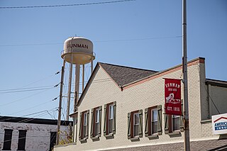
Sunman is a town in Adams Township, Ripley County, in the U.S. state of Indiana. The population was 1,049 at the 2010 census.

<span class="mw-page-title-main">Columbia City, Indiana</span> City in Indiana, United States

Columbia City is a city in Columbia Township, Whitley County, in the U.S. state of Indiana. The population was 9,892 at the 2020 Census, up from 8,750 at the 2010 Census, estimated to be 10,064 in 2023. The city is the county seat of Whitley County, and is the largest community therein. It is part of the Fort Wayne MSA.

<span class="mw-page-title-main">Gove City, Kansas</span> City in Gove County, Kansas

Gove City, more commonly known as Gove, is a city in and the county seat of Gove County, Kansas, United States. As of the 2020 census, the population of the city was 80.

<span class="mw-page-title-main">Kingman, Kansas</span> City in Kingman County, Kansas

Kingman is a city in and the county seat of Kingman County, Kansas, United States. As of the 2020 census, the population of the city was 3,105.

<span class="mw-page-title-main">Georgetown, Minnesota</span> City in Minnesota, United States

Georgetown is a city in Clay County, Minnesota, United States, along the Buffalo River near its confluence with the Red River of the North. The population was 86 at the 2020 census.

<span class="mw-page-title-main">Smithville, Missouri</span> City in Missouri, United States

Smithville is a city in Clay and Platte counties in the U.S. state of Missouri and is part of the Kansas City metropolitan area, along the Little Platte River. The population was 10,406 at the 2020 United States Census.

<span class="mw-page-title-main">Ogallala, Nebraska</span> City in Nebraska, United States

Ogallala is a city in and the county seat of Keith County, Nebraska, United States. The population was 4,878 at the 2020 census, up from 4,737 at the 2010 census. In the days of the Nebraska Territory, the city was a stop on the Pony Express and later along the transcontinental railroad. The Ogallala Formation that carries the Ogallala Aquifer was named after the city.

<span class="mw-page-title-main">Wasco, Oregon</span> City in Oregon, United States

Wasco is a city in Sherman County, Oregon, United States. The population was 410 at the 2010 census.

<span class="mw-page-title-main">Clay Township, Lancaster County, Pennsylvania</span> Township in Pennsylvania, United States

Clay Township is a township in north central Lancaster County, Pennsylvania, United States. The population was 6,887 at the 2020 census.

<span class="mw-page-title-main">Clay, West Virginia</span> Town in West Virginia, United States

Clay is a town in and the county seat of Clay County, West Virginia, United States. The population was 399 at the 2020 census. It is the only incorporated town in Clay County.

References

  1. "2020 U.S. Gazetteer Files". United States Census Bureau. Retrieved March 16, 2022.
  2. 1 2 3 "Feature ID 431462". Geographic Names Information System . United States Geological Survey . Retrieved June 30, 2014.
  3. 1 2 "FIPS55 Data: Indiana". FIPS55 Data. United States Geological Survey. February 23, 2006. Archived from the original on June 18, 2006. Retrieved June 30, 2014.
  4. "Quick Facts: Brazil City, Indiana". U.S. Census. 2022.
  5. "Find a County". National Association of Counties. Archived from the original on June 15, 2011. Retrieved June 7, 2011.
  6. "BBC Brasil, Economia e Iraque dividem votos na cidade Brazil" (in Portuguese). October 2004. Retrieved May 12, 2008.
  7. "Brazil Public Library, Library History". Archived from the original on June 6, 2008. Retrieved May 12, 2008.
  8. "Brazil, Indiana Facts".
  9. "Chafariz Dos Contos Fountain". Archived from the original on May 17, 2008. Retrieved May 12, 2008.
  10. "KFC markets 'fiery' wings on fire hydrants". USA TODAY. January 6, 2010. Retrieved August 27, 2013.
  11. "National Register Information System". National Register of Historic Places . National Park Service. July 9, 2010.
  12. "US Gazetteer files: 2010, 2000, and 1990". United States Census Bureau. February 12, 2011. Retrieved April 23, 2011.
  13. "G001 - Geographic Identifiers - 2010 Census Summary File 1". United States Census Bureau. Archived from the original on February 13, 2020. Retrieved July 28, 2015.
  14. "Census of Population and Housing". Census.gov. Retrieved June 4, 2015.
  15. 1 2 "U.S. Census website". United States Census Bureau . Retrieved December 11, 2012.
  16. "U.S. Census website". United States Census Bureau . Retrieved January 31, 2008.
  17. Stebbins, Samuel; Sauter, Mark B. "Which town in your state is the poorest? Here is the list". www.usatoday.com. USA Today . Retrieved April 24, 2019.
  18. "Elected Officials".
  19. "Mayor Brian Wyndham".
  20. "Homepage". Brazil Public Library. Retrieved March 4, 2018.
  21. FAA Airport Form 5010 for 0I2 – Brazil Clay County Airport PDF . Federal Aviation Administration. Effective June 30, 2011.
  22. "Brazil, Indiana Köppen Climate Classification (Weatherbase)". Weatherbase. Retrieved January 12, 2016.