Carbon, Indiana

Last updated

Carbon, Indiana
Clay County Indiana Incorporated and Unincorporated areas Carbon Highlighted 1810198.svg
Location of Carbon in Clay County, Indiana.
Coordinates: 39°35′56″N87°6′27″W / 39.59889°N 87.10750°W / 39.59889; -87.10750
Country United States
State Indiana
County Clay
Township Van Buren
Area
[1]
  Total0.15 sq mi (0.39 km2)
  Land0.15 sq mi (0.39 km2)
  Water0.00 sq mi (0.00 km2)
Elevation
689 ft (210 m)
Population
 (2020)
  Total263
  Density1,765.10/sq mi (682.31/km2)
Time zone UTC-5 (EST)
  Summer (DST) UTC-5 (EST)
ZIP code
47837
Area code 812
FIPS code 18-10198 [2]
GNIS feature ID0432123 [3]

Carbon is a town in Van Buren Township, Clay County, Indiana, United States. The population was 397 at the 2010 census. It is part of the Terre Haute Metropolitan Statistical Area.

Contents

History

Carbon had its start by the building of the railroad through that territory. [4] A post office was established at Carbon in 1870. [5] It was named after the Carbon Coal Company. [6]

Geography

Carbon is located at 39°35′56″N87°6′27″W / 39.59889°N 87.10750°W / 39.59889; -87.10750 (39.598974, -87.107510). [7]

According to the 2010 census, Carbon has a total area of 0.16 square miles (0.41 km2), all land. [8]

Demographics

Historical population
CensusPop.Note
1880 600
1890 521−13.2%
1900 95182.5%
1910 493−48.2%
1920 57216.0%
1930 476−16.8%
1940 5107.1%
1950 480−5.9%
1960 409−14.8%
1970 344−15.9%
1980 307−10.8%
1990 35014.0%
2000 334−4.6%
2010 39718.9%
2020 263−33.8%
U.S. Decennial Census [9]

2010 census

As of the census [10] of 2010, there were 397 people, 138 households, and 98 families living in the town. The population density was 2,481.3 inhabitants per square mile (958.0/km2). There were 165 housing units at an average density of 1,031.3 per square mile (398.2/km2). The racial makeup of the town was 96.7% White, 2.3% from other races, and 1.0% from two or more races. Hispanic or Latino of any race were 3.0% of the population.

There were 138 households, of which 41.3% had children under the age of 18 living with them, 55.8% were married couples living together, 8.7% had a female householder with no husband present, 6.5% had a male householder with no wife present, and 29.0% were non-families. 21.0% of all households were made up of individuals, and 9.4% had someone living alone who was 65 years of age or older. The average household size was 2.88 and the average family size was 3.40.

The median age in the town was 35.6 years. 30.7% of residents were under the age of 18; 7.3% were between the ages of 18 and 24; 26.4% were from 25 to 44; 26.4% were from 45 to 64; and 9.1% were 65 years of age or older. The gender makeup of the town was 50.6% male and 49.4% female.

2000 census

As of the census [2] of 2000, there were 334 people, 122 households, and 86 families living in the town. The population density was 2,109.4 inhabitants per square mile (814.4/km2). There were 136 housing units at an average density of 858.9 per square mile (331.6/km2). The racial makeup of the town was 99.70% White, and 0.30% from two or more races. Hispanic or Latino of any race were 1.20% of the population.

There were 122 households, out of which 41.8% had children under the age of 18 living with them, 54.1% were married couples living together, 12.3% had a female householder with no husband present, and 29.5% were non-families. 25.4% of all households were made up of individuals, and 8.2% had someone living alone who was 65 years of age or older. The average household size was 2.74 and the average family size was 3.28.

In the town, the population was spread out, with 31.4% under the age of 18, 10.5% from 18 to 24, 30.5% from 25 to 44, 16.5% from 45 to 64, and 11.1% who were 65 years of age or older. The median age was 30 years. For every 100 females, there were 92.0 males. For every 100 females age 18 and over, there were 94.1 males.

The median income for a household in the town was $35,208, and the median income for a family was $37,656. Males had a median income of $25,341 versus $22,500 for females. The per capita income for the town was $13,089. About 15.5% of families and 14.8% of the population were below the poverty line, including 14.3% of those under age 18 and 24.2% of those age 65 or over.

Related Research Articles

<span class="mw-page-title-main">Sylvan Springs, Alabama</span> Town in Alabama, United States

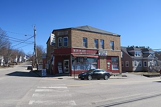
Sylvan Springs is a town in Jefferson County, Alabama, United States, located northwest of the Birmingham suburb of Pleasant Grove. It incorporated on May 22, 1957. At the 2010 census the population was 1,542, up from 1,465 in 2000. This area was damaged by an F5 tornado on April 8, 1998, including the First United Methodist Church of Sylvan Springs.

<span class="mw-page-title-main">Frisco City, Alabama</span> Town in Alabama, United States

Frisco City is a town in Monroe County, Alabama, United States. The population was 1,170 at the 2020 census.

<span class="mw-page-title-main">Center Point, Indiana</span> Town in Indiana, United States

Center Point is a town in Sugar Ridge Township, Clay County, Indiana, United States. The population was 242 at the 2010 census. It is part of the Terre Haute Metropolitan Statistical Area.

<span class="mw-page-title-main">Edwardsport, Indiana</span> Town in Indiana, United States

Edwardsport is a town in Vigo Township, Knox County, Indiana, United States. The population was 303 at the 2010 census. It was founded in 1832 and named after Edward Wilkins, a founding father.

<span class="mw-page-title-main">Sabattus, Maine</span> Town in the state of Maine, United States

Sabattus is a town in Androscoggin County, Maine, United States. The population was 5,044 at the 2020 census. It is included in both the Lewiston-Auburn, Maine Metropolitan Statistical Area and the Lewiston-Auburn, Maine Metropolitan New England City and Town Area. The town was formerly known as "Webster", and changed its name to "Sabattus" in 1971, in honor of a former Anasagunticook Indian chief. The village of Sabattus is in the northwestern corner of the town, at the outlet of Sabattus Pond.

<span class="mw-page-title-main">Mapleton, Maine</span> Town in the state of Maine, United States

Mapleton is a town in Aroostook County, Maine, United States. The population was 1,886 at the 2020 census.

<span class="mw-page-title-main">Sherman, Maine</span> Town in the state of Maine, United States

Sherman is a town in Aroostook County, Maine, United States. The population was 815 at the 2020 census.

<span class="mw-page-title-main">Hartford, Maine</span> Town in the state of Maine, United States

Hartford is a town in Oxford County, Maine, United States. Hartford is included in the Lewiston-Auburn, Maine metropolitan New England City and Town Area. The population was 1,203 at the 2020 census.

<span class="mw-page-title-main">Avon, Montana</span> CDP in Montana, United States

Avon is a census-designated place (CDP) in Powell County, Montana, United States. The population was 124 at the 2000 census. The town sits along the Little Blackfoot River, and serves as a gateway to the Beaverhead-Deerlodge National Forest.

<span class="mw-page-title-main">San Jon, New Mexico</span> Village in New Mexico, United States

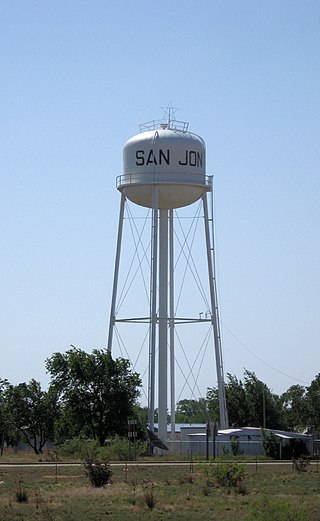
San Jon ( is a village in Quay County, New Mexico, United States. The population was 216 at the 2010 census.

<span class="mw-page-title-main">New Paris, Pennsylvania</span> Borough in Pennsylvania, United States

New Paris is a borough in Bedford County, Pennsylvania, United States. The population was 192 at the 2020 census.

Pine Ridge is a town in Lexington County, South Carolina, United States. The population was 2,064 at the 2010 census. It is part of the Columbia, South Carolina Metropolitan Statistical Area.

<span class="mw-page-title-main">Bancroft, West Virginia</span> Town in West Virginia, United States

Bancroft is a town in Putnam County, West Virginia, United States, along the Kanawha River. The population was 389 at the 2020 census. It is part of the Huntington–Ashland metropolitan area.

<span class="mw-page-title-main">Mabscott, West Virginia</span> Town in West Virginia, United States

Mabscott is a town in Raleigh County, West Virginia, United States. The population was 1,333 at the 2020 census. The town's name is a contraction of the name Mabel Scott, wife of local coal operator Cyrus H. Scott.

<span class="mw-page-title-main">Camden-on-Gauley, West Virginia</span> Town in West Virginia, United States

Camden-on-Gauley is a town in Webster County, West Virginia, United States, along the Gauley River. The population was 126 at the 2020 census.

<span class="mw-page-title-main">Greenwood, Wisconsin</span> City in Wisconsin, United States

Greenwood is a city in Clark County in the U.S. state of Wisconsin. The population was 1,026 at the 2010 census.

<span class="mw-page-title-main">Hanna, Wyoming</span> Town in Wyoming, United States

Hanna is a town in Carbon County, Wyoming, United States. The population was 683 at the 2020 census. The town was started as a coal supply location for the Union Pacific Railroad. Much of the old town is built on top of the former workings of the Hanna No. 4 mine. On December 18, 1979, the Town of Hanna annexed the adjacent Town of Elmo. The population peaked at 2,288 in 1980 and has declined as local coal mines have ceased operation.

<span class="mw-page-title-main">Riverside, Wyoming</span> Town in Wyoming, United States

Riverside is a town in Carbon County, Wyoming, United States. The population was 52 at the 2010 census.

<span class="mw-page-title-main">Bairoil, Wyoming</span> Town in Wyoming, United States

Bairoil is a town in Sweetwater County, Wyoming, United States. The population was 106 at the 2010 census.

<span class="mw-page-title-main">Withee, Wisconsin</span> Village in Wisconsin, United States

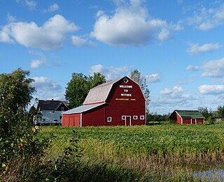
Withee is a village in Clark County in the U.S. state of Wisconsin. The population was 487 at the 2010 census. The village is located mostly within the Town of Hixon, with a small portion extending south into the Town of Longwood.

References

  1. "2020 U.S. Gazetteer Files". United States Census Bureau. Retrieved March 16, 2022.
  2. 1 2 "U.S. Census website". United States Census Bureau . Retrieved January 31, 2008.
  3. "US Board on Geographic Names". United States Geological Survey. October 25, 2007. Retrieved January 31, 2008.
  4. Blanchard, Charles (1884). Counties of Clay and Owen, Indiana: Historical and Biographical. F.A. Battey & Company. pp.  246.
  5. "Clay County". Jim Forte Postal History. Retrieved August 30, 2014.
  6. Baker, Ronald L. (October 1995). From Needmore to Prosperity: Hoosier Place Names in Folklore and History . Indiana University Press. p.  87. ISBN   978-0-253-32866-3. ...by the Carbon Coal Company, which was so named for the coal here.
  7. "US Gazetteer files: 2010, 2000, and 1990". United States Census Bureau. February 12, 2011. Retrieved April 23, 2011.
  8. "G001 - Geographic Identifiers - 2010 Census Summary File 1". United States Census Bureau. Archived from the original on February 13, 2020. Retrieved July 13, 2015.
  9. "Census of Population and Housing". Census.gov. Retrieved June 4, 2015.
  10. "U.S. Census website". United States Census Bureau . Retrieved December 11, 2012.