English, Indiana

Last updated

English, Indiana
Crawford County Courthouse, English.jpg
Crawford County Indiana Incorporated and Unincorporated areas English Highlighted 1821214.svg
Location of English in Crawford County, Indiana.
Coordinates: 38°20′27″N86°27′33″W / 38.34083°N 86.45917°W / 38.34083; -86.45917
Country United States
State Indiana
County Crawford
Township Sterling
Area
[1]
  Total3.04 sq mi (7.88 km2)
  Land3.04 sq mi (7.88 km2)
  Water0.00 sq mi (0.00 km2)
Elevation
[2]
646 ft (197 m)
Population
 (2020)
  Total685
  Density225.03/sq mi (86.89/km2)
Time zone UTC-5 (Eastern)
  Summer (DST) UTC-4 (EDT [3] )
ZIP code
47118
Area code 812
FIPS code 18-21214 [4]
GNIS feature ID2396928 [2]

English is a town and the county seat of Crawford County, Indiana, United States. [5] The population was 645 at the 2010 census, making it one of Indiana's smallest county seats. The settlement was named Hartford (1839-1884) prior to its incorporation.

Contents

Geography

The Camp Fork, a stream that has played a destructive role in the community's history Camp Fork at English.jpg
The Camp Fork, a stream that has played a destructive role in the community's history

According to the 2010 United States Census, English has a total area of 3.04 square miles (7.87 km2), all land. [6]

Climate

The climate in this area is characterized by highly variable fluctuations in weather with hot, humid summers and frigidly cold, generally wet winters. According to the Köppen Climate Classification system, English previously had a humid continental climate, but as of the 2016 update it now has a humid subtropical climate due to climate change. [7] As Southern Indiana is in a transitional zone between these two areas, localized climate does not firmly adhere to either classification. [8]

Demographics

Historical population
CensusPop.Note
1890 423
1900 64953.4%
1910 583−10.2%
1920 576−1.2%
1930 70422.2%
1940 7577.5%
1950 83910.8%
1960 698−16.8%
1970 664−4.9%
1980 633−4.7%
1990 614−3.0%
2000 6739.6%
2010 645−4.2%
2020 6856.2%
U.S. Decennial Census [9]

2010 census

As of the 2010 United States Census, [10] there were 645 people, 285 households, and 177 families in the town. The population density was 212.2 inhabitants per square mile (81.9/km2). There were 335 housing units at an average density of 110.2 per square mile (42.5/km2). The racial makeup of the town was 97.5% White, 0.3% African American, 0.6% Native American, 0.2% Asian, 0.3% from other races, and 1.1% from two or more races. Hispanic or Latino of any race were 0.8% of the population.

There were 285 households, of which 27.7% had children under the age of 18 living with them, 44.9% were married couples living together, 12.6% had a female householder with no husband present, 4.6% had a male householder with no wife present, and 37.9% were non-families. 32.3% of all households were made up of individuals, and 14.8% had someone living alone who was 65 years of age or older. The average household size was 2.26 and the average family size was 2.79.

The median age in the town was 43.6 years. 20.9% of residents were under the age of 18; 10.5% were between the ages of 18 and 24; 20.3% were from 25 to 44; 28.4% were from 45 to 64; and 20% were 65 years of age or older. The gender makeup of the town was 47.3% male and 52.7% female.

2000 census

As of the 2000 United States Census, there were 673 people, 294 households, and 171 families in the town. The population density was 220.5 inhabitants per square mile (85.1/km2). There were 341 housing units at an average density of 111.7 per square mile (43.1/km2). The racial makeup of the town was 98.66% White, 1.19% Native American, 0.15% from other races. Hispanic or Latino of any race were 0.59% of the population.

There were 294 households, out of which 28.2% had children under the age of 18 living with them, 42.9% were married couples living together, 13.6% had a female householder with no husband present, and 41.8% were non-families. 38.8% of all households were made up of individuals, and 20.4% had someone living alone who was 65 years of age or older. The average household size was 2.24 and the average family size was 2.99.

The town population contained 24.4% under the age of 18, 9.5% from 18 to 24, 26.6% from 25 to 44, 22.4% from 45 to 64, and 17.1% who were 65 years of age or older. The median age was 38 years. For every 100 females, there were 83.4 males. For every 100 females age 18 and over, there were 81.1 males.

The median income for a household in the town was $20,870, and the median income for a family was $27,708. Males had a median income of $25,000 versus $18,971 for females. The per capita income for the town was $11,065. About 24.0% of families and 33.9% of the population were below the poverty line, including 54.9% of those under age 18 and 25.2% of those age 65 or over.

History

English was called Hartford when it was laid out in 1839. [11] When the town incorporated in 1884 it was renamed English for William Hayden English, an Indiana politician of the day. [12] On December 28, 1893, the county seat of Crawford County was relocated from Leavenworth to English.

The first community was located at the confluence of two small rivers (Bird Dog Creek and Brownville Creek) with Blue River. It was a thriving community during the first half of the 20th century, with population rising to above 800 by 1950, but economic activity slowed thereafter (partly due to recurring flooding), [13] and commercial establishments closed. Most residents now live on the higher ground surrounding the original settlement. A large swath of the previous inhabited level area has been converted into the Lucas Oil Golf Course. [14] [15]

From 1959 to 1990, English suffered six floods. The town council decided that the only solution to the flooding problem was to move the town. 160 acres (0.65 km2) of high ground were purchased, a partnership was formed with Lincoln Hills Development Corporation, and a major portion of the town was relocated. [16]

Education

The Crawford County Public Library, one of two lending libraries in the county (the other is Breeden Memorial Library in Leavenworth), is located at English. [17]

Notable people

Related Research Articles

<span class="mw-page-title-main">Mountainburg, Arkansas</span> City in Arkansas, United States

Mountainburg is a town in Crawford County, Arkansas, United States. It is part of the Fort Smith, Arkansas-Oklahoma Metropolitan Statistical Area. As of the 2010 census the population was 631.

<span class="mw-page-title-main">Alton, Indiana</span> Town in Indiana, United States

Alton is a town in Boone Township, Crawford County, Indiana, United States. The population was 29 at the 2020 census.

<span class="mw-page-title-main">Leavenworth, Indiana</span> Town in Indiana, United States

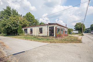
Leavenworth is a town in Jennings Township, Crawford County, Indiana, along the Ohio River. The 2010 US Census recorded a population of 238 persons.

<span class="mw-page-title-main">Milltown, Indiana</span> Town in Indiana, United States

Milltown is a town in Whiskey Run Township in Crawford County, Indiana and in Blue River and Spencer townships in Harrison County. The population was 818 at the time of the 2010 census.

<span class="mw-page-title-main">Dillsboro, Indiana</span> Town in Indiana, United States

Dillsboro is a town in Clay Township, Dearborn County, Indiana, United States. As of 2020, the population is 1,360.

<span class="mw-page-title-main">Newberry, Indiana</span> Town in Indiana, United States

Newberry is a town in Cass Township, Greene County, Indiana, United States. The population was 193 at the 2010 census. It is part of the Bloomington, Indiana Metropolitan Statistical Area.

<span class="mw-page-title-main">Elizabeth, Indiana</span> Town in Indiana, United States

Elizabeth is a town in Posey Township, Harrison County, Indiana, United States. The population was 162 at the 2010 census.

<span class="mw-page-title-main">Whiteland, Indiana</span> Town in Indiana, United States

Whiteland is a town in Pleasant, Franklin and Clark townships, Johnson County, Indiana, United States. The population was 4,599 at the 2020 census.

<span class="mw-page-title-main">Waveland, Indiana</span> Town in Indiana, United States

Waveland is a town in Brown Township, Montgomery County, in the U.S. state of Indiana. The population was 427 at the 2020 census.

<span class="mw-page-title-main">Paoli, Indiana</span> Town in Indiana, United States

Paoli is a town within Paoli Township and the county seat of Orange County, in the U.S. state of Indiana. The population was 3,677 at the 2010 census.

<span class="mw-page-title-main">Spencer, Indiana</span> Town in Indiana, United States

Spencer is a town in Washington Township, Owen County, in the U.S. state of Indiana. The population was 2,217 at the 2010 census. It is the county seat of Owen County.

<span class="mw-page-title-main">Rockville, Indiana</span> Town in Indiana, United States

Rockville is a town in Adams Township, Parke County, in the U.S. state of Indiana. The population was 2,607 at the 2010 census. The town is the county seat of Parke County. It is known as "The Covered Bridge Capital of the World".

<span class="mw-page-title-main">Winslow, Indiana</span> Town in Indiana, United States

Winslow is a town in Patoka Township, Pike County, in the U.S. state of Indiana. The population was 864 at the 2010 census. It is part of the Jasper Micropolitan Statistical Area.

<span class="mw-page-title-main">Fredericksburg, Indiana</span> Census-designated place in Indiana, United States

Fredericksburg is an unincorporated community in Posey Township, Washington County, in the U.S. state of Indiana. The population was 85 at the 2010 census, at the time it was a town.

<span class="mw-page-title-main">Hardinsburg, Indiana</span> Town in Indiana, United States

Hardinsburg is a town in Posey Township, Washington County, in the U.S. state of Indiana. The population was 222 at the 2020 census.

<span class="mw-page-title-main">Masardis, Maine</span> Town in Maine, United States

Masardis is a town in Aroostook County, Maine, United States. The population was 204 at the 2020 census.

<span class="mw-page-title-main">Warwick, North Dakota</span> City in North Dakota, United States

Warwick is a city in Benson County, North Dakota, United States. The population was 55 at the 2020 census. Warwick was founded in 1907.

<span class="mw-page-title-main">New Rockford, North Dakota</span> City in North Dakota, United States

New Rockford is a city in Eddy County, North Dakota, United States. It is the county seat of Eddy County. The population was 1,361 at the 2020 census. New Rockford was founded in 1883.

<span class="mw-page-title-main">Parkston, South Dakota</span> City in South Dakota, United States

Parkston is a city in Hutchinson County, South Dakota, United States. The population was 1,567 at the 2020 census.

<span class="mw-page-title-main">Burnsville, West Virginia</span> Town in West Virginia, United States

Burnsville is a town in Braxton County, West Virginia, United States, at the confluence of the Little Kanawha River and Saltlick Creek. The population was 401 at the 2020 census. Burnsville was incorporated in 1902 by the Circuit Court and named for Captain John Burns who operated the first sawmill in that section of the state and who established the town shortly after the close of the American Civil War. It was named "All West Virginia City" in 1976.

References

  1. "2020 U.S. Gazetteer Files". United States Census Bureau. Retrieved March 16, 2022.
  2. 1 2 U.S. Geological Survey Geographic Names Information System: English, Indiana
  3. Indiana's Time Zones and Daylight Saving Time (accessed 18 October 2020)
  4. "US Census website". US Census Bureau. Retrieved January 31, 2008.
  5. "Find a County". National Association of Counties. Archived from the original on May 31, 2011. Retrieved June 7, 2011.
  6. "Geographic Identifiers - 2010 Census Summary File 1". US Census Bureau. Archived from the original on February 13, 2020. Retrieved July 16, 2015.
  7. Climate Summary for English, Indiana
  8. Beck, Hylke E.; Zimmermann, Niklaus E.; McVicar, Tim R.; Vergopolan, Noemi; Berg, Alexis; Wood, Eric F. (October 30, 2018). "Present and future Köppen-Geiger climate classification maps at 1-km resolution". Scientific Data. 5: 180214. Bibcode:2018NatSD...580214B. doi:10.1038/sdata.2018.214. PMC   6207062 . PMID   30375988.
  9. "Census of Population and Housing". Census.gov. Retrieved June 4, 2015.
  10. "U.S. Census website". US Census Bureau. Retrieved December 11, 2012.
  11. Biographical and Historical Souvenir for the Counties of Clark, Crawford, Harrison, Floyd, Jefferson, Jennings, Scott, and Washington, Indiana. Chicago Printing Co. 1889. p. 59. ISBN   9781548571665.
  12. Cottman, George Streiby; Coleman, Christopher Bush; Esarey, Logan (1921). Indiana Magazine of History. p. 241.
  13. "The Indianapolis Star".
  14. About the Course (Lucas Oil Golf Course, accessed 18 October 2020)
  15. Lucas Oil Golf Course (Google Maps, accessed 18 October 2020)
  16. "Flood-Prone Town Will Move—Uphill". Los Angeles Times . September 30, 1990.
  17. "Indiana public library directory" (PDF). Indiana State Library. Archived from the original (PDF) on February 18, 2017. Retrieved March 4, 2018.